Pogogul Airport
Pogogul Airport Bandar Udara Pogogul | |||||||||||
|---|---|---|---|---|---|---|---|---|---|---|---|
| |||||||||||
| Coordinates | 01°06′03″N 121°24′58″E / 1.10083°N 121.41611°E[1] | ||||||||||
| Map | |||||||||||
| Runways | |||||||||||
| |||||||||||
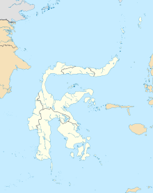
Pogogul Airport (Indonesian: Bandar Udara Pogogul) (IATA: UOL, ICAO: WAFY) is an airport near Buol, a city in the province of Central Sulawesi on the island of Sulawesi in Indonesia.
Facilities
The airport resides at an
mean sea level. It has one runway
designated 06/24 with a compacted coral and sand surface measuring 1,500 by 30 metres (4,921 ft × 98 ft).
Airlines and destinations
| Airlines | Destinations |
|---|---|
| Palu
| |
| Palu
|
References

