
Spačva basin
Spačva basin
Spačvanski bazen ( UTC+2 (CEST ) |
|---|

The Spačva basin (
macroregion of Croatia, surrounding the Spačva River and the Studva River. The entire region measures 51,000 hectares, out of which 40,000 hectares is located in Croatia and 11,000 in Serbia.[1]
The region's 40,000 hectares of
Sava River the entire region was regularly flooded in spring.[1]
In addition, the region forms an organic continuum with the Bosut Forest (Bosutska šuma,
Sava River as well, where it is known as Donje Podrinje in Bosnia and Herzegovina and Central Serbia.[6]
Wood industry based in Spačva basin is an important natural resource in the economic output of
Vukovar-Syrmia County. The industrial exploitation of the forest was initiated in the 19th century at the time of Slavonian Military Frontier.[1] The major settlement in the region is the town of Otok.[3]
Gallery
-
 Croatia
 -
 Serbia
 -
-
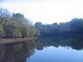
 Otočki virovi


See also
- Geography of Croatia
- Kopački Rit
- Historical Palača Swamp of the Bobota Canal
- Lonjsko Polje and Jelas-polje
- Gornje Podunavlje and Tikvara in Vojvodina
- Danube–Tisza Interfluve and Danube-Drava National Park in Hungary
- Ramsar Convention
- Vukovar Plateau
References
- ^ ISBN 978-953-58754-6-8.
- ^ "Approved 10 projects over HRK million worth". 27 April 2016. Retrieved 2 December 2016.
- ^ a b Ika Lucić (2014). "The Impact of Spačvanski Bazen of Economic Development in Vukovar-Srijem County". Faculty of Science, University of Zagreb. Retrieved 2 December 2016.
- ^ Vuletić, Dijana. "Ecological and climate changes and regeneration related issues of pedunculate oak forests in Spačva basin". Croatian Forest Research Institute. Retrieved 25 February 2020.
- ^ "Bosutske šume – najveće lužnjačke šume u Evropi". Radio Television of Vojvodina. 7 May 2018. Retrieved 25 February 2020.
- ^ Jeremić, Jasna. "The area of Morovićko-bosutske šume and Spačvanski bazen as a potential retention and transboundary protected area". Retrieved 25 February 2020.
External links
Hydrography of Croatia | ||||||
|---|---|---|---|---|---|---|
| Rivers |
|  | ||||
| Lakes | ||||||
| Valleys, estuaries, canyons, wetlands | ||||||
| Waterfalls | ||||||
| Canals |
| |||||
| Adriatic Sea | ||||||
