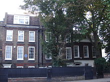
King's Road
 King's Road, looking east towards Sloane Square | |
| Length | 1.9 mi (3.1 km) |
|---|---|
| Location | Chelsea, London, England |
| Postal code | SW3, SW6, SW10 |
| South end | Sloane Square |
| West end | Waterford Road |
| Other | |
| Known for | Shopping, Peter Jones, Saatchi Gallery |

King's Road or Kings Road (or sometimes the King's Road, especially when it was the king's private road until 1830, or as a colloquialism by middle/upper class London residents) is a major street stretching through Chelsea and Fulham, both in west London, England. It is associated with 1960s style and with fashion figures such as Mary Quant and Vivienne Westwood. Sir Oswald Mosley's Blackshirt movement had a barracks on the street in the 1930s.[1]
Location
King's Road runs for just under two miles (3.2 km) through Chelsea, in the
History
King's Road derives its name from its function as a private road used by
The world's first artificial ice rink, the Glaciarium, opened just off King's Road in 1876, and later that year it relocated to a building on the street.[citation needed]
During the 1960s the street became a symbol of
484 King's Road was the headquarters of Swan Song Records, owned by Led Zeppelin. The company was closed and the building vacated in 1983. King's Road was the site of the first UK branch of Starbucks, which opened in 1999.
In 1984, Keith Wainwright, a pioneer responsible for starting one of the first men's hairdressers catering for the longer men's styles of the time, with such clients including Roy Wood, Cat Stevens and The Walker Brothers, opened the salon "Smile", at 434 King's Road.[citation needed]
535 King's Road was the headquarters of Cube Records, an independent record label of the late 1960s and early 1970s. The label folded in the mid-1970s, becoming part of Elektra Records. The building has since been demolished but the new building on the same site still houses a record company.
The corner of Kings Road and Manresa Road was occupied from 1895 to 1985 by Chelsea College of Science and Technology before it was subsumed into King's College London and immediately sold into private hands.
In popular culture
The road has been represented in popular culture on various occasions: "King's Road" is the title of a song by
In the 1960s radio series Round the Horne, in the 'Jules and Sandy' section, their establishment (named 'Bona...'), is often located in the King's Road (for example, Bona Books in series 4).[citation needed]
Pet Shop Boys met in an electronics shop on King's Road in August 1981.
Planning and transport
- Planning
The eastern part of King's Road is identified in the London Plan as one of 35 major centres in Greater London.[3] King's Road is part of A3217.[4][5]
- Bus
Buses
- Rail and tube
The western end of King's Road is close to
- River
See also
- 213 and 215 King's Road
- 190 New King's Road
- Cadogan Estate
- Carlyle Square
- Markham Square
- Mallord Street
- King's Highway (disambiguation)
- Sloane Ranger
- World's End, Chelsea
- List of eponymous roads in London
- Fulham
- Parsons Green
- Sands End
References
- ^ Mosley, Sir Oswald. My Life, Thomson Nelson & Sons, 1970
- ^ Seebohm, Caroline (19 July 1971). "English Girls in New York: They Don't Go Home Again". New York. p. 34. Retrieved 6 January 2015.
- ^ Mayor of London (February 2008). "London Plan (Consolidated with Alterations since 2004)" (PDF). Greater London Authority. Archived from the original (PDF) on 2 June 2010.
- ^ "A3217". Roader's Digest: The SABRE Wiki. The Society for All British and Irish Road Enthusiasts. Retrieved 28 June 2022.
- ^ "A3217 Kings Road". The Argus (Brighton). Gannett. Retrieved 29 June 2022.
External links
- Audio Walking Tour of King's Road
- King's Road London – Local news, community and shopping – kingsroadlondon.com
