
Kingman, Kansas
Kingman, Kansas | ||
|---|---|---|
City and County seat | ||
 Downtown Kingman (2009) | ||
|
FIPS code 20-36950 | | |
| GNIS ID | 485602[1] | |
| Website | CityOfKingman.com | |
Kingman is a city in and the county seat of Kingman County, Kansas, United States.[1] As of the 2020 census, the population of the city was 3,105.[4]
History
Kingman was laid out in 1874.[5] Like Kingman County, it was named for Samuel A. Kingman, chief justice of the supreme court.[6]
Geography
Kingman is located next to the Ninnescah River. According to the United States Census Bureau, the city has a total area of 3.53 square miles (9.14 km2), of which 3.52 square miles (9.12 km2) is land and 0.01 square miles (0.03 km2) is water.[7]
Climate
The climate in this area is characterized by hot, humid summers and generally mild to cool winters. According to the
| Climate data for Kingman, Kansas, 1991–2020 normals, extremes 1907–present | |||||||||||||
|---|---|---|---|---|---|---|---|---|---|---|---|---|---|
| Month | Jan | Feb | Mar | Apr | May | Jun | Jul | Aug | Sep | Oct | Nov | Dec | Year |
| Record high °F (°C) | 79 (26) |
88 (31) |
92 (33) |
98 (37) |
106 (41) |
112 (44) |
116 (47) |
115 (46) |
109 (43) |
100 (38) |
96 (36) |
84 (29) |
116 (47) |
| Mean maximum °F (°C) | 67.5 (19.7) |
72.0 (22.2) |
80.2 (26.8) |
86.9 (30.5) |
92.8 (33.8) |
97.5 (36.4) |
103.4 (39.7) |
101.9 (38.8) |
97.3 (36.3) |
89.3 (31.8) |
75.8 (24.3) |
65.6 (18.7) |
104.7 (40.4) |
| Mean daily maximum °F (°C) | 43.8 (6.6) |
48.2 (9.0) |
58.2 (14.6) |
67.6 (19.8) |
76.9 (24.9) |
87.4 (30.8) |
92.8 (33.8) |
90.7 (32.6) |
82.8 (28.2) |
70.3 (21.3) |
56.9 (13.8) |
45.2 (7.3) |
68.4 (20.2) |
| Daily mean °F (°C) | 31.5 (−0.3) |
35.7 (2.1) |
45.2 (7.3) |
54.7 (12.6) |
64.9 (18.3) |
75.3 (24.1) |
80.5 (26.9) |
78.3 (25.7) |
70.0 (21.1) |
56.9 (13.8) |
44.3 (6.8) |
33.4 (0.8) |
55.9 (13.3) |
| Mean daily minimum °F (°C) | 19.2 (−7.1) |
23.1 (−4.9) |
32.1 (0.1) |
41.9 (5.5) |
53.0 (11.7) |
63.1 (17.3) |
68.2 (20.1) |
66.0 (18.9) |
57.2 (14.0) |
43.4 (6.3) |
31.7 (−0.2) |
21.6 (−5.8) |
43.4 (6.3) |
| Mean minimum °F (°C) | 4.9 (−15.1) |
7.1 (−13.8) |
15.4 (−9.2) |
26.7 (−2.9) |
38.9 (3.8) |
52.9 (11.6) |
59.3 (15.2) |
56.9 (13.8) |
42.0 (5.6) |
27.3 (−2.6) |
15.6 (−9.1) |
8.2 (−13.2) |
0.1 (−17.7) |
| Record low °F (°C) | −17 (−27) |
−22 (−30) |
−4 (−20) |
16 (−9) |
23 (−5) |
41 (5) |
47 (8) |
42 (6) |
24 (−4) |
13 (−11) |
−4 (−20) |
−17 (−27) |
−22 (−30) |
| Average precipitation inches (mm) | 0.89 (23) |
1.33 (34) |
2.47 (63) |
3.10 (79) |
4.88 (124) |
4.40 (112) |
4.06 (103) |
3.67 (93) |
2.82 (72) |
2.93 (74) |
1.38 (35) |
1.29 (33) |
33.22 (845) |
| Average snowfall inches (cm) | 1.5 (3.8) |
2.1 (5.3) |
1.7 (4.3) |
0.2 (0.51) |
0.0 (0.0) |
0.0 (0.0) |
0.0 (0.0) |
0.0 (0.0) |
0.0 (0.0) |
0.1 (0.25) |
0.7 (1.8) |
2.6 (6.6) |
8.9 (22.56) |
| Average precipitation days (≥ 0.01 in) | 3.9 | 4.3 | 6.6 | 7.3 | 8.7 | 7.3 | 7.4 | 7.1 | 5.7 | 6.1 | 4.2 | 4.2 | 72.8 |
| Average snowy days (≥ 0.1 in) | 1.7 | 1.8 | 0.7 | 0.2 | 0.0 | 0.0 | 0.0 | 0.0 | 0.0 | 0.2 | 0.6 | 1.6 | 6.8 |
| Source 1: NOAA[9] | |||||||||||||
| Source 2: National Weather Service[10] | |||||||||||||
Demographics
| Census | Pop. | Note | %± |
|---|---|---|---|
| 1890 | 2,390 | — | |
| 1900 | 1,785 | −25.3% | |
| 1910 | 2,570 | 44.0% | |
| 1920 | 2,407 | −6.3% | |
| 1930 | 2,752 | 14.3% | |
| 1940 | 3,213 | 16.8% | |
| 1950 | 3,200 | −0.4% | |
| 1960 | 3,582 | 11.9% | |
| 1970 | 3,622 | 1.1% | |
| 1980 | 3,563 | −1.6% | |
| 1990 | 3,196 | −10.3% | |
| 2000 | 3,387 | 6.0% | |
| 2010 | 3,177 | −6.2% | |
| 2020 | 3,105 | −2.3% | |
| U.S. Decennial Census | |||
2020 census
The
Of the 1,335 households, 27.1% had children under the age of 18; 44.5% were married couples living together; 28.8% had a female householder with no spouse or partner present. 36.7% of households consisted of individuals and 18.6% had someone living alone who was 65 years of age or older.[12] The average household size was 2.0 and the average family size was 2.7.[16] The percent of those with a bachelor’s degree or higher was estimated to be 13.7% of the population.[17]
22.6% of the population was under the age of 18, 7.5% from 18 to 24, 22.0% from 25 to 44, 26.4% from 45 to 64, and 21.4% who were 65 years of age or older. The median age was 43.7 years. For every 100 females, there were 106.4 males.[12] For every 100 females ages 18 and older, there were 106.9 males.[12]
The 2016-2020 5-year
2010 census
As of the
There were 1,346 households, of which 29.3% had children under the age of 18 living with them, 46.7% were married couples living together, 9.7% had a female householder with no husband present, 3.9% had a male householder with no wife present, and 39.8% were non-families. 35.0% of all households were made up of individuals, and 18% had someone living alone who was 65 years of age or older. The average household size was 2.29 and the average family size was 2.95.
The median age in the city was 40.7 years. 24.9% of residents were under the age of 18; 8% were between the ages of 18 and 24; 21.6% were from 25 to 44; 23.3% were from 45 to 64; and 22.2% were 65 years of age or older. The gender makeup of the city was 47.7% male and 52.3% female.
2000 census
As of the
There were 1,407 households, out of which 28.9% had children under the age of 18 living with them, 52.7% were married couples living together, 9.5% had a female householder with no husband present, and 35.2% were non-families. 33.0% of all households were made up of individuals, and 18.8% had someone living alone who was 65 years of age or older. The average household size was 2.34 and the average family size was 2.95.
In the city, the population was spread out, with 26.4% under the age of 18, 7.1% from 18 to 24, 23.6% from 25 to 44, 20.2% from 45 to 64, and 22.7% who were 65 years of age or older. The median age was 40 years. For every 100 females, there were 84.3 males. For every 100 females age 18 and over, there were 82.7 males.
The median income for a household in the city was $36,018, and the median income for a family was $42,813. Males had a median income of $32,000 versus $23,988 for females. The
Education

The community is served by
- Kingman High School
- Kingman Elementary-Middle School
Private Schools
Transportation
Bus service is provided daily eastward towards Wichita, Kansas and westward towards Pueblo, Colorado by BeeLine Express (subcontractor of Greyhound Lines).[24][25]
Notable people
- George Aiton, Major League Baseball player.
- Cessna Aircraft Corporation.
- Martin Dewey, American orthodontist.
- Eugene John Gerber, Roman Catholic bishop.
- Don Lock, Major League Baseball player.
Gallery
- Historic Images of Kingman, Special Photo Collections at Wichita State University Library
-
 Kingman County Courthouse (2009)
 -
 Old City Hall Building (2017)
 -
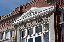 Kingman Carnegie Library (2012)
 -
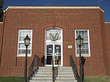 Kingman U.S. Post Office (2014)
 -
 Kingman National Guard Armory (2014)
 -
 Former Kingman Santa Fe Depot (2017)


References
- ^ a b c d U.S. Geological Survey Geographic Names Information System: Kingman, Kansas
- ^ a b Kingman - Directory of Public Officials Archived 2011-12-13 at the Wayback Machine
- ^ "2019 U.S. Gazetteer Files". United States Census Bureau. Retrieved July 24, 2020.
- ^ a b "Profile of Kingman, Kansas in 2020". United States Census Bureau. Archived from the original on March 27, 2022. Retrieved March 27, 2022.
- ^ Blackmar, Frank Wilson (1912). Kansas: A Cyclopedia of State History. Standard Publishing Company. pp. 72.
- ^ Kansas State Historical Society (1916). Biennial Report of the Board of Directors of the Kansas State Historical Society. Kansas State Printing Plant. pp. 215.
- ^ "US Gazetteer files 2010". United States Census Bureau. Archived from the original on July 2, 2012. Retrieved July 6, 2012.
- ^ Climate Summary for Kingman, Kansas
- ^ "U.S. Climate Normals Quick Access – Station: Kingman, KS". National Oceanic and Atmospheric Administration. Retrieved November 26, 2023.
- ^ "NOAA Online Weather Data – NWS Wichita". National Weather Service. Retrieved November 26, 2023.
- ^ "US Census Bureau, Table P16: HOUSEHOLD TYPE". data.census.gov. Retrieved January 3, 2024.
- ^ a b c d e "US Census Bureau, Table DP1: PROFILE OF GENERAL POPULATION AND HOUSING CHARACTERISTICS". data.census.gov. Retrieved January 3, 2024.
- ^ Bureau, US Census. "Gazetteer Files". Census.gov. Retrieved December 30, 2023.
- ^ "US Census Bureau, Table P1: RACE". data.census.gov. Retrieved January 3, 2024.
- ^ "US Census Bureau, Table P2: HISPANIC OR LATINO, AND NOT HISPANIC OR LATINO BY RACE". data.census.gov. Retrieved January 3, 2024.
- ^ "US Census Bureau, Table S1101: HOUSEHOLDS AND FAMILIES". data.census.gov. Retrieved January 3, 2024.
- ^ "US Census Bureau, Table S1501: EDUCATIONAL ATTAINMENT". data.census.gov. Retrieved January 3, 2024.
- ^ "US Census Bureau, Table S1903: MEDIAN INCOME IN THE PAST 12 MONTHS (IN 2020 INFLATION-ADJUSTED DOLLARS)". data.census.gov. Retrieved January 3, 2024.
- ^ "US Census Bureau, Table S2001: EARNINGS IN THE PAST 12 MONTHS (IN 2020 INFLATION-ADJUSTED DOLLARS)". data.census.gov. Retrieved January 3, 2024.
- ^ "US Census Bureau, Table S1701: POVERTY STATUS IN THE PAST 12 MONTHS". data.census.gov. Retrieved January 3, 2024.
- ^ "US Census Bureau, Table S1702: POVERTY STATUS IN THE PAST 12 MONTHS OF FAMILIES". data.census.gov. Retrieved January 3, 2024.
- ^ "U.S. Census website". United States Census Bureau. Retrieved July 6, 2012.
- ^ "U.S. Census website". United States Census Bureau. Retrieved January 31, 2008.
- ^ BeeLine Express
- ^ "Greyhound Lines". Archived from the original on September 6, 2019. Retrieved January 3, 2016.
Further reading
External links
Municipalities and communities of Kingman County, Kansas, United States | ||
|---|---|---|
| Cities |  | |
| Unincorporated communities | ||
| Townships | ||
| Footnotes | †This community is designated a Census-Designated Place (CDP) by the United States Census Bureau. | |
| ||
| International | |
|---|---|
| National | |
| Geographic | |
| Other | |