
Ningxia
Ningxia | |
|---|---|
25th) | |
| Website | www |
| Ningxia | ||
|---|---|---|
Hanyu Pinyin | Níngxià | |
Hanyu Pinyin | Níngxià Huízú Zìzhìqū | |
BUC | Nìng-hâ Huòi-cŭk Cê̤ṳ-dê-kṳ̆ | |
Ningxia,[a] officially the Ningxia Hui Autonomous Region, is an autonomous region in Northwestern China.
Formerly a province, Ningxia was incorporated into Gansu in 1954 but was later separated from Gansu in 1958 and reconstituted as an autonomous region for the Hui people, one of the 56 officially recognised nationalities of China. Twenty percent of China's Hui population lives in Ningxia.[7]
Ningxia is bounded by Shaanxi to the east, Gansu to the south and west and Inner Mongolia Autonomous Region to the north and has an area of around 66,400 square kilometres (25,600 sq mi).[1] This sparsely settled, mostly desert region lies partially on the Loess Plateau and in the vast plain of the Yellow River and features the Great Wall of China along its northeastern boundary. Over about 2000 years, an extensive system of canals (with a total length of approximately 1397 kilometers)[8] has been built from Qin dynasty. Extensive land reclamation and irrigation projects have made increased cultivation possible. The arid region of Xihaigu, which covers large parts of the province, suffers from severe water shortage, which the canals were intended to alleviate.[9]
Ningxia was the core area of the Western Xia in the 11th–13th centuries, established by the Tangut people; its name, "Peaceful Xia", derived from the Mongol conquest of the state.[10] The Tanguts made significant achievements in literature, art, music, and architecture, particularly invented Tangut script. Long one of the country's poorest areas, a small winemaking industry has become economically important since the 1980s. Before the arrival of viticulture, Ningxia's 6.8 million people, 36 per cent of whom are Muslims from the Hui ethnic group, relied largely on animal grazing, subsistence agriculture and the cultivation of wolfberries used in traditional Chinese medicine. Since then, winemaking has become the premier specialty of Ningxia, and the province devotes almost 40,000 hectares to vineyards and producing 120 million bottles of wine in 2017 – a quarter of the entire nation's production.[11]
History

As a frontier zone between nomadic pastoralists and sedentary farmers, Ningxia was a frequent seat of war and incursions by non-Chinese tribes. Ningxia and its surrounding areas were incorporated into the
By the 11th century the
It then came under
In 1914, Ningxia was merged with the
From 1950 to 1958, a
A number of Chinese artifacts dating from the Tang dynasty and Song dynasty, some of which had been owned by Emperor Zhenzong, were excavated and then came into the hands of Ma Hongkui, who refused to publicize the findings. Among the artifacts were a white marble tablet from the Tang dynasty, gold nails, and bands made out of metal. It was not until after Ma died that his wife went to Taiwan in 1971 from America to bring the artifacts to Chiang Kai-shek, who turned them over to the Taipei National Palace Museum.[16]
Geography

Present-day Ningxia is one of the nation's smallest provincial-level units and borders the provinces of Shaanxi and Gansu and the Inner Mongolia Autonomous Region. At 3556 meters above sea level, Aobaogeda (敖包疙瘩) in the Helan Mountains is the highest point in Ningxia.[17]
Ningxia is a relatively dry, desert-like region and features a diverse geography of forested mountains and hills, table lands, deserts, flood plains and basins cut through by the
The northern section, through which the Yellow River flows, supports the best agricultural land. A railroad, linking Lanzhou with Baotou, crosses the region. A highway has been built across the Yellow River at Yinchuan.
On 16 December 1920, the Haiyuan earthquake, 8.6 magnitude, at 36°36′N 105°19′E / 36.6°N 105.32°E, initiated a series of landslides that killed an estimated 200,000 people. Over 600 large loess landslides created more than 40 new lakes.[18][19]
| Part of a series on Islam in China |
|---|
 |
|
|
In 2006, satellite images indicated that a 700 by 200-meter fenced area within Ningxia—5 km (3.1 mi) southwest of Yinchuan, near the remote village of Huangyangtan—is a near-exact 1:500 scale terrain model reproduction of a 450 by 350-kilometer area of Aksai Chin bordering India, complete with mountains, valleys, lakes and hills. Its purpose is as yet unknown.[20][21]
Grasslands
It was reported that approximately 34 percent (33.85 million
Climate
| Taole | ||||||||||||||||||||||||||||||||||||||||||||||||||||||||||||
|---|---|---|---|---|---|---|---|---|---|---|---|---|---|---|---|---|---|---|---|---|---|---|---|---|---|---|---|---|---|---|---|---|---|---|---|---|---|---|---|---|---|---|---|---|---|---|---|---|---|---|---|---|---|---|---|---|---|---|---|---|
| Climate chart (explanation) | ||||||||||||||||||||||||||||||||||||||||||||||||||||||||||||
| ||||||||||||||||||||||||||||||||||||||||||||||||||||||||||||
| ||||||||||||||||||||||||||||||||||||||||||||||||||||||||||||
The region is 1,200 kilometres (750 mi) from the sea and has an arid continental climate on the north to humid continental climate to the south, with average summer temperatures rising to 17 to 24 °C (63 to 75 °F) in July and average winter temperatures dropping to between −7 and −15 °C (19 and 5 °F) in January. Seasonal extreme temperatures can reach 39 °C (102 °F) in summer and −30 °C (−22 °F) in winter. The diurnal temperature variation can reach above 17 °C (31 °F), especially in spring. Annual rainfall averages from 190 to 700 millimetres (7.5 to 27.6 in), with more rain falling in the south of the region.
Mineral resources
Ningxia is rich in mineral resources with proven deposits of 34 kinds of minerals, much of which located in grassland areas.[23] In 2011 it was estimated that the potential value per capita of these resources accounted for 163.5 percent of the nation's average. Ningxia boasts verified coal reserves of over 30 billion tons, with an estimated reserve of more than 202 billion tons, ranking sixth nationwide. Coal deposits are spread over one-third of the total surface of Ningxia, and mined in four major fields in the Helan and Xiangshan mountains, Ningdong and Yuanzhou (or Guyuan). The region's reserves of oil and natural gas can be found in Yanchi and Lingwu County, and are ideal for large-scale development of oil, natural gas and chemical industries. Ningxia leads China in gypsum deposits, with a proven reserve of more than 4.5 billion tons, of which the rarely found, top-grade gypsum accounts for half of the total deposits. The Hejiakouzi deposit in Tongxin County features a reserve of 20 million tons of gypsum with a total thickness of 100 meters. There is a considerable deposit of quartz sandstone, of which 17 million tons have been ascertained. In addition, there are phosphorus, flint, copper, iron, barite, other minerals and Helan stone – a special clay stone.[10][29]
Governance
The politics of Ningxia is structured in a dual party-government system like all other governing institutions in mainland China.[citation needed]
The Chairman of the Autonomous Region is the highest-ranking official in the People's Government of Ningxia. However, in the Autonomous Region's dual party-government governing system, the Chairman has less power than the Chinese Communist Party (CCP) Ningxia Committee Secretary, colloquially termed the "Ningxia CCP Party Chief".[citation needed]
Ningxia has a friendship agreement with Sogn og Fjordane county of Norway.[30]
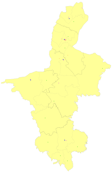
Administrative divisions
Ningxia is divided into five
| Administrative divisions of Ningxia | ||||||||
|---|---|---|---|---|---|---|---|---|
| Division code[31] | Division | Area in km2[32] | Population 2020[33] | Seat | Divisions[34] | |||
Districts
|
Counties
|
CL cities | ||||||
| 640000 | Ningxia Hui Autonomous Region | 66,400.00 | 7,202,654 | Yinchuan city | 9 | 11 | 2 | |
| 640100 | Yinchuan city | 8,874.61 | 2,859,074 | Jinfeng District |
3 | 2 | 1 | |
| 640200 | Shizuishan city | 5,208.13 | 751,389 | Dawukou District |
2 | 1 | ||
| 640300 | Wuzhong city | 21,420.14 | 1,382,713 | Litong District |
2 | 2 | 1 | |
| 640400 | Guyuan city | 13,449.03 | 1,142,142 | Yuanzhou District |
1 | 4 | ||
| 640500 | Zhongwei city | 17,448.09 | 1,067,336 | Shapotou District |
1 | 2 | ||
| Administrative divisions in Chinese and varieties of romanizations | ||||
|---|---|---|---|---|
| English | Chinese | Pinyin | Xiao'erjing | |
| Ningxia Hui Autonomous Region | 宁夏回族自治区 | Níngxià Huízú Zìzhìqū | نِئٍثِيَا خُوِزُو زِجِٿِيُوِ | |
| Yinchuan city | 银川市 | Yínchuān Shì | ءٍچُوًا شِ | |
| Shizuishan city | 石嘴山市 | Shízuǐshān Shì | شِظُوِشًا شِ | |
| Wuzhong city | 吴忠市 | Wúzhōng Shì | وُجْو شِ | |
| Guyuan city | 固原市 | Gùyuán Shì | قُيُوًا شِ | |
| Zhongwei city | 中卫市 | Zhōngwèi Shì | جْووِ شِ | |
The five prefecture-level cities of Ningxia are subdivided into 22
Urban areas
| Population by urban areas of prefecture & county cities | ||||
|---|---|---|---|---|
| # | Cities | 2020 Urban area[35] | 2010 Urban area[36] | 2020 City proper |
| 1 | Yinchuan | 1,230,650 | 1,159,457 | 2,859,074 |
| 2 | Shizuishan | 422,043 | 403,901 | 751,389 |
| 3 | Wuzhong | 400,677 | 232,134 | 1,382,713 |
| 4 | Guyuan | 267,810 | 130,155 | 1,142,142 |
| 5 | Zhongwei | 249,307 | 160,279 | 1,067,336 |
| 6 | Lingwu | 200,920 | 125,976 | see Yinchuan |
| 7 | Qingtongxia | 142,349 | 99,367 | see Wuzhong |
Economy
Rural Ningxia was for long an officially designated poverty area, and remains on the lower rungs of the developmental ladder.[23] It is the province with the third smallest GDP (Tibet being the last) in China, even though its neighbors, Inner Mongolia and Shaanxi, are among the strongest emerging provincial economies in the country. Its nominal GDP in 2011 was just 200.0 billion yuan (US$32.7 billion) and a per capita GDP of 21,470 yuan (US$3,143). It comprises 0.44% of the national economy
Agriculture
Similar to other areas, Ningxia has seen a gradual decline of its peasant population due to rural–urban migration. Despite this, the great majority (62.8 percent) was still agricultural at the time of the survey.[37] Animal husbandry is important for the regional economy. In the main pastoral county, Yanchi, it is even the leading industry when specified for the primary sector. The dominant grazing animals are sheep and goat.[38] In the (semi-)pastoral regions, herders engage in a mixed sedentary farming operation of dryland agriculture and extensive animal husbandry, while full nomadic pastoralism is no longer practiced.[23]
Ningxia is the principal region of China where
Industries and economic zones
Desheng Industrial Park (in Helan County) is a base for about 400 enterprises. The industrial park has industrial chains from Muslim food and commodities to trade and logistics, new materials and bio-pharmaceuticals that has 80 billion yuan in fixed assets. Desheng is looking to be the most promising industrial park in the city. It achieved a total output value of 4.85 billion in 2008, up 40 percent year-on-year. The local government plans to cut taxes and other fees to reduce the burden on local enterprises. The industrial output value reached 2.68 billion yuan in 2008, an increase of 48 percent from a year earlier.
Transport

Airports
- Yinchuan Hedong International Airport
- Zhongwei Shapotou Airport
- Guyuan Liupanshan Airport
- Wuhai Airport (serves the northern area)
Highways
- China National Highway 109
- China National Highway 110
- China National Highway 211
- China National Highway 307
- China National Highway 309
- China National Highway 312
Bridge
- Taole Yellow River Expressway Bridge (陶乐黄河大桥)
Rail
Education
Demographics
| Year | Pop. | ±% |
|---|---|---|
| 1912[42] | 303,000 | — |
| 1928[43] | 1,450,000 | +378.5% |
| 1936–37[44] | 978,000 | −32.6% |
| 1947[45] | 759,000 | −22.4% |
| 1982[46] | 3,895,578 | +413.3% |
| 1990[47] | 4,655,451 | +19.5% |
| 2000[48] | 5,486,393 | +17.8% |
| 2010[49] | 6,301,350 | +14.9% |
| 2020[50] | 7,202,654 | +14.3% |
| Ningxia Province/AR was part of Gansu 1914–1929 and 1954–1958 In 1947 parts of Ningxia Province/AR were incorporated into Inner Mongolia AR. | ||
Religion
Religion in Ningxia (around 2010)
Islam is the single biggest religious tradition in Ningxia, adhered to by 34% of the population according to a 2010 survey.[51] Many of the Han Chinese practise Chinese folk religions, Taoism, Confucianism and Chinese Buddhism. Christianity was the religion of 1.17% of the province's population according to the Chinese General Social Survey of 2004.[52]
In 2008, there were 3,760 mosques in Ningxia, which is about one per 1730 residents.[53]
Hospitals
- People's Hospital of Ningxia
- Hospital of Traditional Chinese Medicine of Ningxia
- Ningxia Medical College Affiliated Hospital
- Yinchuan Hospital of Traditional Chinese Medicine
- Yinchuan People's Hospital
- Yinchuan Stomatological Hospital
- Yinchuan Women and Children's Healthcare Center
- Women and Children's Healthcare Center of Ningixa
- Yinchuan No.1 People's Hospital
- Yinchuan No.2 People's Hospital
- Yinchuan No.3 People's Hospital
- Shizuishan No.2 People's Hospital
- Guyuan Hospital of Ningxia
Tourism
One of Ningxia's main tourist spots is the internationally renowned
Museums
- Ningxia Museum, opened in 1988
- Ningxia Transportation Museum, opened in August 2008
- Museum of Contemporary Art Yinchuan (MOCA Yinchuan), opened on 8 August 2015.
Notable people
Gallery
-
 View ofChengtian Temple Pagoda.
 -
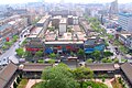
 People's Square in Yinchuan.
 -
 Phoenix Tablet fountain in Yinchuan.
 -
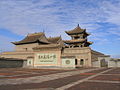 Tongxin Great Mosque, one of the oldest mosques in Ningxia and a famous cultural relic among the locals.
 -
 A tomb of the Western Xia


See also
- Major national historical and cultural sites in Ningxia
Notes
- ^ /nɪŋˈʃɑː/,[5]/ˈnɪŋˈʃjɑː/;[6] Chinese: 宁夏, Mandarin pronunciation: [nǐŋ.ɕjâ]; alternately romanized as Ninghsia
References
Citations
- ^ a b "Administrative Divisions (2013)". Ningxia Statistical Yearbook 2014. Statistical Bureau of Ningxia. Archived from the original on 4 March 2016. Retrieved 19 December 2015.
- ^ "Communiqué of the Seventh National Population Census (No. 3)". National Bureau of Statistics of China. 11 May 2021. Retrieved 11 May 2021.
- ^ GDP-2020 is a preliminary data "Home – Regional – Quarterly by Province" (Press release). China National Bureau of Statistics. 1 March 2021. Retrieved 31 December 2022.
- ISBN 978-7-5001-6138-7.
- ^ "Ningxia". Lexico UK English Dictionary. Oxford University Press. Archived from the original on 18 May 2021.
- ^ "Ningxia". Dictionary.com Unabridged (Online). n.d.
- ^ "By Choosing Assimilation, China's Hui Have Become One of the World's Most Successful Muslim Minorities". The Economist. 8 October 2016. Retrieved 8 October 2016.
- ^ "Níngxià huízú zìzhìqū zīyuán gàikuàng" 宁夏回族自治区资源概况 [Overview of Resources in Ningxia Hui Autonomous Region]. Zhōngguó wǎng (in Chinese). 17 December 2009. Archived from the original on 4 August 2020. Retrieved 2 October 2018.
- ^ In China's Ningxia province, water shortage is so severe that the government is relocating people
- ^ a b Hsieh, Chiao-min; Falkenheim, Victor C. "Ningxia". Encyclopædia Britannica. Archived from the original on 27 October 2016.
- ^ Tobin, Meaghan (12 May 2019). "Can China Become the Wine World's Next California?". South China Morning Post.
- ^ S2CID 83080752.
- ^ Xu, Xin (2003). The Jews of Kaifeng: China History, Culture, and Religion. Jersey City, NJ: Ktav Publishing House.
- ISSN 0012-8376.
- ^ Lin (2011), pp. 37–39.
- ^ China Archaeology and Art Digest, Volume 3, Issue 4. Art Text (HK). 2000. p. 354. Retrieved 28 November 2010.
- ^ "Dēng áobāo gēda shǎng juédǐng měijǐng" 登敖包疙瘩 赏绝顶美景. Fènghuáng zīxùn (in Chinese). 2 September 2014. Retrieved 6 November 2018.
- ^ Close, U.; McCormick (1922). "Where the Mountains Walked". National Geographic Magazine. Vol. 41, no. 5. pp. 445–464.
- ^ Feng, X.; Guo, A. (1985). "Earthquake Landslides in China". Proceedings, IVth International Conference and Field Workshop on Landslides. Tokyo: Japan Landslide Society. pp. 339–346.. (1985) "
- ^ Haines, Lester (19 July 2006). "Chinese Black Helicopters Circle Google Earth". The Register.
- McClatchy Newspapers/ Real Cities Network.
- ^ Ningxia Bureau of Statistics, 2013, 1.2
- ^ S2CID 157632052.
- PMID 20106474.
- S2CID 154397243.
- S2CID 144410824.
- ^ Zhou, Z. 2013. A view of Ningxia ten years since the grazing ban [Jìn mù yī nián kàn Níngxià]. People's Daily, 29 June. p. 10.
- ^ "NASA Earth Observations Data Set Index". National Aeronautics and Space Administration. Archived from the original on 10 May 2020. Retrieved 30 January 2016.
- ^ "Níngxià kuàngchǎn zīyuán gàikuàng jí fēnbù" 宁夏矿产资源概况及分布 [Overview and Distribution of Mineral Resources in Ningxia]. Zhōngguó bǎikē wǎng (in Chinese). 16 March 2011. Archived from the original on 12 November 2014.
- ^ Rivedal, Henning (17 July 2015). "Ningxia og Sogn og Fjordane eit steg vidare på samarbeidsvegen" [Ningxia and Sogn og Fjordane One Step Further on the Co-Operation Road]. Sfj.no (in Norwegian). Retrieved 7 May 2015.
- ^ "Zhōnghuá rénmín gònghéguó xiàn yǐshàng xíngzhèng qūhuà dàimǎ" 中华人民共和国县以上行政区划代码 [Code of Administrative Divisions Above the County Level of the People's Republic of China] (in Simplified Chinese) – via Ministry of Civil Affairs.
- ^ Shenzhen Bureau of Statistics. Shēnzhèn tǒngjì niánjiàn 2014 / 2014 Shenzhen Statistical Yearbook 深圳统计年鉴2014 (in Simplified Chinese and English). China Statistics Print. Archived from the original on 12 May 2015. Retrieved 29 May 2015.
- ISBN 978-7-5037-6660-2.
- ISBN 978-7-5037-7130-9.
- ISBN 978-7-5037-9772-9.
- ISBN 978-7-5037-6659-6.
- ^ Ningxia Bureau of Statistics 2013, 4.2
- ^ Ningxia Bureau of Statistics 2013, 11.20
- ^ "Grape expansion: Chinese wine companies move west" Archived 31 July 2015 at the Wayback Machine, Want China Times, 15 December 2011. Retrieved 17 December 2011.
- ^ Phillips, Tom (14 June 2016). "China's Bordeaux: winemakers in 'gold rush' to turn desert into vineyards". The Guardian. Helan county, Ningxia province.
- ^ 欢迎访问银川经济技术开发区网站. Ycda.gov.cn. 24 April 2015. Retrieved 7 May 2015.
- ^ 1912年中国人口. Retrieved 6 March 2014.
- ^ 1928年中国人口. Retrieved 6 March 2014.
- ^ 1936–37年中国人口. Retrieved 6 March 2014.
- ^ 1947年全国人口. Retrieved 6 March 2014.
- ^ 中华人民共和国国家统计局关于一九八二年人口普查主要数字的公报. National Bureau of Statistics of China. Archived from the original on 10 May 2012.
- ^ 中华人民共和国国家统计局关于一九九〇年人口普查主要数据的公报. National Bureau of Statistics of China. Archived from the original on 19 June 2012.
- ^ 现将2000年第五次全国人口普查快速汇总的人口地区分布数据公布如下. National Bureau of Statistics of China. Archived from the original on 29 August 2012.
- ^ "Communiqué of the National Bureau of Statistics of People's Republic of China on Major Figures of the 2010 Population Census". National Bureau of Statistics of China. Archived from the original on 27 July 2013.
- ^ "Key Takeaways from China's 2020 Population Census". Reuters. 11 May 2021.
- ^ a b Min Junqing. The Present Situation and Characteristics of Contemporary Islam in China. JISMOR, 8. 2010 Islam by province, page 29. Data from: Yang Zongde, Study on Current Muslim Population in China, Jinan Muslim, 2, 2010.
- ^ a b China General Social Survey 2004. Report by: Wang, Xiuhua (2015). Explaining Christianity in China: Why a Foreign Religion has Taken Root in Unfertile Ground (PDF) (Master's thesis). Baylor University. p. 15. Archived from the original (PDF) on 25 September 2015.
- ^ "Níngxià měi 577 míng mùsīlín yǒngyǒu yīzuò qīngzhēnsì-sōuhú xīnwén" 宁夏每577名穆斯林拥有一座清真寺-搜狐新闻. news.sohu.com (in Chinese). 9 May 2008. Retrieved 11 January 2021.
- ^ "Guyuan Travel Guide: Map, Location, Climate, Attractions". travelchinaguide.com. Retrieved 29 January 2015.
Sources
- Lin, Hsiao-ting (2011). Modern China's Ethnic Frontiers: A Journey to the West. Abingdon-on-Thames: Routledge.
External links
 Definitions from Wiktionary
 Media from Commons
 News from Wikinews
 Quotations from Wikiquote
 Texts from Wikisource
 Textbooks from Wikibooks
 Resources from Wikiversity
 Travel information from Wikivoyage
- Ningxia Provincial Government Archived 15 April 2012 at the Wayback Machine
- Ningxia at the Encyclopædia Britannica
- Economic profile for Ningxia at HKTDC
- Ningxia Profile – UNESCAP Archived 16 January 2014 at the Wayback Machine
- Ningxia Profile – China Economic Information Network
Places adjacent to Ningxia | ||||||||||||||||
|---|---|---|---|---|---|---|---|---|---|---|---|---|---|---|---|---|
| ||||||||||||||||