
Tamworth, Virginia
Tamworth, Virginia | ||
|---|---|---|
ZIP codes 23027 | ||
| Area code | 804 | |
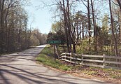
Tamworth, patented 1728, is an historical hamlet in Cumberland County, Virginia, United States, centered along Tamworth Road. In addition to farming, a gristmill and broad-crested weir on Muddy Creek comprised the principal economic activity. In addition to the mill, there are several other structures of historical interest dating from the 18th and 19th centuries: the miller's residence; a farmhouse; barns; assorted outbuildings; a post office; and Tamworth Cottage. All of the buildings are privately owned and are shown by appointment only.
History
The gristmill is known alternatively as Muddy Creek Mills or later as Moon's Mill.[1] The Mill was established in 1753 by Nicholas Davies and enlarged by Richard James in 1775.[2] Operations at the mill ceased in the mid 1950s. The mill was added to the National Register of Historic Places in 1974.[3]
The post office building (constructed 1792 [4]) also functioned as a general store and has been unused since the late 1980s when it was closed by the US Postal Service. The post office building features an ornately patterned slate-tiled roof.
Tamworth Cottage was initially constructed sometime between the first two phases of the mill construction (i.e. later half of the 18th century). It was moved during Mr Moon's tenure to its current location. The cottage was substantially enlarged and renovated in 1981.
In 2019, the film Harriet was filmed partially in Tamworth, with the mill featured prominently and several buildings having been constructed (slave quarters and a corn crib) for the set.
Geography
Situated in the Virginia
Tamworth is located in the Eastern Time Zone (EST/EDT) and along with the rest of Virginia observes daylight saving time.
Weather
The average July high temperature is +30.9 °C, the average January low is -3.9 °C, and the average annual rainfall is 116.8 cm. Snowfall is 19.3 cm per year on average. Sunny days typically outnumber rainy days by almost 2 to 1 with a UV index of 4.6.[8] Tamworth lies in USDA Plant Hardiness Zone 7a.[9]
Gallery
-
 Tamworth highway sign
 -
 Muddy Creek Mill
 -
 Muddy Creek Weir


-
 Farm House
 -
 Tamworth Cottage
 -
 Tamworth 1723


References
- ^ Cumberland County Comprehensive Plan
- ^ National Register of Historic Places, Nomination Form, 1974
- ^ National Register of Historic Places, State Listings, 2007
- ^ Cumberland County website
- ^ Tamworth Community Profile
- ^ HomeTownLocator website
- ^ "Muddy Creek Bridge in Powhatan closed until May".
- ^ BestPlaces.net
- ^ "USDA Plant Hardiness Zone Map". Agricultural Research Service. Retrieved February 20, 2023.
External links
- http://www.cumberlandcounty.virginia.gov/ (Cumberland County's Official Website)
- http://www.cumberlandva.com/
 | ||||
| CDP | ||||
| Unincorporated communities | ||||
| Footnotes | ‡This populated place also has portions in an adjacent county or counties | |||
| ||||