
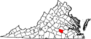
Nottoway County, Virginia
Nottoway County | |
|---|---|
 | |
|
UTC−4 (EDT) | |
| Congressional district | 5th |
| Website | www |
Nottoway County is a
History
Prior to the arrival of European settlers, the land that would become Nottoway County was inhabited by American Indians of the Nadowa tribe, an
Before the county established its own government, it was known as Nottoway Parish, a district of Amelia County. Nottoway Parish became Nottoway County by legislative act in 1788. The county contained numerous early crossroads settlements connecting the new western frontier with the population centers of Petersburg and Richmond to the north and east and until recent times owed much of its prosperity to tobacco. First coming to Nottoway in the 1850s, railroad construction and associated industries eventually came to represent a major portion of business in the area. In the 1860 census, 73.2% of the total population of Nottoway County were slaves, the highest percentage of any Virginia county.[4]
One of the county's larger towns,
During the
Nottoway's three towns were incorporated in the late 1800s, all along what was to become the
The 20th century saw an increase in the diversification of the county in its agricultural, industrial and commercial sectors. During this time, major state and federal facilities were created in the county.
Geography
According to the U.S. Census Bureau, the county has a total area of 316 square miles (820 km2), of which 314 square miles (810 km2) is land and 1.7-square-mile (4.4 km2) (0.5%) is water.[5]
Adjacent counties
- Amelia County - north
- Dinwiddie County - east
- Brunswick County - southeast
- Lunenberg County - south
- Prince Edward County - west
Major highways
 US 360 (W & E Patrick Henry Hwy; joins with US 460in Burkeville)
 US 460 (W & E Colonial Trail Hwy. US Bus 460 goes through Nottoway Courthouse to Blackstone. US 460 bypasses Blackstone and unites before the junction of SR 153)
 SR 40 (S. Main St & Dinwiddie Ave in Blackstone, Kenbridge Rd, Darvills Rd)
 SR 46 (Christianna Hwy)
 SR 49 (Watsons Wood Rd N of Crewe, unites with US 460 in Crewe, The Falls Rd S of Crewe)
 SR 153 (Rocky Hill Rd)
 SR 307 (Holly Farms Rd)
Demographics
| Census | Pop. | Note | %± |
|---|---|---|---|
| 1800 | 9,401 | — | |
| 1810 | 9,278 | −1.3% | |
| 1820 | 9,658 | 4.1% | |
| 1830 | 10,130 | 4.9% | |
| 1840 | 9,719 | −4.1% | |
| 1850 | 8,437 | −13.2% | |
| 1860 | 8,836 | 4.7% | |
| 1870 | 9,291 | 5.1% | |
| 1880 | 11,156 | 20.1% | |
| 1890 | 11,582 | 3.8% | |
| 1900 | 12,366 | 6.8% | |
| 1910 | 13,462 | 8.9% | |
| 1920 | 14,161 | 5.2% | |
| 1930 | 14,866 | 5.0% | |
| 1940 | 15,556 | 4.6% | |
| 1950 | 15,479 | −0.5% | |
| 1960 | 15,141 | −2.2% | |
| 1970 | 14,260 | −5.8% | |
| 1980 | 14,666 | 2.8% | |
| 1990 | 14,993 | 2.2% | |
| 2000 | 15,725 | 4.9% | |
| 2010 | 15,853 | 0.8% | |
| 2020 | 15,642 | −1.3% | |
| U.S. Decennial Census[6] 1790-1960[7] 1900-1990[8] 1990-2000[9] 2010[10] 2020[11] | |||
2020 census
| Race / Ethnicity | Pop 2010[10] | Pop 2020[11] | % 2010 | % 2020 |
|---|---|---|---|---|
White alone (NH)
|
8,799 | 8,452 | 55.50% | 54.03% |
Black or African American alone (NH)
|
6,179 | 5,773 | 38.98% | 36.91% |
Alaska Native alone (NH)
|
42 | 50 | 0.26% | 0.32% |
| Asian alone (NH) | 50 | 64 | 0.32% | 0.41% |
| Pacific Islander alone (NH) | 3 | 3 | 0.02% | 0.02% |
| Some Other Race alone (NH) | 16 | 72 | 0.10% | 0.46% |
| Mixed Race/Multi-Racial (NH) | 155 | 455 | 0.98% | 2.91% |
| Hispanic or Latino (any race) | 609 | 773 | 3.84% | 4.94% |
| Total | 15,853 | 15,642 | 100.00% | 100.00% |
Note: the US Census treats Hispanic/Latino as an ethnic category. This table excludes Latinos from the racial categories and assigns them to a separate category. Hispanics/Latinos can be of any race.
2000 census
As of the census
There were 5,664 households, out of which 29.90% had children under the age of 18 living with them, 48.60% were married couples living together, 15.40% had a female householder with no husband present, and 31.40% were non-families. 27.60% of all households were made up of individuals, and 14.20% had someone living alone who was 65 years of age or older. The average household size was 2.48 and the average family size was 3.00.
In the county, the age distribution of the population shows 22.90% under the age of 18, 8.10% from 18 to 24, 29.30% from 25 to 44, 22.60% from 45 to 64, and 17.10% who were 65 years of age or older. The median age was 39 years. For every 100 females there were 106.60 males. For every 100 females age 18 and over, there were 106.60 males.
The median income for a household in the county was $30,866, and the median income for a family was $39,625. Males had a median income of $28,533 versus $19,718 for females. The
Communities
Towns
Census-designated place
- Nottoway Court House (Nottoway)
Notable people
- Maurice Anderson, professional football player
- William Hodges Mann, Governor of Virginia from 1910 to 1914, and State Senator, introduced legislation to construct 350 high schools in Virginia and to close 800 rural saloons.
- Peter Randolph (1779 – January 30, 1832) was a United States federal judge.
Politics
| Year | Republican | Democratic | Third party | |||
|---|---|---|---|---|---|---|
| No. | % | No. | % | No. | % | |
| 2020 | 4,027 | 56.89% | 2,971 | 41.98% | 80 | 1.13% |
| 2016 | 3,712 | 55.04% | 2,829 | 41.95% | 203 | 3.01% |
| 2012 | 3,409 | 49.80% | 3,344 | 48.85% | 93 | 1.36% |
| 2008 | 3,499 | 50.07% | 3,413 | 48.84% | 76 | 1.09% |
| 2004 | 3,303 | 54.78% | 2,635 | 43.70% | 92 | 1.53% |
| 2000 | 2,870 | 52.26% | 2,460 | 44.79% | 162 | 2.95% |
| 1996 | 2,416 | 46.34% | 2,327 | 44.63% | 471 | 9.03% |
| 1992 | 2,610 | 45.45% | 2,411 | 41.98% | 722 | 12.57% |
| 1988 | 3,161 | 57.38% | 2,217 | 40.24% | 131 | 2.38% |
| 1984 | 3,418 | 59.00% | 2,296 | 39.63% | 79 | 1.36% |
| 1980 | 2,813 | 50.13% | 2,593 | 46.21% | 205 | 3.65% |
| 1976 | 2,486 | 47.61% | 2,558 | 48.99% | 178 | 3.41% |
| 1972 | 2,979 | 68.22% | 1,308 | 29.95% | 80 | 1.83% |
| 1968 | 1,614 | 33.42% | 1,529 | 31.66% | 1,687 | 34.93% |
| 1964 | 2,353 | 52.30% | 2,138 | 47.52% | 8 | 0.18% |
| 1960 | 1,319 | 40.14% | 1,882 | 57.27% | 85 | 2.59% |
| 1956 | 1,124 | 33.76% | 1,242 | 37.31% | 963 | 28.93% |
| 1952 | 1,454 | 51.02% | 1,381 | 48.46% | 15 | 0.53% |
| 1948 | 486 | 24.76% | 1,004 | 51.15% | 473 | 24.10% |
| 1944 | 472 | 24.46% | 1,453 | 75.28% | 5 | 0.26% |
| 1940 | 373 | 22.28% | 1,290 | 77.06% | 11 | 0.66% |
| 1936 | 260 | 16.58% | 1,297 | 82.72% | 11 | 0.70% |
| 1932 | 277 | 16.58% | 1,348 | 80.67% | 46 | 2.75% |
| 1928 | 667 | 40.35% | 986 | 59.65% | 0 | 0.00% |
| 1924 | 181 | 15.59% | 840 | 72.35% | 140 | 12.06% |
| 1920 | 154 | 15.79% | 821 | 84.21% | 0 | 0.00% |
| 1916 | 91 | 12.85% | 608 | 85.88% | 9 | 1.27% |
| 1912 | 72 | 8.61% | 683 | 81.70% | 81 | 9.69% |
See also
References
- ^ "Nottoway County, Virginia". United States Census Bureau. Retrieved January 30, 2022.
- ^ "Find a County". National Association of Counties. Retrieved June 7, 2011.
- ISBN 9780549325543.
- ^ Grymes, Charles. "Population of Virginia - 1860". Virginia Places. Retrieved October 29, 2017.
- ^ "US Gazetteer files: 2010, 2000, and 1990". United States Census Bureau. February 12, 2011. Retrieved April 23, 2011.
- US Census Bureau. Retrieved January 24, 2022.
- ^ "Historical Census Browser". University of Virginia Library. Retrieved January 4, 2014.
- ^ "Population of Counties by Decennial Census: 1900 to 1990". United States Census Bureau. Retrieved January 4, 2014.
- ^ "Census 2000 PHC-T-4. Ranking Tables for Counties: 1990 and 2000" (PDF). United States Census Bureau. Archived (PDF) from the original on March 27, 2010. Retrieved January 4, 2014.
- ^ a b "P2 HISPANIC OR LATINO, AND NOT HISPANIC OR LATINO BY RACE - 2010: DEC Redistricting Data (PL 94-171) - Nottoway County, Virginia". United States Census Bureau.
- ^ a b "P2 HISPANIC OR LATINO, AND NOT HISPANIC OR LATINO BY RACE - 2020: DEC Redistricting Data (PL 94-171) - Nottoway County, Virginia". United States Census Bureau.
- ^ "U.S. Census website". United States Census Bureau. Retrieved May 14, 2011.
- ^ "Free Virginia Public Records: Search Divorce, Marriage, Warrants". Virginia Records Page. Retrieved May 8, 2023.
- ^ Leip, David. "Dave Leip's Atlas of U.S. Presidential Elections". uselectionatlas.org. Retrieved December 9, 2020.
External links
Places adjacent to Nottoway County, Virginia | ||||||||||||||||
|---|---|---|---|---|---|---|---|---|---|---|---|---|---|---|---|---|
| ||||||||||||||||
 | ||||
| CDP | ||||
| Other communities | ||||
| ||||
37°08′N 78°03′W / 37.14°N 78.05°W
| International | |
|---|---|
| National | |
| Other | |