
Cumbre Vieja tsunami hazard

_La_Palma_%26_La_Gomera_Islands,_Canary_Islands_(cropped).jpg)
The island of
Steven N. Ward and Simon Day in a 2001 research article proposed that a
The recurrence rate of similar collapses is extremely low, about one every 100,000 years or less in the case of the Canary Islands. Other volcanoes across the world are at risk of causing such tsunamis.
Sector collapses and tsunamis caused by them
Giant landslides and collapses of ocean island volcanoes were first described in 1964 in Hawaii and are now known to happen in almost every ocean basin.[1] As volcanoes grow in size they eventually become unstable and collapse, generating landslides[2] and collapses such as the failure of Mount St. Helens in 1980[3] and many others.[4] In the Hawaiian Islands, collapses with volumes of over 5,000 cubic kilometres (1,200 cu mi) have been identified.[5]
A number of such landslides have been identified in the Canary Islands, especially in the more active volcanoes El Hierro, La Palma and Tenerife[6] where about 14 such events are recorded through their deposits.[7] They mostly take the form of debris flows[6] with volumes of 50–200 cubic kilometres (12–48 cu mi)[7] that emanate from an amphitheatre-shaped depression on the volcanic island and come to rest on the seafloor at 3,000–4,000 metres (9,800–13,100 ft) depth. They do not appear to form through individual collapses; multi-stage failures lasting hours or days appear to be more common[6] as has been inferred from the patterns of landslide-generated turbidite deposits in the Agadir Basin north of the Canary Islands.[8] The most recent such event took place at El Hierro 15,000 years ago[6] and was later re-dated to have occurred between 87,000±8,000 (margin of uncertainty) and 39,000±13,000 years ago.[9]
Many processes are involved in the onset of volcano instability and the eventual failure of the edifice.
Tsunami hazards
Large collapses on volcanoes have generated tsunamis, of which about 1% relates to volcanic collapse;
Other historically recorded examples include the
Prehistoric landslides that caused tsunamis include the
The size of such tsunamis depends both on the geological details of the landslide (such as its
Regional context: Cumbre Vieja and the Atlantic Ocean
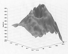
The Cumbre Vieja volcano lies on the southern third of La Palma (Canary Islands) and rises about 2 kilometres (1.2 mi)[1] above sea level and 6 kilometres (3.7 mi) above the seafloor.[30] It is the fastest growing volcano in the archipelago and thus dangerous in terms of collapses and landslides.[7] Several collapses took place since the Pliocene, followed by the growth of Cumbre Vieja during the last 125,000 years.[31] The latest eruption began on 19 September 2021 following a week of seismic activity.[32]
During the
Models
Model by Ward and Day 2001
Ward and Day 2001 estimated that the unstable part of Cumbre Vieja would be at least 15 kilometres (9.3 mi) wide in north–south direction. In light of the behaviour of other documented sector collapses such as at
The authors used
- 2 Minutes: A 900 metres (3,000 ft) thick dome of water rises above the landslide.[39]
- 5 Minutes: The dome collapses to a height of 500 metres (1,600 ft) as it advances by 50 kilometres (31 mi); additionally, wave valleys form.[39]
- 10 Minutes: The landslide is now over. Waves reaching heights of 400–600 metres (1,300–2,000 ft) hit the three western Canary Islands.[40]
- 15–60 Minutes: 50–100 metres (160–330 ft) high waves hit Africa. A 500 kilometres (310 mi) wide train of waves advances across the Atlantic.[40]
- 3–6 Hours: The waves hit
- 9 Hours: Waves 20–25 metres (66–82 ft) approach Florida; they are not expected to grow farther as they hit the coast.[40]
Later models
Mader 2001 employed a shallow water code that includes friction and the Coriolis force. Assuming shallow-water behaviour of the wave even with runup the eventual tsunami heights in the US and the Caribbean would not exceed 3 metres (9.8 ft) and in Africa and Europe it would not be higher than 10 metres (33 ft).[42] Mader 2001 also estimated that dispersion along the US coast could reduce tsunami amplitude to less than 1 metre (3 ft 3 in).[43]
Gisler, Weaver and Gittings 2006 used public domain
Løvholt, Pedersen and Gisler in 2008 published another study that employed the worst-case landslide scenario of Ward and Day 2001, but used hydrodynamic modelling that accounts for dispersion, non-linear effects and the deformation of the landslide material itself to simulate waves generated by such a collapse.[7] In this model, the landslide had a volume of 375 cubic kilometres (90 cu mi) and a maximum speed of 190 metres per second (620 ft/s). It generates a high leading wave that eventually separates from the landslide, while turbulent flow behind the slide generates lower waves. Overall, a complex wave field develops[49] with a sickle-shaped front wave that is over 100 metres (330 ft) high when it reaches a radius of 100 kilometres (62 mi).[50] The waves do not decay at a constant rate with distance, with the crestal wave decaying slightly faster than 1/distance while the trailing wave decays slightly more slowly.[51] Thus at distance the trailing waves can become higher than the leading wave,[52] especially the waves propagating west display this behaviour.[53] Undulating bores also develop, a factor not commonly considered in tsunami models.[54]
In the Løvholt, Pedersen and Gisler 2008 model, the impact in the Canary Islands would be quite severe, with the tsunami reaching heights of over 10–188 metres (33–617 ft), threatening even inland valleys and towns and hitting the two largest cities of the islands (Santa Cruz and Las Palmas) badly.[55] The impact in Florida would not be as severe as in the Ward and Day 2001 model by a factor of 2–3[56] but wave heights of several metres would still occur around the North Atlantic.[57] Off the US coast, wave amplitude would reach 9.6 metres (31 ft).[58]
Abadie et al. 2009 simulated both the most realistic landslide geometry and the tsunamis that would result from it near its source.[59] They concluded that most realistic volumes would be 38–68 cubic kilometres (9.1–16.3 cu mi) for a small collapse and 108–130 cubic kilometres (26–31 cu mi) for a large collapse.[60] The initial height of the wave depends strongly on the viscosity of the landslide and can exceed 1.3 kilometres (0.81 mi).[61]
Løvholt, Pedersen and Glimsdal 2010 noted that landslide-generated tsunamis can have a leading wave smaller than following waves, requiring a dispersive wave model. They simulated inundation in
Abadie, Harris and Grilli 2011 employed three-dimensional simulations with the hydrodynamic simulator "THETIS" to reproduce the tsunamis induced by failures of 20 cubic kilometres (4.8 cu mi), 40 cubic kilometres (9.6 cu mi), 80 cubic kilometres (19 cu mi) and 450 cubic kilometres (110 cu mi). These volumes were taken from studies on the stability of La Palma's western flank, while the 450 cubic kilometres (110 cu mi) reflects worst-case scenarios from earlier tsunami studies at Cumbre Vieja.[64] The landslide is directed southwestward and induces a wave train, with the 80 cubic kilometres (19 cu mi) collapse having a maximum wave height of 80 metres (260 ft).[65] At El Hierro the tsunami can shoal and rise to a height of 100 metres (330 ft), while the wave train surrounds La Palma and continues eastward with a height of 20–30 metres (66–98 ft).[66]
Zhou et al. 2011 used numerical simulations to model various tsunamis, including a scenario resulting from a mass failure at La Palma.[67] It assumes a smaller volume of 365 cubic kilometres (88 cu mi) as the collapse hits only the western flank[68] and does not assume a southwest-directed propagation direction, thus increasing the hazard to the US coast.[69] The resulting tsunami approaches the US coast between 6–8 hours after the collapse, in a north-to-south fashion.[70] Waves grow due to shoaling as they approach the continental shelf[71] but later decline due to increased bottom friction[72] and eventually reach heights of 3–10 metres (9.8–32.8 ft) when they come ashore. The impact of undular bore formation on runup is unclear.[72]
Abadie et al. 2012 simulated both the development of waves using dispersive models that include non-linear effects, and the behaviour of the landslide generating them through slope stability and material strength models.[73] They considered both volumes of 38–68 cubic kilometres (9.1–16.3 cu mi), obtained from research on the stability of the flank of Cumbre Vieja, as well as volumes of 500 cubic kilometres (120 cu mi) as hypothesized by the original Ward and Day 2001 study.[74] The slide has a complex acceleration behaviour and most of the waves are formed during a short period early in the slide where the Froude number briefly exceeds 1;[75] the initial wave can reach a height of 1.3 kilometres (0.81 mi)–0.8 kilometres (0.50 mi)[76] and eventually wave trains are formed, which are diffracted around the southern tip of La Palma and go on to hit the other Canary Islands. With increasing volume of the slides, the wavelength becomes shorter and the amplitude higher, yielding steeper waves.[77] Abadie et al. 2012 estimated a fast decay of the waves with distance but cautioned that since their model was not appropriate to use for simulating far-field wave propagation the decay may be exaggerated. In the Canary Islands, inundation would reach a height of 290 metres (950 ft) on La Palma;[78] even for a 80 cubic kilometres (19 cu mi) slide would reach heights of 100 metres (330 ft) in the city of Santa Cruz de La Palma (population 18,000) while the largest city of La Palma (Los Llanos de Aridane, population 20,000) may be spared.[79] The waves would take approximately one hour to propagate through the archipelago,[80] and important cities in the entire Canary Islands would be hit by substantial tsunamis irrespective of the landslide size.[81]
Tehranirad et al. 2015 modelled the impact both of a worst-case 450 cubic kilometres (110 cu mi) landslide and of a more realistic 80 cubic kilometres (19 cu mi) collapse on
Abadie et al. 2020 repeated their 2012 simulations using a model which incorporates
Ward and Day 2006 indicated that the combined effects of several wave trains may amplify the tsunami impact over that of a single wave.[101] Research by Frohlich et al. 2009 on boulders emplaced on Tongatapu endorsed the hypothesis of large landslide-induced tsunamis[102] and Ramalho et al. 2015 identified evidence of a megatsunami, implying a single step collapse, caused by the collapse of Fogo volcano in the Cape Verde islands.[103]
Criticism
The findings of Ward and Day 2001 have gained considerable attention,
- The authors employed a linear tsunami model that may not properly reflect non-linear processes such as wave breaking that could reduce the height of the resulting tsunami by a factor of about 10.[113][7] Wave dispersion might also act to reduce tsunami height since the wave induced by the Ward and Day 2001 landslide behaves as an intermediate-water depth wave.[114]
- The estimated speed and acceleration of the landslide may be unrealistically high for the slopes it would move on, and thus inadequate to establish effective coupling between the tsunami and the landslide.[115] Later research has found evidence that sufficient speeds have been reached during collapses at other volcanoes.[116]
- The landslide modelled by Ward and Day 2001 may be implausibly thick given the known volumes of Canary Islands mega-landslides, and collapses may have occurred in multiple steps rather than a single failure[117][7] or may have a smaller volume.[118] The thickness of the landslide is a particular issue, as different estimates have been obtained at various volcanoes.[119] Another issue is whether giant landslides occur as a single step failure (as argued for Hawaiian giant landslides) or multistage failures (as appears to be more common in the Canary Islands)[120] and stacking in turbidite deposits generated by landslides are a reliable indicator that these landslides occurred in piecemeal fashion.[121]
In general, many of these studies have found lower wave heights at distance than the original Ward and Day 2001 paper.[122] There are also questions about the southern limit of the width of the unstable zone,[123] about whether creep might stabilize it[124] and about whether it actually exists at all.[125]
Probability
Giant landslides are rare events.[111] Humanity has never witnessed enormous collapses on La Palma[58] and there is evidence that the western flank of La Palma is currently stable[64] and a collapse in the near future unlikely.[126] A worst-case scenario giant landslide like the one modelled by Ward and Day 2001 is a very low probability event, probably much less common than once per 100,000 years[117] which is the probable occurrence rate of large landslides in the Canary Islands.[6][127] A smaller landslide scenario, which Tehranirad et al. 2015 defined as "extreme credible worst case scenario", has a recurrence rate of about once every 100,000 years.[82] Because of their low incidence probability, the hazard from large flank collapses at La Palma is considered to be low.[125] Return periods are not the only factor involved in estimating risk, as the amount of damage done by an extreme event has to be considered.[127] Globally, the return period of giant landslide-induced tsunamis may exceed one per 10,000 years.[128]
Potential impact
A Cumbre Vieja landslide tsunami may constitute a threat to Brazil,[129] Canada,[130] Caribbean,[131] Ireland,[132] Morocco,[133] the Northeastern United States,[134] Portugal[135] and the United Kingdom.[136] The impact would not be limited to humans.[137] Aside from the tsunami hazard, the impact of a large collapse on people living on the island would be severe. The communities of El Paso, Fuencaliente, Los Llanos and Tazacorte are located on the unstable block.[138]
Other volcanoes with such threats
Other volcanoes in the world with such landslide risks include:
- Anak Krakatau, which is quickly regrowing after its 2018 collapse.[139]
- Augustine[140]
- Beerenberg[141]
- Fogo and Santo Antão in the Cape Verde islands, although the latter is currently inactive and it is not clear whether the former, which underwent a past such collapse, has reached a critical size again.[142]
- Kick 'em Jenny in the Lesser Antilles.[143]
- Kilauea, where a 2,000 cubic kilometres (480 cu mi) mass movement took place in 2000. It was a slow movement[144] but a sudden collapse could hit all of the Pacific Rim.[145]
- Kueishantao[146]
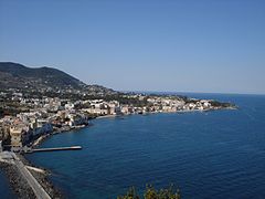
- Monte Nuovo on Ischia, which might fail during renewed magmatic activity. Both the landslide itself (on Ischia) and tsunamis (Ischia and the coast of Campania) would be affected.[147]
- There is little known about the potential for such landslide-induced tsunamis in the Pacific Ocean, except for Hawaii.[148]
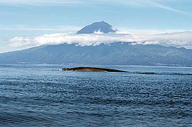
- A slump off Pico[149]
- Santorini[150]
- Stromboli[140]
- North Atlantic.[151]
While non-volcanic, tsunami threats from
-
 Anak Krakatau in 2013, before the 2018 collapse
 -
 Augustine volcano
 -
 Beerenberg
 -
 Fogo volcano on the island of the same name
 -
 Santo Antao, Cape Verde
 -
 Kick 'em Jenny
 -
 The Hilina Slump on Kilauea
 -
 Kueishantao
 -
 Harbour on Ischia
 -
 Pico volcano on Pico island
 -
 Stromboli
 -
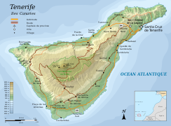 Tenerife
 -
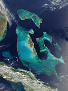 Bahamas

.jpg)


References
- ^ a b c d e Ward & Day 2001, p. 3397.
- ^ a b Abadie et al. 2012, p. 1.
- ^ a b c Gisler, Weaver & Gittings 2006, p. 2.
- ^ a b McGuire 2006, p. 121.
- ^ a b c d McGuire 2006, p. 122.
- ^ a b c d e Masson et al. 2006, p. 2021.
- ^ a b c d e f Løvholt, Pedersen & Gisler 2008, p. 2.
- ^ Masson et al. 2006, p. 2023.
- ISSN 0377-0273.
- ^ McGuire 2006, p. 128.
- ^ a b McGuire 2006, p. 125.
- ^ McGuire 2006, p. 126.
- ^ a b Masson et al. 2006, p. 2024.
- ^ Løvholt, Pedersen & Gisler 2008, p. 1.
- ^ Grilli et al. 2019, p. 1.
- ^ Grilli et al. 2019, p. 8.
- ^ Necmioglu et al. 2023, p. 1811.
- ^ a b Dawson & Stewart 2007, p. 170.
- ^ Necmioglu et al. 2023, p. 1812.
- ^ a b Dawson & Stewart 2007, p. 169.
- ^ a b c d McGuire 2006, p. 132.
- ^ Grilli et al. 2019, p. 2.
- ^ a b Masson et al. 2006, p. 2025.
- S2CID 134889445.
- ^ a b Abadie et al. 2012, p. 2.
- ISSN 0377-0273.
- ^ Løvholt, Pedersen & Gisler 2008, p. 3.
- ^ Pararas-Carayannis 2002, p. 255.
- ^ McGuire 2006, p. 123.
- ^ Chamberlain 2006, p. 34.
- ^ Chamberlain 2006, pp. 35–36.
- ^ Estévez, Karen (19 September 2021). "La erupción del volcán de La Palma obliga a la evacuación de miles de personas". elDiario.es (in Spanish). Retrieved 20 September 2021.
- ^ Chamberlain 2006, p. 37.
- ^ Chamberlain 2006, p. 42.
- .
- ^ S2CID 130438036.
- ^ Carracedo et al. 2009, p. 44.
- ^ a b Ward & Day 2001, p. 3398.
- ^ a b c Ward & Day 2001, p. 3399.
- ^ a b c d e Ward & Day 2001, p. 3400.
- ^ Pararas-Carayannis 2002, p. 253.
- ^ Mader 2001, p. 3.
- ^ Mader 2001, p. 5.
- ^ Gisler, Weaver & Gittings 2006, p. 3.
- ^ Gisler, Weaver & Gittings 2006, p. 4.
- ^ Gisler, Weaver & Gittings 2006, p. 5.
- ^ Gisler, Weaver & Gittings 2006, p. 11.
- ^ Gisler, Weaver & Gittings 2006, p. 12.
- ^ Løvholt, Pedersen & Gisler 2008, pp. 5–6.
- ^ Løvholt, Pedersen & Gisler 2008, p. 9.
- ^ Løvholt, Pedersen & Gisler 2008, pp. 6–7.
- ^ Løvholt, Pedersen & Gisler 2008, p. 12.
- ^ Løvholt, Pedersen & Gisler 2008, pp. 13–14.
- ^ Løvholt, Pedersen & Gisler 2008, p. 18.
- ^ Løvholt, Pedersen & Gisler 2008, pp. 10–11.
- ^ Løvholt, Pedersen & Gisler 2008, p. 15.
- ^ Løvholt, Pedersen & Gisler 2008, p. 17.
- ^ a b Zhou et al. 2011, p. 2685.
- ^ Abadie et al. 2009, p. 1384.
- ^ Abadie et al. 2009, p. 1390.
- ^ Abadie et al. 2009, pp. 1390–1392.
- ^ Løvholt, Pedersen & Glimsdal 2010, p. 76.
- ^ Løvholt, Pedersen & Glimsdal 2010, p. 77.
- ^ a b Abadie, Harris & Grilli 2011, p. 688.
- ^ Abadie, Harris & Grilli 2011, p. 691.
- ^ Abadie, Harris & Grilli 2011, p. 692.
- ^ Zhou et al. 2011, p. 2677.
- ^ Zhou et al. 2011, p. 2687.
- ^ Zhou et al. 2011, p. 2688.
- ^ Zhou et al. 2011, p. 2689.
- ^ Zhou et al. 2011, p. 2690.
- ^ a b Zhou et al. 2011, p. 2691.
- ^ Abadie et al. 2012, p. 3.
- ^ Abadie et al. 2012, p. 4.
- ^ Abadie et al. 2012, p. 7.
- ^ Abadie et al. 2012, p. 12.
- ^ Abadie et al. 2012, p. 13.
- ^ Abadie et al. 2012, p. 15.
- ^ Abadie et al. 2012, p. 16.
- ^ Abadie et al. 2012, p. 21.
- ^ Abadie et al. 2012, p. 24.
- ^ a b Tehranirad et al. 2015, p. 3591.
- ^ Tehranirad et al. 2015, p. 3594.
- ^ Tehranirad et al. 2015, p. 3593.
- ^ Tehranirad et al. 2015, pp. 3596–3598.
- ^ a b Tehranirad et al. 2015, p. 3599.
- ^ Tehranirad et al. 2015, p. 3601.
- ^ Tehranirad et al. 2015, p. 3608.
- ^ Tehranirad et al. 2015, p. 3610.
- ^ Tehranirad et al. 2015, p. 3611.
- ^ Tehranirad et al. 2015, p. 3606.
- ^ Tehranirad et al. 2015, p. 3614.
- ^ Abadie et al. 2020, p. 3020.
- ^ Abadie et al. 2020, p. 3022.
- ^ Abadie et al. 2020, p. 3026.
- ^ Abadie et al. 2020, p. 3027.
- ^ Abadie et al. 2020, p. 3028.
- ^ Abadie et al. 2020, p. 3029.
- ^ Abadie et al. 2020, p. 3031.
- ^ Abadie et al. 2020, p. 3032.
- ^ Ward, Steven N.; Day, Simon (2008). "Tsunami balls: a granular approach to tsunami runup and inundation". Communications in Computational Physics: 242 – via ResearchGate.
- ISSN 0091-7613.
- PMID 26601287.
- ^ Orlowski 2021, p. 55.
- ^ Fernández Torres et al. 2014, pp. 32–33.
- ^ Smolka 2006, p. 2158.
- S2CID 153898787.
- .
- ISBN 978-3-642-25892-3.
- ^ Carracedo et al. 2009, p. 52.
- ^ a b Orlowski 2021, p. 56.
- ^ Masson et al. 2006, pp. 2027–2029.
- ^ Masson et al. 2006, pp. 2027–2028.
- ^ Mader 2001, p. 2.
- ^ Masson et al. 2006, pp. 2028–2029.
- ^ McGuire 2006, p. 134.
- ^ a b Masson et al. 2006, p. 2029.
- ^ Zhou et al. 2011, p. 2686.
- ^ McGuire 2006, p. 133.
- ^ Smolka 2006, p. 2163.
- ^ McGuire 2006, pp. 134–135.
- ^ Abadie et al. 2009, p. 1389.
- .
- S2CID 128899101.
- ^ a b Carracedo et al. 2009, p. 55.
- ^ Pararas-Carayannis 2002, p. 256.
- ^ a b Tehranirad et al. 2015, p. 3590.
- S2CID 36216617.
- S2CID 131568916.
- S2CID 129351944.
- ISSN 0037-0738.
- ISSN 1561-8633.
- S2CID 129393431.
- ISSN 0964-5691.
- hdl:10400.21/1265 – via ResearchGate.
- .
- .
- ^ Chamberlain 2006, p. 40.
- ^ Grilli et al. 2019, p. 10.
- ^ a b McGuire 2006, p. 137.
- S2CID 250460481.
- .
- S2CID 140162662.
- ^ Ward 2002, p. 973.
- ^ Ward 2002, p. 974.
- PMID 30401817.
- S2CID 129761721.
- S2CID 129166027.
- .
- ^ Necmioglu et al. 2023, p. 1827.
- ISSN 0012-821X.
- PMID 27811961.
Sources
- Abadie, Stéphane; Gandon, Clément; Grilli, Stephan; Fabre, Richard; Riss, Joëlle; Tric, Emmanuel; Morichon, Denis; Glockner, Stéphane (1 May 2009). McKee Smith, Jane (ed.). 3D numerical simulations of waves generated by subaerial mass failures: application to la palma case. Coastal Engineering 2008. Vol. 1. Hamburg, Germany: World Scientific Publishing Company. pp. 1384–1395. ISBN 978-981-4277-36-5 – via Academia.edu.
- Abadie, Stéphane; Harris, Jeffrey; Grilli, Stéphan (1 January 2011). Numerical Simulation of Tsunami Generation By the Potential Flank Collapse of the Cumbre Vieja Volcano. The Twenty-first International Offshore and Polar Engineering Conference. ISBN 978-1-880653-96-8.
- Abadie, S. M.; Harris, J. C.; Grilli, S. T.; Fabre, R. (May 2012). "Numerical modeling of tsunami waves generated by the flank collapse of the Cumbre Vieja Volcano (La Palma, Canary Islands): Tsunami source and near field effects: Modeling of La Palma tsunami". Journal of Geophysical Research: Oceans. 117 (C5): n/a. .
- Abadie, Stéphane; Paris, Alexandre; Ata, Riadh; Le Roy, Sylvestre; Arnaud, Gael; Poupardin, Adrien; Clous, Lucie; Heinrich, Philippe; Harris, Jeffrey; Pedreros, Rodrigo; Krien, Yann (10 November 2020). "La Palma landslide tsunami: calibrated wave source and assessment of impact on French territories". Natural Hazards and Earth System Sciences. 20 (11): 3019–3038. ISSN 1561-8633.
- Carracedo, Juan Carlos; Pérez Torrado, Francisco José; Paris, Raphael; Rodríguez Badiola, Eduardo (2009). "Megadeslizazmientos en las Islas Canarias" [Megalandslides in the Canary Islands]. Enseñanza de las Ciencias de la Tierra (in Spanish). ISSN 1132-9157.
- Chamberlain, Tracy (2006). Potential effects of flank collapse of the Cumbre Vieja volcano, La Palma, Canary Islands (PDF). Open University Geological Society Journal Symposium Edition 2006. University of Nottingham.
- Dawson, Alastair G.; Stewart, Iain (15 August 2007). "Tsunami deposits in the geological record". Sedimentary Geology. 200 (3): 166–183. ISSN 0037-0738.
- Gisler, Galen; Weaver, Robert; Gittings, Michael L. (2006). "SAGE calculations of the tsunami threat from La Palma". Science of Tsunami Hazards. 24 (4). CiteSeerX 10.1.1.505.3475.
- Grilli, Stephan T.; Tappin, David R.; Carey, Steven; Watt, Sebastian F. L.; Ward, Steve N.; Grilli, Annette R.; Engwell, Samantha L.; Zhang, Cheng; Kirby, James T.; Schambach, Lauren; Muin, Muslim (16 August 2019). "Modelling of the tsunami from the 22 December 2018 lateral collapse of Anak Krakatau volcano in the Sunda Straits, Indonesia". Scientific Reports. 9 (1): 11946. S2CID 199668546.
- Løvholt, Finn; Pedersen, Geir Kleivstul; Glimsdal, Sylfest (2010). "Coupling of dispersive tsunami propagation and shallow water coastal response". The Open Oceanography Journal. 4 (2): 71–82. ISSN 1874-2521.
- Løvholt, F.; Pedersen, G.; Gisler, G. (16 September 2008). "Oceanic propagation of a potential tsunami from the La Palma Island". Journal of Geophysical Research. 113 (C9): C09026. .
- Mader, Charles L. (2001). "Modeling the La Palma landslide tsunami". Science of Tsunami Hazards. 19 (3): 150–170 – via Academia.edu.
- Masson, D.G; Harbitz, C.B; Wynn, R.B; Pedersen, G; Løvholt, F (15 August 2006). "Submarine landslides: processes, triggers and hazard prediction". Philosophical Transactions of the Royal Society A: Mathematical, Physical and Engineering Sciences. 364 (1845): 2009–2039. S2CID 11012536.
- McGuire, W. J. (1 January 2006). "Lateral collapse and tsunamigenic potential of marine volcanoes". Geological Society, London, Special Publications. 269 (1): 121–140. S2CID 140635792.
- Necmioglu, Ocal; Heidarzadeh, Mohammad; Vougioukalakis, Georgios E.; Selva, Jacopo (May 2023). "Landslide Induced Tsunami Hazard at Volcanoes: the Case of Santorini". Pure and Applied Geophysics. 180 (5): 1811–1834. .
- Orlowski, Benedikt M. (8 March 2021). Rivalling Disaster Experiences. transcript Verlag. S2CID 240063012.
- Pararas-Carayannis, George (2002). "Evaluation of the threat of mega tsunami generation from postulated massive slope failures of island stratovolcanoes on La Palma, Canary Islands, and on the island of Hawaii". Science of Tsunami Hazards. 20 (5): 251–277 – via Academia.edu.
- Smolka, Anselm (15 August 2006). "Natural disasters and the challenge of extreme events: risk management from an insurance perspective". Philosophical Transactions of the Royal Society A: Mathematical, Physical and Engineering Sciences. 364 (1845): 2147–2165. S2CID 38520920.
- Tehranirad, Babak; Harris, Jeffrey C.; Grilli, Annette R.; Grilli, Stephan T.; Abadie, Stéphane; Kirby, James T.; Shi, Fengyan (December 2015). "Far-Field Tsunami Impact in the North Atlantic Basin from Large Scale Flank Collapses of the Cumbre Vieja Volcano, La Palma" (PDF). Pure and Applied Geophysics. 172 (12): 3589–3616. S2CID 128009476.
- Fernández Torres, José; González Méndez, Pablo José; Camacho, Antonio G.; Prieto, Juan Francisco; Bru, Guadalupe (10 August 2014). "An Overview of Geodetic Volcano Research in the Canary Islands". Pure and Applied Geophysics. 172 (11): 3189–3228. S2CID 128948152.
- Ward, Steven N.; Day, Simon (2001). "Cumbre Vieja Volcano – Potential collapse and tsunami at La Palma, Canary Islands". Geophysical Research Letters. 28 (17): 3397–3400. ISSN 1944-8007.
- Ward, Steven N. (February 2002). "Slip-sliding away". Nature. 415 (6875): 973–974. S2CID 4318886.
- Zhou, H.; Moore, C. W.; Wei, Y.; Titov, V. V. (10 October 2011). "A nested-grid Boussinesq-type approach to modelling dispersive propagation and runup of landslide-generated tsunamis". Natural Hazards and Earth System Sciences. 11 (10): 2677–2697. ISSN 1561-8633.