Great South Australian Coastal Upwelling System


The Great South Australian Coastal Upwelling System is a seasonal upwelling system in the eastern Great Australian Bight, extending from Ceduna, South Australia, to Portland, Victoria, over a distance of about 800 kilometres (500 mi). Upwelling events occur in the austral summer (from November to May) when seasonal winds blow from the southeast. These winds blow parallel to the shoreline at certain areas of the coast, which forces coastal waters offshore via Ekman transport and draws up cold, nutrient-rich waters from the ocean floor.[1]: 9–10
Because the deep water carries abundant nutrients up from the
The Great South Australian Coastal Upwelling System (GSACUS) is Australia's only deep-reaching coastal upwelling system, with nutrient-enriched water stemming from depths exceeding 300 metres (980 ft).[3]
Recently, a new upwelling centre has been discovered on the western shelf of Tasmania.[4] Since this new upwelling centre is located outside South Australian waters, the entire upwelling system should be rather called the Great Southern Australian Coastal Upwelling System.
Oceanographic processes
During the austral summer,
Key upwelling centres form in three different locations, described in the sub-sections below; the Kangaroo Island and Eyre Peninsula centres are linked by the same upwelling process.[1]: 2, 10, 25 [2] Upwelling events occur nearly simultaneously across the three separate centres, appearing within a few days of each other, despite spanning a distance of approximately 800 kilometres (500 mi).[2]: 1–2 While the Bonney Upwelling, where the strongest and most reliable upwelling events occur, was reported and explored over 30 years ago,[5] the full extent of the upwelling system was discovered only as recently as 2004.[2]
Bonney Upwelling
The Bonney Upwelling is the largest and most predictable upwelling in the GSACUS. It stretches from
Kangaroo Island and Eyre Peninsula
Upwelling at
Ecology


Extensive upwelling of nutrient-rich water makes the GSACUS an important marine hot spot on Australia's southern shelves. During upwelling events, the abundance of the GSACUS ecosystem can approach that of some of the world’s most productive upwelling centers, such as those offshore of Peru, California, and Namibia.[8]
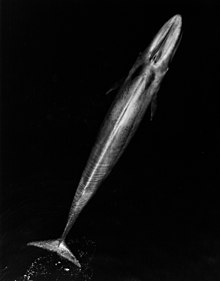
During upwelling events, surface chlorophyll a concentrations, an indicator of phytoplankton abundance, increase tenfold.[2]: 2 Phytoplankton blooms bring about swarms of krill, which in turn attract blue whales. Blue whales are found in various locations off the southeast coast of Australia, but most predominantly in the Bonney Upwelling region, which is one of 12 identified blue whale feeding sites worldwide. Marine biologist Peter Gill estimates that 100 blue whales visit the Bonney Upwelling area every year, ranging over 18,000 square kilometres (6,900 sq mi) of ocean from Robe, South Australia to Cape Otway in Victoria. The feeding grounds may extend further northwest, encompassing the rest of the GSACUS, but incomplete whale surveys are insufficient to establish their true range.[1]: 2, 20–24 [9]
Other marine life that thrives in the upwelling includes filter feeders like
Economic importance
The GSACUS supports a productive fishery, and local fishers recognize the bounty that the upwelling provides them.[1]: 26 Every November, Portland, Victoria, hosts an Upwelling Festival to celebrate the abundance of the Bonney Upwelling, and to begin the summer fishing season.[11]
Humans have exploited the GSACUS for thousands of years. Oral histories of local Aboriginal tribes indicate a close connection to the ocean, and said tribes may possibly have eaten
Today, southern rock lobster (referred to locally as crayfish) and trawling are the most important fishing industries in the Bonney Upwelling.[1]: ii, 28 whereas the upwelling off the Eyre Peninsula supports a large sardine fishery, operating chiefly out of Port Lincoln, South Australia.[6]: 1 [13]
Conservation
Next to the
Significant reserves of natural gas are present beneath the Bonney Coast, and are undergoing exploration.[1]: 33 Fears have been expressed that expanded gas drilling may threaten whales through noise pollution and ship collisions.[1]: iii [15]
See also
References
- ^ CSIRO Marine and Atmospheric Research) and Environment Australia, Dec. 2002. Accessed 12 July 2013.
- ^
- ^
- ^ Lewis, R.K. 1981. Seasonal upwelling along the south-eastern coastline of South Australia. Australian Journal of Marine and Freshwater Research 32: 843-854.
- ^ .
- ^ Von Der Borch, C.C., J.R. Conolly, R.S. Dietz, Sedimentation and structure of the continental margin in the vicinity of the Otway Basin, southern Australia, Marine Geology, Volume 8, Issue 1, January 1970, Pages 59-83.
- ^
- ^ Clevers, Jeni. Producer's Diary. ‘’The Big Blue’’. Australian Broadcasting Company, 2007. Accessed 16 July 2013.
- ^ Willis, J., and Hobday, A. J. (2007). Influence of upwelling on movement of southern bluefin tuna (Thunnus maccoyii) in the Great Australian Bight. Marine and Freshwater Research 58, 699–708.
- ^ a b "Portland Upwelling Festival - The Bonney Upwelling". Archived from the original on 26 March 2014. Retrieved 12 July 2013.
- ISBN 0-85575-281-5 Excerpt also published on Museum Victoria website Archived 2012-09-05 at the Wayback Machine, accessed 26 November 2008
- ^ "South Australian Sardine Industry Inc". Archived from the original on 15 August 2013. Retrieved 18 July 2013.
- Hobart, Tasmania: Artemis Publishing Consultants, 2004. Commonwealth Marine Reserves. 06 Dec. 2012. Accessed 16 July 2013.
- ^ Fyfe, Melissa (1 May 2004). "A deep mystery unfolds". The Age. Retrieved 18 July 2013.


