
Jarmen
Jarmen | |
|---|---|
 Old Marketplace | |
 Coat of arms | |
Location of Jarmen within Vorpommern-Greifswald district Vorpommern-Greifswald | |
| Municipal assoc. | Jarmen-Tutow |
| Subdivisions | 8 |
| Government | |
| • Mayor | Arno Karp |
| Area | |
| • Total | 30.64 km2 (11.83 sq mi) |
| Elevation | 7 m (23 ft) |
| Population (2022-12-31)[1] | |
| • Total | 2,914 |
| • Density | 95/km2 (250/sq mi) |
| Time zone | UTC+01:00 (CET) |
| • Summer (DST) | UTC+02:00 (CEST) |
| Postal codes | 17126 |
| Dialling codes | 039997 |
| Vehicle registration | DM |
| Website | www.jarmen.de |
Jarmen (German pronunciation: Mecklenburg-Western Pomerania, Germany. It is situated on the southern bank of the river Peene, 20 km south of Greifswald, in the historic region of Pomerania.
Founded during the
Autobahn 20 crosses the Peene
at Jarmen.
Administrative division
In addition to the town itself, the following villages are within the Jarmen city limits:
- Plötz
- Neu Plötz
- Wilhelminenthal
- Groß Toitin
- Klein Toitin
- Kronsberg
- Müssentin
The municipality is within the
.History
In the vicinity of Jarmen, remains of Stone and Bronze Age settlements have been found. In 690 AD, West Slavic Veleti settled the area. In the High Middle Ages, the area was known as the terrae of Miserez and Ploth.
The area was part of the
Cammin bishops, until they gave it to Otto I, the Pomeranian duke, as a fief in 1305. Jarmen remained a small town, but prospered moderately because of its location at a ford and the maintenance of a ferry service since 1368. In 1631, Jarmen became seat of the Amt Ueckermünde. At this time, the Thirty Years' War had already reached the area, which became Swedish
in the following.

Jarmen remained with
narrow gauge railways: In 1893 to Anklam and Friedland by the Mecklenburg-Pommersche Schmalspurbahn, and in 1897 to Altentreptow and Demmin by the Demminer Kleinbahn Ost as well as to Greifswald and Züssow by the Greifswald-Jarmener Kleinbahn
. None of these narrow gauge railways exist anymore.
In the final stages of
Autobahn 20 and L35, formerly Bundesstraße 96
.
Gallery
-
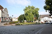 New Marketplace
 -
 Saint Mary Church
 -
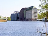 Granaries at the harbour
 -
 Peene bridge


References
- Statistisches Amt Mecklenburg-Vorpommern. 2023.
- ^ "Amt Jarmen-Tutow: Stadt Jarmen" (in German). Archived from the original on 4 April 2017. Retrieved 11 September 2020.
- ^ Stanisław Kozierowski, Atlas nazw geograficznych Słowiańszczyzny Zachodniej Zeszyt IIA, Poznań, 1937, p. 13 (in Polish)
- ^ Ernst Eichler, Städtenamenbuch der DDR, Leipzig, 1988, p. 140 (in German)
- ^ Jolanta Aniszewska, W obowiązku pamięci... Stalag II D i formy upamiętnienia jeńców wojennych w Stargardzie Szczecińskim, "Łambinowicki rocznik muzealny" Tom 34, Opole, 2011, p. 11 (in Polish)
External links
![]() Media related to Jarmen at Wikimedia Commons
Media related to Jarmen at Wikimedia Commons
- Official website
 (in German)