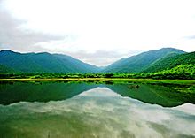
List of rivers of Kerala
There are 44 major rivers in Kerala, all but three originating in the Western Ghats. 41 of them flow westward and 3 eastward. The rivers of Kerala are small, in terms of length, breadth and water discharge. The rivers flow faster, owing to the hilly terrain and as the short distance between the Western Ghats and the sea. All the rivers are entirely monsoon-fed and many of them shrink into rivulets or dry up completely during summer.
Features

Kerala is wedged between the
backwaters or Arabian Sea there.[5] The longer rivers have several tributaries and streams too.[5] The Western Ghats form a wall of mountains interrupted only near Palakkad; hence also known Palghat, where the Palakkad Gap breaks.[6] The river Bharathappuzha flows through the Palakkad Gap. The 3 east-flowing rivers also originate in Western Ghats, but flow eastwards either into Karnataka or Tamil Nadu.[5]
Kerala's western coastal belt is relatively flat compared to the eastern region, and is criss-crossed by a network of interconnected
Achankovil River; 128 kilometres (80 mi). The average length of the rivers is 64 kilometres (40 mi). Many of the rivers are small and entirely fed by monsoon rain.[13] As Kerala's rivers are small and lacking in delta, they are more prone to environmental effects. The rivers face problems such as sand mining and pollution.[14]
West flowing rivers
This is a list of the westward-flowing rivers of
Kerala Backwaters or into the Arabian Sea. Length in kilometers is in parentheses. Kasaragod district have the maximum number of west-flowing rivers in Kerala - 12.[15]
Periyar, known as Choorni in ancient period, is the longest river in Kerala.[5]
Bharathappuzha, the second-longest river of Kerala of which 209 km flows through Kerala, has played a major role in shaping the Culture of Kerala.[16][17]
The 130 km long Kadalundi River, which empties into the sea near Kadalundi Bird Sanctuary, is the fifth-longest river in Kerala.
Athirappilly Falls is situated on the 130 km long Chalakudy River
.- Periyar River (244)
- Edamala River
- Cheruthoni River
- Mullayar River
- Muthirapuzha River
- Perinjankutti River
- Ambazhachal River
- Kaniyampuzha River
- Muttar River
- Panniyar
- Bharatapuzha River(209)
- Thuthapuzha River
- Kanjirappuzha
- Gayathripuzha River
- Kalpathipuzha River
- Kannadipuzha River
- Pamba River (176)
- Chaliyar River(169)
- Cherupuzha (Mavoor)
- Iruvanjippuzha
- Thottumukkam River
- Kuthirappuzha
- Kuruvanpuzha
- Karimpuzha
- Pandippuzha
- Neerppuzha
- Chalakudy River (145)
- Kadalundy River(130)
- Achankoil River(128)
- Kallada River (121)
- Muvattupuzha River(121)
- Thodupuzha River
- Kothayar River
- Kaliyar River
- Kariyar River
- Thevalakkadu River
- Uzhavoor River
- Valapattanam River(110)
- Bavali River
- Pulloopi River
- Payyavoor River
- Mundayapuzha River
- Veni River
- Aralam River
- Chandragiri River (105)
- Manimala River (90)
- Vamanapuram River (88)
- Kuppam River (88)
- Kuttikol River
- Meenachil River (78)
- Meenachal River
- Kodoor River
- Karapuzha River
- Pulinackal River
- Moorkankavu River
- Kuttiyadi River(74)
- Karamana River (68)
- Shiriya River (68)
- Kariangode River (64)
- Chaithravahini River
- Ithikkara River (56)
- Neyyar River(56)
- Mahe River (54)
- Mundathode River
- Keecheri River (51)
- Perumba River (51)
- Vayalapra River
- Uppala River (50)
- Karuvannur River (48)
- Anjarakandy River (48)
- Tirur River (48)
- Neeleshwaram River (46)
- Pallikkal River (42)
- Kallayi River (40)
- Korapuzha River (40)
- Mogral River (34)
- Kavvayi River(31)
- Thanikkudam River(29)
- Thalassery River (28)
- Ummanchira River
- Mamam river (27)
- Chithari River (25)
- Ramapuram River (19)
- Ayiroor River (17)
- Manjeswaram River (16)
East flowing rivers

There are three rivers rise in Kerala and flow eastwards, Kabini into
Kaveri river
.
See also
References
- ^ ISBN 978-8180692949. Retrieved 19 March 2019.
- ISBN 978-8170999133. Retrieved 18 November 2012.
- ^ Pratiyogita Darpan (September 2006). Pratiyogita Darpan. Pratiyogita Darpan. p. 72. Retrieved 18 November 2012.
- ISBN 978-8174781642. Retrieved 18 November 2012.
- ^ a b c d Chandran 2018, p. 341.
- ^ Chandran Nair, Dr.S.Sathis. "India – Silent Valley Rainforest Under Threat Once More". rainforestinfo.org.au. Retrieved 12 November 2015.
- ISBN 978-0415773362. Retrieved 18 November 2012.
- ISBN 978-8131767344. Retrieved 18 November 2012.
- ^ Press Trust of India (1 June 2020). "Kerala Boat Ferries Lone Passenger To Help Her Take Exam". NDTV. Retrieved 17 November 2020.
- ^ Suchitra, M (13 August 2003). "Thirst below sea level". The Hindu. Archived from the original on 22 September 2019. Retrieved 17 November 2020.
- ISBN 978-0070702882. Retrieved 18 November 2012.
- ^ Inland Waterways Authority of India (IWAI—Ministry of Shipping) (2005). "Introduction to Inland Water Transport". IWAI (Ministry of Shipping). Archived from the original on 4 February 2005. Retrieved 19 January 2006.
- ISBN 978-8171885947.
- Vembanad lake, Southwest coast of India", Environmental Geology 54(4), 879–89. springerlink.com. Retrieved 17 July 2009.
- ^ Chandran 2018, p. 448.
- ^ Binoy, Rasmi (27 September 2018). "The river sutra". The Hindu. Retrieved 24 January 2021.
- ISBN 9788126415786.
- ^ Chandran 2018, p. 342.
- ^ "Oldest teak plantation, Conolly's Plot, to reopen after maintenance". Mathrubhumi. 16 May 2017. Retrieved 12 October 2020.
Notes
- Chandran, VP (2018). Mathrubhumi Yearbook Plus - 2019 (Malayalam Edition). Kozhikode: P. V. Chandran, Managing Editor, Mathrubhumi Printing & Publishing Company Limited, Kozhikode.


