
Leh district
Leh district | |
|---|---|
Hindi/Urdu | |
| Time zone | UTC+05:30 (IST) |
| Vehicle registration | LA-01 |
| Website | leh |
Leh district is a district in Indian-administered Ladakh in the disputed Kashmir-region.[1] Ladakh is an Indian-administered union territory. With an area of 45,110 km2, it is the second largest district in the country, second only to Kutch. It is bounded on the north by Gilgit-Baltistan's Kharmang and Ghanche districts and Xinjiang's Kashgar Prefecture and Hotan Prefecture, to which it connects via the historic Karakoram Pass. Aksai Chin and Tibet are to the east, Kargil district to the west, and Lahul and Spiti to the south. The district headquarters is in Leh. It lies between 32 and 36 degree north latitude and 75 to 80 degree east longitude.
All of Ladakh was under the administration of Leh until 1 July 1979, when the Kargil and Leh administrative districts were created. Religion has been a source of grievance between Buddhists and Muslims since the late 20th century and contributed to this division.[3]
In 2017, the district was declared a tobacco-free zone. The Directorate of Health Services Kashmir, under the National Tobacco Control Programme, began working towards the designation early in 2017 and the status was declared in August. Rehana Kousar (in-charge, NTCP, Kashmir) said that work was done with civil society, religious and women's groups and that a "major success was achieved by the involvement of women in the anti-tobacco campaign."[4]
In August 2019, the
Administration
Leh district has seven sub-divisions and twelve tehsils. The sub-divisions are:
. The tehsils are:

As a result of The Jammu and Kashmir Reorganisation (Removal of Difficulties) Second Order, 2019, Leh district claimed de jure jurisdiction over the following areas of Pakistani-administered Kashmir: Gilgit, Gilgit Wazarat, Chilas, and Tribal territory,[7] making it only slightly smaller than the country of Tunisia.
The
As of July 2019, Leh district is divided into 7 sub-divisions (new sub-divisions in Leh), 12
| Sub–divisions, Blocks and Villages in Leh[10] | |||
|---|---|---|---|
| District | Sub-Division | Blocks | Villages |
| Leh district | Khaltsi | Khaltsi | Kanji, Khaltsi, Lamayuru, Leh Dho, Nurla, Skindiang, Takmachik, Temisgam, Tia |
| Singaylalok | |||
| Skurbuchan | Damkhar, Hanoo, Skur Buchan
| ||
| Leh | Chuchot | Chuchot Yakma, Chuchot Gongma, Chuchot Shama, Mathoo, Stakna, Stok | |
| Leh | Phey, Saboo, Phyang, Spituk, Choglamsar | ||
| Thiksay | Nang, Rambir Por, Shey, Thiksey | ||
| Nubra | Diskit | Khardong, Khema Khungru, Lakjung, Largiab, Partapur, Skanpuk, Skuru, Tangyar, Terchey, Udmaru, Warisfistan
| |
| Panamic | |||
| Turtuk | Turtok
| ||
Durbuk
|
Durbuk
|
Tangste
| |
| Kharu | Kharu | ||
| Likir | Nimoo |
||
| Saspol | Alchi, Giramangu, Saspochey, Suspol, Tarhipti, Hemishok Pachan | ||
| Nyoma | Nyoma | Mood, Nyoma
| |
| Rong-Chumathang | Tukla
| ||
| Rupsho-Puga | Karzok, Kharnak, Samad Rakchan | ||
| Total | 7 | 16 | 113 |
Demographics
According to the
Religion
| Leh district: religion, gender ratio, and % urban of population, according to the 2011 Census.[11] | |||||||||
|---|---|---|---|---|---|---|---|---|---|
| Hindu | Muslim | Christian | Sikh | Buddhist | Jain | Other | Not stated | Total | |
| Total | 22,882 | 19,057 | 658 | 1,092 | 88,635 | 103 | 54 | 1,006 | 133,487 |
| 17.14% | 14.28% | 0.49% | 0.82% | 66.40% | 0.08% | 0.04% | 0.75% | 100.00% | |
| Male | 21,958 | 10,493 | 469 | 1,018 | 44,019 | 49 | 29 | 936 | 78,971 |
| Female | 924 | 8,564 | 189 | 74 | 44,616 | 54 | 25 | 70 | 54,516 |
| Gender ratio (% female) | 4.0% | 44.9% | 28.7% | 6.8% | 50.3% | 52.4% | 46.3% | 7.0% | 40.8% |
| Sex ratio (no. females per 1,000 males) |
42 | 816 | 403 | 73 | 1,014 | – | – | 75 | 690 |
| Urban | 14,542 | 5,169 | 358 | 927 | 24,023 | 24 | 53 | 575 | 45,671 |
| Rural | 8,340 | 13,888 | 300 | 165 | 64,612 | 79 | 1 | 431 | 87,816 |
| % Urban | 63.6% | 27.1% | 54.4% | 84.9% | 27.1% | 23.3% | 98.1% | 57.2% | 34.2% |
Languages
Ladakhi is the most spoken language, and Hindi/Urdu is the second-largest language, mainly spoken in Leh. Balti is found in Nubra near the boundary with Gilgit-Baltistan. Tibetan, Punjabi, Marathi and Nepali are all mainly spoken in Leh. Urdu and English are widely understood in Leh.[3]
Politics
Parliamentary Constituency
The district falls under
Assembly constituencies
Leh district had two assembly constituencies, Nubra and Leh under Jammu and Kashmir Legislative Assembly.[15] Since Ladakh is a union territory without a legislature, it does not currently have a legislative assembly.[16]
Autonomous Hill Council
Leh District is administered by an elected body known as the Ladakh Autonomous Hill Development Council, Leh. The LAHDC was established in 1995.[17]
The latest elections were held in October 2020. The BJP secured 15 seats while the INC won 9 and the Independents won 2.
Transportation
Road
Leh is connected to the rest of India by two high-altitude roads both of which are subject to landslides and neither of which are passable in winter when covered by deep snows. The
The overland approach to Ladakh from the Kashmir valley via the 434-km.
- Leh-Manali Highway
Since 1989, the 473-km Leh-Manali Highway has been serving as the second land approach to Ladakh. Open for traffic from June to late October, this high road traverses the upland desert plateaux of Rupsho whose altitude ranges from 3,660 m to 4,570 m. There are a number of high passes en route among which the highest one, known as
- Nimmu–Padam–Darcha road
This is the third road axis to Leh. It is currently under construction.
Air

Leh's
Rail
There is no railway service currently in Ladakh, however, 2 railway routes are proposed- the Bhanupli–Leh line and Srinagar–Kargil–Leh line.[19]
Gallery
-
 Indus River Valley in Thiksey
 -
 Indus Valley in Leh
 -
 Khardung La pass in Ladakh Range
 -
 Rock formations alongLeh-Manali Highway
 -
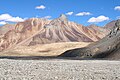
 Mountain peaks around Leh
 -
 Tsomoririlake
 -
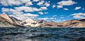 Pangonglake
 -
 Leh district flower fields and mountains


,_Mountains,_Indus_River_Valley,_Ladakh,_North_India,_Himalayas.jpg)


.jpg)
See also
References
- ^ due weightin the coverage. Although "controlled" and "held" are also applied neutrally to the names of the disputants or to the regions administered by them, as evidenced in sources (h) through (i) below, "held" is also considered politicized usage, as is the term "occupied," (see (j) below).
(a) Kashmir, region Indian subcontinent, Encyclopaedia Britannica, retrieved 15 August 2019 (subscription required) Quote: "Kashmir, region of the northwestern Indian subcontinent ... has been the subject of dispute between India and Pakistan since the partition of the Indian subcontinent in 1947. The northern and western portions are administered by Pakistan and comprise three areas: Azad Kashmir, Gilgit, and Baltistan, the last two being part of a territory called the Northern Areas. Administered by India are the southern and southeastern portions, which constitute the state of Jammu and Kashmir but are slated to be split into two union territories.";
(b) Pletcher, Kenneth, Aksai Chin, Plateau Region, Asia, Encyclopaedia Britannica, retrieved 16 August 2019 (subscription required) Quote: "Aksai Chin, Chinese (Pinyin) Aksayqin, portion of the Kashmir region, at the northernmost extent of the Indian subcontinent in south-central Asia. It constitutes nearly all the territory of the Chinese-administered sector of Kashmir that is claimed by India to be part of the Ladakh area of Jammu and Kashmir state.";
(c) "Kashmir", Encyclopedia Americana, Scholastic Library Publishing, 2006, p. 328,ISBN 978-1-84904-621-3Quote:"Some politicised terms also are used to describe parts of J&K. These terms include the words 'occupied' and 'held'." - ^ "Lok Sabha Members". Lok Sabha. Retrieved 12 July 2021.
- ^ a b "Muslim Precedence Politics - How it operates in Ladakh". Kashmir Sentinel. August 2002. Archived from the original on 6 October 2008.
- ^ "Leh Declared Tobacco-Free". The Tribune India. Retrieved 24 August 2017.
- ^ "Article 370 revoked Updates: Jammu & Kashmir is now a Union Territory, Lok Sabha passes bifurcation bill". Business Today. 6 August 2019.
- ^ a b Leh tehsils.
- ^ "J&K Reorganisation (Removal of Difficulties) Second Order, 2019 -- [Territory of Leh district shall constitute, Gilgit, Gilgit Wazarat, Chilas, Tribal territory & 'Leh & Ladakh' except present territory of Kargil]". 2 November 2019.
- ^ "Ladakh Autonomous Hill development Council act 1997" (PDF). Retrieved 26 January 2021.
- ^ "Subdivisions & Blocks". District Leh - Ladakh.
- ^ "Villages | District Leh, Union Territory of Ladakh | India". District Leh - Ladakh – Government of India. Archived from the original on 24 December 2020. Retrieved 24 December 2020.
- ^ a b c C-1 Population By Religious Community – Jammu & Kashmir (Report). Office of the Registrar General & Census Commissioner, India. Retrieved 28 July 2020.
- ^ "Leh district census data 2011" (PDF). Retrieved 20 February 2019.
- ^ US Directorate of Intelligence. "Country Comparison:Population". Archived from the original on 13 June 2007. Retrieved 1 October 2011.
Saint Lucia 161,557 July 2011 est.
- ^ C-16 Population By Mother Tongue – Jammu & Kashmir (Report). Office of the Registrar General & Census Commissioner, India. Retrieved 18 July 2020.
- ^ "ERO's and AERO's". Chief Electoral Officer, Jammu and Kashmir. Archived from the original on 22 October 2008. Retrieved 28 August 2008.
- ^ "J&K to be a union territory with legislature, Ladakh to be without". India Today. Retrieved 5 August 2019.
- ^ "Ladakh Autonomous Hill Development Council, Leh". Leh. Archived from the original on 30 October 2007. Retrieved 6 December 2007.
- ^ See the article on Khardung La for a discussion of the world's highest motorable passes.
- ^ "Himachal CM meets Union railway minister, seeks 100% Centre funding for Bhanupali-Bilaspur-Leh rail line". Hindustan Times. Retrieved 9 November 2020.
External links
- Official Website of Ladakh Autonomous Hill Development Council, Leh
- Leh tehsil map, Maps of India
- Ladakh Tourism Guide - Photo Gallery of Leh, Monasteries in Leh, NGO's in Leh, Important Phone #.
- Shaam Region in Leh (not to be confused with the Middle Eastern region)
Places adjacent to Leh district | |
|---|---|