
Tibet
 | This article's images may require adjustment of the picture tutorial and the image placement policy for further information. (June 2022) |
Tibet | |
|---|---|
Population | |
• 2023 estimate | 7,000,000 (Tibetan people) |

| |||||||||||||||||||||||||||||||||||||||||||||||||||||||||||||||||||||||||||||

| Tibet | |||||||
|---|---|---|---|---|---|---|---|
Tibetan བོད | | ||||||
| |||||||
Tibet (
The
Following the
The dominant
Names and etymologies

The
The modern
The best-known medieval Chinese name for Tibet is Tubo (Chinese:
Other pre-modern Chinese names for Tibet include:
- Wusiguo (Chinese: 烏斯國; pinyin: Wūsīguó; cf. Tibetan: dbus, Ü, [wyʔ˨˧˨]);
- Wusizang (Chinese: 烏斯藏; pinyin: wūsīzàng, cf. Tibetan: dbus-gtsang, Ü-Tsang);
- Tubote (Chinese: 圖伯特; pinyin: Túbótè); and
- Tanggute (Chinese: 唐古忒; pinyin: Tánggǔtè, cf. Tangut).
American Tibetologist Elliot Sperling has argued in favor of a recent tendency by some authors writing in Chinese to revive the term Tubote (simplified Chinese: 图伯特; traditional Chinese: 圖伯特; pinyin: Túbótè) for modern use in place of Xizang, on the grounds that Tubote more clearly includes the entire Tibetan plateau rather than simply the Tibet Autonomous Region.[16]
The English word Tibet or Thibet dates back to the 18th century.
Language
.jpg)
Linguists generally classify the
From the perspective of historical linguistics, Tibetan most closely resembles
Sino-Tibetan, and that through it Tibetan and Burmese are distant cousins of Chinese.[19]

The language has numerous regional dialects which are generally not mutually intelligible. It is employed throughout the Tibetan plateau and Bhutan and is also spoken in parts of Nepal and northern India, such as Sikkim. In general, the dialects of central Tibet (including Lhasa), Kham, Amdo and some smaller nearby areas are considered Tibetan dialects. Other forms, particularly Dzongkha, Sikkimese, Sherpa, and Ladakhi, are considered by their speakers, largely for political reasons, to be separate languages. However, if the latter group of Tibetan-type languages are included in the calculation, then 'greater Tibetan' is spoken by approximately 6 million people across the Tibetan Plateau. Tibetan is also spoken by approximately 150,000 exile speakers who have fled from modern-day Tibet to India and other countries.[citation needed]
Although spoken Tibetan varies according to the region, the written language, based on
Starting in 2001, the local
The first Tibetan-English dictionary and grammar book was written by Alexander Csoma de Kőrös in 1834.[21]
History
Early history

Humans inhabited the Tibetan Plateau at least 21,000 years ago.[23] This population was largely replaced around 3,000 BP by Neolithic immigrants from northern China, but there is a partial genetic continuity between the Paleolithic inhabitants and contemporary Tibetan populations.[23]
The earliest Tibetan historical texts identify the
Tibetan Empire

The history of a unified Tibet begins with the rule of
Under the next few Tibetan kings, Buddhism became established as the state religion and Tibetan power increased even further over large areas of Central Asia, while major inroads were made into Chinese territory, even reaching the Tang's capital Chang'an (modern Xi'an) in late 763.[29] However, the Tibetan occupation of Chang'an only lasted for fifteen days, after which they were defeated by Tang and its ally, the Turkic Uyghur Khaganate.

The
In 747, the hold of Tibet was loosened by the campaign of general
At its height in the 780s to 790s, the Tibetan Empire reached its highest glory when it ruled and controlled a territory stretching from modern-day Afghanistan, Bangladesh, Bhutan, Burma, China, India, Nepal, Pakistan, Kazakhstan, Kyrgyzstan, Tajikistan.
In 821/822 CE, Tibet and China signed a peace treaty. A bilingual account of this treaty, including details of the borders between the two countries, is inscribed on a stone pillar which stands outside the
Yuan dynasty

The Mongol
Tibet retained nominal power over religious and regional political affairs, while the Mongols managed a structural and administrative
Yuan control over the region ended with the Ming overthrow of the Yuan and Tai Situ Changchub Gyaltsen's revolt against the Mongols.[34] Following the uprising, Tai Situ Changchub Gyaltsen founded the Phagmodrupa dynasty, and sought to reduce Yuan influences over Tibetan culture and politics.[35]
Phagmodrupa, Rinpungpa and Tsangpa dynasties
Between 1346 and 1354, Tai Situ Changchub Gyaltsen toppled the Sakya and founded the Phagmodrupa dynasty. The following 80 years saw the founding of the Gelug school (also known as Yellow Hats) by the disciples of Je Tsongkhapa, and the founding of the important Ganden, Drepung and Sera monasteries near Lhasa. However, internal strife within the dynasty and the strong localism of the various fiefs and political-religious factions led to a long series of internal conflicts. The minister family Rinpungpa, based in Tsang (West Central Tibet), dominated politics after 1435. In 1565 they were overthrown by the Tsangpa dynasty of Shigatse which expanded its power in different directions of Tibet in the following decades and favoured the Karma Kagyu sect.

Rise of Ganden Phodrang and Buddhist Gelug school
In 1578,
The 5th Dalai Lama (1617–1682) is known for unifying the Tibetan heartland under the control of the Gelug school of Tibetan Buddhism, after defeating the rival Kagyu and Jonang sects and the secular ruler, the Tsangpa prince, in a prolonged civil war. His efforts were successful in part because of aid from Güshi Khan, the Oirat leader of the Khoshut Khanate. With Güshi Khan as a largely uninvolved overlord, the 5th Dalai Lama and his intimates established a civil administration which is referred to by historians as the Lhasa state. This Tibetan regime or government is also referred to as the Ganden Phodrang.
Qing dynasty

For several decades, peace reigned in Tibet, but in 1792, the Qing Qianlong Emperor sent a large Chinese army into Tibet to push the invading Nepalese out. This prompted yet another Qing reorganization of the Tibetan government, this time through a written plan called the "Twenty-Nine Regulations for Better Government in Tibet". Qing military garrisons staffed with Qing troops were now also established near the Nepalese border.[40] Tibet was dominated by the Manchus in various stages in the 18th century, and the years immediately following the 1792 regulations were the peak of the Qing imperial commissioners' authority; but there was no attempt to make Tibet a Chinese province.[41]
In 1834, the

As the Qing dynasty weakened, its authority over Tibet also gradually declined, and by the mid-19th century, its influence was minuscule. Qing authority over Tibet had become more symbolic than real by the late 19th century,[43][44][45][46] although in the 1860s, the Tibetans still chose for reasons of their own to emphasize the empire's symbolic authority and make it seem substantial.[47]
In 1774, a Scottish nobleman, George Bogle, travelled to Shigatse to investigate prospects of trade for the East India Company. His efforts, while largely unsuccessful, established permanent contact between Tibet and the Western world.[48] However, in the 19th century, tensions between foreign powers and Tibet increased. The British Empire was expanding its territories in India into the Himalayas, while the Emirate of Afghanistan and the Russian Empire were both doing likewise in Central Asia.[citation needed]
In 1904, a
In 1910, the Qing government sent a military expedition of its own under Zhao Erfeng to establish direct Manchu-Chinese rule and, in an imperial edict, deposed the Dalai Lama, who fled to British India. Zhao Erfeng defeated the Tibetan military conclusively and expelled the Dalai Lama's forces from the province. His actions were unpopular, and there was much animosity against him for his mistreatment of civilians and disregard for local culture.[citation needed]
Post-Qing period

After the
When in the 1930s and 1940s the regents displayed negligence in affairs, the Kuomintang Government of the Republic of China took advantage of this to expand its reach into the territory.[55] On December 20, 1941, Kuomintang leader Chiang Kai-Shek noted in his diary that Tibet would be among the territories which he would demand as restitution for China following the conclusion of World War II.[56]
From 1950 to present

Emerging with control over most of
The Dalai Lama had a strong following as many people from Tibet looked at him not just as their political leader, but as their spiritual leader.
In 1980, General Secretary and reformist
The central region of Tibet is now an autonomous region within China, the Tibet Autonomous Region. The Tibet Autonomous Region is a province-level entity of the People's Republic of China. It is governed by a People's Government, led by a chairman. In practice, however, the chairman is subordinate to the branch secretary of the Chinese Communist Party (CCP). In 2010 it was reported that, as a matter of convention, the chairman had almost always been an ethnic Tibetan, while the party secretary had always been ethnically non-Tibetan.[65]
Geography

.jpeg)
All of modern China, including Tibet, is considered a part of
Mountains and rivers

Tibet has some of the world's tallest mountains, with several of them making the top ten list.
Tibet has been called the "Water Tower" of Asia, and China is investing heavily in water projects in Tibet.[70][71]
.jpg)
The Indus and Brahmaputra rivers originate from the vicinities of Lake
Climate
The climate is severely dry nine months of the year, and average annual snowfall is only 46 cm (18 inches), due to the rain shadow effect. Western passes receive small amounts of fresh snow each year but remain traversible all year round. Low temperatures are prevalent throughout these western regions, where bleak desolation is unrelieved by any vegetation bigger than a low bush, and where the wind sweeps unchecked across vast expanses of arid plain. The Indian monsoon exerts some influence on eastern Tibet. Northern Tibet is subject to high temperatures in the summer and intense cold in the winter.
| Climate data for Lhasa (1986−2015 normals, extremes 1951−2022) | |||||||||||||
|---|---|---|---|---|---|---|---|---|---|---|---|---|---|
| Month | Jan | Feb | Mar | Apr | May | Jun | Jul | Aug | Sep | Oct | Nov | Dec | Year |
| Record high °C (°F) | 20.5 (68.9) |
21.3 (70.3) |
25.1 (77.2) |
25.9 (78.6) |
29.4 (84.9) |
30.8 (87.4) |
30.4 (86.7) |
27.2 (81.0) |
26.5 (79.7) |
24.8 (76.6) |
22.8 (73.0) |
20.1 (68.2) |
30.8 (87.4) |
| Mean daily maximum °C (°F) | 8.4 (47.1) |
10.1 (50.2) |
13.3 (55.9) |
16.3 (61.3) |
20.5 (68.9) |
24.0 (75.2) |
23.3 (73.9) |
22.0 (71.6) |
20.7 (69.3) |
17.5 (63.5) |
12.9 (55.2) |
9.3 (48.7) |
16.5 (61.7) |
| Daily mean °C (°F) | −0.3 (31.5) |
2.3 (36.1) |
5.9 (42.6) |
9.0 (48.2) |
13.1 (55.6) |
16.7 (62.1) |
16.5 (61.7) |
15.4 (59.7) |
13.8 (56.8) |
9.4 (48.9) |
3.8 (38.8) |
−0.1 (31.8) |
8.8 (47.8) |
| Mean daily minimum °C (°F) | −7.4 (18.7) |
−4.7 (23.5) |
−0.8 (30.6) |
2.7 (36.9) |
6.8 (44.2) |
10.9 (51.6) |
11.4 (52.5) |
10.7 (51.3) |
8.9 (48.0) |
3.1 (37.6) |
−3 (27) |
−6.8 (19.8) |
2.7 (36.8) |
| Record low °C (°F) | −16.5 (2.3) |
−15.4 (4.3) |
−13.6 (7.5) |
−8.1 (17.4) |
−2.7 (27.1) |
2.0 (35.6) |
4.5 (40.1) |
3.3 (37.9) |
0.3 (32.5) |
−7.2 (19.0) |
−11.2 (11.8) |
−16.1 (3.0) |
−16.5 (2.3) |
| Average precipitation mm (inches) | 0.9 (0.04) |
1.8 (0.07) |
2.9 (0.11) |
8.6 (0.34) |
28.4 (1.12) |
75.9 (2.99) |
129.6 (5.10) |
133.5 (5.26) |
66.7 (2.63) |
8.8 (0.35) |
0.9 (0.04) |
0.3 (0.01) |
458.3 (18.06) |
| Average precipitation days (≥ 0.1 mm) | 0.6 | 1.2 | 2.1 | 5.4 | 9.0 | 14.0 | 19.4 | 19.9 | 14.6 | 4.1 | 0.6 | 0.4 | 91.3 |
| Average relative humidity (%)
|
26 | 25 | 27 | 36 | 41 | 48 | 59 | 63 | 59 | 45 | 34 | 29 | 41 |
| Mean monthly sunshine hours | 250.9 | 231.2 | 253.2 | 248.8 | 280.4 | 260.7 | 227.0 | 214.3 | 232.7 | 280.3 | 267.1 | 257.2 | 3,003.8 |
| Percent possible sunshine | 78 | 72 | 66 | 65 | 66 | 61 | 53 | 54 | 62 | 80 | 84 | 82 | 67 |
| Source 1: China Meteorological Administration,[72] all-time extreme temperature[73][74] | |||||||||||||
| Source 2: China Meteorological Administration National Meteorological Information Center | |||||||||||||
| Climate data for Leh (1951–1980) | |||||||||||||
|---|---|---|---|---|---|---|---|---|---|---|---|---|---|
| Month | Jan | Feb | Mar | Apr | May | Jun | Jul | Aug | Sep | Oct | Nov | Dec | Year |
| Record high °C (°F) | 8.3 (46.9) |
12.8 (55.0) |
19.4 (66.9) |
23.9 (75.0) |
28.9 (84.0) |
34.8 (94.6) |
34.0 (93.2) |
34.2 (93.6) |
30.6 (87.1) |
25.6 (78.1) |
20.0 (68.0) |
12.8 (55.0) |
34.8 (94.6) |
| Mean daily maximum °C (°F) | −2.0 (28.4) |
1.5 (34.7) |
6.5 (43.7) |
12.3 (54.1) |
16.2 (61.2) |
21.8 (71.2) |
25.0 (77.0) |
25.3 (77.5) |
21.7 (71.1) |
14.6 (58.3) |
7.9 (46.2) |
2.3 (36.1) |
12.8 (55.0) |
| Mean daily minimum °C (°F) | −14.4 (6.1) |
−11.0 (12.2) |
−5.9 (21.4) |
−1.1 (30.0) |
3.2 (37.8) |
7.4 (45.3) |
10.5 (50.9) |
10.0 (50.0) |
5.8 (42.4) |
−1.0 (30.2) |
−6.7 (19.9) |
−11.8 (10.8) |
−1.3 (29.7) |
| Record low °C (°F) | −28.3 (−18.9) |
−26.4 (−15.5) |
−19.4 (−2.9) |
−12.8 (9.0) |
−4.4 (24.1) |
−1.1 (30.0) |
0.6 (33.1) |
1.5 (34.7) |
−4.4 (24.1) |
−8.5 (16.7) |
−17.5 (0.5) |
−25.6 (−14.1) |
−28.3 (−18.9) |
| Average rainfall mm (inches) | 9.5 (0.37) |
8.1 (0.32) |
11.0 (0.43) |
9.1 (0.36) |
9.0 (0.35) |
3.5 (0.14) |
15.2 (0.60) |
15.4 (0.61) |
9.0 (0.35) |
7.5 (0.30) |
3.6 (0.14) |
4.6 (0.18) |
105.5 (4.15) |
| Average rainy days | 1.3 | 1.1 | 1.3 | 1.0 | 1.1 | 0.4 | 2.1 | 1.9 | 1.2 | 0.4 | 0.5 | 0.7 | 13.0 |
| Average relative humidity (%) (at 17:30 IST )
|
51 | 51 | 46 | 36 | 30 | 26 | 33 | 34 | 31 | 27 | 40 | 46 | 38 |
| Source: India Meteorological Department[75][76] | |||||||||||||
Wildlife
Snow leopards are hunted for their fur and the eggs of black-necked cranes have been collected as a delicacy food.
Regions
Cultural Tibet consists of several regions. These include Amdo (A mdo) in the northeast, which is administratively part of the provinces of Qinghai, Gansu, and Sichuan. Kham (Khams) in the southeast encompasses parts of western Sichuan, northern Yunnan, southern Qinghai, and the eastern part of the Tibet Autonomous Region. Ü-Tsang (dBus gTsang) (Ü in the center, Tsang in the center-west, and Ngari (mNga' ris) in the far west) covered the central and western portion of Tibet Autonomous Region.[79]
Tibetan cultural influences extend to the neighboring states of
Cities, towns and villages
There are over 800 settlements in Tibet. Lhasa is Tibet's traditional capital and the capital of Tibet Autonomous Region.[78] It contains two world heritage sites – the Potala Palace and Norbulingka, which were the residences of the Dalai Lama. Lhasa contains a number of significant temples and monasteries, including Jokhang and Ramoche Temple.
Other cities and towns in cultural Tibet include
Economy
This section needs to be updated. (October 2021) |

The Tibetan economy is dominated by
.The main crops grown are barley, wheat, buckwheat, rye, potatoes, and assorted fruits and vegetables. Tibet is ranked the lowest among China's 31 provinces[80] on the Human Development Index according to UN Development Programme data.[81] In recent years, due to increased interest in Tibetan Buddhism, tourism has become an increasingly important sector, and is actively promoted by the authorities.[82] Tourism brings in the most income from the sale of handicrafts. These include Tibetan hats, jewelry (silver and gold), wooden items, clothing, quilts, fabrics, Tibetan rugs and carpets. The Central People's Government exempts Tibet from all taxation and provides 90% of Tibet's government expenditures.[83][84][85][86] However, most of this investment goes to pay migrant workers who do not settle in Tibet and send much of their income home to other provinces.[87]

Forty percent of the rural cash income in the Tibet Autonomous Region is derived from the harvesting of the fungus Ophiocordyceps sinensis (formerly Cordyceps sinensis); contributing at least 1.8 billion yuan, (US$225 million) to the region's GDP.[89]

The
In January 2007, the Chinese government issued a report outlining the discovery of a large mineral deposit under the Tibetan Plateau.[93] The deposit has an estimated value of $128 billion and may double Chinese reserves of zinc, copper, and lead. The Chinese government sees this as a way to alleviate the nation's dependence on foreign mineral imports for its growing economy. However, critics worry that mining these vast resources will harm Tibet's fragile ecosystem and undermine Tibetan culture.[93]
On January 15, 2009, China announced the construction of Tibet's first expressway, the
From January 18–20, 2010, a national conference on Tibet and areas inhabited by Tibetans in Sichuan, Yunnan, Gansu and Qinghai was held in China and a plan to improve development of the areas was announced. The conference was attended by General secretary
Development zone
The State Council approved Tibet Lhasa Economic and Technological Development Zone as a state-level development zone in 2001. It is located in the western suburbs of Lhasa, the capital of the Tibet Autonomous Region. It is 50 kilometres (31 miles) away from the
The zone has a planned area of 5.46 km2 (2.11 sq mi) and is divided into two zones. Zone A developed a land area of 2.51 km2 (0.97 sq mi) for construction purposes. It is a flat zone, and has the natural conditions for good drainage.[96]
Demographics


Historically, the population of Tibet consisted of primarily ethnic
.The proportion of the non-Tibetan population in Tibet is disputed. On the one hand, the Central Tibetan Administration of the Dalai Lama accuses China of actively swamping Tibet with
Culture

Religion
Buddhism


Religion is extremely important to the Tibetans and has a strong influence over all aspects of their lives.
Tibetan Buddhism has five main traditions (the suffix pa is comparable to "er" in English):
- Kadampa tradition. Tsongkhapa was renowned for both his scholasticism and his virtue. The Dalai Lama belongs to the Gelugpa school, and is regarded as the embodiment of the Bodhisattva of Compassion.[106]
- Kagyu(pa), Oral Lineage. This contains one major subsect and one minor subsect. The first, the Dagpo Kagyu, encompasses those Kagyu schools that trace back to Gampopa. In turn, the Dagpo Kagyu consists of four major sub-sects: the Karma Kagyu, headed by a Karmapa, the Tsalpa Kagyu, the Barom Kagyu, and Pagtru Kagyu. The once-obscure Shangpa Kagyu, which was famously represented by the 20th-century teacher Kalu Rinpoche, traces its history back to the Indian master Niguma, sister of Kagyu lineage holder Naropa. This is an oral tradition which is very much concerned with the experiential dimension of meditation. Its most famous exponent was Milarepa, an 11th-century mystic.
- Nyingma(pa), The Ancient Ones. This is the oldest, the original order founded by Padmasambhava.
- Sakya(pa), Grey Earth, headed by the Sakya Trizin, founded by Khon Konchog Gyalpo, a disciple of the great translator Drokmi Lotsawa. Sakya Pandita1182–1251 CE was the great-grandson of Khon Konchog Gyalpo. This school emphasizes scholarship.
- Sakya school. The Jonang school was widely thought to have become extinct in the late 17th century at the hands of the 5th Dalai Lama, who forcibly annexed the Jonang monasteries to his Gelug school, declaring them heretical. Thus, Tibetologists were astonished when fieldwork turned up several active Jonangpa monasteries, including the main monastery, Tsangwa, located in Zamtang County, Sichuan. Almost 40 monasteries, comprising about 5000 monks, have subsequently been found, including some in the Amdo Tibetan and rGyalgrong areas of Qinghai, Sichuan and Tibet. One of the primary supporters of the Jonang lineage in exile has been the 14th Dalai Lama of the Gelugpa lineage. The Jonang tradition has recently officially registered with the Tibetan Government in exile to be recognized as the fifth living Buddhist tradition of Tibetan Buddhism. The 14th Dalai Lama assigned Jebtsundamba Khutuktuof Mongolia (who is considered to be an incarnation of Taranatha) as the leader of the Jonang tradition.
The Chinese government continued to pursue a strategy of forced assimilation and suppression of Tibetan Buddhism, as demonstrated by the laws designed to control the next reincarnation of the Dalai Lama and those of other Tibetan eminent lamas. Monks and nuns who refused to denounce the Dalai Lama have been expelled from their monasteries, imprisoned, and tortured.[107]
It was reported in June 2021 that amidst the
Christianity
The first Christians documented to have reached Tibet were the
Roman Catholic Jesuits and Capuchins arrived from Europe in the 17th and 18th centuries. Portuguese missionaries Jesuit Father António de Andrade and Brother Manuel Marques first reached the kingdom of Gelu in western Tibet in 1624 and was welcomed by the royal family who allowed them to build a church later on.[112][113] By 1627, there were about a hundred local converts in the Guge kingdom.[114] Later on, Christianity was introduced to Rudok, Ladakh and Tsang and was welcomed by the ruler of the Tsang kingdom, where Andrade and his fellows established a Jesuit outpost at Shigatse in 1626.[115]
In 1661 another Jesuit,
In 1877, the
Islam

Muslims have been living in Tibet since as early as the 8th or 9th century. In Tibetan cities, there are small communities of
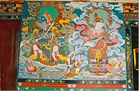
Tibetan art
Tibetan representations of art are intrinsically bound with
-
-
 Aritual box
 -
 A ceremonial priest's yak bone apron


Architecture
Tibetan architecture contains Chinese and Indian influences, and reflects a deeply
.The most distinctive feature of Tibetan architecture is that many of the houses and monasteries are built on elevated, sunny sites facing the south, and are often made out of a mixture of rocks, wood, cement and earth. Little fuel is available for heat or lighting, so flat roofs are built to conserve heat, and multiple windows are constructed to let in sunlight. Walls are usually sloped inwards at 10 degrees as a precaution against the frequent earthquakes in this mountainous area.
Standing at 117 metres (384 feet) in height and 360 metres (1,180 feet) in width, the Potala Palace is the most important example of Tibetan architecture. Formerly the residence of the Dalai Lama, it contains over one thousand rooms within thirteen stories, and houses portraits of the past Dalai Lamas and statues of the Buddha. It is divided between the outer White Palace, which serves as the administrative quarters, and the inner Red Quarters, which houses the assembly hall of the Lamas, chapels, 10,000 shrines, and a vast library of Buddhist scriptures. The Potala Palace is a World Heritage Site, as is Norbulingka, the former summer residence of the Dalai Lama.
Music
The music of Tibet reflects the cultural heritage of the trans-Himalayan region, centered in Tibet but also known wherever ethnic Tibetan groups are found in India, Bhutan, Nepal and further abroad. First and foremost Tibetan music is religious music, reflecting the profound influence of Tibetan Buddhism on the culture.
Tibetan music often involves
Festivals

Tibet has various festivals, many for worshipping the Buddha,[129] that take place throughout the year. Losar is the Tibetan New Year Festival. Preparations for the festive event are manifested by special offerings to family shrine deities, painted doors with religious symbols, and other painstaking jobs done to prepare for the event. Tibetans eat Guthuk (barley noodle soup with filling) on New Year's Eve with their families. The Monlam Prayer Festival follows it in the first month of the Tibetan calendar, falling between the fourth and the eleventh days of the first Tibetan month. It involves dancing and participating in sports events, as well as sharing picnics. The event was established in 1049 by Tsong Khapa, the founder of the Dalai Lama and the Panchen Lama's order.
Cuisine
Sports
This section is empty. You can help by adding to it. (January 2024) |
See also
- Index of Tibet-related articles
- List of Major National Historical and Cultural Sites in Tibet
- Outline of Tibet
- Sinicization of Tibet
- Chinese Settlements in Tibet
- Free Tibet
References
Citations
- ^ "Altitude sickness may hinder ethnic integration in the world's highest places". Princeton University. July 1, 2013. Archived from the original on March 18, 2021. Retrieved March 6, 2021.
- ^ Wittke, J.H. (February 24, 2010). "Geology of the Tibetan Plateau". Archived from the original on May 23, 2019. Retrieved March 29, 2019.
- ^ US Department of Commerce, National Oceanic and Atmospheric Administration. "What is the highest point on Earth as measured from Earth's center?". oceanservice.noaa.gov. Archived from the original on May 28, 2016. Retrieved November 12, 2021.
- ^ Goldstein, Melvyn, C., Change, Conflict and Continuity among a Community of Nomadic Pastoralist: A Case Study from Western Tibet, 1950–1990, 1994: "What is Tibet? – Fact and Fancy", pp. 76–87
- ^ Clark, Gregory, "In fear of China", 1969, saying: ' Tibet, although enjoying independence at certain periods of its history, had never been recognized by any single foreign power as an independent state. The closest it has ever come to such recognition was the British formula of 1943: suzerainty, combined with autonomy and the right to enter into diplomatic relations. '
- ^ "Q&A: China and the Tibetans". BBC News. August 15, 2011. Archived from the original on July 16, 2018. Retrieved May 17, 2017.
- ^ Lee, Peter (May 7, 2011). "Tibet's only hope lies within". The Asia Times. Archived from the original on December 28, 2011. Retrieved May 10, 2011.
Robin [alias of a young Tibetan in Qinghai] described the region as a cauldron of tension. Tibetans still were infuriated by numerous arrests in the wake of the 2008 protests. But local Tibetans had not organized themselves. 'They are very angry at the Chinese government and the Chinese people,' Robin said. 'But they have no idea what to do. There is no leader. When a leader appears and somebody helps out they will all join.' We ... heard tale after tale of civil disobedience in outlying hamlets. In one village, Tibetans burned their Chinese flags and hoisted the banned Tibetan Snow Lion flag instead. Authorities ... detained nine villagers ... One nomad ... said 'After I die ... my sons and grandsons will remember. They will hate the government.'
- ^ "Regions and territories: Tibet". BBC News. December 11, 2010. Archived from the original on April 22, 2011. Retrieved April 22, 2011.
- from the original on June 16, 2017. Retrieved May 17, 2017.
- ^ "China: Tibetan Detainees at Serious Risk of Torture and Mistreatment". March 19, 2008. Archived from the original on March 7, 2023. Retrieved March 7, 2023.
- ^ "Bon". ReligionFacts. Archived from the original on May 9, 2017. Retrieved May 17, 2017.
- ^ "2020年西藏自治区国民经济和社会发展统计公报". State Ethnic Affairs Commission. Archived from the original on March 20, 2022. Retrieved April 24, 2022.
- ^ Beckwith (1987), pg. 7
- ^ Étienne de la Vaissière, "The Triple System of Orography in Ptolemy's Xinjiang", Exegisti Monumenta: Festschrif in Honour of Nicholas Sims-Williams, eds. Werner Sundermann, Almut Hintze & François de Blois (Wiesbaden, Germany: Harrassowitz, 2009), 532.
- ^ Baxter, William H. (March 30, 2001). "An Etymological Dictionary of Common Chinese Characters". Archived from the original on April 11, 2011. Retrieved April 16, 2011.
- ^ Elliot Sperling. "Tubote, Tibet, and the Power of Naming". Tibetan Political Review. Archived from the original on March 28, 2016. Retrieved July 31, 2018.
- ^ The word Tibet was used in the context of the first British mission to this country under George Bogle in 1774. See Markham, Clements R., ed. [1876] 1971. Narratives of the Mission of George Bogle to Tibet and the Journey of Thomas Manning to Lhasa. New Delhi: Manjushri Publishing House.
- ^ Behr, Wolfgang, 1994. "Stephan V. Beyer 'The Classical Tibetan Language' (book review)." Pp. 558–59 in Oriens 34, edited by R. Sellheim. Leiden: E.J. Brill. Archived from the original Archived March 26, 2023, at the Wayback Machine on October 16, 2015.
- ^ Kapstein 2006, pg. 19
- ^ Kapstein 2006, p. 22.
- ^ Essay towards a Dictionary, Tibetan and English. Prepared, with assistance of Bandé Sangs-rgyas Phuntshogs ... by Alexander Csoma de Kőrös, etc., Calcutta: Baptist Mission Press, 1834 Archived March 26, 2023, at the Wayback Machine.
- ISBN 978-81-7835-723-2. Archivedfrom the original on April 14, 2023. Retrieved October 18, 2020.
- ^ PMID 19955425.
- ^ Norbu 1989, pp. 127–128
- ^ Helmut Hoffman in McKay 2003 vol. 1, pp. 45–68
- ISBN 978-81-208-2943-5. Archivedfrom the original on December 3, 2022. Retrieved December 3, 2022.
- ^ Haarh, Erik: Extract from "The Yar Lun Dynasty", in: The History of Tibet, ed. Alex McKay, Vol. 1, London 2003, p. 147; Richardson, Hugh: The Origin of the Tibetan Kingdom, in: The History of Tibet, ed. Alex McKay, Vol. 1, London 2003, p. 159 (and list of kings p. 166-167).
- ^ Forbes, Andrew ; Henley, David (2011). 'The First Tibetan Empire' in: China's Ancient Tea Horse Road. Chiang Mai: Cognoscenti Books. ASIN: B005DQV7Q2
- ^ Beckwith 1987, pg. 146
- ^ Marks, Thomas A. (1978). "Nanchao and Tibet in South-western China and Central Asia." The Tibet Journal. Vol. 3, No. 4. Winter 1978, pp. 13–16.
- ISBN 0-947593-00-4.
- ^ a b c Dawa Norbu. China's Tibet Policy Archived April 14, 2023, at the Wayback Machine, p. 139. Psychology Press.
- ^ Wylie. p.104: 'To counterbalance the political power of the lama, Khubilai appointed civil administrators at the Sa-skya to supervise the mongol regency.'
- ^ Rossabi 1983, p. 194
- ^ Norbu, Dawa (2001) p. 57
- ^ Laird 2006, pp. 142–143.
- ^ Wang Jiawei, "The Historical Status of China's Tibet", 2000, pp. 162–6.
- ^ Kychanov, E.I. and Melnichenko, B.I. Istoriya Tibeta s drevneishikh vremen do nashikh dnei [History of Tibet since Ancient Times to Present]. Moscow: Russian Acad. Sci. Publ., p.89-92
- ^ Goldstein 1997, pg. 18
- ^ Goldstein 1997, pg. 19
- ^ Goldstein 1997, pg. 20
- ^ The Sino-Indian Border Disputes, by Alfred P. Rubin, The International and Comparative Law Quarterly, Vol. 9, No. 1. (Jan., 1960), pp. 96–125.
- ^ Goldstein 1989, pg. 44
- ^ Goldstein 1997, pg. 22
- ^ Brunnert, H. S. and Hagelstrom, V. V. _Present Day Political Organization of China_, Shanghai, 1912. p. 467.
- ^ Stas Bekman: stas (at) stason.org. "What was Tibet's status during China's Qing dynasty (1644–1912)?". Stason.org. Archived from the original on April 7, 2008. Retrieved August 26, 2012.
- ^ The Cambridge History of China, vol. 10, p. 407.
- ^ Teltscher 2006, pg. 57
- ^ a b Smith 1996, pp. 154–6
- ISBN 1-74059-523-8.
- ^ Shakya 1999, pg. 5
- ^ "ltwa.net". ww38.ltwa.net. Archived from the original on October 30, 2012.
- ^ Wang Jiawei, "The Historical Status of China's Tibet", 2000, p. 150.
- ^ Fisher, Margaret W.; Rose, Leo E.; Huttenback, Robert A. (1963), Himalayan Battleground: Sino-Indian Rivalry in Ladakh, Praeger, pp. 77–78 – via archive.org,
By refusing to sign it, however, the Chinese lost an opportunity to become the acknowledged suzerain of Tibet. The Tibetans were therefore free to make their own agreement with the British.
- ISBN 978-0-393-32167-8. Archivedfrom the original on June 10, 2016. Retrieved June 28, 2010.
- OCLC 1141442704. Archivedfrom the original on April 2, 2023. Retrieved October 15, 2022.
- ^ "The 17-Point Agreement" The full story as revealed by the Tibetans and Chinese who were involved Archived on 28 September 2011.
- Dalai Lama, Freedom in ExileHarper San Francisco, 1991
- ^ "1.Chinese Communist Troops in Tibet, 2. Chinese Communist Program for Tibet" (PDF). Archived from the original (PDF) on January 23, 2017. Retrieved February 10, 2017.
- ^ "Notes for DCI briefing of Senate Foreign Relations Committee on 28 April 1959" (PDF). Archived from the original (PDF) on January 23, 2017. Retrieved February 10, 2017.
- ^ Rossabi, Morris (2005). "An Overview of Sino-Tibetan Relations". Governing China's Multiethnic Frontiers. University of Washington Press. p. 197.
- ^ "World Directory of Minorities and Indigenous Peoples – China : Tibetans". Minority Rights Group International. July 2008. Archived from the original on November 1, 2014. Retrieved April 23, 2014.
- ISBN 978-0-415-15977-7.
- ^ ISSN 0362-8841.
- ^ "Leadership shake-up in China's Tibet: state media". France: France 24. Agence France-Presse. January 15, 2010. Archived from the original on January 18, 2010. Retrieved July 29, 2010.
- ^ National Geophysical Data Center, 1999. Global Land One-kilometer Base Elevation (GLOBE) v.1. Hastings, D. and P.K. Dunbar. National Geophysical Data Center, NOAA Archived February 10, 2011, at the Wayback Machine. doi:10.7289/V52R3PMS [access date: 2015-03-16]
- ^ Amante, C. and B.W. Eakins, 2009. ETOPO1 1 Arc-Minute Global Relief Model: Procedures, Data Sources and Analysis. NOAA Technical Memorandum NESDIS NGDC-24. National Geophysical Data Center, NOAA Archived June 26, 2015, at the Wayback Machine. doi:10.7289/V5C8276M [access date: 2015-03-18].
- ^ "plateaus". Archived from the original on April 1, 2009. Retrieved May 16, 2009.
- ^ "Circle of Blue, 8 May 2008 China, Tibet, and the strategic power of water". Circleofblue.org. May 8, 2008. Archived from the original on July 2, 2008. Retrieved March 26, 2010.
- ^ "The Water Tower Function of the Tibetan Autonomous Region". Futurewater.nl. Archived from the original on April 25, 2012. Retrieved August 26, 2012.
- ^ "China to spend record amount on Tibetan water projects". English.people.com.cn. August 16, 2011. Archived from the original on December 27, 2011. Retrieved August 26, 2012.
- ^ 中国地面国际交换站气候标准值月值数据集(1971-2000年) (in Chinese). China Meteorological Administration. Archived from the original on October 16, 2013. Retrieved May 4, 2010.
- ^ "Extreme Temperatures Around the World". Archived from the original on June 22, 2013. Retrieved February 21, 2013.
- ^ "55591: Lhasa (China)". ogimet.com. OGIMET. March 28, 2022. Archived from the original on March 29, 2022. Retrieved March 29, 2022.
- ^ "Leh Climatological Table Period: 1951–1980". India Meteorological Department. Archived from the original on February 25, 2018. Retrieved April 11, 2015.
- ^ "Leh Climatological Table Period: 1951–1980". India Meteorological Department. Archived from the original on July 21, 2011. Retrieved April 4, 2020.
- PMID 26526544.
- ^ ISBN 0-516-20155-7.
- ^ Petech, L., China and Tibet in the Early XVIIIth Century: History of the Establishment of Chinese Protectorate in Tibet Archived January 1, 2016, at the Wayback Machine, p51 & p98
- ^ Tsering, Tashi. "Globalization To Tibet" (PDF). Tibet Justice Center. p. 9. Archived (PDF) from the original on March 20, 2012. Retrieved July 10, 2013.
- ^ "Tibet Environmental Watch – Development". Tew.org. Archived from the original on June 8, 2011. Retrieved March 26, 2010.
- ^ "China TIBET Tourism Bureau". Archived from the original on August 31, 2009. Retrieved March 7, 2009.
- ^ Grunfeld 1996, p. 224.
- ISBN 1-896745-95-4
- ISBN 957-13-1040-9
- ^ "Tibet's economy depends on Beijing". NPR News. August 26, 2002. Archived from the original on December 26, 2017. Retrieved February 24, 2006.
- ^ Brown, Kerry (January 11, 2014). "How Xi Can Solve The Tibet Problem". thediplomat.com. The Diplomat. Archived from the original on January 11, 2014. Retrieved January 10, 2014.
- ^ In pictures: Tibetan nomads Archived July 19, 2018, at the Wayback Machine BBC News
- S2CID 29381859.
- ^ "China opens world's highest railway". Australian Broadcasting Corporation. July 1, 2005. Archived from the original on July 6, 2006. Retrieved July 1, 2006.
- ^ "China completes railway to Tibet". BBC News. October 15, 2005. Archived from the original on August 23, 2006. Retrieved July 4, 2006.
- ^ "Dalai Lama Urges 'Wait And See' On Tibet Railway". Deutsche Presse Agentur. June 30, 2006. Archived from the original on May 22, 2016. Retrieved July 4, 2006.
- ^ a b "Valuable mineral deposits found along Tibet railroad route". New York Times. January 25, 2007. Archived from the original on July 24, 2016. Retrieved January 6, 2014.
- ^ Peng, James (January 16, 2009). "China Says 'Sabotage' by Dalai Lama Supporters Set Back Tibet". Bloomberg News. Archived from the original on October 14, 2007. Retrieved February 7, 2009.
- ^ "China to achieve leapfrog development, lasting stability in Tibet" Archived January 27, 2010, at the Wayback Machine news.xinhuanet.com/english
- ^ "Lhasa Economic & Technology Development Zone". RightSite.asia. Archived from the original on July 6, 2011. Retrieved December 31, 2010.
- ^ "Population Transfer Programmes". Central Tibetan Administration. 2003. Archived from the original on July 30, 2010. Retrieved July 29, 2010.
- ^ "Tibet's population tops 3 million; 90% are Tibetans". Xinhua News Agency. May 4, 2011. Archived from the original on May 13, 2011. Retrieved December 4, 2011.
- ISBN 978-1-85168-066-5.
- ^ a b Tibetan monks: A controlled life Archived February 18, 2009, at the Wayback Machine. BBC News. March 20, 2008.
- ^ Tibet During the Cultural Revolution Pictures from a Tibetan People's Liberation Army's officer Archived copy at the Library of Congress (May 5, 2010).
- ^ The last of the Tibetans Los Angeles Times. March 26, 2008.
- ^ Gargan, Edward A. (June 14, 1987). "Tibet's Buddhist Monks Endure to Rebuild a Part of the Past". The New York Times. Archived from the original on April 14, 2023.
- ^ Laird 2006, pp. 351, 352
- ^ Goldstein, Melvyn C. (2007). A History of Modern Tibet: Volume 2 The Calm before the Storm, 1951–1955. Berkeley, CA: University of California Press.
- Chenrezig
- ^ "USCIRF 2020 Annual Report on International Religious Freedoms" (PDF). United States Commission on International Religious Freedom. April 2020. Archived (PDF) from the original on August 3, 2020. Retrieved August 28, 2021.
- ^ Rezaul H Laskar (June 22, 2021). "China raises new militias of Tibetan youth, deploys 1st batch in Chumbi Valley". Hindustan Times. Archived from the original on June 23, 2022. Retrieved June 23, 2022.
{{cite web}}: CS1 maint: bot: original URL status unknown (link) - ^ Kapstein 2006, pp. 31, 71, 113.
- ^ Stein 1972, pp. 36, 77–78.
- ISBN 90-04-12866-2
- ^ Graham Sanderg, The Exploration of Tibet: History and Particulars (Delhi: Cosmo Publications, 1973), pp. 23–26; Thomas Holdich, Tibet, The Mysterious (London: Alston Rivers, 1906), p. 70.
- ^ Sir Edward Maclagan, The Jesuits and The Great Mogul (London: Burns, Oates & Washbourne Ltd., 1932), pp. 344–345.
- ^ Lettera del P. Alano Dos Anjos al Provinciale di Goa, 10 Novembre 1627, quoted from Wu Kunming, Zaoqi Chuanjiaoshi jin Zang Huodongshi (Beijing: Zhongguo Zangxue chubanshe, 1992), p. 163.
- ^ Extensively using Italian and Portuguese archival materials, Wu's work gives a detailed account of Cacella's activities in Tsang. See Zaoqi Chuanjiaoshi jin Zang Huodongshi, esp. chapter 5.
- ^ Narratives of the Mission of George Bogle to Tibet, and of the Journey of Thomas Manning to Lhasa, pp. 295–302. Clements R. Markham. (1876). Reprint Cosmo Publications, New Delhi. 1989.
- ^ Stein 1972, p. 85.
- Hsiao-ting Lin. "When Christianity and Lamaism Met: The Changing Fortunes of Early Western Missionaries in Tibet". Pacificrim.usfca.edu. Archived from the originalon June 26, 2010. Retrieved March 26, 2010.
- ^ "BBC News Country Profiles Timeline: Tibet". November 5, 2009. Archived from the original on March 11, 2009. Retrieved March 11, 2009.
- ^ Lettera del P. Antonio de Andrade. Giovanni de Oliveira. Alano Dos Anjos al Provinciale di Goa, 29 Agosto, 1627, quoted from Wu, Zaoqi Chuanjiaoshi jin Zang Huodongshi, p. 196; Maclagan, The Jesuits and The Great Mogul, pp. 347–348.
- ^ Cornelius Wessels, Early Jesuit Travellers in Central Asia, 1603–1721 (The Hague: Nijhoff, 1924), pp. 80–85.
- ^ Maclagan, The Jesuits and The Great Mogul, pp. 349–352; Filippo De Filippi ed., An Account of Tibet, pp. 13–17.
- ^ Relação da Missão do Reino de Uçangue Cabeça dos do Potente, Escrita pello P. João Cabral da Comp. de Jesu. fol. 1, quoted from Wu, Zaoqi Chuanjiaoshi jin Zang Huodongshi, pp. 294–297; Wang Yonghong, "Luelun Tianzhujiao zai Xizang di Zaoqi Huodong", Xizang Yanjiu, 1989, No. 3, pp. 62–63.
- ^ "Yunnan Province of China Government Web". Archived from the original on March 12, 2009. Retrieved February 15, 2008.
- ^ Kapstein 2006, pp. 31, 206
- ^ Kaiman, Jonathan (February 21, 2013). "Going undercover, the evangelists taking Jesus to Tibet". The Guardian. Archived from the original on August 26, 2013. Retrieved February 21, 2013.
- Government of Tibet in exile, January/February 1994
- ^ Crossley-Holland, Peter. (1976). "The Ritual Music of Tibet." The Tibet Journal. Vol. 1, Nos. 3 & 4, Autumn 1976, pp. 47–53.
- .
Sources
- ISBN 0-691-02469-3
- )
- ISBN 81-215-0582-8Pagination is identical to University of California edition.
- Goldstein, Melvyn C. The Snow Lion and the Dragon: China, Tibet, and the Dalai Lama (1997) University of California Press. ISBN 0-520-21951-1
- ISBN 1-56324-713-5.
- ISBN 0-87477-257-5
- ISBN 978-0-631-22574-4
- Laird, Thomas. The Story of Tibet: Conversations with the Dalai Lama (2006) Grove Press. ISBN 0-8021-1827-5
- ISBN 1-57416-092-3
- Powers, John. History as Propaganda: Tibetan Exiles versus the People's Republic of China (2004) Oxford University Press. ISBN 978-0-19-517426-7
- ISBN 0-87773-376-7
- ISBN 0-231-11814-7
- ISBN 0-8047-0901-7
- Teltscher, Kate. ISBN 0-7475-8484-2
Further reading
- ISBN 0-7195-5427-6.
- Bell, Charles (1924). Tibet: Past & Present. Oxford: Clarendon Press.
- Dowman, Keith (1988). The Power-Places of Central Tibet: The Pilgrim's Guide. Routledge & Kegan Paul. London, ISBN 0-14-019118-6.
- Feigon, Lee. (1998). Demystifying Tibet: unlocking the secrets of the land of the snows. Chicago: Ivan R. Dee. ISBN 1-56663-089-4
- Gyatso, Palden (1997). The Autobiography of a Tibetan Monk. Grove Press. NY, NY. ISBN 0-8021-3574-9
- Human Rights in China: China, Minority Exclusion, Marginalization and Rising Tensions, London, Minority Rights Group International, 2007
- Le Sueur, Alec (2013). ISBN 978-1-57143-101-1
- McKay, Alex (1997). Tibet and the British Raj: The Frontier Cadre 1904–1947. London: Curzon. ISBN 0-7007-0627-5.
- Norbu, Thubten Jigme; Turnbull, Colin (1968). Tibet: Its History, Religion and People. Reprint: Penguin Books (1987).
- Pachen, Ani; Donnely, Adelaide (2000). Sorrow Mountain: The Journey of a Tibetan Warrior Nun. Kodansha America, Inc. ISBN 1-56836-294-3.
- Petech, Luciano (1997). China and Tibet in the Early XVIIIth Century: History of the Establishment of Chinese Protectorate in Tibet. T'oung Pao Monographies, Brill Academic Publishers, ISBN 90-04-03442-0.
- Rabgey, Tashi; Sharlho, Tseten Wangchuk (2004). Sino-Tibetan Dialogue in the Post-Mao Era: Lessons and Prospectsv (PDF). Washington: East-West Center. ISBN 978-1-932728-22-4. Archived from the original(PDF) on July 16, 2007. Retrieved August 14, 2008.
- Samuel, Geoffrey (1993). Civilized Shamans: Buddhism in Tibetan Societies. Smithsonian ISBN 1-56098-231-4.
- Schell, Orville (2000). Virtual Tibet: Searching for Shangri-La from the Himalayas to Hollywood. Henry Holt. ISBN 0-8050-4381-0.
- Smith, Warren W. (1996). History of Tibet: Nationalism and Self-determination. Boulder, CO: Westview Press. ISBN 978-0-8133-3155-3.
- Smith, Warren W. (2004). China's Policy on Tibetan Autonomy – EWC Working Papers No. 2 (PDF). Washington: East-West Center. Archived from the original (PDF) on August 19, 2008. Retrieved August 14, 2008.
- Smith, Warren W. (2008). bChina's Tibet?: Autonomy or Assimilation. Rowman & Littlefield Publishers. ISBN 978-0-7425-3989-1.
- ISSN 1547-1330. Archived from the original(PDF) on August 19, 2008. Retrieved August 14, 2008. – (online version)
- Thurman, Robert (2002). Robert Thurman on Tibet. DVD. ASIN B00005Y722.
- Van Walt van Praag, Michael C. (1987). The Status of Tibet: History, Rights, and Prospects in International Law. Boulder, Colorado: Westview Press.
- Wilby, Sorrel (1988). Journey Across Tibet: A Young Woman's 1,900-mile (3,060 km) Trek Across the Rooftop of the World. Contemporary Books. ISBN 0-8092-4608-2.
- Wilson, Brandon (2004). Yak Butter Blues: A Tibetan Trek of Faith. Pilgrim's Tales. ISBN 0-9770536-7-9. (second edition 2005)
- Wang Jiawei (2000). The Historical Status of China's Tibet. ISBN 7-80113-304-8.
- Tibet wasn't always ours, says Chinese scholar Archived May 17, 2007, at the Wayback Machine by Venkatesan Vembu, Daily News & Analysis, February 22, 2007
- Wylie, Turrell V. "The First Mongol Conquest of Tibet Reinterpreted", Harvard Journal of Asiatic Studies (Volume 37, Number 1, June 1977)
- Zenz, Adrian (2014). Tibetanness under Threat? Neo-Integrationism, Minority Education and Career Strategies in Qinghai, P.R. China. Global Oriental. ISBN 978-90-04-25796-2.
External links
 Definitions from Wiktionary
 Media from Commons
 News from Wikinews
 Quotations from Wikiquote
 Texts from Wikisource
 Textbooks from Wikibooks
 Resources from Wikiversity
 Travel information from Wikivoyage
- Tibetan Resources on the Web from Columbia University Libraries
- British photographs of Tibet 1920–1950
- The Language of Tibet
- White Paper on Tibetan Culture released by the Information Office of the State Council of the People's Republic of China June 22
- Historical maps and images of Tibet presented by University of Wisconsin-Milwaukee Libraries Digital Collections
- The Tibetan & Himalayan Library (THL)
- . Encyclopædia Britannica. Vol. 26 (11th ed.). 1911. pp. 916–928.

| International | |
|---|---|
| National | |