
Middlesboro, Kentucky
Middlesboro, Kentucky | ||
|---|---|---|
City | ||
| City of Middlesboro | ||
 View of Middlesboro from the Pinnacle Overlook. | ||
|
FIPS code 21-51924 | | |
| GNIS feature ID | 498153[3] | |
| Website | www | |
Middlesboro (locally
It is located 1 mile (1.6 km) west of the
Name
Originally funded by English businessmen, the town opened its first post office on September 14, 1888, under the name Middlesborough, presumably in honor of the
History
Early history
The area was originally inhabited by American Indians such as the Shawnee. The first European known to have visited the area was Gabriel Arthur in 1674. He was later followed by Thomas Walker in 1750 and Daniel Boone in 1769.[13]
Pittsburgh of the South
John Turner of Virginia established the settlement of Yellow Creek nearby in 1810, but the town did not begin to develop until the

By 1888, the new town was platted and named "Middlesborough", presumably after the English town, either after a local contest selected it as the best entry or after the hometown of the brothers who owned the local English Hotel.[16] The Middlesboro Country Club was founded as part of Arthur's original development. Its nine-hole course is one of the oldest in the United States and it claims to be the oldest continuously played course in the country.[17] Pianist Ben Harney is also claimed to have originated ragtime music in Middlesboro, where he played in local saloons in the early 1890s.[17] Boosters from Middlesborough petitioned to host the 1892 World's Fair.[18] Just south of the Cumberland Gap in the area of the present-day Lincoln Memorial University, a $1-million Four Seasons Hotel was built in 1892 with 500 rooms, a 200-room spa, and a sanitarium.[13]
Arthur's project failed by 1893. The
Despite being the largest city in the county, the development of Middlesboro came too late to avoid Pineville's being the seat of the local courthouse. The two cities have remained friendly rivals since Middlesboro's founding.
Little Las Vegas
Middlesboro installed the first
Athens of the Mountains
By the 1950s, Middlesboro had a population of roughly 15,000 residents. Their strong support for the arts led to the city being called "the Athens of the Mountains". It was one of the few cities in the
During the 1970s, the area's coal industry revived and the city prospered again. A grand centennial celebration was held in 1990 that included a
Present-day

Currently, Middlesboro is investing in downtown revitalization to help create new business and give the city a better image. In 2004, Discover Downtown Middlesboro, Inc. (DDM), was formed to promote and lead the revamping of the historic downtown area. Since its inception, Discover Downtown Middlesboro has helped numerous businesses receive a facelift and has restored the historic Fountain Square in downtown. The organization also helps to create awareness of the city's grand and regal past. Numerous large-scaled sepia murals are placed throughout downtown, paying homage to the founder of Middlesboro, his wife, and other historic points in the history of Middlesboro. DDM also hosts numerous events for the community and the tri-state area that are free to the public, one of the most popular includes the Downtown Ducky Dash and Block Party. DDM oversees all projects that take place within the downtown area and has plans to create brick stamped crosswalks at Fountain Square. Ultimately, they plan to make the historic downtown area more pedestrian-friendly with more benches, bike racks, planters, and streetscape improvements in the works. Recently, the organization has applied for nearly $1 million in grant money for the purpose of preservation and development of the general downtown district. Currently, DDM has invested in a Preservation Plan, which should be unveiled in September 2013. This plan, once complete, will outline the plans for the revitalization of downtown Middlesboro, help create a brand for the downtown area, as well help lay a foundation to preserve the rich architectural details in the downtown historic district.
In June 2011 a severe flash flood damaged many homes and businesses in Middlesboro. Following a rainfall of 8.5 in (22 cm) in 48 hours, the waterways could not cope with the deluge. Two area residents perished in the flood, and dozens were left homeless. The downtown area was one of the hardest hit areas in the city. At one point during the rain event, enough water was present throughout the entire downtown area that vehicles were completely submerged. For many hours after the flood, travel in and around the city was very difficult due to large amounts of standing water in the basin that Middlesboro is built in. A few days afterwards, Governor Steve Beshear toured the area and formally declared it a disaster, permitting state funds to be used in rebuilding.
In April 2012, Middlesboro became the first city in the United States to have a community-wide organic garden, which features 60 raised-bed gardens that will be used to grow food for people in the community. Some beds are even disability accessible. The beds will be given out on a first come, first served basis. The food that is grown in the beds will help to reduce costs for families in need, and can be donated to people in need or sold to local restaurants. The community organic garden was made possible through the City of Middlesboro, Bell County Health Department, and several donors and volunteers. Middlesboro is currently working to become one of the first cities in Kentucky to be a certified Trail Town. The Mayor, along with the City Council, showed support and took initiative in becoming a certified Trail Town. This feat will be a collaboration between the Bell County Tourism Commission, Bell County Adventure Tourism, Discover Downtown Middlesboro, Bell County Chamber of Commerce, and the City of Middlesboro.
Middlesboro was featured on the
On September 15, 2015, Middlesboro held an election to allow alcohol production and retail in the city limits. Previously, all of Bell County had been dry except for the special circumstance of a state park in Pineville, Kentucky. Allowing alcohol in the city would make Bell County a Moist County. The vote passed 1,298-yes to 1,179-no.[24] With such a close vote, tension arose around the topic of alcohol allowance in the small community.
Beginning in the summer of 2015, Discover Downtown Middlesboro is the recipient of a grant from the Levitt Foundation of California. This grant provides funding for a series of 10 outdoor music concerts each summer. The concert venue is a formerly abandoned lot near the main intersection of town at 20th & Cumberland Ave. Middlesboro is one of 15 cities across the nation to be chosen for the Levitt AMP series.[25]
Geography
Middlesboro is located at 36°36′37″N 83°43′24″W / 36.61028°N 83.72333°W (36.610146, -83.723230).[26] The city sits just inside the Cumberland Gap, along U.S. Route 25E, and is located inside of a meteorite crater.[27]
According to the United States Census Bureau, the city has a total area of 7.6 square miles (20 km2), all but 0.09 square miles (0.23 km2) of which is land. U.S. 25E provides four-lane connection to Interstate 75 at Corbin, 45 miles (72 km) to the northwest. With the recently completed renovations on U.S. 25E, travelers now have four-lane connection to Interstate 81 at Morristown, Tennessee, 45 miles (72 km) to the south.
Climate
Middlesboro experiences a
| Climate data for Middlesboro Fire Department, Kentucky (1981–2010 normals, extremes 1892–2009) | |||||||||||||
|---|---|---|---|---|---|---|---|---|---|---|---|---|---|
| Month | Jan | Feb | Mar | Apr | May | Jun | Jul | Aug | Sep | Oct | Nov | Dec | Year |
| Record high °F (°C) | 77 (25) |
84 (29) |
93 (34) |
100 (38) |
100 (38) |
102 (39) |
112 (44) |
105 (41) |
104 (40) |
94 (34) |
90 (32) |
78 (26) |
112 (44) |
| Mean daily maximum °F (°C) | 45.1 (7.3) |
49.7 (9.8) |
59.2 (15.1) |
69.2 (20.7) |
77.4 (25.2) |
84.6 (29.2) |
87.4 (30.8) |
86.0 (30.0) |
80.4 (26.9) |
69.8 (21.0) |
59.4 (15.2) |
47.7 (8.7) |
68.0 (20.0) |
| Daily mean °F (°C) | 35.1 (1.7) |
38.5 (3.6) |
46.2 (7.9) |
55.3 (12.9) |
63.7 (17.6) |
72.0 (22.2) |
75.3 (24.1) |
74.4 (23.6) |
67.8 (19.9) |
56.4 (13.6) |
47.1 (8.4) |
37.6 (3.1) |
55.8 (13.2) |
| Mean daily minimum °F (°C) | 25.0 (−3.9) |
27.3 (−2.6) |
33.2 (0.7) |
41.5 (5.3) |
50.0 (10.0) |
59.4 (15.2) |
63.3 (17.4) |
62.7 (17.1) |
55.2 (12.9) |
43.1 (6.2) |
34.7 (1.5) |
27.5 (−2.5) |
43.6 (6.4) |
| Record low °F (°C) | −18 (−28) |
−20 (−29) |
−4 (−20) |
15 (−9) |
26 (−3) |
28 (−2) |
40 (4) |
40 (4) |
30 (−1) |
16 (−9) |
3 (−16) |
−11 (−24) |
−20 (−29) |
| Average precipitation inches (mm) | 4.18 (106) |
4.03 (102) |
4.39 (112) |
4.28 (109) |
4.58 (116) |
4.28 (109) |
4.89 (124) |
4.74 (120) |
3.45 (88) |
2.73 (69) |
3.80 (97) |
4.54 (115) |
49.89 (1,267) |
| Source: | |||||||||||||
Demographics
| Census | Pop. | Note | %± |
|---|---|---|---|
| 1890 | 3,271 | — | |
| 1900 | 4,162 | 27.2% | |
| 1910 | 7,305 | 75.5% | |
| 1920 | 8,041 | 10.1% | |
| 1930 | 10,350 | 28.7% | |
| 1940 | 11,777 | 13.8% | |
| 1950 | 14,482 | 23.0% | |
| 1960 | 12,607 | −12.9% | |
| 1970 | 11,878 | −5.8% | |
| 1980 | 12,251 | 3.1% | |
| 1990 | 11,328 | −7.5% | |
| 2000 | 10,384 | −8.3% | |
| 2010 | 10,334 | −0.5% | |
| 2020 | 9,405 | −9.0% | |
| 2022 (est.) | 9,131 | [30] | −2.9% |
| U.S. Decennial Census[31] | |||
As of the
There were 4,443 households, out of which 28.4% had children under the age of 18 living with them, 43.1% were married couples living together, 18.3% had a female householder with no husband present, and 34.1% were non-families. 31.5% of all households were made up of individuals, and 14.2% had someone living alone who was 65 years of age or older. The average household size was 2.30 and the average family size was 2.88.
In the city, the population was spread out, with 23.6% under the age of 18, 8.9% from 18 to 24, 26.6% from 25 to 44, 23.9% from 45 to 64, and 17.0% who were 65 years of age or older. The median age was 39 years. For every 100 females, there were 83.5 males. For every 100 females age 18 and over, there were 78.1 males.
The median income for a household in the city was $19,565, and the median income for a family was $25,016. Males had a median income of $23,285 versus $19,040 for females. The
Transportation

The city's main thoroughfare is U.S. 25E. The U.S. 25E Tunnel (a.k.a. the Cumberland Gap Tunnel) is a .87-mile (1.40 km) tunnel that travels underneath the famous Cumberland Gap. The northern terminus is located in Middlesboro and the southern terminus is in Cumberland Gap, Tennessee.[22] Middlesboro is one of the few cities in Kentucky that was not built on or near a significant waterway, so it is not reachable by water. The only major body of water near the city is Fern Lake, a small lake that sits on the Kentucky-Tennessee border. A man-made canal flows through the heart of the city. The canal channels Yellow Creek from the western part of the city through downtown and then heads north, northeast out of the city. The Middlesboro Canal was built by a large number of immigrants soon after the city was founded. The canal is home to numerous populations and species of ducks, all of which are considered to be honorary citizens of the city, despite the traffic headaches they may cause. Traffic and pedestrians must yield the right of way to the ducks at all times and anyone caught harming the ducks could face fines or jail time. Due to Middlesboro being known around the region for the large duck population, the canal serves as the "raceway" for the Downtown Ducky Dash rubber duck race held annually in August by Discover Downtown Middlesboro.

Middleboro's main thoroughfare is named Cumberland Avenue, which runs through Middlesboro's historic downtown district. Discover Downtown Middlesboro, Inc. (DDM) is a non-profit downtown revitalization effort charged with the restoration of the downtown area. DDM has been around since 2004 and since then, has restored Middlesboro's famed Fountain Square, completed many historical murals in town, started and formed a farmer's market, updated signage in the downtown area, and received grants for new plantings for the numerous planters that line Cumberland Avenue. Many of the streets which run parallel to Cumberland Avenue (east-west) are named for peerages and locales in Britain, while perpendicular (north-south) streets are named numerically. U.S. 25E is also known as 12th street, with higher numbers found as one moves west.
Airport
Middlesboro is served by the
Education
Middlesboro has a public library, a branch of the Bell County Public Library District.[33]
Economy
Middlesboro is home to Middlesboro Mall, the only enclosed shopping mall in the area. The area also features Middlesboro Crossing, a recently constructed strip mall on the north end of the city.
Sports
Middlesboro was home to several
Notable people
- Joseph Bosworth, Businessman, lawyer, and politician
- Lela E. Buis, writer
- Gerry Bussell, defensive back for the Denver Broncos
- David Grant Colson, U.S. Representative in 19th Century
- Ben Harney, ragtime pianist
- Matt Jones, host of Kentucky Sports Radio
- Lee Majors, actor, The Six Million Dollar Man and The Fall Guy was raised in the town as a child
- Leonard F. Mason, Medal of Honor recipient
- Henry Harrison Mayes, evangelist, known for religious signs and markers along US highways
- Persiaand author
- Julie Parrish, actress, The Doberman Gang
- Trish Suhr, comedian and actress
- Rising Sun Blues"
- rhythm-and-bluespianist
- Leo Wardrup, Navy officer and Virginia state legislator
- John White, U.S. Representative and former speaker of the U.S. House of Representatives
See also
References
- ^ a b c Commonwealth of Kentucky. Office of the Secretary of State: Land Office. "Middlesboro, Kentucky". Accessed 26 August 2013.
- ^ "2020 U.S. Gazetteer Files". United States Census Bureau. Retrieved March 18, 2022.
- ^ a b U.S. Geological Survey Geographic Names Information System: Middlesboro, Kentucky
- ^ "Annual Estimates of the Resident Population for Incorporated Places in Kentucky: April 1, 2020 to July 1, 2022". United States Census Bureau. Retrieved May 26, 2023.
- ^ a b c d e f g Rennick, Robert. Kentucky Place Names, University Press of Kentucky (Lexington), 1987, p. 196. Accessed 26 August 2013.
- ^ "Summary and Reference Guide to House Bill 331 City Classification Reform" (PDF). Kentucky League of Cities. Retrieved December 30, 2014.
- ^ "U.S. Census website". United States Census Bureau. Retrieved May 14, 2011.
- ^ "Table 1. Annual Estimates of the Population of Metropolitan and Micropolitan Statistical Areas: April 1, 2000 to July 1, 2009 (CBSA-EST2009-01)". 2009 Population Estimates. United States Census Bureau, Population Division. March 23, 2010. Archived from the original (CSV) on June 15, 2010. Retrieved June 6, 2010.
- ISBN 0-8131-1772-0. Retrieved on 2010-06-29
- ^ University of Kentucky. Kentucky Atlas: "Middlesborough". Accessed 11 March 2010.
- ^ City of Middlesboro. "Middlesboro Kentucky". Accessed 26 August 2013.
- ^ "Middlesboro Independent Schools: Home". Retrieved April 25, 2019.
- ^ a b c d WKYT. "History of Middlesboro, Kentucky Archived 2010-02-18 at the Wayback Machine". Accessed 11 March 2010.
- ^ ISBN 0813129567
- ^ McNeil, J.R. The Ralston Family: Through Eight Generations, with Ratcliffe, Johnson, and Allied Families, p. 119. McNeil, 2000.
- ^ Rennick details the importance of the hotel but mistakenly ascribes it to a "Mr. Watts"[5] when in fact it was owned by two brothers – Frank and Edgar Watts – involved with Alexander Arthur's development plans.[15]
- ^ a b City of Middlesboro. "About Us". Accessed 26 August 2013.
- ^ "Cumberland Gap was passed over for the 1892 World's Fair". March 10, 2024.
{{cite web}}: CS1 maint: url-status (link) - ^ Baughn, James. Bridgehunter: "CSX Cumberland Gap Tunnel". Accessed 26 August 2013.
- ^ The tunnel actually ran directly beneath the corner between Kentucky, Tennessee, and Virginia, although the Virginia section was entirely underground.[19]
- ^ "About Us". MiddlesboroDailyNews.com. Retrieved September 10, 2015.
- ^ a b National Park Service. "Cumberland Gap Tunnel". Accessed 17 August 2010.
- ^ Woodward, Stephen (August 2009). "BBC comes to the 'Crater'". Middlesboro Daily News. Middlesboro, Kentucky. Archived from the original on October 8, 2011. Retrieved November 5, 2011.
- ^ Noe, Caleb (September 15, 2015). "Middlesboro votes 'yes' to become a moist town". Archived from the original on November 20, 2015.
- ^ "Levitt AMP Middlesboro Music Series". Grant.levittamp.org. Retrieved November 14, 2021.
- ^ "US Gazetteer files: 2010, 2000, and 1990". United States Census Bureau. February 12, 2011. Retrieved April 23, 2011.
- ^ Crawford, Matthew; Hunsberger, Hanna (2011). "Geology of Cumberland Gap National Historical Park" (PDF). Kentucky Geological Survey. University of Kentucky, Lexington. Retrieved July 30, 2014.
- ^ "NowData – NOAA Online Weather Data". National Oceanic and Atmospheric Administration. Retrieved June 22, 2021.
- ^ "Station: Middlesboro Fire Department, KY". U.S. Monthly Climate Normals (1981-2010). National Oceanic and Atmospheric Administration. Retrieved June 22, 2021.
- ^ "Annual Estimates of the Resident Population for Incorporated Places in Kentucky: April 1, 2020 to July 1, 2022". United States Census Bureau. Retrieved May 26, 2023.
- ^ "Census of Population and Housing". Census.gov. Retrieved June 4, 2015.
- ^ "U.S. Census website". United States Census Bureau. Retrieved January 31, 2008.
- ^ "Kentucky Public Library Directory". Kentucky Department for Libraries and Archives. Archived from the original on January 11, 2019. Retrieved June 5, 2019.
- ^ "Hilltop Speedway Park in Middlesboro, KY minor league baseball history and teams on StatsCrew.com". Statscrew.com. Retrieved November 14, 2021.
Further reading
- Roberts, Charles Blanton (January 1933). "The Building of Middlesborough". Filson Club History Quarterly. 7 (1). Retrieved November 29, 2011.
- Matheny, Ann Dudley. The Magic City: Footnotes to the History of Middlesborough, Kentucky, and the Yellow Creek Valley. Middlesboro, KY: Bell County Historical Society, 2003. Print.
External links
- City of Middlesboro
- The Middlesboro Daily News
- Middlesboro Independent Schools
- Middlesborough History
Municipalities and communities of Bell County, Kentucky, United States | ||
|---|---|---|
| Cities | 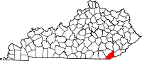 | |
| CDP | ||
| Other unincorporated communities |
| |
| post offices (and the creeks they are on) |
| |
| Ghost towns |
| |
| Footnotes | ‡This populated place also has portions in an adjacent county or counties | |
| ||
| Counties | |
|---|---|
| Cities and towns Over 10k | |
| Cities and towns 5k-10k | |
| Cities and towns 1k-5k | |
| Cities and towns under 1k | |
| Statistical areas |
|
| See also | |
| International | |
|---|---|
| National | |
| Geographic | |
| Other | |