
User:Dixtrix1/sandbox
Jeju Island
제주도 | |
|---|---|
| Korean transcription(s) | |
| • Hangul | 제주특별자치도 |
| • Hanja | 濟州特別自治道 |
| • McCune‑Reischauer | Cheju T'ŭkpyŏl Chach'ido |
| • Revised Romanization | Jeju Teukbyeoljachi-do |
|
Jeju | |
| Website | Official Website |
| Geography | |
|---|---|
| Location | East Asia |
| Archipelago | Jeju |
| Administration | |
South Korea | |
| Demographics | |
| Population | 583,284 |
Jeju Island, officially the Jeju Special Self-Governing Province (Korean: 제주도; RR: Jejudo; Korean pronunciation: [tɕe.dʑu.do])[1] is South Korea's largest island and one of the nine provinces of South Korea. With a total land area of 1,848 km2 and a population of 604,771, it lies in the Korea Strait, southwest of South Jeolla Province, of which it was a part before it became a separate province in 1946. The island is formerly transliterated as Cheju, Cheju Do, etc., or known as Quelpart to Europeans. Its capital is Jeju City.
Apart from the capital city
History
Historically, the island has been called by many different names including:
- Doi (Korean: 도이, hanja: 島夷, literally "Island barbarian")
- Dongyeongju (Korean: 동영주; hanja: 東瀛州)
- Juho (Korean: 주호, hanja: 州胡)
- Tammora (탐모라, 耽牟羅)
- Seomra (섭라, 涉羅)
- Tangna (탁라, 乇羅)
- Tamna (탐라, 耽羅)
- Quelpart,[7][8] Quelparte[9] or Quelpaert Island[10]
- Joonwonhado (준원하도, 준원下島 meaning southern part of peninsula)
- Taekseungnido (Korean: 택승리도, meaning the peaceful hot island in Joseon)
Early history
According to legend, three demi-gods emerged from Samsung which is said to have been on the northern slopes of
It has also been claimed that three brothers—including Ko-hu—who were the 15th descendants of Koulla, one of the Progenitors of the Jeju people, were received by the court of Silla, at which time[when?] the name Tamna was officially recognized, while the official government posts of Commander, Prince and Governor were conferred by the court upon the three. However, there is no concrete evidence of when the "Three Names" (Samseong-Ko, Yang and Pu) appeared nor for the exact date of when Ko-hu and his brothers were received by Silla. It may be supposed that the "Three Names" Founding Period occurred during the Three Kingdoms (Goguryeo, Baekje and Silla) Period on the mainland of Korea.
Taejo, founder of Goryeo, attempted to establish the same relationship between Goryeo and Tamna as Tamna had had with Silla. Tamna refused to accept this position and the Goryeo court dispatched troops to force Tamna to submit. Ko ja-gyeon, chief of Tamna, submitted to Goryeo in 938 and sent his son, Prince Mallo, to Goryeo's court as a de facto hostage. In 1105 (King Sukjong's 10th year), the Goryeo court abolished the name Takna which had been used up to this time and, from that year on, the island was known as "Tamna-gun" (district) and Goryeo officials were sent to handle the affairs of the island.
Tamna-country was changed to Tamna-county in 1153 during the reign of King Uijong and Choi Cheok-kyeong was posted as Tamna-Myeong or Chief of Tamna. During the reign of Gojong of Goryeo, Tamna was renamed "Jeju" which means "province across the sea".[11]
In 1271, General
During the
Modern history
Japanese occupation
In 1910, Japan annexed Korea, including Jeju, inaugurating a period of hardship and deprivation for the islanders, many of whom were compelled to travel to the mainland or Japan for work.[11]: 99 Residents of Jeju were active in the Korean independence movement during the period of Japanese rule.[11] On Jeju, the peak of resistance came in 1931–32 when haenyeo ("sea women") from six eastern villages launched a protest against the Japanese-controlled Divers Association.[11] Before it was brutally crushed, the protests spread and eventually 17,000 people participated, with over 100 arrested in Korea's largest protest movement ever led by women and fisheries workers.[11]
Jeju Uprising, 1948
On April 3, 1948, against a background of an ongoing ideological struggle for control of Korea and a variety of grievances held by islanders against the local authorities, the many communist sympathizers on the island attacked police stations and government offices. The brutal and often indiscriminate suppression of the leftist rebellion resulted in the deaths of tens of thousands of both villagers and communist radicals and the imprisonment of thousands more in internment camps.[12]
While claims have been made that the U.S. government oversaw and supported "anti-communist" activities administratively if not openly in the field, validation remains to be made. It is a fact the US was heavily involved in counter-insurgence operations across Korea at this time leading up to the
The provincial administrative building was burned to the ground in September 1948 and a new building was completed in 1-do, 2-dong in December, 1952.
Becoming The World Heritage
Jeju Volcanic Island and Lava Tubes unanimously at the 31st World Heritage Committee June 27, 2007, was inscribed on the World Natural Heritage.
Geography
Jejudo is a volcanic island, dominated by Hallasan: a volcano 1,950 metres (6,400 ft) high and the highest mountain in South Korea. The island measures approximately 73 kilometres (45 mi) across, east to west, and 41 kilometres (25 mi) from north to south.[16]
The island was created entirely from volcanic eruptions approximately 2 million years ago[citation needed], during the time period extending from the Tertiary to the beginning of the Quaternary period, and consists chiefly of basalt and lava. The eruptions took place in the Cenozoic era.
Process of formation
- Step 1: About 1.2 million years ago, a magma chamber formed under the sea floor and begun to erupt.
- Step 2: About 700 thousand years ago, the island had been formed through volcanic activity.
※ After step 2 volcanic activity ceased, and there was no more volcanic activity for about 100 thousand years.
- Step 3: About 300 thousand years ago, volcanic activity restarted along the coastline.
- Step 4: About 100 thousand years ago, volcanic activity formed Halla Mountain.
- Step 5: About 25 thousand years ago, lateral eruptions around Halla Mountain left multiple oreum (smaller 'parasitic' cones on the flanks of the primary cone).
- Step 6: Volcanic activity stopped and prolonged weathering and erosion formed the Jeju Island we know, today.[17]
It has a humid subtropical climate, warmer than that of the rest of Korea, with four distinct weather seasons. Winters are cool and dry while summers are hot, humid, and sometimes rainy.
An area covering about 12% (224 square kilometres or 86 square miles) of Jejudo is known as Gotjawal Forest.[18] This area remained uncultivated until the 21st century, as its base of ʻAʻā lava made it difficult to develop for agriculture. Because this forest remained pristine for so long, it has a unique ecology.[19]
The forest is the main source of groundwater and thus the main water source for the half million people of the island, because rainwater penetrates directly into the aquifer through the cracks of the ʻAʻā lava under the forest. Gotjawal forest is considered an internationally important wetland under the Ramsar Convention by some researchers[20] because it is the habitat of unique species of plants and is the main source of water for the residents, although to date it has not been declared a Ramsar site.[21]
-
 Baengnokdam in Hallasan
 -
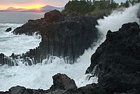 Waves crashing on Jeju seashore
 -
 Halla Mountainin Jeju


Climate
| Climate data for Jeju City, Jejudo (1981–2010) | |||||||||||||
|---|---|---|---|---|---|---|---|---|---|---|---|---|---|
| Month | Jan | Feb | Mar | Apr | May | Jun | Jul | Aug | Sep | Oct | Nov | Dec | Year |
| Mean daily maximum °C (°F) | 8.3 (46.9) |
9.4 (48.9) |
12.8 (55.0) |
17.5 (63.5) |
21.6 (70.9) |
24.8 (76.6) |
29.0 (84.2) |
29.8 (85.6) |
25.8 (78.4) |
21.3 (70.3) |
16.0 (60.8) |
11.0 (51.8) |
18.9 (66.0) |
| Daily mean °C (°F) | 5.7 (42.3) |
6.4 (43.5) |
9.4 (48.9) |
13.8 (56.8) |
17.8 (64.0) |
21.5 (70.7) |
25.8 (78.4) |
26.8 (80.2) |
23.0 (73.4) |
18.2 (64.8) |
12.8 (55.0) |
8.1 (46.6) |
15.8 (60.4) |
| Mean daily minimum °C (°F) | 3.2 (37.8) |
3.6 (38.5) |
6.1 (43.0) |
10.2 (50.4) |
14.4 (57.9) |
18.7 (65.7) |
23.3 (73.9) |
24.3 (75.7) |
20.4 (68.7) |
15.1 (59.2) |
9.8 (49.6) |
5.3 (41.5) |
12.9 (55.2) |
| Average precipitation mm (inches) | 65.2 (2.57) |
62.6 (2.46) |
88.6 (3.49) |
89.6 (3.53) |
96.4 (3.80) |
181.4 (7.14) |
239.9 (9.44) |
262.5 (10.33) |
221.6 (8.72) |
80.3 (3.16) |
61.9 (2.44) |
47.7 (1.88) |
1,497.6 (58.96) |
| Average precipitation days (≥ 0.1 mm) | 12.6 | 10.3 | 11.2 | 10.0 | 10.4 | 11.8 | 12.5 | 13.5 | 10.8 | 7.0 | 9.3 | 10.8 | 130.2 |
| Average relative humidity (%)
|
65.3 | 64.9 | 64.9 | 66.5 | 70.4 | 76.8 | 78.3 | 76.5 | 73.7 | 66.9 | 65.1 | 65.1 | 69.6 |
| Mean monthly sunshine hours | 70.4 | 105.4 | 158.9 | 194.4 | 211.9 | 170.9 | 195.6 | 195.6 | 161.7 | 178.5 | 126.0 | 84.8 | 1,854.1 |
| Source: Korea Meteorological Administration[22] | |||||||||||||
| Climate data for Seogwipo-si, Jejudo (1981–2010) | |||||||||||||
|---|---|---|---|---|---|---|---|---|---|---|---|---|---|
| Month | Jan | Feb | Mar | Apr | May | Jun | Jul | Aug | Sep | Oct | Nov | Dec | Year |
| Mean daily maximum °C (°F) | 10.7 (51.3) |
11.6 (52.9) |
14.4 (57.9) |
18.5 (65.3) |
22.0 (71.6) |
24.6 (76.3) |
28.3 (82.9) |
30.1 (86.2) |
27.4 (81.3) |
23.4 (74.1) |
18.2 (64.8) |
13.2 (55.8) |
20.2 (68.4) |
| Daily mean °C (°F) | 6.8 (44.2) |
7.8 (46.0) |
10.6 (51.1) |
14.8 (58.6) |
18.6 (65.5) |
21.7 (71.1) |
25.6 (78.1) |
27.1 (80.8) |
23.9 (75.0) |
19.3 (66.7) |
14.1 (57.4) |
9.3 (48.7) |
16.6 (61.9) |
| Mean daily minimum °C (°F) | 3.6 (38.5) |
4.4 (39.9) |
7.1 (44.8) |
11.3 (52.3) |
15.3 (59.5) |
19.2 (66.6) |
23.5 (74.3) |
24.6 (76.3) |
21.1 (70.0) |
15.9 (60.6) |
10.6 (51.1) |
5.9 (42.6) |
13.5 (56.3) |
| Average precipitation mm (inches) | 61.0 (2.40) |
77.1 (3.04) |
131.2 (5.17) |
174.9 (6.89) |
205.8 (8.10) |
276.9 (10.90) |
309.8 (12.20) |
291.6 (11.48) |
196.6 (7.74) |
81.6 (3.21) |
71.4 (2.81) |
45.1 (1.78) |
1,923 (75.71) |
| Average precipitation days (≥ 0.1 mm) | 10.3 | 9.5 | 11.0 | 10.5 | 10.7 | 12.9 | 14.3 | 14.2 | 10.3 | 6.1 | 7.4 | 8.1 | 125.3 |
| Average relative humidity (%)
|
62.8 | 62.1 | 62.4 | 64.5 | 69.9 | 78.2 | 84.1 | 79.0 | 72.5 | 63.9 | 63.2 | 62.2 | 68.7 |
| Mean monthly sunshine hours | 152.2 | 152.6 | 174.0 | 190.9 | 199.0 | 144.2 | 142.1 | 184.2 | 176.1 | 207.1 | 170.5 | 161.8 | 2,054.7 |
| Source: Korea Meteorological Administration[23] | |||||||||||||
| Climate data for Seongsan-eup, Jejudo (1981–2010) | |||||||||||||
|---|---|---|---|---|---|---|---|---|---|---|---|---|---|
| Month | Jan | Feb | Mar | Apr | May | Jun | Jul | Aug | Sep | Oct | Nov | Dec | Year |
| Mean daily maximum °C (°F) | 9.0 (48.2) |
10.2 (50.4) |
13.4 (56.1) |
17.8 (64.0) |
21.6 (70.9) |
24.2 (75.6) |
27.9 (82.2) |
29.5 (85.1) |
26.5 (79.7) |
22.0 (71.6) |
16.6 (61.9) |
11.4 (52.5) |
19.2 (66.6) |
| Daily mean °C (°F) | 5.4 (41.7) |
6.2 (43.2) |
9.3 (48.7) |
13.6 (56.5) |
17.5 (63.5) |
20.8 (69.4) |
24.9 (76.8) |
26.3 (79.3) |
23.1 (73.6) |
18.0 (64.4) |
12.5 (54.5) |
7.6 (45.7) |
15.4 (59.7) |
| Mean daily minimum °C (°F) | 2.0 (35.6) |
2.4 (36.3) |
5.2 (41.4) |
9.2 (48.6) |
13.5 (56.3) |
17.6 (63.7) |
22.4 (72.3) |
23.6 (74.5) |
20.2 (68.4) |
14.2 (57.6) |
8.4 (47.1) |
3.9 (39.0) |
11.9 (53.4) |
| Average precipitation mm (inches) | 83.2 (3.28) |
69.7 (2.74) |
142.2 (5.60) |
150.1 (5.91) |
177.7 (7.00) |
223.7 (8.81) |
283.2 (11.15) |
360.6 (14.20) |
228.4 (8.99) |
90.8 (3.57) |
85.1 (3.35) |
72.0 (2.83) |
1,966.8 (77.43) |
| Average precipitation days (≥ 0.1 mm) | 11.1 | 9.1 | 10.9 | 9.1 | 9.4 | 12.4 | 13.0 | 13.6 | 9.8 | 5.8 | 7.7 | 8.9 | 120.8 |
| Average relative humidity (%)
|
67.5 | 65.1 | 65.0 | 66.7 | 71.4 | 81.1 | 84.4 | 80.6 | 75.3 | 68.4 | 67.8 | 67.6 | 71.7 |
| Mean monthly sunshine hours | 122.5 | 146.9 | 170.1 | 192.9 | 205.3 | 145.6 | 157.4 | 173.4 | 157.2 | 187.8 | 155.5 | 130.3 | 1,944.7 |
| Source: Korea Meteorological Administration[24] | |||||||||||||
| Climate data for Gosan-ri, Jejudo (1981–2010) | |||||||||||||
|---|---|---|---|---|---|---|---|---|---|---|---|---|---|
| Month | Jan | Feb | Mar | Apr | May | Jun | Jul | Aug | Sep | Oct | Nov | Dec | Year |
| Mean daily maximum °C (°F) | 8.6 (47.5) |
9.4 (48.9) |
12.3 (54.1) |
16.5 (61.7) |
20.0 (68.0) |
23.4 (74.1) |
27.3 (81.1) |
29.1 (84.4) |
26.0 (78.8) |
21.2 (70.2) |
16.2 (61.2) |
11.2 (52.2) |
18.4 (65.1) |
| Daily mean °C (°F) | 6.2 (43.2) |
6.7 (44.1) |
9.3 (48.7) |
13.3 (55.9) |
16.8 (62.2) |
20.6 (69.1) |
24.7 (76.5) |
26.2 (79.2) |
23.1 (73.6) |
18.3 (64.9) |
13.3 (55.9) |
8.6 (47.5) |
15.6 (60.1) |
| Mean daily minimum °C (°F) | 3.8 (38.8) |
4.2 (39.6) |
6.5 (43.7) |
10.4 (50.7) |
14.2 (57.6) |
18.3 (64.9) |
22.7 (72.9) |
23.9 (75.0) |
20.6 (69.1) |
15.7 (60.3) |
10.7 (51.3) |
6.1 (43.0) |
13.1 (55.6) |
| Average precipitation mm (inches) | 43.9 (1.73) |
46.9 (1.85) |
75.8 (2.98) |
86.4 (3.40) |
110.2 (4.34) |
148.7 (5.85) |
178.0 (7.01) |
201.8 (7.94) |
116.2 (4.57) |
45.7 (1.80) |
57.4 (2.26) |
31.7 (1.25) |
1,142.8 (44.99) |
| Average precipitation days (≥ 0.1 mm) | 11.4 | 9.1 | 10.9 | 9.3 | 10.1 | 11.8 | 11.9 | 13.4 | 9.3 | 6.1 | 8.0 | 9.7 | 121 |
| Average relative humidity (%)
|
67.0 | 68.4 | 69.5 | 73.2 | 79.5 | 85.1 | 88.4 | 83.2 | 77.2 | 69.0 | 67.1 | 66.0 | 74.5 |
| Mean monthly sunshine hours | 90.9 | 126.5 | 167.0 | 196.3 | 201.6 | 158.0 | 176.6 | 215.5 | 187.8 | 207.2 | 153.6 | 108.4 | 1,989.2 |
| Source: Korea Meteorological Administration[25] | |||||||||||||
| Climate data for Witse Oreum, Jejudo (2003–2009, elevation 1,672m) | |||||||||||||
|---|---|---|---|---|---|---|---|---|---|---|---|---|---|
| Month | Jan | Feb | Mar | Apr | May | Jun | Jul | Aug | Sep | Oct | Nov | Dec | Year |
| Mean daily maximum °C (°F) | −1.6 (29.1) |
0.9 (33.6) |
3.4 (38.1) |
10.0 (50.0) |
14.9 (58.8) |
18.1 (64.6) |
20.3 (68.5) |
20.6 (69.1) |
18.1 (64.6) |
13.2 (55.8) |
6.8 (44.2) |
0.0 (32.0) |
10.4 (50.7) |
| Daily mean °C (°F) | −5.9 (21.4) |
−3.5 (25.7) |
−0.8 (30.6) |
5.2 (41.4) |
10.3 (50.5) |
14.0 (57.2) |
17.4 (63.3) |
17.4 (63.3) |
14.2 (57.6) |
8.2 (46.8) |
2.2 (36.0) |
−3.5 (25.7) |
6.4 (43.5) |
| Mean daily minimum °C (°F) | −9.1 (15.6) |
−7.5 (18.5) |
−5.1 (22.8) |
0.7 (33.3) |
5.7 (42.3) |
10.4 (50.7) |
14.7 (58.5) |
14.5 (58.1) |
11.0 (51.8) |
4.3 (39.7) |
−0.9 (30.4) |
−6.6 (20.1) |
2.7 (36.9) |
| Average precipitation mm (inches) | 46.9 (1.85) |
128.0 (5.04) |
301.2 (11.86) |
426.1 (16.78) |
653.1 (25.71) |
651.9 (25.67) |
742.3 (29.22) |
836.4 (32.93) |
526.7 (20.74) |
126.5 (4.98) |
165.8 (6.53) |
64.6 (2.54) |
4,669.4 (183.83) |
| Source: Jeju Regional Meteorological Administration[26] | |||||||||||||
Unusual weather event
In January 2016, a cold wave affected the region. Snow and frigid weather forced the cancellation of 1,200 flights on Jejudo, stranding approximately 90,300 passengers.[27]
Administrative divisions
Historical
In 1273, the Mongolian
During the
In 1402, the titles of Commander and Prince were abolished. In 1416, the island was divided into three major administrative districts: The area lying generally north of Mt. Halla was headed by a 'Moksa' or county magistrate, while the eastern area of Jeongui-county (today's Seongeup Folk village) and the south western area of Daejeong-county (today's Moseulpo, Daejeong-eup and Mt. Sanbang) were each headed by a Hyeon-gam (also county magistrate).
In August 1864, both Jeongui and Daejeong hyeons were removed from the control of the 'moksa' north of the mountain in today's Jeju-si area and were renamed 'Gun" (county) and came under the direct control of the Gwanchalsa (governor) of Jeolla province. Because of strife between these 'Guns' and the Jeju 'moksa', the system was abolished in January, 1880 and the two 'Guns' reverted again to 'hyeon'.
In 1895, Jeju-mok was redesignated as Jeju-Bu with a governor (Gwanchalsa) and Vice-governor (Chamsagwan) and a police agency was newly established, while in both Jeongui and Daejeong the offices of 'Gunsu' (county chief) were re-established. The very next year, the office of 'Gunsu' was abolished and the old system was restored.
Then in 1906, abolishing the Moksa system altogether, the Gunsu or County chief system was adopted. In 1910, Jeongui and Daejeong were included in Jeju gun while Chuja-myeon was placed under the jurisdiction of Wando-gun, part of South Jeolla province.
Modern
Japan annexed Korea in 1910. In 1915 the gun or county system which had been adopted in 1906 was abolished and Jeju island was designated as part of the 'island' system and called Jeju myeon under South Jeolla province. In 1931, Jeju-myeon was raised to the status of Jeju-eup or 'township' which gave the island one township (today's Jeju-si area) and 12 'myeon'.
On September 1, 1955, Jeju Township was elevated to city status with 40 administrative wards which on January 1, 1962, were reduced to 14 wards. On July 8, 1956, Seogwi, Daejeong and Hallim-myeons were raised to the status of townships while the southwestern portion of Hallim Township was separated and newly designated as the Hankyeong district (myeon) which gave the province one city, two counties, three townships and 10 myeon or districts with 14 wards in Jeju City. May 23, 1979 saw the restructuring of the Jeju-si wards and the addition of three more, giving 17 wards.
In March, 1980, the construction of a new provincial office was started in Yeon-dong of Jeju-si and in December of that year the four myeon of Aewol, Gujwa, Namwon and Seongsan were elevated to the status of townships giving the administrative area one city, two counties, seven townships, six districts and, within Jeju-si, 17 wards.
In 1981, the development of the Jungmun Tourist Complex brought about the unification of Seogwi township and Jungmun-myeon (district) into one as Seogwipo-si consisting of 12 wards (dong) giving the province two cities, two counties, six townships, five districts and 29 wards. On October 1, 1983, Jeju-si's Samdo ward was divided into two wards to give a total of 30 wards in the province.
Yongdam ward in Jeju-si was restructured into Yongdam ward one and Yongdam ward two on October 1, 1985. On April 1, 1986 Jocheon myeon (district) was elevated to the status of Township and Yeonpyeong-ri Gujwa township was raised to the status of Udo district (myeon). The provincial area now administered 2 cities, 2 counties, 7 townships, 5 districts and 31 wards, the status of the province as of 3 December 1996.
Current
Until 2005, Jeju Province was divided into two cities (si), Jeju and Seogwipo, and two counties (gun), Bukjeju (North Jeju) and Namjeju (South Jeju) respectively. The two cities were further divided into thirty-one neighbourhoods (dong), while the two counties were divided into seven towns (eup) and five districts (myeon). The seven towns and five districts were in turn divided into 551 villages (ri).
In 2005, Jeju residents approved, by referendum, a proposal to merge Bukjeju County into Jeju City, and Namjeju County into Seogwipo City. Effective 1 July 2006, the province was also renamed Jeju Special Self-Governing Province with two nominal subdivisions, Jeju City and Seogwipo City. In addition to the changes in name, the province was given extensive administrative powers that had previously been reserved for the central government. This is part of plans to turn Jeju into a "Free International City".[28]
Jeju, on 1 July 2006, was made into the first and only Special Self-Governing Province of South Korea
Naming
In Korean, do is the phonetic transcription of two distinct
| English Name | Korean Name | Hangul | Hanja |
|---|---|---|---|
| Jeju Island | Jejudo | 제주도 | 濟州島 |
| Jeju Province | Jeju-teukbyeoljachido / Jeju-do | 제주특별자치도 / 제주도 | 濟州特別自治道 / 濟州道 |
| Jeju City | Jeju-si | 제주시 | 濟州市 |
Cities
| Map | # | Name | Hangul | Hanja | Population (2013) | Subdivisions |
|---|---|---|---|---|---|---|

| ||||||
| — Administrative City —
| ||||||
| 1 | Jeju | 제주시 | 濟州市 | 445,457 | 4 eup, 3 myeon, 19 haengjeong-dong | |
| 2 | Seogwipo | 서귀포시 | 西歸浦市 | 159,213 | 3 eup, 2 myeon, 12 haengjeong-dong | |
Symbols
- Provincial flower: Rhododendron (Rhododendron Weyrichii / Max (Chamkkot))
- Provincial Cinnamomum camphorasiebold / Noknamu)
- Provincial bird: Woodpecker (Dendrocopos leucotos quelpartensis)
Society and culture

Because of the relative isolation of the island, the people of Jeju have developed a culture and language that are distinct from those of mainland Korea. Jeju is home to thousands of local legends. Perhaps the most distinct cultural artifact is the ubiquitous dol hareubang ("stone grandfather") carved from a block of basalt.
Another distinct aspect of Jeju is the matriarchal family structure, found especially in Udo and Mara, but also present in the rest of the province. The best-known example of this is found among the haenyeo ("sea women"), who were often the heads of families, because they controlled the income. They earned their living from free diving, often all year round in quite cold water, without scuba gear, in order to harvest abalones, conches, and a myriad of other marine products. It is thought that women are better at spending all day deep-water diving because they resist cold better.[29] In the early 1960s, 21% of women on the island were free divers, providing 60% of the island's fisheries revenue.[30] However, because of rapid economic development and modernization, as of 2014[update] only about 4,500 haenyeo, most aged over 60, were still actively working.[30][31][32]
- Bangsatap
Bangsatap are small, round towers made of many stones. There are many Bangsataps and you can see them near the countryside in Jeju. People usually pile up many stones, making a shape like a tower in order to protect themselves from the bad luck in their village. They built Bangsatap according to the theory of divination because they believe that geography is very important in choosing the right place for them. It is also a good example to demonstrate religious belief in Jeju island because it is an object in which people put faith: people put a rice paddle inside the Bangsatap to gather as much money as possible, as well as an iron pot to overcome disaster and fight fire in their village. Nobody knows that when the Bangsatap was built over the year previous.[33]
Myths and legends
In Jeju, a story divides into ‘myth’, ‘legend’, and ‘folktale’. There is a saying: yetmal (Korean: 옛말, means ‘old language’). This yetmal contains the whole meaning of the tale, myth, legend, folktale. Moreover, it has a meaning of a proverb, tabooed tale, or foreseeing tale. These are all passed down in the form of prosaic story and it has characteristics that speaker and listener comes face to face and they share the story goes on. And the story has a common character although all story contains truth, but it is a fiction. This fictional story could be an oral literature but in the eye of ideological aspect, the story also becomes a philosophy. So, the story of Jeju Province could be passed on by the special condition and the historical circumstance of Jeju island.[34]
The major philosophies include the characteristic stories of Jeju that can be found from the nature and historical legends the island holds. In the defining Ahunahopgol legend (Korean: 아흔아홉골 전설, means ’myth of 99 canyon’), it illustrates the regret it cannot produce the King or talented people because of the nature of island. It expesses the geomatical destiny perspective. ('The historical legends mostly talked about the very strong man. The heroine man is usually set to the starving strong man.') The example is the malmurlee legend (Korean: 말머리전설, means ‘head of horse’).Although the heroine man is born to strong, they cannot overcome the historical isolation.[35] Also, the myth of Seolmundae Halmang is well known in Jeju. According to this myth, Seolmundae Halmang (Grandmother Seolmundae) could reach from Seongsan Ilchulbong to Guan Tal island at Aewol in a single stride, and with two strides to Mount Halla. She was very strong, had 500 children, and built Mount Halla with seven scoops of earth. One day, Seolmundae Halmang was making soup for her sons while they were out hunting. While they were gone, she fell into the pot and drowned. On their return, they hungrily ate the soup, without knowing that it contained their mother. However, the youngest son knew. He told the truth to the rest of the sons, and the whole family cried, and eventually turned into 500 stones.[36]
Controversies
Influx of Chinese tourists and developers
In recent years, Jeju province has become a popular destination for Chinese tourists and commercial developers. These Chinese are enticed to travel to Jeju for a number of reasons, including the island’s close proximity to China (just a two-hour flight from Beijing), Jeju’s policy of allowing foreigners to travel to Jeju without a visa and the willingness of Jeju officials to grant Chinese condominium owners permanent resident status.[37][38] Because of these attractive policies, the presence of Chinese citizens on Jeju has increased dramatically. According to the New York Times, nearly half of the 6.1 million Chinese tourists who visited South Korea last year visited Jeju, a fivefold increase from 2011.[38] Additionally, Chinese now own 2,050 acres (830 ha) on Jeju, up from just five acres in 2009.[38]
While it may be beneficial to Jeju’s economy, this phenomenon has a lot of Jeju residents worried. With the legacy of Japanese occupation still fresh in their minds, some Jeju inhabitants fear their island home is now turning into a "Chinese colony".[38] These fears are exacerbated by China's increased military activity in the East and South China Seas and South Korea’s growing economic reliance on China.[38]
More day-to-day concerns include the fact that while the Chinese certainly spend a lot of money on Jeju, much of the money is spent in restaurants and hotels owned by Chinese, not by Jeju residents.[38] Similarly, some residents have expressed anger over Chinese owned hotels and casinos popping up near schools.[37] In a recent poll, 68% of Jeju residents said the influx of Chinese tourists did not help Jeju’s development.[38] The sentiment among many Jeju residents that the Chinese do not respect South Korea or local customs has led to frequent scuffles between locals and Chinese tourists in bars and shops.[37][38]
Religion
Religion in Jeju (2005)[42]
According to the census of 2005, of the people of Jeju 32.7% follow Buddhism and 17.5% follow Christianity (10.3% Protestantism and 7.2% Catholicism).[42] 49.8% of the population is mostly not religious or follows indigenous religions.
Sports
International competition
Jeju-do served as one of the host cities of the
Football
Jeju United is the only professional sports club on Jeju-do. Jeju United was runner-up in the K League in 2010. Jeju-do has a famous high school football tournament which began in 1971.
Cuisine
Jeju Island is the southernmost and largest island isolated from the
Gamgyul is a type of orange similar to the Mandarin orange or tangerine, commonly harvested in Jeju island. Black pig is a delicacy on the island as well. Black pigs are famous for their black hair and their meat for its chewy texture. The meat is nutritious but does not have the unique smell of pork. Black pigs other notable features are their long faces, narrow snouts and small ears that stand up. Horse meat is also a delicacy of the island.
Economy
The Jeju economy has traditionally been supported by primary industry, agriculture and fishing, but tourism has taken a more and more important role as the island receives ten million visitors per year.[50] These are mostly Korean mainlanders but through the opening of the 2010 decade hundreds of thousands of Chinese tourists have been arriving and the number is increasing.
In 2006, the
8.5 billion), approximately 15 million won per capita. The provincial government's budget for 2006 was projected at 1.1 trillion won, an increase of 10% over 2005.Jeju is also a home for key functions of
until August, 2010.Jeju is also famous for hosting many conferences and international meetings, including the World Scout Conference in July 2008. Jeju has its own international convention center called ICC Jeju. The
In 2010, the South Korean central government tasked Jeju Island to develop itself as an international
Utilities
The island's power-grid is connected to mainland plants by the HVDC Haenam–Cheju, and electricity is also provided by generators located on the island. As of 2001, there were four power plants on Jeju, with more under planning and construction. The most notable of these are the gas-fired generators of Jeju Thermal Power Plant, located in Jeju City. The present-day generators of this plant were constructed from 1982 onwards, replacing earlier structures that dated from 1968.[53] As elsewhere in Korea, the power supply is overseen by the Korea Electric Power Corporation, or KEPCO.
In February 2012, the governor of the state of Hawaii (USA), Neil Abercrombie, and the director of the Electricity Market and
Tourism


Tourism commands a large fraction of Jeju's economy. Jeju's temperate climate, natural scenery, and beaches make it a popular
Jeju was chosen as one of the New 7 Wonders of Nature through the
Museums on the island include Nexon Computer Museum.
Places of interest

Hallim Park[55] is one of the oldest and most popular tourist attractions on Jeju. It is located on the west coast of the island.
There is an annual fire festival on the island that stems from a custom of removing harmful insects and old grass in villages every winter. The fire festival is held on the fifteenth day of the first lunar month each year. Dal-gip (to pile up much wood) is burned when the moon rises while praying for good harvests and making good wishes. Jeju traditional food is eaten at the site of the festival. This festival was held 13 times until 2009. The ""Jeju Jeongwol Daeboreum Fire Festival"" started in 1997 and become a leading festival of Jeju. This takes place in Saebyeol Oreum located in Bongseong ri, Aewol Eup. It takes up to 25 minutes to reach it from Jeju International Airport by car. Jeju citizens do their utmost to prepare the Fire Festival so as to pass down, develop and ultimately develop branding for the unique folk culture resources of Jeju. Saebyeol oreum has a characteristic of a complex volcano. It has a horseshoe shaped crater that is both very wide and slightly split. Also, it rises high with the little peaks making an oval from the south peak to northwest. The scale is
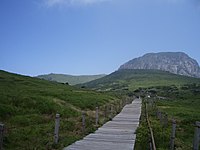
Olle[56] is a word in the local dialect which refers to the paths between houses and public roads."
The
Manjanggul[57] is one of the longest lava tubes in the world. Manjang Cave, situated at Donggimnyeong-ri, Gujwa-eup, North Jeju, 30 km (19 mi) east of Jeju City, was designated as Natural Monument No. 98 on March 28, 1970. The annual temperature inside the cave ranges from 11℃ to 21℃, thus facilitating a favorable environment throughout the year.

Sangumburi Crater[58] is the crater of an extinct volcano. Unlike its brethren Halla-san and Songsan Ilch'ubong, this one exploded quickly, but did not spew much lava nor did it form much of a surrounding cone. This phenomenon is called maru in Korean, and Sangumburi is the only one of its kind in the country, making it Natural Monument #263. The remaining crater is 100 m (330 ft) deep and an average of 350 m (1,150 ft)s across. Over 400 species of plants and animals live inside the crater. Visitors can walk around part of the rim (the rest is private property and fenced off), but they cannot venture down inside the crater. A well-paved path leads from the parking area to the viewing area, which has a small pavilion and several vista points. Also on the grounds are numerous grave sites made in traditional Jeju fashion: a wide, trapezoidal stone wall surrounding the burial mound. Several of the sites also have small stone figures that guard the mound from evil spirits. At the park entrance are several large rocks from the crater. During the eruption, molten rock flew from the volcano into the air and cooled into many exotic shapes.
Oedolgae is a 20-meter-tall pillar-shaped rock in Sammaebong, Seogwipo. It was created 1.5 million years ago by a volcanic eruption. At the top of Oedolgae, there are several pine trees growing naturally. According to legend, an old woman became a rock after waiting for her husband who went to sea to catch fish and didn’t return for a long time. So people also call it 'halmang bawi' meaning grandmother rock. On the left side of Oedolgae, there is a rock called someri bawi. A large grass area covers the rock, and the surrounding area is great for fishing. Oedolgae is a popular tourist destination, particularly with foreigners.
Mt. Halla[59] is the mountain of one of the three gods. It stands at the center of Jeju Island, spreading east and west. The east face is steep, the north side is gentle, and the east and west form a flat, wide highland. Mount Halla is a dormant volcano created by volcanic activities during the
Jungmun Saekdal Beach is a beach located at the Saekdal-dong, Seogwipo-si. It is located nearby the hotel zone. So the beach has a convenient accessibility. Sinla Jeju hotel, Lotte hotel, Jeju Hana hotel are positioned around 2 kilometers near the beach. Jungmun Saekdal Beach has a particular geographical feature. The beach shore is faced to the North and the Water level of the beach is steady knee height until about 200 meters off the shore. and also there are a lots of great and small waves under the influences of the Maparam(Korean: 마파람, means the wind from the North in Korean) so the beach is clouded by the people who came from many other regions to enjoy surfing in summer.
Visa policy
Jeju Special Administrative Province has independent visa policy which varies from that of the Republic of Korea mainland. All ordinary passport holders except the following can stay visa-free 30 days in Jeju Province, even if they normally require a visa for South Korea:[60]
*Domestic flights do not require identification. All people who try to enter the mainland of South Korea from Jeju Special Administrative Province must bring National Citizen ID Card (Korean: 주민등록증) or a passport with proper visa.
Media
There are five local newspapers on Jeju Island: the Cheju Daily News,[61] Jeminilbo,[62] Hallailbo,[63] Seogwipo-News,[64] Jejumaeil.[65][66] The Jeju Weekly is the only print English-language newspaper on the island.[67] JejuWorldWide.com is a daily online news and events Web site which opened in early 2013.[68]
TV and radio stations include
, and KCTV Jeju.Sister provinces
Jeju's international sister provinces are also primarily islands (with the exception of California):
- Hainan Province
 – Bali Province
 – Sakhalin Province
 – State of Hawaii
 – Autonomous Region of Madeira
-
 - California[69]
See also
- List of Korea-related topics
- Subdivisions of South Korea
- Geography of South Korea
- Jeju dialect
- Love Land, a sex-themed sculpture park on the island
- Jeju language
- Jeju Province
- Jeju Uprising
- Jeju City
- Jeju International Airport
- Alddreu Airfield
- Jeju black cattle, indigenous cattle breed
- Jeju horse, indigenous horse breed
Notes and references
- ^ "Jeju Special Self-Governing Province". Retrieved 16 May 2012.
- ^ Staff, By CNN. "Why go to Jeju Island? - CNN.com". CNN. Retrieved 2017-05-03.
{{cite web}}:|first=has generic name (help) - ^ Herald, The Korea (2017-04-29). "Airports, expressways crowded as Koreans embark on extended holidays". Retrieved 2017-05-03.
- ^ http://www.amadeus.com/web/amadeus/en_1A-corporate/Amadeus-Home/News-and-events/News/2013_04_17_300-world-super-routes-attract/1319560217161-Page-AMAD_DetailPpal?assetid=1319526516400&assettype=PressRelease_C
- ^ "Manjanggul Cave [UNESCO World Heritage] (만장굴 [유네스코 세계자연유산]) | Official Korea Tourism Organization". english.visitkorea.or.kr. Retrieved 2017-05-03.
- ^ "Jeju Island | New7Wonders of Nature". New7Wonders of Nature. 2016-09-23. Retrieved 2017-05-03.
- JSTOR 198722.
- JSTOR 208503.
- ^ Hulbert, Archer Butler (1902). "The Queen of Quelparte".
- S2CID 144230819.
- ^ ISBN 9788991913837.
- ^ Wheeler, Wolcott, "The 1948 Cheju-do Civil War", Korea WebWeekly, archived from the original on 1999-10-12, retrieved 2014-04-21
- ^ "Doopedia(두산백과) : 제주 4.3 사건(The Jeju 4.3 Affair)".
- ^ "Dictionary of common current affair(시사상식사전) : 제주 4.3 사건(The Jeju 4.3 Affair)".
- ^ Eperjesi, John (Aug 14, 2011). "Jeju: From peace island to war island". Asia Times. The Asia-Pacific Journal: Japan Focus. Retrieved 2013-05-04.
- ^ Map of Korea: Cheju Island The People's Korea. Accessed 8 July 2012
- ^ "제주특별자치도 자연환경생태정보시스템". nature.jeju.go.kr. Archived from the original on 2016-07-12. Retrieved 2016-03-14.
- ^ Jeong, Gwang-jung, 2004, Gotjawal and the livelihood of Jeju's People, 2004, Jeju Educational College, V. 33, pp. 41–65. 정광중, 2004, 곶자왈과 제주인의 삶, 제주교육대학교 논문집. http://www.riss4u.net/link?id=A35499718, page 49
- ^ Yim, Eun-young, 2007, Bryophyte Flora of Dongbaek-dongsan, Jeju-do, Cheju National University, M.A. thesis. 임은영, 2007, 제주도 동백동산의 선태식물상, 제주대학교 석사학위논문. http://www.riss4u.net/link?id=U10812496_003
- ^ Jang, Yong-chang and Chanwon Lee, 2009, "Gotjawal Forest as an internationally important wetland," Journal of Korean Wetlands Studies, 2009, Vol 1.
- ^ "Ramsar site list" (PDF). Archived from the original (PDF) on January 14, 2009. Retrieved 2007-06-20. Accessed June 2009
- ^ "평년값자료(1981–2010) 제주(184)". Korea Meteorological Administration. Retrieved 2011-05-23.
- ^ "평년값자료(1981–2010) 서귀포(189)". Korea Meteorological Administration. Retrieved 2011-05-23.
- ^ "평년값자료(1981–2010) 성산(188)". Korea Meteorological Administration. Retrieved 2011-05-23.
- ^ "평년값자료(1981–2010) 고산(185)". Korea Meteorological Administration. Retrieved 2011-05-23.
- ^ "제주도상세기후특성집(2010) 윗세오름(871)". Jeju Regional Meteorological Administration. Retrieved 2010-11-30.
- ^ Ap, Tiffany (January 25, 2016). "Deaths, travel disruption as bitter cold grips Asia". CNN. Retrieved January 25, 2016.
- ^ "Cheju Consolidation Vote". Korea Times July 28, 2005. Archived from the original on November 29, 2005. Retrieved July 29, 2005.
- ^ Ernest S Campbell, MD. "Acclimatization to Cold Water". Scuba-doc.com. Retrieved 2013-08-25.
- ^ a b Choe Sang-Hun (29 March 2014). "Hardy Divers in Korea Strait, 'Sea Women' Are Dwindling". New York Times. Retrieved 31 March 2014.
- ^ "Jeju Cyber Samdakwan :: Diving into the sea out of Jeju". English.jejusamda.com. 1970-01-01. Archived from the original on June 29, 2007. Retrieved 2013-08-25.
- ^ McConvey, Joel (2008-09-16). "Lady Good Divers | BLOUIN ARTINFO". Artinfo.com. Retrieved 2013-08-25.
- ^ "Jeju Special Self-Governing Province". Bangsa tower(folk cultural assets).
- ^ "<국어국문학자료사전>".
- ^ Lee, Hyeon-sook. "설문대 할망이 제주시인을 만났다". the Hallailbo.
- ^ Kim, Nam-jung. "설문대할망, 오돌또기 탐라에 얽힌 이야기 집대성". the kukminilbo. Archived from the original on 2016-08-29.
- ^ ISSN 0099-9660. Retrieved 2015-11-09.
- ^ ISSN 0362-4331. Retrieved 2015-11-09.
- ^ Jeju naval base: The Koreaherald.com, Published; 2016-02-29, - Retrieved 2017-03-05
- ^ Save Jeju Now- Retrieved 2017-03-05
- ^ Cheju / Jeju Naval Base: GlobalSecurity.org- Retrieved 2017-03-05
- ^ a b 2005 Census - Religion Results Archived 2015-09-04 at the Wayback Machine
- ^ Paul Osborne. "South Korea to host 2014 AIBA Women's Boxing World Championships after Canada withdraw". insidethegames.biz - Olympic, Paralympic and Commonwealth Games News.
- ^ "자반". Archived from the original on July 14, 2011. Retrieved 2011-07-14.
- ^ "자반". Archived from the original on June 10, 2011. Retrieved 2011-06-10.
- ^ "doopedia". encyber.com. Archived from the original on 2010-03-06.
- ^ "doopedia". encyber.com.[permanent dead link]
- ^ "doopedia". encyber.com.[permanent dead link]
- ^ "doopedia". encyber.com.[permanent dead link]
- ^ "Jeju Island: South Korea's volcanic holiday destination". CNN. 2014-04-17. Retrieved 2015-04-15.
- ^ "How Daum fell under Jeju's spell - JEJU WEEKLY". jejuweekly.com.
- ^ "Little Jeju, big dreams". TTGmice. Retrieved 8 April 2013.
- ^ "Jeju Thermal P/P". Korea Midland Power website. Archived from the original on June 16, 2005. Retrieved July 29, 2005.
- ^ "Korea and Hawaii join forces in Smart Grid venture". The Jeju Weekly. Feb 24, 2012. Retrieved Mar 5, 2012.
- ^ "Hallim Park". Retrieved 25 April 2016.
- ^ "제주올레". jejuolle.org.
- ^ "Take a unique 1-kilometer subterranean stroll - JEJU WEEKLY". jejuweekly.com.
- ^ Sangumburi.net, Korean only
- ^ "Jeju Special Self-Governing Province". English.tour2jeju.net. Retrieved 2013-08-25.
- ^ "Korea Visa & Passports - Official Korea Tourism Organization". visitkorea.or.kr.
- ^ "제주일보". Chejunews.co.kr. Archived from the original on 2006-03-22. Retrieved 2013-08-25.
- ^ "제주도민의 자존심 제민일보". Jemin.com. Retrieved 2013-08-25.
- ^ http://www.hallailbo.co.kr
- ^ "서귀포신문 : 인터넷일간신문". Seogwipo.co.kr. Retrieved 2013-08-25.
- ^ http://www.jejutimes.co.kr/
- ^ "Mass Media - Jeju Special Self-Governing Province". English.jeju.go.kr. Retrieved 2013-08-25.
- ^ "Don't let print pass you by". Jeju Weekly. Retrieved 2013-08-25.
- ^ Robert Neff (2013-01-01). "A New Year and a new newspaper". Jeju World Wide. Retrieved 2013-08-25.
- ^ "ACR 42 Assembly Concurrent Resolution - CHAPTERED". ca.gov.
External links
- Official Site of Korea Tourism Org
- Jeju World Wide, a source of news and information for Jeju
- Official provincial info site
- Jeju at Curlie
- The Jeju Weekly newspaper
- Jeju Island Global geopark
- Jeju World Natural Heritage
- Jeju Tour Information
- Birds of Jeju
- Jeju Peace Institute
Places adjacent to Dixtrix1/sandbox | ||||||||||||||||
|---|---|---|---|---|---|---|---|---|---|---|---|---|---|---|---|---|
| ||||||||||||||||
Jeju (capital) | ||
| Administrative cities |  | |
| Former counties | ||
33°22′N 126°32′E / 33.367°N 126.533°E