Opovo
Opovo
Опово (Serbian) | |
|---|---|
Town and municipality | |
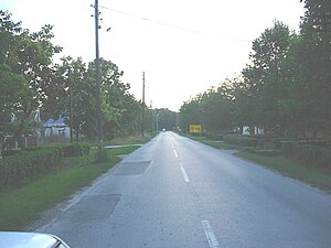
 A street in Opovo | |
|
UTC+2 (CEST) | |
| Postal code | 26204 |
| Area code | +381(0)13 |
| Car plates | PA |
| Website | www.opovo.org.rs |

Opovo (Serbian Cyrillic: Опово; Hungarian: Ópáva) is a town and municipality located in the South Banat District of the autonomous province of Vojvodina, Serbia. The town has a population of 4,546, while Opovo municipality has 10,475 inhabitants.
Name
In
History
There are traces from
During
In 1918, following the collapse of
Inhabited places
Opovo municipality includes the town of Opovo and the following villages:
Opovo is the largest settlement in the municipality.
Demographics
| Year | Pop. | ±% p.a. |
|---|---|---|
| 1948 | 12,256 | — |
| 1953 | 12,305 | +0.08% |
| 1961 | 11,848 | −0.47% |
| 1971 | 11,515 | −0.28% |
| 1981 | 11,541 | +0.02% |
| 1991 | 11,384 | −0.14% |
| 2002 | 11,016 | −0.30% |
| 2011 | 10,440 | −0.59% |
| Source: [3] | ||
According to the 2011 census, the total population of the municipality of Opovo was 10,440 inhabitants.
Ethnic groups
All settlements in the municipality have an ethnic Serb majority. The ethnic composition of the Opovo municipality:
Cultural projects
Wifi network greenlinks is non-profit wireless network originated in Opovo, member of Srbija Wireless.
See also
- List of places in Serbia
- List of cities, towns and villages in Vojvodina
References
- Dr Slobodan Ćurčić, Naselja Banata - geografske karakteristike, Novi Sad, 2004.
- Istorijski atlas, Geokarta, Beograd, 1999.
- The Times History of Europe, Times Books, London, 2002.
Notes
- ^ Source: Stevan Kovačević, Gradovi Srbije u slici i reči, Beograd, 2010.
- ^ "Archived copy". Archived from the original on 2011-10-07. Retrieved 2011-07-04.
{{cite web}}: CS1 maint: archived copy as title (link) - ^ "2011 Census of Population, Households and Dwellings in the Republic of Serbia" (PDF). stat.gov.rs. Statistical Office of the Republic of Serbia. Retrieved 19 March 2017.


