
Kraljevo
Kraljevo
Краљево (Serbian) | |
|---|---|
| City of Kraljevo | |
       From top: Kraljevo City Museum, The church of the Holy Trinity, Main pedestrian street, Maglič Fortress, Morava Airport, Žiča Monastery, Archive in Kraljevo | |
|
UTC+2 (CEST) | |
| Postal code | 36000 |
| Area code | +381(0)36 |
| ISO 3166 code | SRB |
| Car plates | KV |
| Website | www |
Kraljevo (
In 2022 the city urban area has a population of 61,490 inhabitants, while the city administrative area has 110,196 inhabitants. With an area of 1530 km2, it is the largest municipality (after Belgrade) in Serbia by area.
Name
Formerly known as Rudo Polje (Рудо Поље), Karanovac (Карановац) and Rankovićevo (Ранковићево), Kraljevo received its present name, meaning "the King's Town", from King Milan I of Serbia in honor of his own coronation and six Serbian kings that had been crowned in that area. The modern coat of arms of the city features seven crowns symbolizing the seven kings.
History and sights
The "lower" Ibar region is thought to be the first area where Serbs began to develop cultural, political and economic life. Since the end of the 11th century, the center of
The village of Rudo Polje, from which Kraljevo arose, was settled during the 14th century. This area was occupied by the Turks between 1458 and 1459.[citation needed]
During the Turkish rule Rudo Polje became known as Karanovac. Karanovac became an important settlement during the war between Austria and Turkey in the period between 1718 and 1739. After 1718, a border between Austria and Turkey was established along right bank of river Morava. During the first uprising of the Serbs in 1805, Karanovac was heavily damaged and most of the Muslim population left, leaving the Serbs to continue development of the city during the period following the uprising.[citation needed]

.jpg)
After the
In 1882 King
In 1919,
During World War II Kraljevo was occupied by the German army. In October 1941, joint forces of Chetniks and Partisans besieged and attacked German forces in Kraljevo during the Siege of Kraljevo. In retaliation the Wehrmacht carried out the Kraljevo massacre, killing 2,000 residents of the city. A memorial complex constructed in the 1970s today commemorates the site of the massacre. In November 1944, heavy battles were fought in Kraljevo and its surrounding areas culminating in the city's liberation on 29 November 1944.
During the

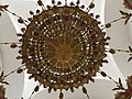
One prominent feature of the area is the Coronation church which belongs to the Žiča monastery. Seven Serbian kings are said to have been crowned (the seven crowns on the city coat of arms represent this assumption) in the church. The church is
The famous monastery of
The silver shrine of Saint Simeon sits within the church, along with many gold and silver ornaments, church vessels and old manuscripts, and a set of vestments and a reliquary, believed by the monks to have been the property of Saint Sava who founded the first hospital in Studenica in the 13th century.
In various historical periods, Kraljevo was part of various administrative formats within Serbia, for example in the Kingdom of Serbs, Croats and Slovenes, as part of Northern Serbia, during the time of Kingdom of Yugoslavia as part of the Moravian Banovina, etc., and today it is officially part of Sumadija & Western Serbia Region
2010 earthquake
Kraljevo was shaken by a
Demographics
| Year | Pop. | ±% p.a. |
|---|---|---|
| 1948 | 76,657 | — |
| 1953 | 82,454 | +1.47% |
| 1961 | 91,580 | +1.32% |
| 1971 | 106,153 | +1.49% |
| 1981 | 121,622 | +1.37% |
| 1991 | 125,772 | +0.34% |
| 2002 | 121,707 | −0.30% |
| 2011 | 125,488 | +0.34% |
| Source: [8] | ||
According to the 2011 census results, a total of 125,488 inhabitants live in the city administrative area of Kraljevo.
The city of Kraljevo has 41,358 households with 3,03 members on average, while the number of homes is 53,367.[9]
Religion structure in the city of Kraljevo is predominantly Serbian Orthodox (120,240), with minorities like Muslims (932), Atheists (487), Catholics (286), Protestants (82) and others.[10] Most of the population speaks Serbian language (122,007).[10]
The composition of population by sex and average age:[10]
- Male - 61,585 (41.02 years) and
- Female - 63,903 (43.45 years).
A total of 53,137 citizens (older than 15 years) have secondary education (49.78%), while the 15,281 citizens have higher education (14.31%). Of those with higher education, 9,326 (8.73%) have university education.[11]
Ethnic groups
The ethnic composition in the city of Kraljevo, according to the 2011 census:[12]
| Ethnic group | Population 2011 |
% |
|---|---|---|
| Serbs | 120,267 | 95.84% |
| Romani | 1,266 | 1.01% |
| Macedonians | 224 | 0.18% |
| Croats | 162 | 0.13% |
| Yugoslavs | 106 | 0.08% |
Muslims
|
44 | 0.04% |
| Russians | 40 | 0.03% |
| Bulgarians | 33 | 0.03% |
| Hungarians | 30 | 0.02% |
| Slovenes | 29 | 0.02% |
| Others | 3,287 | 2.62% |
| Total | 125,488 |
Settlements
At 1,530 square kilometres (591 sq mi) Kraljevo is the largest municipality of Serbia by area. Apart from the urban area, the city administrative area includes 92 settlements:
- Adrani
- Banjevac
- Bapsko Polje
- Bare
- Bogutovac
- Bojanići
- Borovo
- Bresnik
- Brezna
- Brezova
- Bukovica
- Bzovik
- Cerje
- Čibukovac
- Čukojevac
- Cvetke
- Đakovo
- Dedevci
- Dolac (Kraljevo)
- Dragosinjci
- Drakčići
- Dražiniće
- Drlupa
- Gledić
- Godačica
- Gokčanica
- Grdica
- Jarčujak
- Kamenica
- Kamenjani
- Konarevo
- Kovači
- Kovanluk
- Lađevci
- Lazac
- Leševo
- Lopatnica
- Lozno
- Maglič
- Mataruge
- Mataruška Banja
- Međurečje
- Meljanica
- Metikoš
- Milakovac
- Milavčići
- Miliće
- Miločaj
- Mlanča
- Mrsać
- Musina Reka
- Obrva
- Oplanići
- Orlja Glava
- Pečenog
- Pekčanica
- Petropolje
- Plana
- Polumir
- Popovići
- Predole
- Progorelica
- Ratina
- Ravanica
- Reka
- Ribnica
- Roćevići
- Rudnjak
- Rudno
- Samaila
- Savovo
- Sibnica
- Sirča
- Stanča
- Stubal
- Šumarice
- Tadenje
- Tavnik
- Tepeče
- Tolišnica
- Trgovište
- Ušće
- Vitanovac
- Vitkovac
- Vrba
- Vrdila
- Vrh
- Zaklopača
- Zakuta
- Zamčanje
- Zasad
- Žiča
Of those,
lie within the proper city limits.Economy
The following table gives a preview of total number of registered people employed in legal entities per their core activity (as of 2019):[13]
| Activity | Total |
|---|---|
| Agriculture, forestry and fishing | 326 |
| Mining and quarrying | 176 |
| Manufacturing | 6,745 |
| Electricity, gas, steam and air conditioning supply | 630 |
| Water supply; sewerage, waste management and remediation activities | 478 |
| Construction | 1,708 |
| Wholesale and retail trade, repair of motor vehicles and motorcycles | 4,846 |
| Transportation and storage | 2,006 |
| Accommodation and food services | 1,364 |
| Information and communication | 561 |
| Financial and insurance activities | 426 |
| Real estate activities | 136 |
| Professional, scientific and technical activities | 1,107 |
| Administrative and support service activities | 737 |
| Public administration and defense; compulsory social security | 2,413 |
| Education | 1,995 |
| Human health and social work activities | 2,793 |
| Arts, entertainment and recreation | 493 |
| Other service activities | 695 |
| Individual agricultural workers | 1,037 |
| Total | 30,674 |
Tourism
Since 1990 an annual
Sport
The most popular sports in Kraljevo are basketball, volleyball and football. The volleyball club OK Ribnica is playing in top-tier Volleyball League of Serbia. The basketball club KK Sloga is playing in the second-tier Basketball League of Serbia B, while the association football club FK Kablar Sijaće Polje is playing in regional league of Serbia.[citation needed]
Climate
| Climate data for Kraljevo (1991–2020, extremes 1961–2020) | |||||||||||||
|---|---|---|---|---|---|---|---|---|---|---|---|---|---|
| Month | Jan | Feb | Mar | Apr | May | Jun | Jul | Aug | Sep | Oct | Nov | Dec | Year |
| Record high °C (°F) | 20.0 (68.0) |
25.5 (77.9) |
30.3 (86.5) |
32.1 (89.8) |
35.0 (95.0) |
39.2 (102.6) |
43.6 (110.5) |
41.0 (105.8) |
37.3 (99.1) |
33.8 (92.8) |
28.6 (83.5) |
22.0 (71.6) |
43.6 (110.5) |
| Mean daily maximum °C (°F) | 4.7 (40.5) |
7.9 (46.2) |
13.0 (55.4) |
18.3 (64.9) |
22.8 (73.0) |
26.6 (79.9) |
29.0 (84.2) |
29.4 (84.9) |
24.0 (75.2) |
18.4 (65.1) |
12.0 (53.6) |
5.7 (42.3) |
17.7 (63.9) |
| Daily mean °C (°F) | 0.6 (33.1) |
2.9 (37.2) |
7.2 (45.0) |
12.2 (54.0) |
16.6 (61.9) |
20.5 (68.9) |
22.4 (72.3) |
22.3 (72.1) |
17.3 (63.1) |
12.1 (53.8) |
7.0 (44.6) |
1.8 (35.2) |
11.9 (53.4) |
| Mean daily minimum °C (°F) | −2.9 (26.8) |
−1.4 (29.5) |
2.1 (35.8) |
6.2 (43.2) |
10.5 (50.9) |
14.3 (57.7) |
15.7 (60.3) |
15.6 (60.1) |
11.6 (52.9) |
7.1 (44.8) |
2.9 (37.2) |
−1.4 (29.5) |
6.7 (44.1) |
| Record low °C (°F) | −24.0 (−11.2) |
−23.6 (−10.5) |
−15.7 (3.7) |
−6.3 (20.7) |
−1.6 (29.1) |
2.9 (37.2) |
7.0 (44.6) |
3.1 (37.6) |
−1.8 (28.8) |
−5.6 (21.9) |
−17.4 (0.7) |
−19.2 (−2.6) |
−24.0 (−11.2) |
| Average precipitation mm (inches) | 44.8 (1.76) |
47.0 (1.85) |
61.0 (2.40) |
63.6 (2.50) |
83.7 (3.30) |
91.7 (3.61) |
73.6 (2.90) |
61.0 (2.40) |
60.4 (2.38) |
62.9 (2.48) |
49.0 (1.93) |
53.4 (2.10) |
752.1 (29.61) |
| Average precipitation days (≥ 0.1 mm) | 13.2 | 13.1 | 12.7 | 12.6 | 14.7 | 11.9 | 10.4 | 8.4 | 10.6 | 10.7 | 10.4 | 13.9 | 142.6 |
| Average snowy days | 9.0 | 7.8 | 4.8 | 0.9 | 0.0 | 0.0 | 0.0 | 0.0 | 0.0 | 0.2 | 2.9 | 7.7 | 33.3 |
| Average relative humidity (%)
|
81.8 | 75.4 | 68.5 | 66.6 | 69.9 | 69.0 | 66.1 | 66.2 | 72.0 | 77.4 | 79.0 | 83.0 | 72.9 |
| Mean monthly sunshine hours | 64.4 | 89.8 | 141.8 | 171.1 | 212.3 | 247.1 | 279.6 | 272.4 | 185.0 | 139.6 | 85.2 | 51.4 | 1,939.7 |
| Source: Republic Hydrometeorological Service of Serbia[16][17] | |||||||||||||
Famous residents
Twin towns – sister cities
- Gjorče Petrov (Skopje), North Macedonia
 Grodno, Belarus
 Ivanovo, Russia
 Lod, Israel
 Maribor, Slovenia
 Niagara Falls, Canada
 Plužine, Montenegro
- Uvarovo, Russia
 Zielona Góra, Poland
 North Mitrovica, Serbia
Gallery
-
 Archive in Kraljevo
 -
 Ibar River, Kraljevo
 -
 Park, Kraljevo
 -
 City center square
 -
 Church of Saint Sava, Kraljevo
 -
 Inside the Cathedral of Saint Sava, Kraljevo
 -
 Monument to the Serbian Soldier, Kraljevo
 -
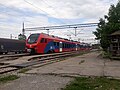 Kraljevo Train Station
 -
 Morava Airport


.jpg)
See also
- Morava Airport
- Pridvorica (Kraljevo)
- Raška District
- Šumadija and Western Serbia
- List of places in Serbia
References
- ^ "Novi gradonačelnik Kraljeva Tomislav Ilić iz Nove Srbije". Blic (in Serbian). 20 June 2014. Archived from the original on 24 September 2015. Retrieved 12 April 2015.
- ^ "Municipalities of Serbia, 2006". Statistical Office of Serbia. Retrieved 2010-11-28.
- ISBN 978-86-6161-228-2. Retrieved 2023-04-30.
- ^ "OCP Error page". www.danas.rs. Archived from the original on 2012-07-29. Retrieved 2010-11-04.
- ^ "2 killed in earthquake in central Serbia". Archived from the original on November 13, 2010.
- ^ Serbia, RTS, Radio televizija Srbije, Radio Television of. "Dan posle zemljotresa". Archived from the original on 2010-11-06. Retrieved 2010-11-04.
{{cite web}}: CS1 maint: multiple names: authors list (link) - ^ "Magnitude 4.3 - SERBIA". Archived from the original on 2010-11-07. Retrieved 2017-09-02.
- ^ "2011 Census of Population, Households and Dwellings in the Republic of Serbia" (PDF). stat.gov.rs. Statistical Office of the Republic of Serbia. Archived from the original (PDF) on 14 July 2014. Retrieved 11 January 2017.
- ^ "Number and the floor space of housing units" (PDF). stat.gov.rs (in Serbian). Statistical Office of the Republic of Serbia. Archived (PDF) from the original on 5 February 2017. Retrieved 21 March 2018.
- ^ a b c "Religion, Mother tongue, and Ethnicity" (PDF). stat.gov.rs (in Serbian). Statistical Office of the Republic of Serbia. Archived (PDF) from the original on 15 July 2014. Retrieved 21 March 2018.
- ^ "Educational attainment, literacy and computer literacy" (PDF). stat.gov.rs (in Serbian). Statistical Office of the Republic of Serbia. Archived (PDF) from the original on 8 August 2019. Retrieved 21 March 2018.
- ^ "Попис становништва, домаћинстава и станова 2011. у Републици Србији" (PDF). stat.gov.rs. Republički zavod za statistiku. Archived from the original (PDF) on 11 August 2014. Retrieved 15 December 2016.
- ^ "Запослени у Републици Србији, 2019. - Годишњи просек -" (PDF). stat.gov.rs (in Serbian). Statistical Office of Republic of Serbia. 31 January 2020. Archived (PDF) from the original on 3 August 2020. Retrieved 15 March 2020.
- ^ M.Dugalić (3 July 2017), "Veseli spust uz povoljan vetar", Politika (in Serbian), p. 05
- Radio Television Serbia. 4 July 2015. Archivedfrom the original on 7 December 2018. Retrieved 4 July 2017.
- ^ "Monthly and annual means, maximum and minimum values of meteorological elements for the period 1991–2020" (in Serbian). Republic Hydrometeorological Service of Serbia. Archived from the original on 20 April 2022. Retrieved 20 April 2022.
- ^ "Monthly and annual means, maximum and minimum values of meteorological elements for the period 1981–2010" (in Serbian). Republic Hydrometeorological Service of Serbia. Archived from the original on 20 July 2021. Retrieved March 13, 2018.
- ^ "Bratski i partnerski gradovi i opštine". kraljevo.rs (in Serbian). Kraljevo. Archived from the original on 2020-08-01. Retrieved 2021-01-18.
External links
 Kraljevo travel guide from Wikivoyage
- Official website


| Villages |
|  |
|---|---|---|
| Landmarks |
| |
| Notable people | ||
| International | |
|---|---|
| National | |