
Tuting
Tuting
Pekong | ||
|---|---|---|
Town | ||
District Upper Siang district | | |
| Elevation | 1,240 m (4,070 ft) | |
| Languages | ||
| • Official | Hindi, English | |
| Time zone | UTC+05:30 (IST) | |
| ISO 3166 code | IN-AR | |
| Vehicle registration | AR | |

Tuting near the McMahon Line
Tuting is a town and headquarters of an eponymous
Indian Military headquarters.[citation needed] The border area reports frequent incursion attempts by the Chinese People's Liberation Army, including an attempt to construct a road in Indian territory.[3][2]
Location
Gelling is located on the 2,000-kilometre-long (1,200 mi) proposed Mago-
Gelling, the last India village before the Indo-Tibet border.[9] Tsangpo river (Brahmaputra) enters here from Tibet and natives know it as the Tsang Chu, downstream of here it is called the Siang river and Bramhaputra in Assam.[2]
Administration
Culture
Tuting is populated by
In Gelling circle in northern reaches of Tuting,
gonpas.[2]
Tourism
Gelling, with three-hour foot track to Indo-China border, is a tourist attraction which has Dampo Tso lake, 300-foot (91 m) tall Sibe-Re waterfall at Bishing, remnants of now defunct Kapangla Pass between Tibet and India, and Inspection Bungalow at Gelling for stay. Trekking and scenery.[2]
Transport
Highway
Tuting is connected to Yingkiong and
India-China Border Roads
.
Tuting Airport
Indian Airforce
.
Map
-
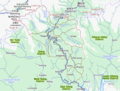 Upper Siang district with Tuting circle and Tuting

See also
| Leadership | |||||||||||||||||||||||||||||||||||||||||||||||||||||
|---|---|---|---|---|---|---|---|---|---|---|---|---|---|---|---|---|---|---|---|---|---|---|---|---|---|---|---|---|---|---|---|---|---|---|---|---|---|---|---|---|---|---|---|---|---|---|---|---|---|---|---|---|---|
| Components & commands |
| ||||||||||||||||||||||||||||||||||||||||||||||||||||
| Military academies |
| ||||||||||||||||||||||||||||||||||||||||||||||||||||
| Insignia | |||||||||||||||||||||||||||||||||||||||||||||||||||||
| History & future | |||||||||||||||||||||||||||||||||||||||||||||||||||||
| Other | |||||||||||||||||||||||||||||||||||||||||||||||||||||
References
- ^ Town. "Tuting". Times of India Travel. Retrieved 23 March 2019.
- ^ a b c d e "Place of interest | District Upper Siang, Government of Arunachal Pradesh". Retrieved 7 February 2021.
- ^ "Chinese road-building team entered 1km inside Arunachal, sent back by Indian Army: Sources". The Times of India. Retrieved 24 December 2018.
- ^ "Top officials to meet to expedite road building along China border". Dipak Kumar Dash. timesofindia.indiatimes.com. Retrieved 27 October 2014.
- ^ "Narendra Modi government to provide funds for restoration of damaged highways". dnaindia.com. Retrieved 27 October 2014.
- ^ "Indian Government Plans Highway Along Disputed China Border". Ankit Panda. thediplomat.com. Retrieved 27 October 2014.
- ^ "Govt planning road along McMohan line in Arunachal Pradesh: Kiren Rijiju". Live Mint. Retrieved 26 October 2014.
- ^ "China warns India against paving road in Arunachal". Ajay Banerjee. tribuneindia.com. Retrieved 26 October 2014.
- ^ "Gelling". Content Owned by District Administration. Developed and hosted by National Informatics Centre, Ministry of Electronics & Information Technology, Government of India. Government of Arunachal Pradesh. Retrieved 17 June 2021.
{{cite web}}: CS1 maint: others (link) - ^ a b c "Districts Officials". Arunachal Pradesh, Official State Portal. Retrieved 23 March 2019.
- ^ "Subdivision & Blocks | District Upper Siang, Government of Arunachal Pradesh". Retrieved 23 March 2019.
Places adjacent to Tuting | ||||||||||||||||
|---|---|---|---|---|---|---|---|---|---|---|---|---|---|---|---|---|
| ||||||||||||||||