
Deserts of Australia
| Great Australian Desert | |
|---|---|
 The Great Australian desert is the 4th largest desert by area after the Antarctic, the Arctic and the Sahara. | |
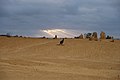
 Typical landscape (Simpson Desert) | |
| Length | 4,710 km (2,930 mi) |
| Width | 1,890 km (1,170 mi) |
| Area | 2,700,000 km2 (1,000,000 sq mi) |
| Geography | |
| Country | Australia |
| States | List
|
| Coordinates | 24°34′S 137°25′E / 24.57°S 137.42°E |
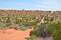
The deserts of Australia or the Australian deserts cover about 2,700,000 km2 (1,000,000 sq mi), or 18% of the Australian mainland, but about 35% of the Australian continent receives so little rain, it is practically desert.[1] Collectively known as the Great Australian desert, they are primarily distributed throughout the Western Plateau and interior lowlands of the country, covering areas from South West Queensland, Far West region of New South Wales, Sunraysia in Victoria and Spencer Gulf in South Australia to the Barkly Tableland in Northern Territory and the Kimberley region in Western Australia.[2]
By international standards, the Great Australian desert receives relatively high rates of rainfall or around 250 mm (9.84 in) on average, but due to the high evapotranspiration it would be correspondingly arid.[3] No Australian weather stations situated in an arid region record less than 100 mm (3.94 in) of average annual rainfall.[4] The deserts in the interior and south lack any significant summer rains. The desert in western Australia is well explained by the little evaporation of the cold sea current of the West Australian Current, of polar origin, which prevents significant rainfall in the interior of the continent.[3] About 40% of Australia is covered by dunes.[5] Australia is the driest inhabited continent,[6][7] with the least fertile soils.[8][9]
In addition to being mostly uninhabited, the Great Australian Desert is diverse, where it consists of
History
Geological

The area's geology spans a geological time period of over 3.8 billion years, therefore featuring some of the oldest rocks on earth. There are three main
Chiefly the Capricorn Orogeny is partly responsible for the assembly of the West Australian landmass by connecting the Yilgarn and Pilbara cratons. The Capricorn Orogeny is exposed in the rocks of the Bangemall Basin, Gascoyne Complex granite-gneisses and the Glengarry, Yerrida and Padbury basins. Unknown Proterozoic orogenic belts, possibly similar to the Albany Complex in southern Western Australia and the Musgrave Block, represent the Proterozoic link between the Yilgarn and Gawler cratons, covered by the Proterozoic-Palaeozoic Officer and Amadeus basins.[13]
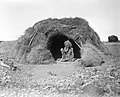
Aboriginal
The
The isolated desert areas remained undeveloped for a long time. For example, the Spinifex people first had contact with whites in the 1950s, when they were expelled from their tribal lands because of nuclear weapons testing (1950–1963) by the British and Australian governments. The Pintupi Nine, a group of nine Aboriginal people of the Pintupi tribe, lived a nomadic hunter-gatherer lifestyle in the Gibson Desert until October 1984, when they first encountered whites as they left the desert. Both discoveries were sensations at the time.[19]
Large parts of the Australian desert areas are part of the Desert Cultural Area. Important cultural sites include Uluṟu and
European

The
The first European to cross the
The
The Tanami Desert was named by explorer and prospector Allan Davidson. He only assigned the name on his second expedition to this desert region, which ended in 1900. "Tanami" was the original Aboriginal name for two rock caves with clear drinking water.[29][30][31]
The
Regions


A large contiguous desert area is formed by the Tanami, Greater Sands, Lesser Sands, Gibson and Greater Victoria Sands in western Australia and a smaller one by the Simpson, Sturt, Strzelecki and Tirari Deserts in the east. Spatially isolated between Great Victoria Sand and Simpson lies the small Pedirka Desert, which spreads out over the geological Pedirka Sedimentary Basin. The Small Sandy Desert connects to the Great Sandy Desert and is similar in terms of landscape and vegetation. The Western Desert, which describes a cultural region of Australia's indigenous people, includes the Gibson, Great Victoria, Great Sand and Small Sand deserts in the states of Northern Territory, South Australia and Western Australia.[35]
Most of the inhabitants of the area are Indigenous Australians. There are other areas in Australia designated as desert that are not related to the Australian deserts mentioned above. On Kangaroo Island off the coast of South Australia is an area of two square kilometers called the Little Sahara, a formation of several sand dunes on its south coast. In Victoria, about 375 km west of Melbourne, there is still the Little Desert National Park. The Painted Desert is 121 kilometers northwest of Coober Pedy in South Australia.
The almost treeless Nullarbor Plain in southern Australia, made of limestone, are also known as the Nullarbor Desert.
| Desert | State/Territory | Area (km2) | Area (miles2) | Area rank | % of Australia |
|---|---|---|---|---|---|
| Great Victoria Desert | South Australia Western Australia |
348,750 km2 | 134,650 sq mi | 1 | 4.5% |
| Great Sandy Desert | Northern Territory Western Australia |
267,250 km2 | 103,190 sq mi | 2 | 3.5% |
| Tanami Desert | Northern Territory Western Australia |
184,500 km2 | 71,200 sq mi | 3 | 2.4% |
| Simpson Desert | Northern Territory Queensland South Australia |
176,500 km2 | 68,100 sq mi | 4 | 2.3% |
| Gibson Desert | Western Australia | 156,000 km2 | 60,000 sq mi | 5 | 2.0% |
| Little Sandy Desert | Western Australia | 111,500 km2 | 43,100 sq mi | 6 | 1.5% |
| Strzelecki Desert | New South Wales Queensland South Australia |
80,250 km2 | 30,980 sq mi | 7 | 1.0% |
| Sturt Stony Desert | Queensland South Australia |
29,750 km2 | 11,490 sq mi | 8 | 0.3% |
| Tirari Desert | South Australia | 15,250 km2 | 5,890 sq mi | 9 | 0.2% |
| Pedirka Desert | South Australia | 1,250 km2 | 480 sq mi | 10 | 0.016% |
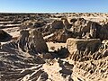
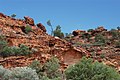
Geography
.jpg)

.jpg)


There are four known types of terrestrial deserts:
- continental (or remote) deserts
- tropical (or zonal) deserts
- shelter deserts
- coastal deserts
Australian deserts generally meet the first three criteria, although some coastal desert areas exist in Western Australia. The great
Areas of the formerly desert outback, deserts such as the Simpson Desert from west to east or mountainous regions such as the Arckaringa Hills are characterized by ocean landscapes of charred rocks, called
Waterbodies
Lakes in the regions (most of which are dried up
- Menindee Lakes
- Willandra Lakes Region
- Lake Mungo
- Peery Lake
- Lake Amadeus
- Lake Mackay
- Lake Neale
- Numby Numby
- Lake Sylvester
- Tarrabool Lake
- Lake Woods
- Lake Yamma Yamma
- Lake Bumbunga
- Lake Dey Dey
- Lake Dutton
- Kati Thanda–Lake Eyre
- Lake Frome
- Lake Gairdner
- Lake Gilles
- Goyder Lagoon
- Lake Gregory
- Lake Hope
- Sleaford Mere
- Lake Torrens
- Serpentine Lakes
- Lake Maitland
- Lake Carnegie
- Lake Way
- Lake Macleod
- Lake Anneen
- Lake Barlee
- Lake Breaden
- Lake Burnside
- Lake Carey
- Lake Dora
- Dumbleyung Lake
- Lake Nabberu
- Serpentine Lakes
- Kumpupintil Lake
- Lake Ballard
- Lake Lefroy
- Lake Gregory
Rivers and creeks, which are sparse and generally ephemeral, in the Australian desert include:
Biodiversity
Vegetation

Two types of semi-desert, referred to as "
Semi-desert savannas with low-growing acacia species cover large areas in the south of the arid zone, where 200 to 500 mm of precipitation falls in winter and summer. The acacia species, called mulga, grow on the plains, mountain slopes and hills of the deserts. In connection with the
In drier areas, species including Old Man Saltbush (
-
 Great Sandy Desert from space
 -
 Tussock grass in Gibson Desert
 -
 Kangaroo in Nambung National Park
 -
 Simpson Desert nearBedourie
 -
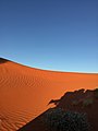 Red dune in Simpson Desert
 -
 Dismantled railway line near Lake Eyre South, South Australia
 -
 Desert savannah nearBirdsville, Queensland
 -
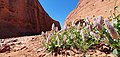 Desert flowers near Uluru


_--_trackbed_near_Lake_Eyre_South,_South_Australia_(cropped).jpg)


Wildlife
Significantly fewer animals live in the Australian deserts than in the Australian coastal regions. The most common creatures in Australia's arid regions are insects, such as termites and ants, which are of great importance to the ecology. Animals in the desert include
About 103 species of mammals lived there at the time of European colonization, of which 19 are extinct, such as the desert bandicoot (
Reptiles live in large numbers in the deserts, for example the
The
-
 The marsupial mole prefers an underground life
 -
 A thorny devil in the Northern Territory
 -
 TheGould's monitorlizard is a large species of lizard found in the Australian desert
 -
 The galah lives in tree-covered savannas and open grasslands
 -

-
 Feral camelsin Central Australia
 -
 Emu in South Australia
 -
 Frilled-neck lizard
 -
 Camel farm in Uluru
.jpg)


.jpg)
_(8692622586).jpg)

Climate

Australia's climate is mostly determined by the hot, sinking air of the subtropical high-pressure belt (i.e. Australian High).[5] Dry conditions are associated with an El Niño–Southern Oscillation in Australia. Vegetation in arid areas is primarily dependent upon soil type.[5]
The average annual rainfall in the Australian desert ranges from 81 to 250 mm (3 to 10 in), which would make it a semi-arid climate. But a massive evaporation rate makes up for the higher than normal desert rainfall. Central Australia is arid, with the driest areas averaging 150 mm (5.91 in) of rainfall each year. Thunderstorms are relatively common in the region, with an annual average of 15 to 20 thunderstorms. Summer daytime temperatures range from 32 to 50 °C (90 to 122 °F); winter maximum temperatures average between 18 and 23 °C (64 to 73 °F), though will be more warmer in the north.[45]
Extensive areas are covered by longitudinal dunes.[5] The northwestern region of the desert is one which gives rise to the heat lows which help drive the NW monsoon. There, almost all rain comes from monsoon thunderstorms or the occasional tropical cyclone rain depression.[46] Frost does not occur in most of the area in the far north. The regions bordering the Gibson Desert in the far southeast may record a light frost or two every year, with frost being more prevalent in the Tanami region.[47] Away from the coast winter nights can still be chilly in comparison to the warm days. Minimum winter temperatures dip to 6 °C (43 °F) in most parts of the desert.[48]
-
 Climate zones in Australia with deserts in orange and semi-deserts in yellow
 -
 Annual rain days in the desert range from less than 20 to no more than 80 days (on the 0.2 mm threshold)


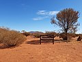
Tourism
.jpg)
Tourism is a major industry across the Great Australian desert, and commonwealth and state tourism agencies explicitly target Outback Australia as a sought after destination for domestic and international travelers.
There are several popular tourist attractions in the desert, which include:
- Arkaroola and Wilpena Pound in the Flinders Ranges
- Australian Stockman's Hall of Fame
- Devils Marbles
- Kakadu National Park
- Kata Tjuta (The Olgas)
- Katherine Gorge
- Kings Canyon (Watarrka)
- MacDonnell Ranges
- Monkey Mia
- Mount Augustus National Park
- Uluru (Ayers Rock)
- Willandra Lakes Region
- Lake Mungo
- Gawler Ranges National Park
- Gawler Ranges Conservation Park
- Great Victoria Desert Nature Reserve
- Lake Gairdner National Park
- Mamungari Conservation Park
- Munga-Thirri National Park
- Karlamilyi National Park
- Mount Willoughby Indigenous Protected Area
- Nullarbor Regional Reserve
- Pureba Conservation Park
- Queen Victoria Spring Nature Reserve
- Tallaringa Conservation Park
- Watarru Indigenous Protected Area
- Yellabinna Regional Reserve
- Yellabinna Wilderness Protection Area
- Yumbarra Conservation Park
- Black Rock Conservation Park
- Bon Bon Station Conservation Reserve
- Bunkers Conservation Reserve
- Caroona Creek Conservation Park
- Coongie Lakes Ramsar Site
- Danggali Wilderness Protection Area
- Ediacara Conservation Park
- Elliot Price Conservation Park
- Gawler Ranges National Park
- Hiltaba Nature Reserve
- Ikara-Flinders Ranges National Park
- Ironstone Hill Conservation Park
- Kanku-Breakaways Conservation Park
- Kati Thanda-Lake Eyre National Park
- Kinchega National Park
- Lake Frome Regional Reserve
- Lake Gairdner National Park
- Lake Gilles Conservation Park
- Lake Torrens National Park
- Mount Brown Conservation Park
- Mount Willoughby Indigenous Protected Area
- Munyaroo Conservation Park
- Mutawintji National Park
- Nantawarrina Indigenous Protected Area
- Pandappa Conservation Park
- Pinkawillinie Conservation Park
- Pualco Range Conservation Park
- Simpson Desert Regional Reserve
- Strzelecki Regional Reserve
- Sturt National Park
- The Dutchmans Stern Conservation Park
- Vulkathunha-Gammon Ranges National Park
- Wabma Kadarbu Mound Springs Conservation Park
- Whyalla Conservation Park
- Winninowie Conservation Park
- Witchelina Nature Reserve
- Witjira National Park
- Yalpara Conservation Park
- Yellabinna Regional Reserve
- Yellabinna Wilderness Protection Area
- Yumbarra Conservation Park
-
 MacDonnell National Park
 -
 Lake Mungo National Park
 -
 Uluru / Ayers Rock
 -
 Millstream-Chichester National Park in Pilbara
 -
 Munga-Thirri National Park in Queensland
 -
 Sturt National Park
 -
 King's Canyon
 -
 Mount Augustus National Park
 -
 Mutawintji National Park


.jpg)


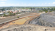
Mining
Other than agriculture and tourism, the primary economic activity in the vast and sparsely settled desert is mining. Owing to the almost complete absence of mountain building and glaciation since the
In Western Australia the Argyle diamond mine in the Kimberley is the world's biggest producer of natural diamonds and contributes approximately one-third of the world's natural supply. The Pilbara region's economy is dominated by mining and petroleum industries.[52] Most of Australia's iron ore is also mined in the Pilbara and it also has one of the world's major manganese mines.

Transport
.jpg)
The outback is reticulated by historic tracks with excellent
Roads in the desert include:
- Birdsville Track
- Burke Developmental Road
- Canning Stock Route
- Colson Track
- Connie Sue Highway
- French Line
- Gary Highway
- Gibb River Road
- Great Central Road
- Gunbarrel Highway
- Kalumburu Road
- Kidman Way
- Lasseter Highway
- Oodnadatta Track
- Peninsula Developmental Road
- Plenty Highway
- Sandover Highway
- Strzelecki Track
- Talawana Track
- Tanami Track
Towns
Although the desert covers about three-quarters of the continent, it only supports around 800,000 residents – less than 5% of the Australian population. In addition, there are approximately 1,200 small Indigenous communities, of which almost half have a population of fewer than 100 people. The
-
 red centre.
 -
 Port Hedland is a coastal, tourist town in the Pilbararegion of Western Australia.
 -
 mining cityin New South Wales that is known as the "Capital of the Outback".
 -
 Port Augusta is a small desert city located on the Spencer Gulf.

.JPG)


Inhabited areas within the Great Australian desert include many towns and as well as some cities, such as:
- Northern Territory
- New South Wales/Victoria
- Western Australia
- Queensland
- Mount Isa
- Cloncurry
- Cunnamulla
- Longreach
- South Australia
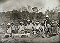
Languages and people
The Aboriginal languages with the most speakers today in the desert include
Ethnic groups include the
-
 Cape Dombey people in Northern Territory, circa 1905
 -
 Aboriginal tribe in NT
 -
 Luritja people
 -
 Frederic Bonney with an Aboriginal tribe
 -
 Arltungadistrict, Northern Territory
 -
 Arrernte boy, South Australia

.JPG)


Popular culture
Popular movies set or filmed in the Australian desert include:
- Kangaroo (1952)
- Wake in Fright (1971)
- Walkabout (1971)
- Mad Max (1979)
- The Road Warrior(1981)
- Mad Max Beyond Thunderdome (1985)
- Crocodile Dundee (1986)
- Crocodile Dundee II (1988)
- Evil Angels (1988)
- Quigley Down Under (1990)
- The Rescuers Down Under (1990)
- The Adventures of Priscilla, Queen of the Desert (1994)
- Napoleon (1995)
- Welcome to Woop Woop (1997)
- Rabbit-Proof Fence (2002)
- The Tracker (2002)
- Kangaroo Jack (2003)
- Wolf Creek (2005)
- The Proposition (2005)
- Rogue (2007)
- Australia (2008)
- Bran Nue Dae (2009)
- Last Ride (2009)
- Samson and Delilah (2009)
- Red Dog (2012)
- Satellite Boy (2012)
- Blinky Bill the Movie (2015)
- Sweet Country (2017)
- Bilby (2018)
- High Ground (2020)
- Furiosa: A Mad Max Saga (2024)
See also
References
- ^ Deserts by Geoscience Australia
- ^ Geosciences Australia –Deserts
- ^ ISBN 978-1438106663. Retrieved 27 September 2015.
- ISBN 978-9400960800. Retrieved 27 September 2015.
- ^ ISBN 978-1444300741. Retrieved 8 November 2012.
- ^ "The Australian continent". Bureau of Meteorology. Retrieved 13 August 2018.
- ^ "Deserts". Geoscience Australia. Australian Government. 15 May 2014. Retrieved 13 August 2018.
- ^ Kelly, Karina (13 September 1995). "A Chat with Tim Flannery on Population Control". Australian Broadcasting Corporation. Archived from the original on 13 January 2010. Retrieved 23 April 2010. "Well, Australia has by far the world's least fertile soils".
- ^ Grant, Cameron (August 2007). "Damaged Dirt" (PDF). The Advertiser. Archived from the original (PDF) on 6 July 2011. Retrieved 23 April 2010.
Australia has the oldest, most highly weathered soils on the planet.
- PMID 27552116.
- ^ Managing the impacts of feral camels in Australia: a new way of doing business. Desert Knowledge CRC Report Number 47. Accessed 8 May 2014.
- ^ Northern Territory > Department of Land Resource Management > Feral Camel Archived 8 May 2014 at the Wayback Machine. Accessed 8 May 2014.
- ^ Pirajno, F., Occhipinti, S. A. and Swager, C. P., 1998. Geology and tectonic evolution of the Palaeoproterozoic Bryah, Padbury and Yerrida basins, Western Australia: implications for the history of the south-central Capricorn orogen. Precambrian Research, 90: 119–140.
- S2CID 4470503.
- ^ Berndt, Ronald Murray; Vogelsang, T. (1939). Notes on the Dieri tribe of South Australia. Royal Society of South Australia.
- PMID 30231025 – via ResearchGate.
The re-excavation of Karnatukul (Serpent's Glen) has provided evidence for the human occupation of the Australian Western Desert to before 47,830 cal. BP (modelled median age). This new sequence is 20,000 years older than the previous known age for occupation at this site
- ^ Cassidy, Caitlin (22 March 2022). "Wattle used for tools, food and medicine by Western Desert traditional owners for 50,000 years, study shows". The Guardian. Retrieved 20 July 2022.
- ^ Rock Art Archived 1 August 2018 at the Wayback Machine, Aboriginal Art Online, retrieved April 2008.
- ^ "The Last Nomads". Aboriginal Art Store. Archived from the original on 6 July 2011.
- ISSN 0261-3077. Retrieved 21 December 2021.
- ^ "Our Country". Aboriginal Australian Art & Culture. n.d. Retrieved 4 November 2020.
- ^ "He found Gippsland". The Argus. Melbourne, Victoria: National Library of Australia. 16 January 1954. p. 8. Retrieved 30 April 2012.
- ^ "Dismissal of Captain Tolmer". South Australian Register. South Australia. 12 March 1856. p. 3. Retrieved 29 December 2019 – via Trove.
- ^ "Afghan cameleers in Australia". australia.gov.au. 15 August 2014. Archived from the original on 15 August 2014. Retrieved 2 June 2019.
- ^ Michael Cathcart, The Water Dreamers, Text Publishing, 2009
- ^ "Governor-General on N.T. Visit". The Sydney Morning Herald. No. 32, 946. New South Wales, Australia. 30 July 1943. p. 4. Retrieved 13 October 2019 – via National Library of Australia.
- ^ "Overland-telegraph | australia.gov.au". Archived from the original on 29 June 2015. Retrieved 27 June 2015.
- ^ ISBN 0-86824-015-X. Archived from the originalon 22 March 2012. Retrieved 12 May 2012.
- Australian Government. Archived from the original on 5 September 2006. Retrieved 31 January 2007.)
{{cite journal}}: Cite journal requires|journal=(help - ^ IBRA Version 6.1 data
- ^ "Interim Biogeographic Regionalisation for Australia (IBRA7) regions and codes". Department of Sustainability, Environment, Water, Population and Communities. Commonwealth of Australia. 2012. Retrieved 13 January 2013.
- .
- ^
- "Desert Parks of South Australia" (PDF). Department of Environment and Heritage, South Australia. Archived from the original (PDF) on 29 July 2008. Retrieved 23 October 2008.
- "Simpson Desert". Britannica Encyclopedia Inc. Retrieved 23 October 2008.
- ^ "The Times & The Sunday Times". thetimes.co.uk. Archived from the original on 10 October 2017. Retrieved 28 April 2018.
- ISBN 978-0-702-23245-9.
- ^ "Department of Agriculture, Water and the Environment". Department of Agriculture, Water and the Environment.
- ^ "Rangelands – Overview – Gibson Desert". Australian Natural Resources Atlas. Department of Sustainability, Environment, Water, Population and Communities. 27 June 2009. Archived from the original on 16 March 2011. Retrieved 19 December 2010.
- ^ Arid Zone Trees Archived June 10, 2007, at the Wayback Machine
- ^ "Acacia kempeana F.Muell". Atlas of Living Australia. Global Biodiversity Information Facility. Retrieved 12 May 2019.
- ^ "South Australian Arid Lands Biodiversity Strategy Draft" (PDF). The Department for Environment and Heritage (Federal Government of Australia) and South Australian Arid Lands Natural Resources Management Board. p. 34. Archived from the original (PDF) on 25 June 2008. Retrieved 23 June 2008.
- ^ "South Australian Arid Lands Biodiversity Strategy Draft" (PDF). The Department for Environment and Heritage (Federal Government of Australia) and South Australian Arid Lands Natural Resources Management Board. p. 17. Archived from the original (PDF) on 25 June 2008. Retrieved 27 June 2008.
- ^ Pavey, Chris (May 2006). "Notomys longicaudatus" (PDF). Department of Natural Resources, Environment and the Arts, Northern Territory Government. Archived from the original (PDF) on 3 September 2008. Retrieved 17 April 2011.
- ^ Wild dog populations will be out of control within five years without dedicated dogger, former trapper says Archived 28 April 2018 at the Wayback Machine SA Country Hour, ABC News, 29 June 2016. Retrieved 13 November 2017.
- ^ Explainer: South Australia's wild dog problem and sheep industry's plea for dedicated doggers Archived 15 April 2017 at the Wayback Machine ABC Rural, 7 April 2017. Retrieved 13 November 2017.
- ^ "Western Australia For Everyone: Great Sandy Desert". www.australiaforeveryone.com.au. Retrieved 24 December 2020.
- ISBN 978-0-237-53286-4.
- ^ "Gibson Desert | desert, Western Australia, Australia". Encyclopedia Britannica. Retrieved 24 December 2020.
- ^ Great Victoria and Gibson Deserts, Western Australia from Climate and Weather Atlas of Australia by Michael Thompson, verified 2006-01-23.
- ^ Australia, Tourism. "Aboriginal Tourism – Markets – Tourism Australia". www.tourism.australia.com. Archived from the original on 22 November 2016. Retrieved 21 December 2016.
- ^ "Latest visitor data – Tourism NT Corporate Site". www.tourismnt.com.au. Archived from the original on 21 December 2016. Retrieved 21 December 2016.
- ^ Archer M; Hand, Suzanne J. & Godthelp H. [1991] 2000. Australia's lost world: Riversleigh, World Heritage Site. Reed, Sydney.
- ^ The Pilbara's oil and gas industry is the region's largest export industry earning $5.0 billion in 2004/05 accounting for over 96% of the State's production. source – WA.gov.au Archived 19 July 2008 at the Wayback Machine
- ^ Wilurarra Creative
- ^ "International Year of Indigenous Languages commemorated with new coins launched by Royal Australian Mint and AIATSIS". Royal Australian Mint. 8 April 2019. Archived from the original on 26 June 2019. Retrieved 26 June 2019.
- ^ Claire Bowern and Quentin Atkinson (2012) "Computational phylogenetics and the internal structure of Pama-Nyungan", Language 88: 817–845.
- AIATSIS. 10 November 2022.
Further reading
- Johnson, John & Catherine de Courcy.(1998) Desert Tracks Port Melbourne, Vic. Lothian Books. ISBN 0-85091-811-1
External links
- The Australian Landscape, A Cultural History – A four-part program exploring the way Europeans and Aboriginal people have engaged with the desert, through art, science and religion, from ABC Radio National
- Encarta (Archived 2009-10-31)
- World Book
- World Wildlife Fund, ed. (2001). "Simpson desert". WildWorld Ecoregion Profile. National Geographic Society. Archived from the original on 8 March 2010.