
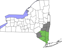
Sullivan County, New York
Sullivan County | |
|---|---|
 Stream in the hamlet of Rock Hill | |
|
UTC−4 (EDT) | |
| Congressional district | 19th |
| Website | sullivanny |
Sullivan County is a
The county was the site of hundreds of Borscht Belt hotels and resorts, which had their heyday from the 1920s through the 1970s.
In 2010, the state's center of population was at the southern edge of Sullivan County.[4]
History
.jpg)
When the Province of New York established its first twelve counties in 1683, the present Sullivan County was part of Ulster County. In 1809, Sullivan County was split from Ulster County.[5]
In the late 19th century, the Industrial Revolution and the advent of factories driven by water power along the streams and rivers led to an increase in population attracted to the jobs.[6] Hamlets enlarged into towns. As industry restructured, many of those jobs left before the middle of the twentieth century. The economy changed again after that, shifting to a more tourist-based variety and benefiting from resorts established by European Jewish immigrants and their descendants in what became called the Borscht Belt of the 20th century. Resort hotels featured a wide variety of entertainers, some nationally known. At the beginning of this period, visitors traveled to the area by train, and later by automobile.[7] The area's natural resources also provided a setting for numerous summer camps frequented by the children of immigrants and their descendants.
Geography


According to the
Sullivan County is in the southern part of New York State, southeast of Binghamton and southwest of Albany. It is separated from Pennsylvania along its southwest boundary by the Delaware River.
The county, which starts about 70 miles northwest of New York City, is in the Catskill Mountains. Its northeastern corner is within the Catskill Park.
The highest point in the county is a 3,118-foot (950 m) peak unofficially known as Beech Mountain, near Hodge Pond, a subsidiary summit to Mongaup Mountain[9] across the Ulster County line. The lowest point is along the Delaware River.[10]
Adjacent counties
- Delaware County - north
- Ulster County - northeast
- Orange County - southeast
- Pike County, Pennsylvania - southwest
- Wayne County, Pennsylvania - west
Demographics
| Census | Pop. | Note | %± |
|---|---|---|---|
| 1810 | 6,108 | — | |
| 1820 | 8,900 | 45.7% | |
| 1830 | 12,364 | 38.9% | |
| 1840 | 15,629 | 26.4% | |
| 1850 | 25,088 | 60.5% | |
| 1860 | 32,385 | 29.1% | |
| 1870 | 34,550 | 6.7% | |
| 1880 | 32,491 | −6.0% | |
| 1890 | 31,031 | −4.5% | |
| 1900 | 32,306 | 4.1% | |
| 1910 | 33,808 | 4.6% | |
| 1920 | 33,163 | −1.9% | |
| 1930 | 35,272 | 6.4% | |
| 1940 | 37,901 | 7.5% | |
| 1950 | 40,731 | 7.5% | |
| 1960 | 45,272 | 11.1% | |
| 1970 | 52,580 | 16.1% | |
| 1980 | 65,155 | 23.9% | |
| 1990 | 69,277 | 6.3% | |
| 2000 | 73,966 | 6.8% | |
| 2010 | 77,547 | 4.8% | |
| 2020 | 78,624 | 1.4% | |
| U.S. Decennial Census[11] 1790-1960[12] 1900-1990[13] 1990-2000[14] 2010-2020[2] | |||
There were 27,661 households, out of which 31.30% had children under the age of 18 living with them, 50.10% were married couples living together, 11.40% had a female householder with no husband present, and 33.80% were non-families. 27.90% of all households were made up of individuals, and 11.40% had someone living alone who was 65 years of age or older. The average household size was 2.50 and the average family size was 3.05.
In the county, the population was spread out, with 24.90% under the age of 18, 7.30% from 18 to 24, 28.10% from 25 to 44, 25.40% from 45 to 64, and 14.30% who were 65 years of age or older. The median age was 39 years. For every 100 females, there were 103.60 males. For every 100 females age 18 and over, there were 102.80 males.
The median income for a household in the county was $36,998, and the median income for a family was $43,458. Males had a median income of $36,110 versus $25,754 for females. The
2020 census
| Race | Num. | Perc. |
|---|---|---|
White (NH)
|
52,691 | 67.01% |
Black or African American (NH)
|
6,069 | 7.72% |
Native American (NH)
|
174 | 0.2% |
Asian (NH)
|
1,569 | 2.0% |
Pacific Islander (NH)
|
10 | 0.01% |
Other/Mixed (NH)
|
4,104 | 5.22% |
Latino
|
14,007 | 17.81% |
National protected area
Government and politics
Sullivan County is a swing county, backing the national winner in all but three presidential elections from 1952 to the present. In 2004, Republican George W. Bush defeated Democrat John Kerry by a margin of 49.47% to 48.55%, or a difference of 285 votes.[17] In 2008, however, it was won by Democrat Barack Obama over Republican John McCain by a margin of 54% to 45%.[18] The margin remained virtually the same in 2012, as Obama won the county again over Republican Mitt Romney by 54-44%.[19] But then, in 2016, the county swung to Republican Donald Trump over Democrat Hillary Clinton by a margin of 53% to 42%.[20] In 2020, the county didn't back the winner nationally for the first time since 2000. Incumbent Republican President Donald Trump won the county with 54% of the votes that year compared to the national winner Democrat Joe Biden's 45%.[21]
There are thirty-six town and village courts in Sullivan County.[22]
Legislative authority is vested in the county legislature which consists of nine members, each elected from single member districts. Currently, there are five Democrats and four Republicans.
| District | Legislator | Title | Party |
|---|---|---|---|
| 1 | Matt McPhillips | Majority Leader | Democratic |
| 2 | Nadia Rajsz | Chair | Democratic |
| 3 | Brian McPhillips | Democratic | |
| 4 | Nicholas Salomone, Jr. | Minority Leader | Republican |
| 5 | Catherine Scott | Democratic | |
| 6 | Luis Alvarez | Democratic | |
| 7 | Joseph Perrello | Republican | |
| 8 | Amanda Ward | Republican | |
| 9 | Terry Blosser-Bernardo | Republican |
| Year | Republican | Democratic | Third party | |||
|---|---|---|---|---|---|---|
| No. | % | No. | % | No. | % | |
| 2020 | 18,665 | 53.87% | 15,489 | 44.71% | 492 | 1.42% |
| 2016 | 15,931 | 53.18% | 12,568 | 41.96% | 1,456 | 4.86% |
| 2012 | 12,705 | 44.71% | 15,268 | 53.73% | 442 | 1.56% |
| 2008 | 13,900 | 44.58% | 16,850 | 54.04% | 433 | 1.39% |
| 2004 | 15,319 | 49.47% | 15,034 | 48.55% | 613 | 1.98% |
| 2000 | 12,703 | 44.53% | 14,348 | 50.29% | 1,477 | 5.18% |
| 1996 | 9,321 | 33.00% | 15,052 | 53.29% | 3,871 | 13.71% |
| 1992 | 11,396 | 36.02% | 13,717 | 43.36% | 6,522 | 20.62% |
| 1988 | 15,713 | 57.00% | 11,635 | 42.20% | 220 | 0.80% |
| 1984 | 18,037 | 63.09% | 10,475 | 36.64% | 78 | 0.27% |
| 1980 | 15,089 | 55.44% | 9,553 | 35.10% | 2,576 | 9.46% |
| 1976 | 13,709 | 48.79% | 14,189 | 50.50% | 198 | 0.70% |
| 1972 | 17,035 | 63.24% | 9,847 | 36.55% | 56 | 0.21% |
| 1968 | 11,657 | 48.17% | 10,860 | 44.88% | 1,681 | 6.95% |
| 1964 | 8,006 | 32.31% | 16,728 | 67.52% | 41 | 0.17% |
| 1960 | 13,744 | 54.37% | 11,486 | 45.44% | 49 | 0.19% |
| 1956 | 15,845 | 63.94% | 8,937 | 36.06% | 0 | 0.00% |
| 1952 | 14,926 | 63.26% | 8,421 | 35.69% | 247 | 1.05% |
| 1948 | 11,253 | 53.20% | 7,654 | 36.19% | 2,245 | 10.61% |
| 1944 | 11,258 | 55.82% | 8,836 | 43.81% | 73 | 0.36% |
| 1940 | 11,877 | 54.64% | 9,785 | 45.01% | 76 | 0.35% |
| 1936 | 9,757 | 48.83% | 9,908 | 49.58% | 317 | 1.59% |
| 1932 | 8,294 | 44.79% | 9,656 | 52.15% | 567 | 3.06% |
| 1928 | 10,331 | 61.27% | 6,207 | 36.81% | 323 | 1.92% |
| 1924 | 7,734 | 56.85% | 4,057 | 29.82% | 1,813 | 13.33% |
| 1920 | 8,029 | 64.45% | 3,623 | 29.08% | 806 | 6.47% |
| 1916 | 4,340 | 53.05% | 3,659 | 44.73% | 182 | 2.22% |
| 1912 | 3,039 | 37.56% | 3,864 | 47.75% | 1,189 | 14.69% |
| 1908 | 4,593 | 52.52% | 3,911 | 44.72% | 242 | 2.77% |
| 1904 | 4,452 | 54.37% | 3,582 | 43.74% | 155 | 1.89% |
| 1900 | 4,393 | 53.92% | 3,625 | 44.49% | 130 | 1.60% |
| 1896 | 4,589 | 58.35% | 3,073 | 39.08% | 202 | 2.57% |
| 1892 | 3,664 | 48.28% | 3,567 | 47.00% | 358 | 4.72% |
| 1888 | 3,860 | 49.66% | 3,757 | 48.33% | 156 | 2.01% |
| 1884 | 3,332 | 45.31% | 3,607 | 49.05% | 415 | 5.64% |
Education
Public school districts
- Eldred Central Schools
- Fallsburg Central Schools
- Liberty Central School District
- Livingston Manor Central School District
- Monticello Central Schools
- Roscoe Central Schools
- Sullivan West Central School
- Tri-Valley Central School
Higher education
- Fallsburg.
Transportation
Sullivan County has services provided by Short Line to New York City. It also has some local service provided by the county itself, as well as community organizations.[24][25][26]
Sullivan County International Airport is located in Bethel and is used frequently for general aviation purposes.
Major roadways
Tourism
Sullivan County has been a popular vacation spot since the 19th century, with mountain climbing, boating, and other outdoor activities, as well as the Monticello Raceway being among the attractions. The majority of the tourism occurs in the summer months. It was the site of the hundreds of resort complexes of the Borscht Belt (with their golf courses, social events, and entertainers), between the 1920s and 1970s.
Borscht Belt hotels, bungalow colonies, summer camps, and kuchaleyns (a
Many famous comedians tested their material and performed regularly at Borscht Belt hotels, including
By the late 1950s, many began closing with most gone by the 1970s, but some major resorts continued to operate, a few into the 1990s. Grossinger's Catskill Resort Hotel closed in 1986[29] and the Concord Resort Hotel struggled to stay open until 1998.[30] By that time, the business owed millions in back taxes to Sullivan County, but the property was sold "for $10.5 million" and a new resort was eventually built.[31][32]
Sullivan County was the site of the 1969
Bethel Woods Center for the Arts, which also includes a museum of the sixties and Woodstock, holds many concerts and other events throughout the year.
Other notable cultural destinations include the CAS Arts Center, a multi-arts exhibit space and education center run by the Catskill Art Society in Livingston Manor, New York, the NaCl Theatre, a professional regional theater company focusing on experimental work in Highland Lake, and the Delaware Valley Arts Alliance (DVAA) which serves as the Arts Council for Sullivan County and is located in Narrowsburg. DVAA offers two art galleries, performing arts and cultural programming, grant opportunities for artists and nonprofits, the Big Eddy Film Festival, and Riverfest.
Communities


Towns
- Bethel
- Callicoon
- Cochecton
- Delaware
- Fallsburg
- Forestburgh
- Fremont
- Highland
- Liberty
- Lumberland
- Mamakating
- Neversink
- Rockland
- Thompson
- Tusten
Villages
- Bloomingburg
- Jeffersonville
- Liberty
- Monticello (county seat)
- Woodridge
- Wurtsboro
Census-designated places
- Barryville
- Bridgeville
- Callicoon
- Eldred
- Fallsburg
- Grahamsville
- Hankins
- Hortonville
- Hurleyville
- Kauneonga Lake
- Kiamesha Lake
- Lake Huntington
- Livingston Manor
- Loch Sheldrake
- Mongaup Valley
- Mountain Dale
- Narrowsburg
- Rock Hill
- Roscoe
- Smallwood
- South Fallsburg
- Swan Lake
- White Lake
- Woodbourne
- Wurtsboro Hills
Hamlets
Notable people
- District Attorney
- Jeff McBride (born 1959), American magician and magic instructor.
See also
- Upstate New York
- Hudson Valley
- Catskill Mountains
- List of counties in New York
- National Register of Historic Places listings in Sullivan County, New York
- Borscht Belt
- Woodstock Festival
References
- Notes
- ^ "US Census 2020 Population Dataset Tables for New York". United States Census Bureau. Retrieved January 2, 2022.
- ^ a b "U.S. Census Bureau QuickFacts: Sullivan County, New York". United States Census Bureau. Retrieved January 2, 2022.
- ^ "Find a County". National Association of Counties. Retrieved June 7, 2011.
- ^ "Centers of Population by State: 2010". United States Census Bureau. Retrieved April 5, 2014.
- ^ "Sullivan County, NY - History & Nostalgia Gallery". Hudson Valley Sojourner. Retrieved February 8, 2022.
- ^ Administrator (June 11, 2016). "Sullivan Life". www.scnyhistory.org. Retrieved February 8, 2022.
- ISSN 0362-4331. Retrieved February 8, 2022.
- ^ "2010 Census Gazetteer Files". United States Census Bureau. August 22, 2012. Archived from the original on May 19, 2014. Retrieved January 7, 2015.
- ^ "Beech Mountain - Peakbagger.com". www.peakbagger.com. Retrieved October 1, 2019.
- ^ "Sullivan County". www.dianebutlerrealestate.com. Retrieved May 19, 2020.
- ^ "U.S. Decennial Census". United States Census Bureau. Retrieved January 7, 2015.
- ^ "Historical Census Browser". University of Virginia Library. Retrieved January 7, 2015.
- ^ "Population of Counties by Decennial Census: 1900 to 1990". United States Census Bureau. Retrieved January 7, 2015.
- ^ "Census 2000 PHC-T-4. Ranking Tables for Counties: 1990 and 2000" (PDF). United States Census Bureau. Retrieved January 7, 2015.
- ^ "U.S. Census website". United States Census Bureau. Retrieved January 31, 2008.
- ^ "P2 HISPANIC OR LATINO, AND NOT HISPANIC OR LATINO BY RACE – 2020: DEC Redistricting Data (PL 94-171) – Sullivan County, New York".
- ^ "Dave Leip's Atlas of U.S. Presidential Elections - State Data".
- ^ "Dave Leip's Atlas of U.S. Presidential Elections - State Data".
- ISSN 0362-4331. Retrieved January 17, 2023.
- ^ "Dave Leip's Atlas of U.S. Presidential Elections - State Data".
- ^ "Dave Leip's Atlas of U.S. Presidential Elections - State Data".
- ^ Sullivan County Evaluation (PDF), National League of Defenders Association, January 2009, p. 8, archived from the original (PDF) on July 27, 2011
- ^ Leip, David. "Dave Leip's Atlas of U.S. Presidential Elections". uselectionatlas.org. Retrieved April 19, 2018.
- ^ "Bus Stops, Fares & Transfers". Archived from the original on November 11, 2013. Retrieved December 19, 2013.
- ^ County, Sullivan. "Sullivan County > Departments > Transportation". www.co.sullivan.ny.us. Retrieved April 19, 2018.
- ^ http://www.coachusa.com/CoachUsaAssets/files/98/HudsonSL.pdf [bare URL PDF]
- ^ "Borscht Belt staff reminisce about the glory days of the Jewish Alps and their part in making it happen".
- ISBN 9781452129570– via Google Books.
- ^ "Ruins of Grossinger's Resort". Atlas Obscura.
- ^ "The Bygone Era of the Jewish Catskills Resorts". blogs.timesofisrael.com.
- ^ "For seniors". Times Herald-Record.
- ^ "Finally it's here: Sullivan's casino opening Thursday". Times Herald-Record. Middletown, NY. February 7, 2018. Retrieved March 9, 2021.
- ^ "50 years later, Sullivan County shows love for Woodstock festival".
- ^ "Woodstock 2019: Bethel Woods ready for party 50 years in making". Poughkeepsie Journal.
- ^ Bloom, Steve (August 19, 2019). "Woodstock Gets a Low-Key 50th Party With Ringo, Santana and That Album Cover Couple".
Further reading
- Sullivan, James; Williams, Melvin E.; Conklin, Edwin P.; Fitzpatrick, Benedict, eds. (1927), "Chapter III. Sullivan County.", History of New York State, 1523–1927 (PDF), vol. 2, New York City, Chicago: Lewis Historical Publishing Co., p. 809-16, Wikidata Q114149636
External links
- Sullivan County, New York
- Sullivan County Chamber of Commerce
- Sullivan County at Curlie
- Sullivan County information
- Sullivan County information
- Sullivan County Historical Society
- Sullivan County Emergency Services
- Early Sullivan County History
- Map of Fire Stations in Sullivan County
Places adjacent to Sullivan County, New York | ||||||||||||||||
|---|---|---|---|---|---|---|---|---|---|---|---|---|---|---|---|---|
| ||||||||||||||||
 | ||||
Villages | ||||
CDPs |
| |||
Other hamlets | ||||
| Indian reservation | ||||
| Footnotes | ‡This populated place also has portions in another county or counties. | |||
| |||||||||
| |||||||||
| International | |
|---|---|
| National | |
| Geographic | |
| Other | |