
LaSalle County, Illinois
LaSalle County | |
|---|---|
UTC−5 (CDT) | |
| Congressional districts | 14th, 16th |
| Website | lasallecountyil |
| [1][2] | |
LaSalle County is located within the
LaSalle County borders Woodford, Marshall, Putnam, Bureau, Livingston, Lee, DeKalb, Kendall, and Grundy counties. Though LaSalle County is in the Chicago media market, it retains a unique identity with a mix of river towns and vast expanses of farmland. The county lies at the intersection of the Chicago, Peoria, Quad Cities and Rockford television markets with all four regions broadcasting within its borders and having a strong influence on the area, despite the county being only 60 miles (97 km) southwest of Chicago.
History
LaSalle County was formed on January 15, 1831,
As William D. Boyce reportedly founded the Boy Scouts of America in Ottawa, the council is named for him. He and two other founders established the BSA, but Boyce is given the sole credit since his faction of the BSA adopted the other two competing factions' elements within the organization. LaSalle County is within what is called the Lowaneu District of the W.D. Boyce Council.
In 1838, William Reddick, a local farmer and landowner, was elected sheriff of LaSalle County.[7] He was hired to restore public order resulting from an influx of workmen creating the Illinois and Michigan Canal.[8] Reddick served as sheriff for four consecutive two-year terms.[7] After being elected to the Illinois State Senate, Reddick commissioned the construction of a luxurious Italianate home, now known as the Reddick Mansion.[8] This structure is one of the largest surviving pre-Civil War homes in Illinois.[9] The mansion was added to the National Register of Historic Places in 1973, as part of the Washington Park Historic District.[10]
The tri-county area of DeKalb, LaSalle, and Kendall has been influential in terms of its politics, sports, multimedia, industry, and technology.
La Salle County was founded largely by immigrants from
Ottawa was the first site of the famous Lincoln–Douglas debates on August 21, 1858. The community has a strong association with the 16th President, and elements of the downtown area of the city retain much mid-19th century architecture. People in LaSalle County were predominantly abolitionist in attitude, and many Underground Railroad sites were maintained in the county prior to the American Civil War.
Utica (officially North Utica) is considered the gateway to the Starved Rock area. Visiting three parks provides a full experience of the area. Starved Rock State Park, (south of Utica on Illinois Route 178), is the crown jewel. Matthiessen State Park (south of Starved Rock on Ill 178) has many of the same features of Starved Rock, but is smaller, and faces the Vermilion River to the west. Buffalo Rock State Park (east of Utica, and west of Naplate/Ottawa on Dee Bennett Road) has an enclosure which features American bison, as well as the mound sculpture complex, known as the Effigy Tumuli. The village was the site of a F3 tornado that ripped through the downtown and killed nine people on April 20, 2004.
On November 15, 2023, a magnitude 3.6 earthquake hit the county. [1]
-
![LaSalle County from the time of its creation to 1836, including a large tract of unorganized territory temporarily attached to it.[5]](//upload.wikimedia.org/wikipedia/commons/thumb/b/b4/LaSalle_County_Illinois_1831.png/85px-LaSalle_County_Illinois_1831.png) LaSalle County from the time of its creation to 1836, including a large tract of unorganized territory temporarily attached to it.[5]
LaSalle County from the time of its creation to 1836, including a large tract of unorganized territory temporarily attached to it.[5] -
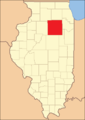 LaSalle County between 1836 and 1837
 -
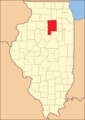
 LaSalle County between 1837 and 1841
 -
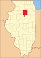
 LaSalle County between 1841 and 1843
 -
 In 1843, the southwest corner was ceded to Marshall County, reducing LaSalle to its present size
![LaSalle County from the time of its creation to 1836, including a large tract of unorganized territory temporarily attached to it.[5]](/File:LaSalle_County_Illinois_1831.png)


Geography
According to the
Adjacent counties
- Lee County – northwest
- DeKalb County – north
- Kendall County – northeast
- Grundy County – east
- Livingston County – southeast
- Woodford County – south
- Marshall County – southwest
- Putnam County – west
- Bureau County – west
LaSalle County, Illinois, is one of the few counties in the United States to border as many as nine counties. Illinois has two such counties, with Pike County being the other.
Many of the residents of LaSalle County live in cities and towns along the Illinois River. It is the main population core, with some exceptions, including Streator to the south of the county. Large cities along the river include Ottawa, LaSalle, Peru, and Marseilles. The regions north and south of the Illinois River are mostly agricultural, including the Fox River portion of the county, and have few large towns.
Climate
| Ottawa, Illinois | ||||||||||||||||||||||||||||||||||||||||||||||||||||||||||||
|---|---|---|---|---|---|---|---|---|---|---|---|---|---|---|---|---|---|---|---|---|---|---|---|---|---|---|---|---|---|---|---|---|---|---|---|---|---|---|---|---|---|---|---|---|---|---|---|---|---|---|---|---|---|---|---|---|---|---|---|---|
| Climate chart (explanation) | ||||||||||||||||||||||||||||||||||||||||||||||||||||||||||||
| ||||||||||||||||||||||||||||||||||||||||||||||||||||||||||||
| ||||||||||||||||||||||||||||||||||||||||||||||||||||||||||||
In recent years, average temperatures in the county seat of Ottawa have ranged from a low of 12 °F (−11 °C) in January to a high of 85 °F (29 °C) in July, although a record low of −25 °F (−32 °C) was recorded in January 1985 and a record high of 112 °F (44 °C) was recorded in July 1936. Average monthly precipitation ranged from 1.32 inches (34 mm) in February to 4.13 inches (105 mm) in June.[15]
Demographics
| Census | Pop. | Note | %± |
|---|---|---|---|
| 1840 | 9,348 | — | |
| 1850 | 17,815 | 90.6% | |
| 1860 | 48,332 | 171.3% | |
| 1870 | 60,792 | 25.8% | |
| 1880 | 70,403 | 15.8% | |
| 1890 | 80,798 | 14.8% | |
| 1900 | 87,776 | 8.6% | |
| 1910 | 90,132 | 2.7% | |
| 1920 | 92,925 | 3.1% | |
| 1930 | 97,695 | 5.1% | |
| 1940 | 97,801 | 0.1% | |
| 1950 | 100,610 | 2.9% | |
| 1960 | 110,800 | 10.1% | |
| 1970 | 111,409 | 0.5% | |
| 1980 | 112,003 | 0.5% | |
| 1990 | 106,913 | −4.5% | |
| 2000 | 111,509 | 4.3% | |
| 2010 | 113,924 | 2.2% | |
| 2020 | 109,658 | −3.7% | |
| 2023 (est.) | 108,309 | [16] | −1.2% |
| U.S. Decennial Census[17] | |||

As of the 2020 United States Census, there were 109,658 people, 45,089 households, and 29,344 families residing in the county.[18] The population density was 95.5 inhabitants per square mile (36.9/km2). There were 49,812 housing units at an average density of 43.4 per square mile (16.8/km2).[14] The racial makeup of the county was 85.6% white, 2.4% black or African American, 0.8% Asian, 0.4% American Indian, 3.6% from other races, and 7.2% from two or more races. Those of Hispanic or Latino origin made up 10.4% of the population.[19] In terms of ancestry, 27.8% were German, 18.0% were Irish, 8.7% were Italian, 8.1% were English, 7.6% were Polish, 4.4% were Norwegian, 3.8% were American, and 3.1% were French.[20]
Of the 45,089 households, 26.1% had children under the age of 18 living with them, 48.6% were married couples living together, 11.7% had a female householder with no husband present, 34.9% were non-families, and 29.5% of all households were made up of individuals. The average household size was 2.34 and the average family size was 2.86. The median age was 42.1 years. For every 100 females there were 101.4 males.[21]
The median income for a household in the county was $60,069 and the median income for a family was $72,583. Males had a median income of $50,214 versus $26,424 for females. The per capita income for the county was $31,020. About 9.7% of families and 13.6% of the population were below the
Education
School districts
Secondary schools
Public
- Earlville High School (CUSD 9), also has district area in DeKalb and Lee counties
- LaSalle-Peru High School, LaSalle
- Leland High School, Leland, also has district area in DeKalb County
- Mendota Township High School, Mendota, also has district area in Bureau and Lee Counties
- Newark Community High School, located within Kendall County, but serves Mission Township
- Ottawa Township High School, Ottawa
- Sandwich Community High School (CUSD 430), located within DeKalb County, but serves Northville Township
- Seneca High School, also has district area in Grundy County
- Serena High School (CUSD 2)
- Somonauk High School, located within DeKalb County, but serves Northville and Adams Townships
- Streator Township High School, Streator
- Woodland High School, Streator
Private
- Marquette Academy, Ottawa
- Ottawa Christian Academy,[23] Ottawa
- St. Bede Academy, Peru
Colleges and universities
- Illinois Valley Community College, Oglesby
Infrastructure
Transportation
Transit
- Carl Sandburg, and Southwest Chief)
- Burlington Trailways
- Mendota station
- List of intercity bus stops in Illinois
Airports
- Earlville Airport, closed in 2010
- Illinois Valley Regional Airport, Peru
Major highways
 Interstate 39
 Interstate 80
- U.S. Highway 6
- U.S. Highway 34
- U.S. Highway 51
- U.S. Highway 52
 Illinois Route 17
 Illinois Route 18
 Illinois Route 23
 Illinois Route 71
 Illinois Route 170
 Illinois Route 178
 Illinois Route 251
 Illinois Route 351
Utilities
- LaSalle County Nuclear Generating Station, Marseilles
Communities
Cities
Villages
- Cedar Point
- Dalzell (part)
- Dana
- Grand Ridge
- Kangley
- Leland
- Leonore
- Lostant
- Millington (part)
- Naplate
- North Utica
- Ransom
- Rutland
- Seneca (part)
- Sheridan
- Somonauk (part)
- Tonica
- Troy Grove
Census-designated places
Other unincorporated communities
- Altmar
- Baker
- Blakes
- Catharine
- Danway
- Dimmick
- Farm Ridge
- Fitchmoor
- Garfield
- Harding
- Hitt
- Jonesville
- Kernan
- Leeds
- Lowell
- Meriden
- Milla
- Mount Palatine (part)
- Northville
- Norway
- Peterstown
- Prairie Center
- Richards
- Science
- Serena
- Stavanger
- Sulphur Springs
- Ticona
- Triumph
- Waltham
- Wedron
- Welland (part)
- Wilsman
Townships
LaSalle County is divided into thirty-seven townships:
- Adams
- Allen
- Brookfield
- Bruce
- Dayton
- Deer Park
- Dimmick
- Eagle
- Earl
- Eden
- Fall River
- Farm Ridge
- Freedom
- Grand Rapids
- Groveland
- Hope
- LaSalle
- Manlius
- Mendota
- Meriden
- Miller
- Mission
- Northville
- Ophir
- Osage
- Ottawa
- Otter Creek
- Peru
- Richland
- Rutland
- Serena
- South Ottawa
- Troy Grove
- Utica
- Vermillion
- Wallace
- Waltham
Ghost towns
Politics
This article needs additional citations for verification. (May 2022) |
| Position | Person | Party |
|---|---|---|
| Auditor | Stephanie Jo Thompson | Republican |
| County Board Chairman | Donald E. Jensen | Republican |
| County Board Majority | 18-11[24] | Republican |
| Circuit Clerk | Greg Vacarro | Republican |
County Clerk
|
Jennifer Ebner | Republican |
| Coroner | Rich Ploch | Democratic |
| Recorder | Karen Friestad Miller | Republican |
| Sheriff | Adam Diss | Republican |
State's Attorney
|
Joe Navarro | Democratic |
| Regional Superintendent | Chris Dvorak | Democratic |
| Treasurer | James L. Spelich | Republican |
LaSalle has generally been a Republican-leaning swing county, more competitive than most in urbanized Northern Illinois.
In its early years, LaSalle County supported the Democratic Party, being southwest of the Free Soil strongholds in the far northeast of the state. Following the formation of the Republican party, LaSalle County voted for that party in every election until 1884, when it supported Democrat Grover Cleveland three consecutive times. Although the county gave a plurality to Woodrow Wilson in 1912 and supported Franklin D. Roosevelt in his first three elections, it otherwise voted Republican until 1960.
A Democratic trend, typical of Yankee Northern Illinois, saw Michael Dukakis carry LaSalle despite failing to win the election in 1988, and no Republican would carry the county again until George W. Bush in 2004.
| Year | Republican | Democratic | Third party | |||
|---|---|---|---|---|---|---|
| No. | % | No. | % | No. | % | |
| 2020 | 30,113 | 56.09% | 22,442 | 41.80% | 1,132 | 2.11% |
| 2016 | 26,689 | 53.65% | 19,543 | 39.29% | 3,511 | 7.06% |
| 2012 | 23,256 | 49.06% | 23,073 | 48.67% | 1,076 | 2.27% |
| 2008 | 21,872 | 43.47% | 27,443 | 54.55% | 995 | 1.98% |
| 2004 | 26,101 | 51.45% | 24,263 | 47.83% | 365 | 0.72% |
| 2000 | 21,276 | 46.25% | 23,355 | 50.76% | 1,376 | 2.99% |
| 1996 | 15,299 | 36.01% | 21,643 | 50.94% | 5,549 | 13.06% |
| 1992 | 16,078 | 32.20% | 23,276 | 46.62% | 10,577 | 21.18% |
| 1988 | 22,166 | 49.64% | 22,271 | 49.88% | 213 | 0.48% |
| 1984 | 27,388 | 56.89% | 20,532 | 42.65% | 219 | 0.45% |
| 1980 | 27,323 | 57.12% | 16,818 | 35.16% | 3,694 | 7.72% |
| 1976 | 25,114 | 51.39% | 23,105 | 47.28% | 646 | 1.32% |
| 1972 | 31,190 | 59.20% | 21,405 | 40.63% | 92 | 0.17% |
| 1968 | 26,054 | 50.48% | 22,940 | 44.45% | 2,616 | 5.07% |
| 1964 | 21,216 | 40.69% | 30,923 | 59.31% | 0 | 0.00% |
| 1960 | 27,552 | 49.98% | 27,532 | 49.94% | 41 | 0.07% |
| 1956 | 33,461 | 64.52% | 18,318 | 35.32% | 83 | 0.16% |
| 1952 | 32,857 | 60.54% | 21,321 | 39.28% | 99 | 0.18% |
| 1948 | 24,453 | 55.02% | 19,666 | 44.25% | 321 | 0.72% |
| 1944 | 28,179 | 54.32% | 21,489 | 41.42% | 2,210 | 4.26% |
| 1940 | 25,296 | 45.66% | 29,704 | 53.62% | 399 | 0.72% |
| 1936 | 22,240 | 43.44% | 26,926 | 52.59% | 2,035 | 3.97% |
| 1932 | 19,179 | 40.30% | 27,500 | 57.79% | 908 | 1.91% |
| 1928 | 24,039 | 53.15% | 20,807 | 46.00% | 382 | 0.84% |
| 1924 | 21,417 | 60.47% | 6,216 | 17.55% | 7,784 | 21.98% |
| 1920 | 23,751 | 73.23% | 6,626 | 20.43% | 2,057 | 6.34% |
| 1916 | 20,662 | 56.62% | 14,625 | 40.08% | 1,203 | 3.30% |
| 1912 | 4,858 | 24.56% | 7,036 | 35.56% | 7,890 | 39.88% |
| 1908 | 11,159 | 55.59% | 7,589 | 37.81% | 1,326 | 6.61% |
| 1904 | 11,967 | 62.67% | 5,628 | 29.47% | 1,500 | 7.86% |
| 1900 | 11,781 | 56.22% | 8,671 | 41.38% | 504 | 2.41% |
| 1896 | 11,548 | 57.60% | 8,108 | 40.44% | 391 | 1.95% |
| 1892 | 7,957 | 44.12% | 9,365 | 51.93% | 711 | 3.94% |
Visitor attractions
- Hegeler Carus Mansion
- Hopalong Cassidy River Trail
- Illini State Park
- Kaskaskia Alliance Trail
- LaSalle Lake State Fish and Wildlife Area
- Middle East Conflicts Wall Memorial
- Mitchell's Grove Nature Preserve
- Ottawa Avenue Cemetery
- Plum Island Eagle Sanctuary
- Washington Park Historic District (Ottawa, Illinois)
- Wild Bill Hickok Memorial
Notable people
- James T. Aubrey (LaSalle) longtime president of CBS Television network
- Bill Brown, (Mendota) former running back for the Minnesota Vikings
- Herbert "Fritz" Crisler, (Earlville, Mendota) head football coach at the University of Michigan (1938–1947), namesake of the school's basketball stadium, and is credited for created the helmet design for the Michigan football team
- Doug Dieken, (rural Streator) former tackle with the Cleveland Browns (1971–1984); color commentary for Browns radio broadcasts
- Walter T. Gunn, Illinois Supreme Court justice, born in LaSalle County
- J. A. Happ, (Peru) pitcher for New York Yankees; pitched for 2008 World Series champion Philadelphia Phillies
- Michael Hermosillo, (Ottawa) outfielder for the Los Angeles Angels and minor league affiliates
- Wild Bill Hickok, (Troy Grove) noted historical Western Figure
- Helen Hokinson, (Mendota) cartoonist for The New Yorker
- Silas Johnson, (Sheridan) credited as the last pitcher to strike out Herman "Babe" Ruth; played for the Cincinnati Reds
- governor of Michigan
- Terrence Malick, (Ottawa) film director, known for Badlands and The Thin Red Line; born in Ottawa
- Bob McGrath, (Ottawa), Sesame Street performer
- Esther Hobart Morris, (Peru) First Female Judge in United States
- Clarence E. Mulford, (Streator) wrote the "Hopalong Cassidy" cowboy novels
- Cleng Peerson, established the community of Norway
- Academy Award
- Maud Powell, (Peru) violinist
- Thomas E. G. Ransom, Civil War general, lived in Peru, namesake of Ransom
- Adam Shabala, (Streator) former outfielder for the San Francisco Giants
- Aaron Shea, (Ottawa) player for the Cleveland Browns
- Clyde Tombaugh, (Streator) astronomer, discovered Pluto
- Martin R. M. Wallace, (Ottawa) Civil War general
- W.H.L. Wallace, (Ottawa) Civil War general
- Walt Willey, (Ottawa) actor, known for All My Children
- Gary K. Wolf, (Earlville) author of Who Censored Roger Rabbit?, adopted into the movie Who Framed Roger Rabbit
- Clay Zavada, (Streator) pitcher for the Arizona Diamondbacks
See also
Notes
- ^ "La Salle County, Illinois – Fact Sheet". American FactFinder. United States Census Bureau. 2000. Archived from the original on June 6, 2011. Retrieved February 26, 2010.
- ^ "LaSalle County". Geographic Names Information System. United States Geological Survey, United States Department of the Interior.
- ^ "Explore Census Data". data.census.gov. Retrieved June 23, 2022.
- ^ "Find a County". National Association of Counties. Archived from the original on May 31, 2011. Retrieved June 7, 2011.
- ^ a b "Origin and Evolution of Illinois Counties" (PDF). Illinois Secretary of State. March 2010. Archived (PDF) from the original on September 30, 2021. Retrieved September 30, 2021.
- ^ Gannett, Henry (1905). The Origin of Certain Place Names in the United States. U.S. Government Printing Office. p. 182.
- ^ a b Catlin, Betty (1971). Reddick's Library (PDF). Illinois Historic Preservation Agency. pp. 3–8. Archived from the original (PDF) on October 23, 2019. Retrieved September 30, 2021.
- ^ (PDF) from the original on October 23, 2019.
- ^ Brown, Janet Rabenstein; Pielemeier, Nancy Rabenstein; Scott, Ann Rabenstein (1995). Ottawa, Illinois in Nineteen Hundred. LaSalle County Genealogy Guild. p. 42.
- ^ National Park Service (October 10, 1972). "Illinois SP Washington Park Historic District". Retrieved December 3, 2019.
- ^ History of La Salle County, Illinois: Together with Sketches of Its Cities, Villages and Towns, Educational, Religious, Civil, Military, and Political History, Portraits of Prominent Persons, and Biographies of Representative Citizens : Also a Condensed History of Illinois, Embodying Accounts of Prehistoric Races, Aborigines, Winnebago and Black Hawk Wars, and a Brief Review of Its Civil and Political History, Volume 1 by Inter-state Publishing Company, 1886
- ^ History of LaSalle County, Illinois, by Elmer Baldwin Rand McNally & Company, 1877
- ^ History of LaSalle County, Illinois, Volume 1 by Michael Cyprian O'Byrne Higginson Book Company, 1924
- ^ a b "Population, Housing Units, Area, and Density: 2010 - County". United States Census Bureau. Archived from the original on February 12, 2020. Retrieved July 12, 2015.
- ^ a b "Monthly Averages for Ottawa, Illinois". The Weather Channel. Archived from the original on September 15, 2010. Retrieved January 27, 2011.
- ^ "Annual Estimates of the Resident Population for Counties: April 1, 2020 to July 1, 2023". United States Census Bureau. Retrieved April 2, 2024.
- ^ "U.S. Decennial Census". Census.gov. Retrieved July 27, 2013.
- ^ "Explore Census Data".
- ^ "Explore Census Data". data.census.gov. Retrieved June 23, 2022.
- ^ "Explore Census Data". data.census.gov. Retrieved June 23, 2022.
- ^ "Explore Census Data". data.census.gov. Retrieved June 23, 2022.
- ^ "DP03 SELECTED ECONOMIC CHARACTERISTICS – 2006-2010 American Community Survey 5-Year Estimates". United States Census Bureau. Archived from the original on February 13, 2020. Retrieved July 12, 2015.
- ^ "About Us". Ottawa Christian Academy. Retrieved September 30, 2021.
- ^ "LaSalle County board". lasallecounty.org. Archived from the original on December 1, 2016.
- ^ Leip, David. "Dave Leip's Atlas of U.S. Presidential Elections". uselectionatlas.org. Archived from the original on March 23, 2018.
References
- Forstall, Richard L. (1996). Population of States and Counties of the United States: 1790 to 1990: From the Twenty-One Decennial Censuses. United States Department of Commerce, Bureau of the Census, Population Division. ISBN 0-934213-48-8.
External links
Places adjacent to LaSalle County, Illinois | ||||||||||||||||
|---|---|---|---|---|---|---|---|---|---|---|---|---|---|---|---|---|
| ||||||||||||||||
 | ||||
Villages | ||||
| Townships |
| |||
| CDPs | ||||
| Other unincorporated communities | ||||
| Ghost towns | ||||
| Footnotes | ‡This populated place also has portions in an adjacent county or counties | |||
| ||||
| Major city |  | |
|---|---|---|
| Cities (over 30,000 in 2010) | ||
| Towns and villages (over 30,000 in 2010) |
| |
| Counties | ||
| Regions |
| |
| Sub-regions | ||
| International | |
|---|---|
| National | |
| Other | |