
Andrews County, Texas
Andrews County | |
|---|---|
UTC−5 (CDT) | |
| Congressional district | 19th |
| Website | www |
Andrews County is a county in the U.S. state of Texas. It is in West Texas and its county seat is Andrews.
As of the
Andrews county was created August 21, 1876, from Tom Green County and organized in 1910.[3] It is named for Richard Andrews, a soldier of the Texas Revolution.
History
Along with the rest of Texas, Andrews County was:
- Part of the Viceroyalty of New Spain from August 18, 1521
- Part of an independent Mexico from September 27, 1821
- Part of the Republic of Texas from March 2, 1836
- Part of a state of the United States of Americafrom December 29, 1845
- Part of the Confederate States of America from March 4, 1861
- Part of a state mandated to rejoin the Union of The United States of America on June 19, 1865, following the surrender of General Robert E. Lee and the Army of Northern Virginia of the Confederate States of America at Appomattox Courthouse, Virginia, that effectively ended the Civil War.
- Part of a state governed by provisional governors during nine years of reconstruction because of the state's insurrection during the Civil War.
- Part of a state whose people were allowed to vote on a new constitution and fully rejoin the Union of the United States of America, with elected representation in the U.S. Congress, by an act of President U.S.Grant, March 30, 1870.
In 1876, the Texas Legislature repealed the constitution of 1869 replacing it with the current constitution and established Andrews County.
Geography
According to the
In the west part of Andrews County on the border with New Mexico (see the state border issue below), a private company,
For years, there has been a simmering dispute over which state these waste sites are lawfully a part of: Texas or New Mexico? The straight north–south border between the two states was originally defined as the 103rd meridian, but the 1859 survey that was supposed to mark that boundary mistakenly set the border between 2.29 and 3.77 miles too far west of that line, making the
Major highways
Adjacent counties
- Gaines County (north)
- Martin County (east)
- Midland County (southeast)
- Ector County (south)
- Winkler County (southwest)
- Lea County, New Mexico (west/Mountain Time Zone)
Demographics
| Census | Pop. | Note | %± |
|---|---|---|---|
| 1890 | 24 | — | |
| 1900 | 87 | 262.5% | |
| 1910 | 975 | 1,020.7% | |
| 1920 | 350 | −64.1% | |
| 1930 | 736 | 110.3% | |
| 1940 | 1,277 | 73.5% | |
| 1950 | 5,002 | 291.7% | |
| 1960 | 13,450 | 168.9% | |
| 1970 | 10,372 | −22.9% | |
| 1980 | 13,323 | 28.5% | |
| 1990 | 14,338 | 7.6% | |
| 2000 | 13,004 | −9.3% | |
| 2010 | 14,786 | 13.7% | |
| 2020 | 18,610 | 25.9% | |
| U.S. Decennial Census[8] 1850–2010[9] 2010[10] 2020[11] | |||
| Race / Ethnicity | Pop 2010[10] | Pop 2020[11] | % 2010 | % 2020 |
|---|---|---|---|---|
White alone (NH)
|
7,083 | 7,405 | 47.90% | 39.79% |
Black or African American alone (NH)
|
199 | 192 | 1.35% | 1.03% |
Alaska Native alone (NH)
|
95 | 96 | 0.64% | 0.52% |
| Asian alone (NH) | 85 | 102 | 0.57% | 0.55% |
| Pacific Islander alone (NH) | 1 | 0 | 0.01% | 0.00% |
| Some Other Race alone (NH) | 17 | 49 | 0.11% | 0.26% |
| Mixed Race/Multi-Racial (NH) | 111 | 366 | 0.75% | 1.97% |
| Hispanic or Latino (any race) | 7,195 | 10,400 | 48.66% | 55.88% |
| Total | 14,786 | 18,610 | 100.00% | 100.00% |
As of the
As of the
There were 4,601 households, out of which 40.70% had children under the age of 18 living with them, 63.70% were married couples living together, 9.50% had a female householder with no husband present, and 23.50% were non-families. 21.80% of all households were made up of individuals, and 10.00% had someone living alone who was 65 years of age or older. The average household size was 2.81 and the average family size was 3.29.
In the county, the population was spread out, with 31.50% under the age of 18, 8.10% from 18 to 24, 27.30% from 25 to 44, 20.50% from 45 to 64, and 12.50% who were 65 years of age or older. The median age was 34 years. For every 100 females there were 96.30 males. For every 100 females age 18 and over, there were 91.20 males.
The median income for a household in the county was $34,036, and the median income for a family was $37,017. Males had a median income of $33,223 versus $21,846 for females. The
Politics
| Year | Republican | Democratic | Third party | |||
|---|---|---|---|---|---|---|
| No. | % | No. | % | No. | % | |
| 2020 | 4,943 | 84.31% | 850 | 14.50% | 70 | 1.19% |
| 2016 | 3,927 | 79.45% | 836 | 16.91% | 180 | 3.64% |
| 2012 | 3,639 | 81.19% | 795 | 17.74% | 48 | 1.07% |
| 2008 | 3,816 | 82.44% | 790 | 17.07% | 23 | 0.50% |
| 2004 | 3,837 | 84.59% | 677 | 14.93% | 22 | 0.49% |
| 2000 | 3,091 | 76.81% | 876 | 21.77% | 57 | 1.42% |
| 1996 | 2,360 | 58.99% | 1,181 | 29.52% | 460 | 11.50% |
| 1992 | 2,266 | 53.60% | 1,081 | 25.57% | 881 | 20.84% |
| 1988 | 3,052 | 72.82% | 1,122 | 26.77% | 17 | 0.41% |
| 1984 | 3,918 | 82.48% | 820 | 17.26% | 12 | 0.25% |
| 1980 | 2,800 | 69.77% | 1,155 | 28.78% | 58 | 1.45% |
| 1976 | 2,127 | 54.03% | 1,777 | 45.14% | 33 | 0.84% |
| 1972 | 2,615 | 79.00% | 677 | 20.45% | 18 | 0.54% |
| 1968 | 1,400 | 38.53% | 922 | 25.37% | 1,312 | 36.10% |
| 1964 | 1,442 | 40.22% | 2,133 | 59.50% | 10 | 0.28% |
| 1960 | 1,550 | 45.47% | 1,821 | 53.42% | 38 | 1.11% |
| 1956 | 1,131 | 53.53% | 968 | 45.81% | 14 | 0.66% |
| 1952 | 805 | 46.56% | 920 | 53.21% | 4 | 0.23% |
| 1948 | 101 | 10.55% | 816 | 85.27% | 40 | 4.18% |
| 1944 | 48 | 11.88% | 329 | 81.44% | 27 | 6.68% |
| 1940 | 26 | 5.58% | 440 | 94.42% | 0 | 0.00% |
| 1936 | 18 | 5.88% | 287 | 93.79% | 1 | 0.33% |
| 1932 | 6 | 3.11% | 186 | 96.37% | 1 | 0.52% |
| 1928 | 66 | 72.53% | 25 | 27.47% | 0 | 0.00% |
| 1924 | 7 | 9.86% | 60 | 84.51% | 4 | 5.63% |
| 1920 | 9 | 10.84% | 74 | 89.16% | 0 | 0.00% |
| 1916 | 0 | 0.00% | 71 | 95.95% | 3 | 4.05% |
| 1912 | 1 | 1.22% | 77 | 93.90% | 4 | 4.88% |
Education
The Andrews Independent School District serves all of Andrews County.[14]
The whole county is in the service area of Odessa College.[15]
Media
The county is served by a weekly newspaper, local stations KACT AM and KACT-FM, nearby stations KBXJ (FM) and KPET (AM), and the various Midland and Odessa radio and TV stations.
Communities
City
- Andrews (county seat)
Census-designated place
Unincorporated communities
Ghost towns
See also
- Andrews County Veterans Memorial
- National Register of Historic Places listings in Andrews County, Texas
- Recorded Texas Historic Landmarks in Andrews County
References
- ^ "U.S. Census Bureau QuickFacts: Andrews County, Texas". United States Census Bureau. Retrieved January 31, 2022.
- ^ "Andrews County, Texas". United States Census Bureau. Retrieved February 23, 2021.
- ^ "Texas: Individual County Chronologies". Texas Atlas of Historical County Boundaries. The Newberry Library. 2008. Archived from the original on May 13, 2015. Retrieved May 20, 2015.
- ^ "2010 Census Gazetteer Files". United States Census Bureau. August 22, 2012. Retrieved April 18, 2015.
- ^ a b "Reference at abcnews.go.com". ABC News.
- ^ "Archived copy" (PDF). Archived from the original (PDF) on August 10, 2013. Retrieved June 13, 2013.
{{cite web}}: CS1 maint: archived copy as title (link) - ^ Daniel Gertson. "Border War Brewing?". Archived from the original on April 18, 2018. Retrieved September 24, 2016.
- US Census Bureau.
- ^ "Texas Almanac: Population History of Counties from 1850–2010" (PDF). Texas Almanac. Archived (PDF) from the original on October 9, 2022. Retrieved April 18, 2015.
- ^ a b "P2 HISPANIC OR LATINO, AND NOT HISPANIC OR LATINO BY RACE - 2010: DEC Redistricting Data (PL 94-171) - Andrews County, Texas". United States Census Bureau.
- ^ a b "P2 HISPANIC OR LATINO, AND NOT HISPANIC OR LATINO BY RACE - 2020: DEC Redistricting Data (PL 94-171) - Andrews County, Texas". United States Census Bureau.
- ^ "U.S. Census website". United States Census Bureau. Retrieved May 14, 2011.
- ^ Leip, David. "Dave Leip's Atlas of U.S. Presidential Elections". uselectionatlas.org. Retrieved July 19, 2018.
- ^ Texas Education Code, Section 130.193, "Odessa College District Service Area".
External links
- Andrews County government website
- Andrews County from the Handbook of Texas Online
- Andrews County from the Texas Almanac
- Andrews County from the TXGenWeb Project
- Andrews County Profile from the Texas Association of Counties
Places adjacent to Andrews County, Texas | ||||||||||||||||
|---|---|---|---|---|---|---|---|---|---|---|---|---|---|---|---|---|
| ||||||||||||||||
Municipalities and communities of Andrews County, Texas, United States | ||
|---|---|---|
| City | 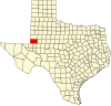 | |
| CDP | ||
| Other communities | ||
| Ghost towns | ||
| ||
| International | |
|---|---|
| National | |
| Other | |