
El Paso–Juárez
El Paso–Juárez | |
|---|---|
Mountain Time Zone ) |

El Paso–Juárez, also known as Juárez–El Paso, the Borderplex or Paso del Norte, is a transborder agglomeration, on the border between Mexico and the United States.[4] The region is centered on two large cities: Ciudad Juárez, Chihuahua, Mexico, and El Paso, Texas, U.S. Additionally, nearby Las Cruces, New Mexico, U.S., is sometimes included as part of the region, referred to as El Paso–Juárez–Las Cruces or El Paso–Juárez–Southern New Mexico.[5] With over 2.7 million people,[6][7] this binational region is the 2nd largest conurbation (San Diego–Tijuana being the largest) on the United States–Mexico border.[8] The El Paso–Juárez region is the largest bilingual, binational work force in the Western Hemisphere.[9]
This region is commonly subdivided into the
Demographics
Ciudad Juárez is the largest city in the region (population 1,321,004 as of 2010). El Paso is the next largest (682,669 as of 2018), and Las Cruces is the third largest (102,296 as of 2018).[10][11]
Major American suburbs are Fabens, Texas; San Elizario, Texas; Socorro, Texas; and Sunland Park, New Mexico.[12] Smaller communities include Anthony, New Mexico; Anthony, Texas; Canutillo, Texas; Chaparral, New Mexico; Horizon City, Texas; Mesilla, New Mexico; Santa Teresa, New Mexico; University Park, New Mexico; Vado, New Mexico; and Westway, Texas.[13]
The population of El Paso has historically been dominated by both Mexican Americans and non-Hispanic white Americans; in recent decades the former group has come to dominate the population. In 1970 El Paso was 57.3% Hispanic and 40.4% non-Hispanic white; in 2010 it was 80.7% Hispanic and 14.2% non-Hispanic white. In the same year El Paso County was 82.2% Hispanic.
History
The Franklin Mountains region has had human settlement for thousands of years, as evidenced by
Spanish explorer

El Paso became the southernmost locality of the Provincia de Nuevo Mexico (modern New Mexico). It remained largest city in New Mexico until its north side was ceded to the US in 1850. It communicated with Santa Fe and Mexico City by the Royal Road. American spies, traders and fur trappers visited the area since 1804 and some intermarried with the area's Hispanic elite.[16] Although there was no combat in the region during the Mexican War of Independence, El Paso del Norte experienced the negative effects it had on its wine trade.
The Texas Revolution (1836) was not felt in the region as the area was never considered part of Texas until 1848. Given the blurry reclamations of the Texas Republic that wanted a chunk of the Santa Fe trade, the Treaty of Guadalupe Hidalgo effectively made the settlements on the north bank of the river a formal American settlement, separate from Old El Paso del Norte on the Mexican side.[16] The present Texas-New Mexico boundary placing El Paso on the Texas side was drawn in the Compromise of 1850.[17]
The communities on both sides of the border continued to function, in large part, as a single community. The United States Senate fixed a boundary between Texas and New Mexico at the thirty-second parallel, thus largely ignoring history and topography. A military post called "The Post opposite El Paso" (meaning opposite El Paso del Norte, across the Rio Grande) was established in 1854. Further west, a settlement on Coons' Rancho called Franklin became the nucleus of the future El Paso, Texas. A year later pioneer

In the later 19th century the population in the region began to grow rapidly. With the arrival of the
Mining and other industries gradually developed in the area. The 1920s and 1930s saw the emergence of major business development in the city partially enabled by
Geography
Typical elevation in the El Paso–Juárez region is approximately 4,000 feet (1,200 m), though the Franklin Mountains, which run through the region, have peaks rising much higher. North Franklin Peak, for example, rises to 7,192 feet (2,192 m).[19]
The most well-known feature of the area is the
Mt. Cristo Rey, a volcanic peak (an example of a
The area lies in the

Climate
| Ciudad Juárez | ||||||||||||||||||||||||||||||||||||||||||||||||||||||||||||
|---|---|---|---|---|---|---|---|---|---|---|---|---|---|---|---|---|---|---|---|---|---|---|---|---|---|---|---|---|---|---|---|---|---|---|---|---|---|---|---|---|---|---|---|---|---|---|---|---|---|---|---|---|---|---|---|---|---|---|---|---|
| Climate chart (explanation) | ||||||||||||||||||||||||||||||||||||||||||||||||||||||||||||
| ||||||||||||||||||||||||||||||||||||||||||||||||||||||||||||
| ||||||||||||||||||||||||||||||||||||||||||||||||||||||||||||
The area has an
Economy
El Paso–Juárez is a major center for manufacturing and international trade. It is one of the largest ports of entry on the U.S.–Mexico border.[22] The region is also the second most important trade point on the border and the 14th largest trading center in the U.S.[23] In 2018, US$81.88 billion in trade took place in the region.[23]
As of 2010[update] the region holds offices for more than 70 Fortune 500 companies.[24] It is also home to more than 320 manufacturing plants (those in Ciudad Juárez are commonly referred to as maquiladoras) and more than 1,100 manufacturing operations total.[25][26] The largest sectors of manufacturing are automobiles and automobile components, and consumer electronic components.[25] Apparel and textile manufacturing, though, are important sectors as well, particularly north of the border.[24] The area employs approximately 262,000 people in manufacturing with 85% of those in Juárez.[26] Many of the workers in Juárez, however, live in the United States.[24]
An important pillar of the economy of El Paso has been Fort Bliss and Biggs Army Airfield. Since frontier days military spending, directly and indirectly, has provided a significant source of money to El Paso and to the region as a whole. As of 2018[update] the economic impact of Fort Bliss is estimated at more than US$23.13 billion.[27]
Call centers are additionally major employers in El Paso and neighboring communities in the U.S.[24]
With the opening of Texas Tech University Health Sciences Center El Paso in 2009, the school became the first medical school to open in 30 years. The university in 2013 became the fourth freestanding institution of the TTU System, and since its opening, the university has expanded to include the Paul L. Foster School of Medicine, the Gayle Greve Hunt School of Nursing, and the Graduate School of Biomedical Sciences. A fourth school, the Woody L. Hunt School of Dental Medicine is expected to open in 2021.[28] The new medical school has become a great contributor to the region's economy, in 2015 the school contributed US$227 million to the local economy.[29]
Regional cooperation
Though the national boundaries are an important point of separation, efforts at regional planning and economic integration exist in the local governments and the business communities. Regional business advocacy groups such as El Paso Regional Economic Development Corporation and World Trade Center El Paso/Juárez serve to attract businesses to the area and market its benefits.[30] Efforts at community and environmental cooperation including the Paso del Norte Clean Cities Coalition exist as well.[31]
Education
The largest universities in the region are the
Other area colleges include Universidad Tecnológica de Ciudad Juárez (Technological University of Ciudad Juárez), Howard Payne University-El Paso, Park University, Southwest University at El Paso, Strayer University, Webster University, and Western Technical College-El Paso. El Paso Community College and Doña Ana Community College provide supplemental higher-education opportunities for students in the region.
Culture
Community contact
Until the 1920s and 1930s the communities of Ciudad Juárez and El Paso enjoyed largely unfettered access to one another, maintaining a sense of unity. Prohibition and World War II brought about more strict enforcement of the border in this region, making access between the communities more difficult. Nevertheless, the communities have continued to share ethnic and cultural bonds particularly as economic integration in the later 20th century has re-opened much of the access between the communities. Even today the cities still see themselves as a single, closely tied community.[33]
The violence in Ciudad Juárez that erupted in 2008–2009 has forced the U.S. to tighten its policies regarding allowing Juárez residents access to El Paso. Tourists, workers, and students who were once allowed regular access across the border have been restricted to much tighter schedules for travel.[34]
Parks and recreation
The area is home to numerous parks and venues for outdoor recreation. The 24,000-acre (9,700 ha) Franklin Mountains State Park in El Paso is the largest urban park in the United States.[35] Other urban parks in the area include Ascarate Park (El Paso), Parque Central (Juárez), Parque Chamizal (Juárez), Preciado Park (Las Cruces), and Rio Bosque Park (Socorro, Texas).
Outside the metropolitan area there are major state and national parks in the vicinity. The most well-known of these is Big Bend National Park, which is adjacent to Big Bend Ranch State Park. Closer to the cities are Guadalupe Mountains National Park, Lincoln National Forest, and Gila National Forest.
Crime and safety

While violent crime has been an increasingly serious issue in Cd. Juárez since the 1990s, El Paso has remained one of the safest large cities in the United States. In January 2014, El Paso was ranked as the safest large city in the United States for the fourth straight year according to the annual City Crime Rankings by CQ Press.[36] El Paso has been in the study's top three large cities with the lowest crime rates since 1997.[37] Though violent crime on the U.S. side of the border has remained very low, murders in Juárez related to the drug cartels began to grow rapidly after 2007. In 2008, officials reported more than 5,400 drug-related murders in Mexico, many in and near Juárez.[38][39] On 20 February 2009, the U.S. State Department announced in an updated travel alert that "Mexican authorities report that more than 1,800 people have been killed in the city since January 2008."[40] CNN listed the city among the ten most dangerous in the world in 2010.[41] The deteriorating situation caused drastic changes in daily life for citizens in Juárez after 2008.
After the homicide rates escalated to the point of making Cd. Juárez the most violent city in the world, the city has seen a significant and steady decline in violent crime since then.[42] In 2012, homicides were at their lowest rate since 2007 when drug violence flared between the
Infrastructure
Healthcare

El Paso is the medical hub of
El Paso is also home to the Medical Center of the Americas, an integrated complex of medical facilities anchored by
Transportation

El Paso is served by
BRT system
The ViveBus BRT system opened to the public in November 2013 with the first route of 5 planned. The project was made a reality with the collaboration of the local municipal government, the private enterprise of Integradora de Transporte de Juarez (INTRA) as well as other city government agencies. Studies have shown that the current bus system averages 8 mph while the new system is projected to average 16 mph. The BRT system studies conducted by the Instituto Municipal de Investigación y Planeación project a daily ridership of 40,000.
The first of the five routes opened to users in late 2013 and is officially named Presidencia-Tierra Nueva and has 34 stations distributed along the north to south corridor. The route starts at Avenida Francisco Villa, follows north to Eje Vial Norte-Sur then veers left at Zaragoza Blvd. and ends at Avenida Independencia and the elevated Carretera Federal 2.
El Paso Streetcar
The El Paso Streetcar is a
Airports

El Paso International Airport, a public airport four miles northeast of
- Abraham González International Airport
Abraham Gonzalez International Airport is located at the southern end of Cd. Juárez. It accommodates the national and international
- Biggs Army Airfield
- Horizon Airport
- Dona Ana International Jetport

International border crossings
The first bridge to cross the Rio Grande at El Paso del Norte was built in the time of
Several bridges serve the El Paso–Ciudad Juárez area in addition to the Paso Del Norte Bridge also known as the Santa Fe Street Bridge, including the
There is also a land crossing at nearby
Gallery
Pictures of El Paso, Texas
-
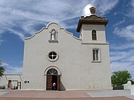 Ysleta Mission constructed in 1680 by the Spanish
 -
 TheCathedral of Saint Patrickbuilt in 1916
 -
 Rio Grande in El Paso's upper valley
 -

-

-
 Asia exhibit entrance at the El Paso Zoo


Pictures of Cd. Juárez, Chihuahua
-
 Juárez mission and cathedral at night, constructed by the Spanish in 1659
 -
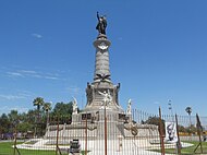 Benito Juárez monument located in central Juárez
 -
 View of the Plaza De La Mexicanidad in north central Juárez
 -
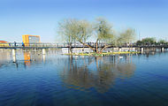 Lake view from Parque Central
 -
 Sand dunes of Samalayuca


See also
- Metropolitan areas of Mexico § Transnational conurbations
- Transborder agglomeration
- San Diego–Tijuana
- Laredo-Nuevo Laredo
- Reynosa–McAllen Metropolitan Area
- Matamoros–Brownsville Metropolitan Area
References
- ^ "The Borderplex Alliance –". El Paso Regional Economic Development Corporation. 2013. Archived from the original on 2013-09-18. Retrieved 2013-09-22.
- ^ "Total Gross Domestic Product for El Paso, TX (MSA)". Federal Reserve Economic Data. Federal Reserve Bank of St. Louis.
- ^ "TelluBase—Mexico Fact Sheet (Tellusant Public Service Series)" (PDF). Tellusant. Retrieved 2024-01-11.
- Texas Alcalde. 87 (5). The University of Texas: 24. May 1999.
Let's Go (2003), p. 447. - ^ "El Paso-Juarez-Las Cruces Binational Health Council (BHC)". Texas Department of State Health Services. Retrieved 24 Feb 2010.
"About The Region". El Paso Regional Economic Development Corporation. Retrieved 24 Feb 2010.
"El Paso–Cd. Juárez–Las Cruces". Pan-American Health Organization. Archived from the original on 2010-03-16. Retrieved 24 Feb 2010.
Michie (1992) - ^ "El Paso–Juárez–Las Cruces" (PDF). elpasotexas.gov. 2013. Archived from the original (PDF) on March 4, 2014. Retrieved March 3, 2014.
- ^ "2 Cities and 4 Bridges Where Commerce Flows". The New York Times. March 28, 2007. Retrieved July 27, 2013.
- ^ "The 411 – Fascinating Facts". Guest Life: El Paso/Juarez and Southern New Mexico. Archived from the original on 28 September 2007. Retrieved 17 February 2010.
- ^ "2 Cities and 4 Bridges Where Commerce Flows –". The New York Times. March 28, 2007. Retrieved 2013-07-27.
- ^ "Annual Estimates of the Resident Population for Incorporated Places Over 100,000, Ranked by July 1, 2008 Population: April 1, 2000 to July 1, 2008". U.S. Census Bureau. Archived from the original on 2010-02-09. Retrieved 18 Feb 2010.
- ^ "Table 4: Annual Estimates of the Resident Population for Incorporated Places in New Mexico, Listed Alphabetically: April 1, 2000 to July 1, 2008 (SUB-EST2008-04-35)". US Census Bureau, Population Division. 2009-07-01. Archived from the original on 2009-07-07. Retrieved 2009-07-11.
- ^ Sandau-Beckler, Pat (2003). "El Paso County Familias Primero: Family Group Conferencing 2003 Project Evaluation" (PDF). American Humane Association. p. 2.[permanent dead link]
- ^ "Press Releases: January 2009 – Posts". El Paso County, Texas. January 2009.
"Dona Ana County". Archived from the original on 2009-02-01. - ^ "Hueco Tanks". Texas Parks and Wildlife Department. Archived from the original on 2007-11-22.
- ISBN 0-930208-32-3.
- ^ a b El Paso, A Borderlands History, by W.H. Timmons, pp. 74, 75
- ^ Griffin, Roger A.: Compromise of 1850 from the Handbook of Texas Online. Retrieved 18 Feb 2010. Texas State Historical Association.
- ^ a b c El Paso, Texas from the Handbook of Texas Online
- ISBN 9780470082980.
- ^ "MSN Weather UK | Today's UK weather forecast and world weather". Weather.uk.msn.com. 2017-02-01. Archived from the original on 2011-09-30. Retrieved 2018-07-25.
- ^ "Weather Averages: Ciudad Juárez, Mex". MSN. Archived from the original on 14 July 2011. Retrieved 18 Feb 2010.
- ISBN 0-275-93591-4.
- ^ a b "USTradeNumbers El Paso". www.ustradenumbers.com. Retrieved 8 Oct 2019.
- ^ a b c d "El Paso: Economy". Advameg, Inc. Retrieved 24 Feb 2010.
- ^ a b "Maquiladora Industry". El Paso Regional Economic Development Corporation. Archived from the original on 20 July 2010. Retrieved 18 Feb 2010.
- ^ a b Cook, Bob (7 Oct 2009). "Manufacturing in the El Paso/Juarez Region: The electronics and medical device sectors are growing quickly in this region despite safety concerns". Industry Week. Archived from the original on 12 October 2009. Retrieved 24 February 2010.
- ^ "Fort Bliss is contributing billions to Texas". KTSM. 29 August 2018. Retrieved 8 Oct 2019.
- ^ "How Is That Dental School Coming Along". eptechview. Retrieved 16 July 2018.
- ^ "TTUHSC El Paso Contributed $227 Million to the El Paso Economy in 2015". eptechview. Retrieved 12 Sep 2016.
- ^ "El Paso Regional economic Development Corporation". El Paso Regional Economic Development Corporation. Archived from the original on 10 June 2010. Retrieved 25 Feb 2010.
"World Trade Center El Paso/Juárez". World Trade Center El Paso/Juárez. Retrieved 25 Feb 2010.[permanent dead link] - ^ "Paso del Norte Clean Cities Coalition" (PDF). Paso del Norte Clean Cities Coalition. Retrieved 25 Feb 2010.
- ^ Randall (1995), p. 162.
- ^ Hidalgo (1984), p. 3.
- ^ Grinberg, Emanuella (20 May 2009). "El Paso school a haven along violent border". CNN.
- ^ "Franklin Mountains State Park" (PDF). Texas Parks and Wildlife Department. Retrieved 18 Feb 2010.
- ^ "City Crime Rankings 2014 –". CQ Press. 2014. Archived from the original on 2014-01-08. Retrieved 2014-01-07.
- ^ "El Paso ranked safest large city in U.S. For 3rd straight year - el Paso Times". Archived from the original on 2013-07-10. Retrieved 2013-07-23.
- ^ "Body count starts anew in Mexico after record 2008 toll". CNN. January 6, 2009.
- ^ "Latin American Herald Tribune - November Was Mexico's Bloodiest Month of Calderon Presidency". www.laht.com. Archived from the original on 2011-09-21. Retrieved 2010-04-05.
- ^ "Travel Alert". U.S. Department of State. 2009-02-20. Archived from the original on February 20, 2009. Retrieved 2009-02-23.
- ^ Kermeliotis, Teo (10 April 2010). "The world's most dangerous cities?". CNN.
- ^ "Juarez shedding violent image, statistics show". CNN. 2014. Retrieved 2014-01-09.
- ^ Booth, William (August 20, 2012). "In Mexico's Murder City the war appears over". The Washington Post. Retrieved 23 August 2012.
- ^ "Homicide rates in Juarez dropping but do residents feel safer?". KVIA. 2014. Archived from the original on 2014-01-09. Retrieved 2014-01-09.
- ^ "Juarez falls to No.37 on world's most violent cities list". El Paso Times. 2014. Archived from the original on 2014-01-17. Retrieved 2014-01-16.
- ^ "William Beaumont Army Medical Center construction nears completion". October 8, 2019. Retrieved October 9, 2019.
- ^ "Texas' Most Congested Roads". www.texastribune.org. Retrieved 2010-10-04.
- ^ "El Paso streetcars make their return after 45-year absence". El Paso Times. November 9, 2018. Retrieved 2018-11-10.
- ^ a b Perez, Elida S. (March 11, 2018). "Downtown El Paso streetcars roll closer to completion; Sun Metro prepares to take over". El Paso Times. Retrieved 2018-11-10.
- ^ a b Ramirez, Cindy (September 23, 2016). "Streetcar work remains on time, budget". El Paso Times. Retrieved 2016-12-14.
- ^ "El Paso streetcar project on schedule, on budget". KTSM-TV. October 6, 2016. Retrieved December 14, 2016.
- ^ "10 Year Passenger Statistics Report". El Paso International Airport Website. Archived from the original on April 22, 2019. Retrieved Oct 8, 2019.
- ^ "CY 2018 All-Cargo Airports by Landed Weight". FAA.gov. Retrieved Oct 8, 2019.
- ^ "OMA's Monthly Traffic Report" (Web). Grupo Aeroportuario del Centro Norte. Retrieved February 28, 2019.
- ISBN 0-8195-6251-3
Sources
- Grassley, Charles E., ed. (1996). Threat To U.s. Trade And Finance From Drug Trafficking And International Organized Crime: Hearing Before The Committee On Finance, U.s. Senate. Diane Publishing. ISBN 978-0-7881-8145-0.
- Hidalgo, Margarita Guadalupe Hidalgo (1984). Language attitudes and language use in Cd. Juarez, Mexico. Center for Inter-American and Border Studies at the University of Texas at El Paso.
- Let's Go Inc. (2003). Let's Go Southwest USA Adventure (3rd ed.). MacMillan. ISBN 978-0-312-31998-4.
- Michie, Donald A. (1992). El Paso, Juarez and Las Cruces Fact Book. El Paso, TX: The University of Texas at El Paso.
{{cite book}}: Unknown parameter|agency=ignored (help) - Randall, Stephen J.; Konrad, Herman W. (1995). NAFTA in transition. Calgary, AB: University of Calgary Press. ISBN 978-1-895176-63-6.
External links
- . Encyclopædia Britannica. Vol. VIII (9th ed.). 1878. p. 153.
- El Paso Regional Economic Development Corporation
Chihuahua (capital) | ||
| Cities |  | |
| Municipalities | ||
| Metropolitan areas | ||
| History | ||
| Sights | ||
| Other topics | ||
| |||||||||||||||||||||||||||||||||||||||||||||||||||||||||||||||||||||||||||||||||||||||||||||
