
Silesia
Silesia
Śląsk ( | |
|---|---|
|
Prussian Silesia, 1871 Oder River Base map shows modern national borders. | |
 Silesia on a map of Poland | |
| Coordinates: 51°36′N 17°12′E / 51.6°N 17.2°E | |
| Country | |
| Largest city | UTC+2 (CEST ) |

.png)
Silesia[a] (see names below) is a historical region of Central Europe that lies mostly within Poland, with small parts in the Czech Republic and Germany. Its area is approximately 40,000 km2 (15,400 sq mi), and the population is estimated at 8,000,000. Silesia is split into two main subregions, Lower Silesia in the west and Upper Silesia in the east. Silesia has a diverse culture, including architecture, costumes, cuisine, traditions, and the Silesian language (minority in Upper Silesia). The largest city of the region is Wrocław.
Silesia is along the
Silesia's borders and national affiliation have changed over time, both when it was a hereditary possession of
After
As the result of the
Etymology
The names of Silesia in different languages most likely share their etymology—
Ślęża is listed as one of the numerous Pre-Indo-European topographic names in the region (see old European hydronymy).[6] According to some Polonists, the name Ślęża [ˈɕlɛ̃ʐa] or Ślęż [ɕlɛ̃ʂ] is directly related to the Old Polish words ślęg [ɕlɛŋk] or śląg [ɕlɔŋk], which means dampness, moisture, or humidity.[7] They disagree with the hypothesis of an origin for the name Śląsk from the name of the Silings tribe, an etymology preferred by some German authors.[8]
In Polish common usage, "Śląsk" refers to traditionally Polish Upper Silesia and today's Silesian Voivodeship, but less to Lower Silesia, which is different from Upper Silesia in many respects as its population was predominantly German-speaking until 1945–48.[9]
History

In the fourth century BC from the south, through the
The first known states in Silesia were
In 1241, the Mongols conducted their first invasion of Poland, causing widespread panic and mass flight. They looted much of the region and defeated the combined Polish, Moravian and German forces led by Duke Henry II the Pious at the Battle of Legnica, which took place at Legnickie Pole near the Silesian city of Legnica. Upon the death of Orda Khan, the Mongols chose not to press forward further into Europe, but returned east to participate in the election of a new Grand Khan (leader).
Between 1289 and 1292, Bohemian king
In the 15th century, several changes were made to Silesia's borders. Parts of the territories that had been transferred to the Silesian Piasts in 1178 were bought by the

In 1742, most of Silesia was seized by King
After World War I, a part of Silesia,

Polish Silesia was among the first regions invaded during Germany's 1939
The
The administrative division of Silesia within Poland has changed several times since 1945. Since 1999, it has been divided between Lubusz Voivodeship, Lower Silesian Voivodeship, Opole Voivodeship, and Silesian Voivodeship. Czech Silesia is now part of the Czech Republic, forming part of the Moravian-Silesian Region and the northern part of the Olomouc Region. Germany retains the Silesia-Lusatia region (Niederschlesien-Oberlausitz or Schlesische Oberlausitz) west of the Neisse, which is part of the federal state of Saxony.
The region was affected by the 1997 Central European flood.
Geography

Most of Silesia is relatively flat, although its southern border is generally mountainous. It is primarily located in a swath running along both banks of the upper and middle
Historically, Silesia was bounded to the west by the Kwisa and Bóbr Rivers, while the territory west of the Kwisa was in Upper Lusatia (earlier Milsko). However, because part of Upper Lusatia was included in the Province of Silesia in 1815, in Germany Görlitz, Niederschlesischer Oberlausitzkreis and neighbouring areas are considered parts of historical Silesia. Those districts, along with Poland's Lower Silesian Voivodeship and parts of Lubusz Voivodeship, make up the geographic region of Lower Silesia.
Silesia has undergone a similar notional extension at its eastern extreme. Historically, it extended only as far as the
As well as the Katowice area, historical Upper Silesia also includes the Opole region (Poland's Opole Voivodeship) and Czech Silesia. Czech Silesia consists of a part of the Moravian-Silesian Region and the Jeseník District in the Olomouc Region.
Natural resources
Silesia is a resource-rich and populous region. Since the middle of the 18th century, coal has been mined. The industry had grown while Silesia was part of Germany, and peaked in the 1970s under the People's Republic of Poland. During this period, Silesia became one of the world's largest producers of coal, with a record tonnage in 1979.[20] Coal mining declined during the next two decades, but has increased again following the end of Communist rule.

The 41 coal mines in Silesia are mostly part of the Upper Silesian Coal Basin, which lies in the Silesian Upland. The coalfield has an area of about 4,500 km2 (1,700 sq mi).[20] Deposits in Lower Silesia have proven to be difficult to exploit and the area's unprofitable mines were closed in 2000.[20] In 2008, an estimated 35 billion tonnes of lignite reserves were found near Legnica, making them some of the largest in the world.[21]
From the fourth century BC, iron ore has been mined in the upland areas of Silesia.[20] The same period had lead, copper, silver, and gold mining. Zinc, cadmium, arsenic,[22] and uranium[23] have also been mined in the region. Lower Silesia features large copper mining and processing between the cities of Legnica, Głogów, Lubin, and Polkowice.
The region is known for stone quarrying to produce limestone, marl, marble, and basalt.[20]
| Mineral Name | Production (tonnes) | Reference |
|---|---|---|
| Bituminous coal | 95,000,000 | |
| Copper | 571,000 | [24] |
| Zinc | 160,000 | [25] |
| Silver | 1,200 | [26] |
| Cadmium | 500 | [27] |
| Lead | 70,000 | [28] |
The region also has a thriving agricultural sector, which produces cereals (wheat, rye, barley, oats, corn), potatoes, rapeseed, sugar beets and others. Milk production is well developed. The Opole Silesia has for decades occupied the top spot in Poland for their indices of effectiveness of agricultural land use.[29]
Mountainous parts of southern Silesia feature many significant and attractive tourism destinations (e.g., Karpacz, Szczyrk, Wisła). Silesia is generally well forested. This is because greenness is generally highly desirable by the local population, particularly in the highly industrialized parts of Silesia.
Demographics
Silesia has been historically diverse in every aspect. Nowadays, the largest part of Silesia is located in Poland; it is often cited as one of the most diverse regions in that country.
The United States Immigration Commission, in its Dictionary of Races or Peoples (published in 1911, during a period of intense immigration from Silesia to the United States), considered Silesian as a geographical (not ethnic) term, denoting the inhabitants of Silesia. It is also mentioned the existence of both Polish Silesian and German Silesian dialects in that region.[30][31]

Ethnicity
Modern Silesia is inhabited by
In the early 19th century the population of the Prussian part of Silesia was between 2/3 and 3/4 German-speaking, between 1/5 and 1/3 Polish-speaking, with Sorbs, Czechs, Moravians and Jews forming other smaller minorities (see Table 1. below).
Before the Second World War, Silesia was inhabited mostly by Germans, with Poles a large minority, forming a majority in Upper Silesia.[34] Silesia was also the home of Czech and Jewish minorities. The German population tended to be based in the urban centres and in the rural areas to the north and west, whilst the Polish population was mostly rural and could be found in the east and in the south.[35]
| Ethnic group | acc. G. Hassel in 1819[36] | % | acc. S. Plater in 1823[37] | % | acc. T. Ładogórski in 1787[38] | % |
|---|---|---|---|---|---|---|
| Germans | 1,561,570 | 75.6 | 1,550,000 | 70.5 | 1,303,300 | 74.6 |
| Poles | 444,000 | 21.5 | 600,000 | 27.3 | 401,900 | 23.0 |
| Sorbs | 24,500 | 1.2 | 30,000 | 1.4 | 900 | 0.1 |
| Czechs | 5,500 | 0.3 | 32,600 | 1.9 | ||
| Moravians | 12,000 | 0.6 | ||||
| Jews | 16,916 | 0.8 | 20,000 | 0.9 | 8,900 | 0.5 |
| Population | c. 2.1 million | 100 | c. 2.2 million | 100 | c. 1.8 million | 100 |
Ethnic structure of Prussian Upper Silesia (Opole regency) during the 19th century and the early 20th century can be found in Table 2.:
| Table 2. Numbers of Polish, German and other inhabitants (Regierungsbezirk Oppeln)[36][39][40] | |||||||||||||||||
|---|---|---|---|---|---|---|---|---|---|---|---|---|---|---|---|---|---|
| Year | 1819 | 1831 | 1834 | 1837 | 1840 | 1843 | 1846 | 1852 | 1855 | 1858 | 1861 | 1867 | 1890 | 1900 | 1905 | 1910 | |
| Polish | 377,100
(67.2%) |
418,837
(62.0%) |
468,691
(62.6%) |
495,362
(62.1%) |
525,395
(58.6%) |
540,402
(58.1%) |
568,582
(58.1%) |
584,293
(58.6%) |
590,248
(58.7%) |
612,849
(57.3%) |
665,865
(59.1%) |
742,153
(59.8%) |
918,728 (58.2%) | 1,048,230 (56.1%) | 1,158,805 (57.0%) | Census, monolingual Polish: 1,169,340 (53.0%)[41]
or up to 1,560,000 together with bilinguals | |
| German | 162,600
(29.0%) |
257,852
(36.1%) |
266,399
(35.6%) |
290,168
(36.3%) |
330,099
(36.8%) |
348,094
(37.4%) |
364,175
(37.2%) |
363,990
(36.5%) |
366,562
(36.5%) |
406,950
(38.1%) |
409,218
(36.3%) |
457,545
(36.8%) |
566,523 (35.9%) | 684,397 (36.6%) | 757,200 (37.2%) | 884,045 (40.0%) | |
| Other | 21,503
(3.8%) |
13,254
(1.9%) |
13,120
(1.8%) |
12,679
(1.6%) |
41,570
(4.6%) |
42,292
(4.5%) |
45,736
(4.7%) |
49,445
(4.9%) |
48,270
(4.8%) |
49,037
(4.6%) |
51,187
(4.6%) |
41,611
(3.4%) |
92,480
(5.9%) |
135,519
(7.3%) |
117,651
(5.8%) |
Total population: 2,207,981 | |
The Austrian part of Silesia had a mixed German, Polish and Czech population, with Polish-speakers forming a majority in Cieszyn Silesia.[42]
Religion

Historically, Silesia was about equally split between
Existing since the 12th century,[44] Silesia's Jewish community was concentrated around Wrocław and Upper Silesia, and numbered 48,003 (1.1% of the population) in 1890, decreasing to 44,985 persons (0.9%) by 1910.[45] In Polish East Upper Silesia, the number of Jews was around 90,000–100,000.[46] Historically, the community had suffered a number of localised expulsions such as their 1453 expulsion from Wrocław.[47] From 1712 to 1820 a succession of men held the title Chief Rabbi of Silesia ("Landesrabbiner"): Naphtali ha-Kohen (1712–16); Samuel ben Naphtali (1716–22); Ḥayyim Jonah Te'omim (1722–1727); Baruch b. Reuben Gomperz (1733–54); Joseph Jonas Fränkel (1754–93); Jeremiah Löw Berliner (1793–99); Lewin Saul Fränkel (1800–7); Aaron Karfunkel (1807–16); and Abraham ben Gedaliah Tiktin (1816–20).[48]
Consequences of World War II
After the German invasion of Poland in 1939, following Nazi racial policy, the Jewish population of Silesia was subjected to Nazi genocide with executions performed by Einsatzgruppe z. B.V. led by Udo von Woyrsch and Einsatzgruppe I led by Bruno Streckenbach,[49][50] imprisonment in ghettos and ethnic cleansing to the General Government. In their efforts to exterminate the Jews through murder and ethnic cleansing Nazi established in Silesia province the Auschwitz and Gross-Rosen camps. Expulsions were carried out openly and reported in the local press.[51] Those sent to ghettos would from 1942 be expelled to concentration and work camps.[52] Between 5 May and 17 June, 20,000 Silesian Jews were sent to Birkenau to gas chambers[53] and during August 1942, 10,000 to 13,000 Silesian Jews were murdered by gassing at Auschwitz.[54] Most Jews in Silesia were exterminated by the Nazis. After the war Silesia became a major centre for repatriation of the Jewish population in Poland which survived Nazi German extermination[55] and in autumn 1945, 15,000 Jews were in Lower Silesia, mostly Polish Jews returned from territories now belonging to Soviet Union,[56] rising in 1946 to seventy thousand[57] as Jewish survivors from other regions in Poland were relocated.[58]
The majority of Germans fled or were expelled from the present-day Polish and Czech parts of Silesia during and after World War II. From June 1945 to January 1947, 1.77 million Germans were expelled from Lower Silesia, and 310,000 from Upper Silesia.
The expulsion of Germans led to widespread underpopulation. The population of the town of Głogów fell from 33,500 to 5,000, and from 1939 to 1966 the population of Wrocław fell by 25%.[60] Attempts to repopulate Silesia proved unsuccessful in the 1940s and 1950s,[61] and Silesia's population did not reach pre-war levels until the late 1970s. The Polish settlers who repopulated Silesia were partly from the former Polish Eastern Borderlands, which was annexed by the Soviet Union in 1939. Wrocław was partly repopulated with refugees from the formerly Polish city of Lwów.
Cities and towns
The following table includes the cities and towns in Silesia with a population greater than 20,000 (2022).
| Name | Population | Area | Country | Administrative | Historic subregion | ||
|---|---|---|---|---|---|---|---|
| 1 |  |
Wrocław | 673,923 | 293 km2 (113 sq mi) | Lower Silesia | ||
| 2 |  |
Ostrava* | 283,504 | 214 km2 (83 sq mi) | Czech Silesia/Moravia | ||
| 3 |  |
Katowice | 281,418 | 165 km2 (64 sq mi) | Upper Silesia | ||
| 4 |  |
Gliwice | 171,896 | 134 km2 (52 sq mi) | Upper Silesia | ||
| 5 |  |
Bielsko-Biała* | 167,509 | 125 km2 (48 sq mi) | Upper Silesia/Lesser Poland | ||
| 6 |  |
Zabrze | 156,082 | 80 km2 (31 sq mi) | Upper Silesia | ||
| 7 |  |
Bytom | 150,594 | 69 km2 (27 sq mi) | Upper Silesia | ||
| 8 |  |
Zielona Góra | 139,503 | 58 km2 (22 sq mi) | Lower Silesia | ||
| 9 |  |
Rybnik | 132,266 | 148 km2 (57 sq mi) | Upper Silesia | ||
| 10 |  |
Ruda Śląska | 132,040 | 78 km2 (30 sq mi) | Upper Silesia | ||
| 11 |  |
Opole | 126,623 | 97 km2 (37 sq mi) | Upper Silesia | ||
| 12 |  |
Tychy | 123,562 | 82 km2 (32 sq mi) | Upper Silesia | ||
| 13 |  |
Chorzów | 102,564 | 33 km2 (13 sq mi) | Upper Silesia | ||
| 14 |  |
Wałbrzych | 102,490 | 85 km2 (33 sq mi) | Lower Silesia | ||
| 15 |  |
Legnica | 93,473 | 56 km2 (22 sq mi) | Lower Silesia | ||
| 16 |  |
Jastrzębie-Zdrój | 83,477 | 85 km2 (33 sq mi) | Upper Silesia | ||
| 17 |  |
Jelenia Góra | 76,174 | 109 km2 (42 sq mi) | Lower Silesia | ||
| 18 |  |
Mysłowice | 71,849 | 66 km2 (25 sq mi) | Upper Silesia | ||
| 19 |  |
Lubin | 68,775 | 41 km2 (16 sq mi) | Lower Silesia | ||
| 20 |  |
Havířov | 68,245 | 32 km2 (12 sq mi) | Czech Silesia | ||
| 21 |  |
Siemianowice Śląskie | 64,139 | 25 km2 (10 sq mi) | Upper Silesia | ||
| 22 |  |
Głogów | 63,240 | 35 km2 (14 sq mi) | Lower Silesia | ||
| 23 |  |
Żory | 61,835 | 65 km2 (25 sq mi) | Upper Silesia | ||
| 24 |  |
Tarnowskie Góry | 61,413 | 84 km2 (32 sq mi) | Upper Silesia | ||
| 25 |  |
Piekary Śląskie | 57,148 | 40 km2 (15 sq mi) | Upper Silesia | ||
| 26 |  |
Kędzierzyn-Koźle | 55,623 | 124 km2 (48 sq mi) | Upper Silesia | ||
| 27 |  |
Görlitz** | 55,519 | 68 km2 (26 sq mi) | Historically part of Lusatia, Görlitz was considered part of Lower Silesia in years 1319–1329 and 1815–1945 | ||
| 28 |  |
Opava | 55,512 | 91 km2 (35 sq mi) | Czech Silesia | ||
| 29 |  |
Frýdek-Místek* | 54,188 | 52 km2 (20 sq mi) | Czech Silesia/Moravia | ||
| 30 |  |
Świdnica | 53,797 | 22 km2 (8 sq mi) | Lower Silesia | ||
| 31 |  |
Świętochłowice | 51,824 | 13 km2 (5 sq mi) | Upper Silesia | ||
| 32 |  |
Racibórz | 50,419 | 75 km2 (29 sq mi) | Upper Silesia | ||
| 33 |  |
Karviná | 50,172 | 58 km2 (22 sq mi) | Czech Silesia | ||
| 34 |  |
Wodzisław Śląski | 45,316 | 50 km2 (19 sq mi) | Upper Silesia | ||
| 35 |  |
Nysa | 41,441 | 27 km2 (10 sq mi) | Lower Silesia | ||
| 36 |  |
Mikołów | 41,383 | 79 km2 (31 sq mi) | Upper Silesia | ||
| 37 |  |
Bolesławiec | 37,355 | 24 km2 (9 sq mi) | Lower Silesia | ||
| 38 |  |
Nowa Sól | 36,479 | 22 km2 (8 sq mi) | Lower Silesia | ||
| 39 |  |
Knurów | 36,044 | 34 km2 (13 sq mi) | Upper Silesia | ||
| 40 |  |
Oleśnica | 35,503 | 21 km2 (8 sq mi) | Lower Silesia | ||
| 41 |  |
Czechowice-Dziedzice | 34,972 | 33 km2 (13 sq mi) | Upper Silesia | ||
| 42 |  |
Třinec | 34,306 | 85 km2 (33 sq mi) | Czech Silesia | ||
| 43 |  |
Brzeg | 33,962 | 15 km2 (6 sq mi) | Lower Silesia | ||
| 44 |  |
Cieszyn | 33,486 | 29 km2 (11 sq mi) | Upper Silesia | ||
| 45 |  |
Oława | 33,158 | 27 km2 (10 sq mi) | Lower Silesia | ||
| 46 |  |
Hoyerswerda** | 31,326 | 96 km2 (37 sq mi) | Historically part of Lusatia, Hoyerswerda was considered part of Lower Silesia in years 1825–1945 | ||
| 47 |  |
Dzierżoniów | 31,256 | 20 km2 (8 sq mi) | Lower Silesia | ||
| 48 |  |
Zgorzelec** | 29,371 | 16 km2 (6 sq mi) | Historically part of Lusatia, Zgorzelec was considered part of Lower Silesia in years 1319–1329 and 1815–1945 | ||
| 49 |  |
Bielawa | 28,475 | 36 km2 (14 sq mi) | Lower Silesia | ||
| 50 |  |
Orlová | 27,966 | 25 km2 (10 sq mi) | Czech Silesia | ||
| 51 |  |
Żagań | 23,949 | 40 km2 (15 sq mi) | Lower Silesia | ||
| 52 |  |
Český Těšín | 23,487 | 34 km2 (13 sq mi) | Czech Silesia | ||
| 53 |  |
Lubliniec | 23,406 | 89 km2 (34 sq mi) | Upper Silesia | ||
| 54 |  |
Krnov | 22,848 | 44 km2 (17 sq mi) | Czech Silesia | ||
| 55 |  |
Kluczbork | 22,418 | 12 km2 (5 sq mi) | Lower Silesia | ||
| 56 |  |
Świebodzice | 22,002 | 30 km2 (12 sq mi) | Lower Silesia | ||
| 57 |  |
Orzesze | 21,758 | 84 km2 (32 sq mi) | Upper Silesia | ||
| 58 |  |
Polkowice | 21,585 | 24 km2 (9 sq mi) | Lower Silesia | ||
| 59 |  |
Łaziska Górne | 21,371 | 21 km2 (8 sq mi) | Upper Silesia | ||
| 60 |  |
Świebodzin | 21,112 | 11 km2 (4 sq mi) | Lower Silesia | ||
| 61 |  |
Jawor | 21,077 | 19 km2 (7 sq mi) | Lower Silesia | ||
| 62 |  |
Nowa Ruda |
20,831 | 37 km2 (14 sq mi) | Lower Silesia | ||
| 63 |  |
Bohumín | 20,648 | 31 km2 (12 sq mi) | Czech Silesia | ||
| 64 |  |
Rydułtowy | 20,436 | 15 km2 (6 sq mi) | Upper Silesia |
* Only part in Silesia
-

-

-

-

-

-

-

-

-

-
-

-

-

-

-

-

-

-
-
 Nowa Ruda
 -


.jpg)


Culture
Cuisine
Flags and coats of arms
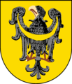
The emblems of Lower Silesia and Upper Silesia originate from the emblems of the Piasts of Lower Silesia and Upper Silesia. The coat of arms of Upper Silesia depicts the golden eagle on the blue shield. The coat of arms of Lower Silesia depicts a black eagle on a golden (yellow) shield.
-
 Coat of arms of the Prussian province of Upper Silesia (1919–1938 and 1941–1945)
 -

-

-
 Henryk IV's Probus coat of arms
 -
 Coat of arms of Austrian Silesia (1742–1918)
 -
 Prussian province of Lower Silesia (1919–1938 and 1941–1945)
 -
 Coat of arms of theLower Silesia Voivodeship
 -
 Coat of arms of Czech Silesia


Flags with their colors refer to the coat of arms of Silesia.
-
 Flag of Prussian Upper Silesia province (1919–1938 and 1941–1945)
 -
 Flag of Silesia Voivodeship
 -
 Flag of the Austrian Silesia (1742–1918), and Czech Silesia
 -
 Flag of Prussian Lower Silesia province (1919–1938 and 1941–1945)
 -
 Flag of Lower Silesia Voivodeship


World Heritage Sites
-

-
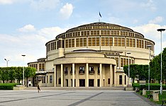 Centennial Hall, Wrocław
 -
 Historic Silver Mine, Tarnowskie Góry
 -
![Muskau Park, Łęknica and Bad Muskau[62]](//upload.wikimedia.org/wikipedia/commons/thumb/f/f6/Das_Neue_Schloss_im_Park.jpg/225px-Das_Neue_Schloss_im_Park.jpg)


![Muskau Park, Łęknica and Bad Muskau[62]](/File:Das_Neue_Schloss_im_Park.jpg)
See also
- 257 Silesia
- Expulsion of Poles by Germany
- Flight and expulsion of Germans (1944–1950)
- List of people from Silesia
- Silesian German
- Silesian Interurbans
- Slezak
- Upper Silesian Industrial Region
- Katowice urban area
- Upper Silesian-Moravian metropolitan area
Notes
References
- ^ "EU regions by GDP, Eurostat". Archived from the original on 27 February 2023. Retrieved 18 September 2023.
- ^ "Silesia". The American Heritage Dictionary of the English Language (5th ed.). HarperCollins. Retrieved 23 July 2019.
- ^ "Silesia". Collins English Dictionary. HarperCollins. Retrieved 23 July 2019.
- ^ "Silesia". Lexico UK English Dictionary. Oxford University Press. Archived from the original on 23 July 2019.
- ^ "Silesia". Merriam-Webster.com Dictionary. Retrieved 23 July 2019.
- ^ Zbigniew Babik, "Najstarsza warstwa nazewnicza na ziemiach polskich w granicach średniowiecznej Słowiańszczyzny", Uniwersitas, Kraków, 2001.
- ^ Rudolf Fischer. Onomastica slavogermanica. Uniwersytet Wrocławski. 2007. t. XXVI. 2007. str. 83
- Reallexikon der Germanischen Altertumskunde(in German). Vol. 33 (2nd ed.). Berlin, Germany; New York City: de Gruyter.
Da die Silingen offensichtlich ihren Namen im mittelalterlichen pagus silensis und dem mons slenz – möglicherweise mit dem Zobten gleichzusetzen [...] – hinterließen und damit einer ganzen Landschaft – Schlesien – den Namen gaben [...]
- ^ Andreas Lawaty, Hubert Orłowski (2003). Deutsche und Polen: Geschichte, Kultur, Politik (in German). C.H.Beck. p. 183.
- ^ R. Żerelik(in:) M. Czpliński (red.) Historia Śląska, Wrocław 2007, pp. 34–35
- ^ R. Żerelik(in:) M. Czpliński (red.) Historia Śląska, Wrocław 2007, pp. 37–38
- ^ a b c R. Żerelik(in:) M. Czpliński (red.) Historia Śląska, Wrocław 2007, pp. 21–22
- ^ R. Żerelik(in:) M. Czpliński (red.) Historia Śląska, Wrocław 2007, p. 81
- ^ gonschior.de (in German)
- ^ Piotr Eberhardt, Political Migrations in Poland, 1939–1948, Warsaw 2006, p.25
- ^ Wardzyńska, Maria (2009). Był rok 1939. Operacja niemieckiej policji bezpieczeństwa w Polsce. Intelligenzaktion (in Polish). Warszawa: IPN.
- ISBN 83-7322-287-1.
- ISBN 9780880331746.
- ISBN 978-0-521-61857-1.)
{{cite book}}: CS1 maint: multiple names: authors list (link - ^ a b c d e "Natural Resources | poland.gov.pl". En.poland.gov.pl. Retrieved 19 November 2013.
- ^ "Mamy największe złoża węgla brunatnego na świecie" (in Polish). Gazetawyborcza.pl. Retrieved 20 November 2013.
- ^ S.Z. Mikulski, "Late-Hercynian gold-bearing arsenic-polymetallic mineralization within Saxothuringian zone in the Polish Sudetes, Northeast Bohemian Massif". In: "Mineral Deposit at the Beginning of the 21st Century", A. Piestrzyński et al. (eds). Swets & Zeitinger Publishers (Google books)
- ^ "Wise International | World Information Service on Energy". 0.antenna.nl. Archived from the original on 10 October 2007. Retrieved 20 November 2013.
- ^ "Copper: World Smelter Production, By Country". Indexmundi.com. 28 July 2011. Retrieved 20 November 2013.
- ^ "Zinc: World Smelter Production, By Country". Indexmundi.com. 1 July 2004. Retrieved 20 November 2013.
- ^ "Silver: World Mine Production, By Country". Indexmundi.com. 13 August 2004. Retrieved 20 November 2013.
- ^ "Cadmium: World Refinery Production, By Country". Indexmundi.com. 18 May 2012. Retrieved 20 November 2013.
- ^ "Lead: World Refinery Production, By Country". Indexmundi.com. 24 June 2005. Retrieved 20 November 2013.
- ^ "Samorząd Województwa Opolskiego". Umwo.opole.pl. Retrieved 20 November 2013.
- ^ Dillingham, William Paul; Folkmar, Daniel; Folkmar, Elnora (1911). Dictionary of Races or Peoples. Washington, D.C.: Washington, Government Printing Office. p. 128.
- ^ Dillingham, William Paul; Folkmar, Daniel; Folkmar, Elnora (1911). Dictionary of Races or Peoples. United States. Immigration Commission (1907–1910). Washington, D.C.: Washington, Government Printing Office. pp. 105, 128.
- ^ "Śląska Biblioteka Cyfrowa – biblioteka cyfrowa regionu śląskiego – Wznowione powszechne taxae-stolae sporządzenie, Dla samowładnego Xięstwa Sląska, Podług ktorego tak Auszpurskiey Konfessyi iak Katoliccy Fararze, Kaznodzieie i Kuratusowie Zachowywać się powinni. Sub Dato z Berlina, d. 8. Augusti 1750". Sbc.org.pl. Retrieved 20 November 2013.
- ^ Weinhold, Karl (1887). Die Verbreitung und die Herkunft der Deutschen in Schlesien [The Spread and the Origin of Germans in Silesia] (in German). Stuttgart: J. Engelhorn.
- ^ Jobst Gumpert (1966). Polen, Deutschland (in German). Callwey. p. 138.
- ^ Hunt Tooley, T (1997). National Identity and Weimar Germany: Upper Silesia and the Eastern Border, 1918–1922, University of Nebraska Press, p.17.
- ^ a b Georg Hassel (1823). Statistischer Umriß der sämmtlichen europäischen und der vornehmsten außereuropäischen Staaten, in Hinsicht ihrer Entwickelung, Größe, Volksmenge, Finanz- und Militärverfassung, tabellarisch dargestellt; Erster Heft: Welcher die beiden großen Mächte Österreich und Preußen und den Deutschen Staatenbund darstellt (in German). Verlag des Geographischen Instituts Weimar. pp. 33–34.
- ^ Plater, Stanisław (1825). Jeografia wschodniey części Europy czyli opis krajów przez wielorakie narody sławiańskie zamieszkanych obeymujący Prussy, Xięztwo Poznańskie, Szląsk Pruski, Gallicyą, Rzeczpospolitę Krakowską, Królestwo Polskie i Litwę (in Polish). Wrocław: Wilhelm Bogumił Korn. p. 60.
- ^ Ładogórski, Tadeusz (1966). Ludność, in: Historia Śląska, vol. II: 1763–1850, part 1: 1763–1806 (in Polish). Wrocław: edited by W. Długoborski. p. 150.
- ^ Paul Weber (1913). Die Polen in Oberschlesien: eine statistische Untersuchung (in German). Berlin: Verlagsbuchhandlung von Julius Springer.
- ^ Kalisch, Johannes; Bochinski, Hans (1958). "Stosunki narodowościowe na Śląsku w świetle relacji pruskich urzędników z roku 1882" (PDF). Śląski Kwartalnik Historyczny Sobótka. 13. Leipzig. Archived from the original (PDF) on 1 February 2020.
- ^ Paul Weber (1913). Die Polen in Oberschlesien: eine statistische Untersuchung (in German). Berlin: Verlagsbuchhandlung von Julius Springer. p. 27.
- ISBN 978-3-88246-398-9.
- ^ Meyers Konversationslexikon 5. Auflage
- ^ Demshuk, A (2012) The Lost German East: Forced Migration and the Politics of Memory, 1945–1970, Cambridge University Press P40
- ^ Kamusella, T (2007). Silesia and Central European nationalisms: the emergence of national and ethnic groups in Prussian Silesia and Austrian Silesia, 1848–1918, Purdue University Press, p.173.
- ^ Christopher R. Browning (2000). Nazi Policy, Jewish Workers, German Killers, Cambridge University Press, 2000, p.147.
- ^ van Straten, J (2011) The Origin of Ashkenazi Jewry: The Controversy Unravelled, Walter de Gruyter P58
- ^ "Silesia". 1906 Jewish Encyclopedia. JewishEncyclopedia.com. Retrieved 6 December 2017.
- ^ Popularna encyklopedia powszechna – Volume 10 – Page 660 Magdalena Olkuśnik, Elżbieta Wójcik – 2001 Streckenbach Bruno (1902–1977), funkcjonariusz niem. państwa nazistowskiego, Gruppenfuhrer SS. Od 1933 szef policji po- lit w Hamburgu. 1939 dow. Einsatzgruppe I (odpowiedzialny za eksterminacje ludności pol. i żydowskiej na Śląsku).
- ^ Zagłada Żydów na polskich terenach wcielonych do Rzeszy Page 53 Aleksandra Namysło, Instytut Pamięci Narodowej—Komisja Ścigania Zbrodni przeciwko Narodowi Polskiemu – 2008 W rzeczywistości ludzie Udona von Woyr- scha podczas marszu przez województwo śląskie na wschód dopuszczali się prawdziwych masakr ludności żydowskiej.
- ^ Steinbacher, S. "In the Shadow of Auschwitz, The murder of the Jews of East Upper Silesia", in Cesarani, D. (2004) Holocaust: From the persecution of the Jews to mass murder, Routledge, P126
- ^ Steinbacher, S. "In the Shadow of Auschwitz, The murder of the Jews of East Upper Silesia", in Cesarani, D. (2004) Holocaust: From the persecution of the Jews to mass murder, Routledge, pp.110–138.
- ^ The Origins of the Final Solution: The Evolution of Nazi Jewish Policy, September 1939 – March 1942 – Page 544 Christopher R. Browning – 2007 Between 5 May and 17 June, 20,000 Silesian Jews were deported to Birkenau to be gassed.
- ^ Christopher R. Browning (2007). The Origins of the Final Solution: The Evolution of Nazi Jewish Policy, September 1939 – March 1942, University of Nebraska Press, p.544.
- ^ The International Jewish Labor Bund After 1945: Toward a Global History David Slucki, page 63
- ^ A narrow bridge to life: Jewish forced labor and survival in the Gross-Rosen camp system, 1940–1945, page 229 Belah Guṭerman
- ^ Kochavi, AJ (2001)Post-Holocaust politics: Britain, the United States & Jewish refugees, 1945–1948, University of North Carolina Press P 176
- ^ Kochavi, AJ (2001). Post-Holocaust politics: Britain, the United States & Jewish refugees, 1945–1948, University of North Carolina Press, p.176.
- ^ DB Klusmeyer & DG Papademetriou (2009). Immigration policy in the Federal Republic of Germany: negotiating membership and remaking the nation, Berghahn, p.70.
- ^ Scholz, A (1964). Silesia: yesterday and today, Martinus Nijhoff, The Hague, p.69.
- ^ Mazower, M (1999). Dark Continent: Europe's 20th Century, Penguin, p.223.
- ^ Łęknica and Bad Muskau were considered part of Silesia in years 1815–1945.
Sources
- Chisholm, Hugh, ed. (1911). . Encyclopædia Britannica. Vol. 25 (11th ed.). Cambridge University Press. pp. 90–92.
- Czapliński, Marek; Wiszewski, Przemysław, eds. (2014). "Cuius regio? Ideological and Territorial Cohesion of the Historical Region of Silesia" (PDF). Region Divided - Times of Nation-States (1918-1945). Vol. 4. Wrocław, Poland: EBooki.com.pl. ISBN 978-83-927132-8-9. Retrieved 18 March 2018.
- ISBN 83-85831-03-7.
- Harc, Lucyna; Wąs, Gabriela, eds. (2014). "Cuius regio? Ideological and Territorial Cohesion of the Historical Region of Silesia" (PDF). The Strengthening of Silesian Regionalism (1526-1740). Vol. 2. Wrocław, Poland: EBooki.com.pl. ISBN 978-83-927132-6-5. Retrieved 18 March 2018.
- Harc, Lucyna; Kulak, Teresa, eds. (2015). "Cuius regio? Ideological and Territorial Cohesion of the Historical Region of Silesia" (PDF). Silesia under the Authority of the Hohenzollerns (1741-1918). Vol. 3. Wrocław, Poland: EBooki.com.pl. ISBN 978-83-942651-3-7. Retrieved 18 March 2018.
- Przemysław, Wiszewski, ed. (2013). "Cuius regio? Ideological and Territorial Cohesion of the Historical Region of Silesia" (PDF). The Long Formation of the Region (c. 1000–1526). Vol. 1. Wrocław, Poland: EBooki.com.pl. ISBN 978-83-927132-1-0. Retrieved 18 March 2018.
- Wiszewski, Przemysław, ed. (2015). "Cuius regio? Ideological and Territorial Cohesion of the Historical Region of Silesia" (PDF). Permanent Change - The New Region(s) of Silesia (1945-2015). Vol. 5. Wrocław, Poland: EBooki.com.pl. ISBN 978-83-942651-2-0. Retrieved 18 March 2018.
- Zahradnik, Stanisław; Marek Ryczkowski (1992). Korzenie Zaolzia. Warszawa - Praga - Trzyniec: PAI-press. OCLC 177389723.