
Del Norte County, California
Del Norte County | |
|---|---|
| County of Del Norte | |
    Images, from top down, left to right: Crescent City Harbor, Redwood National Park, Castle Rock, the mouth of the Smith River | |
 Seal | |
 Interactive map of Del Norte County | |
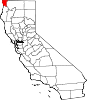
 Location in the state of California | |
| Country | United States |
| State | California
|
| Region | North Coast |
| Incorporated | March 2, 1857[1] |
| Named for | Its location, "Of the North" (Spanish: Del norte), in California |
| County seat | Crescent City |
| Largest city | Crescent City |
| Government | |
| • Type | Council–CAO |
| • Chair | Darrin Short |
| • Vice Chair | Valerie Starkey |
| • Board of Supervisors[2] | Supervisors
|
| • County Administrative Officer | Neal Lopez |
| Area | |
| • Total | 1,230 sq mi (3,200 km2) |
| • Land | 1,006 sq mi (2,610 km2) |
| • Water | 223 sq mi (580 km2) |
| Highest elevation FIPS code | 06-015 |
| GNIS feature ID | 1682074 |
| Congressional district | 2nd |
| Website | www |
Del Norte County /dɛl ˈnɔːrt/ (Spanish for "Of The North") is a county at the far northwest corner of the U.S. state of California, along the Pacific Ocean adjacent to the Oregon border. Its population is 27,743 as of the 2020 census, down from 28,610 from the 2010 census. The county seat and only incorporated city is Crescent City.[5] Del Norte was pioneered and populated by Azorean Portuguese settlers and dairy farmers, which may account for the local pronunciation of the county name.[6] Locals pronounce the county name as Del Nort, not Del Nor-teh as would be expected in Spanish.[7]
Del Norte County comprises the Crescent City, CA
The rural county is notable for forests containing giant Coast Redwoods, with some attaining heights over 350 feet (110 m). This northernmost county on the California coast also has scores of unique plants and flowers, dozens of species of coastal birds and fish, rocky primitive beaches and sea stacks, pristine rivers, and historic lighthouses.
History
The area that is now known as Del Norte was and still is inhabited by the
Del Norte County was established in 1857, from part of the territory of
Geography
According to the
The mountainous terrain associated with the Coastal Range and the Klamath Mountains dominates Del Norte County's geography. Elevation ranges from sea level to over 6,400 feet. Although much of the county is made up of steep terrain, there are small patches of flat terrain along the coast and in isolated mountain valleys. There are 37 miles of coastline in the county, forming a coastal zone that covers approximately 51,000 acres (80 square miles). A broad coastal plain can be found in the northwest portion of the county with the western edge of the Klamath Mountains as its easterly boundary. Rising abruptly from the coastal plain, the Klamath Mountains extend north into Oregon and are situated between the Cascade Range to the east and the Coast Range to the north.[9]
Adjacent counties
- Curry County, Oregon - northwest
- Josephine County, Oregon - northeast
- Siskiyou County - east
- Humboldt County - south
Beach
Recreation area
Rivers
- Klamath - one of the longest in California.
- National Wild and Scenic Riverprogram.
Wildlife refuge
Parks

- Del Norte Coast Redwoods State Park
- Jedediah Smith Redwoods State Park
- Redwood National Park
- Tolowa Dunes State Park
- Ruby Van Deventer County Park
- Florence Keller County Park
Ecology
There is a diversity of flora and fauna within Del Norte County. Vegetative plant associations feature several forest types including mixed oak forest. The California
Demographics
2011
| Population, race, and income | |||||
|---|---|---|---|---|---|
| Total population[11] | 28,561 | ||||
| White[11] | 20,804 | 72.8% | |||
| Black or African American[11] | 937 | 3.3% | |||
| American Indian or Alaska Native[11] | 1,571 | 5.5% | |||
| Asian[11] | 891 | 3.1% | |||
| Native Hawaiian or other Pacific Islander[11] | 271 | 0.9% | |||
| Some other race[11] | 2,343 | 8.2% | |||
| Two or more races[11] | 1,744 | 6.1% | |||
| Hispanic or Latino (of any race)[12] | 5,003 | 17.5% | |||
| Per capita income[13] | $19,247 | ||||
| Median household income[14] | $37,588 | ||||
| Median family income[15] | $52,076 | ||||
Places by population, race, and income
| Places by population and race | ||||||||
|---|---|---|---|---|---|---|---|---|
| Place | Type[16] | Population[11] | White[11] | Other[11] [note 1] |
Asian[11] | Black or African American[11] |
Native American[11] [note 2] |
Hispanic or Latino (of any race)[12] |
Bertsch-Oceanview |
CDP | 2,729 | 77.9% | 13.6% | 1.1% | 0.0% | 7.4% | 8.1% |
| Crescent City | City |
7,673 | 54.0% | 26.9% | 3.9% | 9.9% | 5.3% | 27.7% |
| Gasquet | CDP | 551 | 100.0% | 0.0% | 0.0% | 0.0% | 0.0% | 14.3% |
| Hiouchi | CDP | 472 | 91.9% | 6.8% | 1.3% | 0.0% | 0.0% | 8.3% |
| Klamath | CDP | 956 | 49.0% | 21.8% | 4.0% | 0.3% | 25.0% | 8.3% |
| Smith River | CDP | 649 | 80.4% | 18.2% | 1.4% | 0.0% | 0.0% | 13.6% |
| Places by population and income | |||||
|---|---|---|---|---|---|
| Place | Type[16] | Population[17] | Per capita income[13] | Median household income[14] | Median family income[15] |
Bertsch-Oceanview |
CDP | 2,729 | $19,434 | $48,205 | $58,727 |
| Crescent City | City |
7,673 | $10,350 | $30,058 | $37,143 |
| Gasquet | CDP | 551 | $19,286 | $43,750 | $55,227 |
| Hiouchi | CDP | 472 | $30,285 | $47,596 | $66,591 |
| Klamath | CDP | 956 | $16,332 | $26,172 | $28,864 |
| Smith River | CDP | 649 | $18,120 | $46,411 | $57,989 |
2010
| Census | Pop. | Note | %± |
|---|---|---|---|
| 1860 | 1,993 | — | |
| 1870 | 2,022 | 1.5% | |
| 1880 | 2,584 | 27.8% | |
| 1890 | 2,592 | 0.3% | |
| 1900 | 2,408 | −7.1% | |
| 1910 | 2,417 | 0.4% | |
| 1920 | 2,759 | 14.1% | |
| 1930 | 4,739 | 71.8% | |
| 1940 | 4,745 | 0.1% | |
| 1950 | 8,078 | 70.2% | |
| 1960 | 17,771 | 120.0% | |
| 1970 | 14,580 | −18.0% | |
| 1980 | 18,217 | 24.9% | |
| 1990 | 23,460 | 28.8% | |
| 2000 | 27,507 | 17.3% | |
| 2010 | 28,610 | 4.0% | |
| 2020 | 27,743 | −3.0% | |
| 2023 (est.) | 26,589 | [18] | −4.2% |
| U.S. Decennial Census[19] 1790–1960[20] 1900–1990[21] 1990–2000[22] 2010–2015[23] | |||
The
| Population reported at 2010 United States Census
| |||||||||
|---|---|---|---|---|---|---|---|---|---|
The County |
Total Population |
White |
African American |
Native American |
Asian |
Pacific Islander |
other races |
two or more races |
Latino (of any race) |
| Del Norte County | 28,610 | 21,098 | 993 | 2,244 | 965 | 32 | 1,980 | 1,298 | 5,093 |
Incorporated city |
Total Population |
White |
African American |
Native American |
Asian |
Pacific Islander |
other races |
two or more races |
Latino (of any race) |
| Crescent City | 7,643 | 5,052 | 910 | 370 | 333 | 7 | 696 | 275 | 2,342 |
Total Population |
White |
African American |
Native American |
Asian |
Pacific Islander |
other races |
two or more races |
Latino (of any race) | |
Bertsch-Oceanview
|
2,436 | 1,810 | 3 | 294 | 94 | 0 | 81 | 154 | 310 |
| Gasquet | 661 | 585 | 2 | 27 | 1 | 1 | 15 | 30 | 39 |
| Hiouchi | 301 | 267 | 0 | 11 | 6 | 2 | 8 | 7 | 11 |
| Klamath | 779 | 379 | 1 | 325 | 3 | 0 | 5 | 66 | 90 |
| Smith River | 866 | 528 | 1 | 59 | 5 | 0 | 234 | 39 | 293 |
Total Population |
White |
African American |
Native American |
Asian |
Pacific Islander |
other races |
two or more races |
Latino (of any race) | |
| All others not CDPs (combined) | 15,924 | 12,477 | 76 | 1,158 | 523 | 22 | 941 | 727 | 2,008 |
2000
As of the
as their first language.There were 9,170 households, out of which 33.5% had children under the age of 18 living with them, 50.0% were married couples living together, 13.6% had a female householder with no husband present, and 31.4% were non-families. 25.3% of all households were made up of individuals, and 10.1% had someone living alone who was 65 years of age or older. The average household size was 2.58 and the average family size was 3.08.
The age distribution was 25.1% under the age of 18, 8.0% from 18 to 24, 32.2% from 25 to 44, 22.3% from 45 to 64, and 12.5% who were 65 years of age or older. The median age was 36 years. For every 100 females there were 123.3 males. For every 100 females age 18 and over, there were 130.3 males.
The median income for a household in the county was $29,642, and the median income for a family was $36,056. Males had a median income of $40,072 versus $22,212 for females. The
Education
Del Norte County is home to a satellite campus of College of the Redwoods, a two-year college based in Humboldt County.
Del Norte County has one of just five combined county office of education-unified school district learning educational agencies (LEA) in the state of California, with one elected Board of Trustees that serves both agencies, and one superintendent overseeing both the County Office of Education, and the Unified School District.
The
The County Office of Education provides special education services to the county, as well as alternative learning options that includes Community Day and juvenile detention. Alternative educational facilities are Del Norte Community Day, Elk Creek detention center, and Sunset Continuation High School.
Del Norte County has several private
Politics
Del Norte is traditionally a strongly
| Year | Republican | Democratic | Third party | |||
|---|---|---|---|---|---|---|
| No. | % | No. | % | No. | % | |
| 2020 | 6,461 | 56.41% | 4,677 | 40.84% | 315 | 2.75% |
| 2016 | 5,134 | 53.71% | 3,485 | 36.46% | 939 | 9.82% |
| 2012 | 4,614 | 52.61% | 3,791 | 43.23% | 365 | 4.16% |
| 2008 | 4,967 | 52.11% | 4,323 | 45.36% | 241 | 2.53% |
| 2004 | 5,356 | 56.85% | 3,892 | 41.31% | 173 | 1.84% |
| 2000 | 4,526 | 54.57% | 3,117 | 37.58% | 651 | 7.85% |
| 1996 | 3,670 | 41.29% | 3,652 | 41.08% | 1,567 | 17.63% |
| 1992 | 3,083 | 32.96% | 3,639 | 38.91% | 2,631 | 28.13% |
| 1988 | 3,714 | 49.73% | 3,587 | 48.03% | 167 | 2.24% |
| 1984 | 3,996 | 58.41% | 2,696 | 39.41% | 149 | 2.18% |
| 1980 | 4,016 | 57.48% | 2,338 | 33.46% | 633 | 9.06% |
| 1976 | 2,481 | 45.29% | 2,789 | 50.91% | 208 | 3.80% |
| 1972 | 2,927 | 51.82% | 2,156 | 38.17% | 565 | 10.00% |
| 1968 | 2,387 | 46.19% | 2,236 | 43.27% | 545 | 10.55% |
| 1964 | 2,075 | 36.23% | 3,652 | 63.77% | 0 | 0.00% |
| 1960 | 3,024 | 48.05% | 3,225 | 51.24% | 45 | 0.71% |
| 1956 | 2,918 | 53.18% | 2,552 | 46.51% | 17 | 0.31% |
| 1952 | 2,938 | 63.44% | 1,640 | 35.41% | 53 | 1.14% |
| 1948 | 1,541 | 54.26% | 1,172 | 41.27% | 127 | 4.47% |
| 1944 | 1,011 | 55.25% | 818 | 44.70% | 1 | 0.05% |
| 1940 | 1,233 | 53.56% | 1,034 | 44.92% | 35 | 1.52% |
| 1936 | 853 | 39.24% | 1,292 | 59.43% | 29 | 1.33% |
| 1932 | 637 | 30.94% | 1,319 | 64.06% | 103 | 5.00% |
| 1928 | 771 | 55.87% | 599 | 43.41% | 10 | 0.72% |
| 1924 | 530 | 52.63% | 122 | 12.12% | 355 | 35.25% |
| 1920 | 596 | 62.61% | 279 | 29.31% | 77 | 8.09% |
| 1916 | 499 | 43.81% | 471 | 41.35% | 169 | 14.84% |
| 1912 | 0 | 0.00% | 323 | 38.32% | 520 | 61.68% |
| 1908 | 450 | 59.29% | 202 | 26.61% | 107 | 14.10% |
| 1904 | 429 | 60.17% | 187 | 26.23% | 97 | 13.60% |
| 1900 | 334 | 51.78% | 291 | 45.12% | 20 | 3.10% |
| 1896 | 345 | 49.50% | 334 | 47.92% | 18 | 2.58% |
| 1892 | 235 | 36.55% | 339 | 52.72% | 69 | 10.73% |
| Year | GOP | DEM |
|---|---|---|
| 2022 | 61.0% 5,111 | 39.0% 3,264 |
| 2021 | 59.9% 5,243 | 40.1% 3,505 |
2018
|
58.7% 4,887 | 41.3% 3,441 |
2014
|
50.4% 3,539 | 49.6% 3,488 |
2010
|
41.2% 3,373 | 50.0% 4,093 |
2006
|
54.9% 3,639 | 38.2% 2,531 |
| 2003 | 55.0% 3,522 | 25.6% 1,634 |
2002
|
45.8% 3,093 | 43.3% 2,922 |
1998
|
41.5% 3,087 | 51.3% 3,820 |
1994
|
61.8% 4,626 | 31.7% 2,372 |
1990
|
53.2% 3,615 | 40.0% 2,717 |
1986
|
65.8% 4,213 | 31.6% 2,026 |
1982
|
51.3% 3,355 | 44.9% 2,934 |
1978
|
49.9% 2,933 | 41.7% 2,451 |
1974
|
46.1% 1,921 | 51.6% 2,149 |
1970
|
57.1% 2,755 | 41.0% 1,977 |
1966
|
64.0% 3,409 | 36.0% 1,918 |
1962
|
45.9% 2,418 | 52.0% 2,741 |
The county has almost an even split in
Del Norte County is in California's 2nd congressional district, represented by Democrat Jared Huffman.[29]
In the
Voter registration statistics
| Population and registered voters | ||
|---|---|---|
| Total population[11] | 28,561 | |
| Registered voters[32][note 3] | 12,239 | 42.9% |
| Democratic[32] | 4,252 | 34.7% |
| Republican[32] | 4,595 | 37.5% |
| Democratic–Republican spread[32] | -343 | -2.8% |
| American Independent[32] | 541 | 4.4% |
| Green[32] | 100 | 0.8% |
| Libertarian[32] | 90 | 0.7% |
| Peace and Freedom[32] | 49 | 0.4% |
| Americans Elect[32] | 0 | 0.0% |
| Other[32] | 150 | 1.2% |
| No party preference[32] | 2,462 | 20.1% |
Cities by population and voter registration
| Cities by population and voter registration | |||||||
|---|---|---|---|---|---|---|---|
| City | Population[11] | Registered voters[32] [note 3] |
Democratic[32] | Republican[32] | D–R spread[32] | Other[32] | No party preference[32] |
| Crescent City | 7,673 | 22.3% | 35.5% | 29.4% | +6.1% | 15.3% | 25.5% |
Crime
The following table includes the number of incidents reported and the rate per 1,000 persons for each type of offense.
| Population and crime rates | ||
|---|---|---|
| Population[11] | 28,561 | |
| Violent crime[33] | 108 | 3.78 |
| Homicide[33] | 1 | 0.04 |
| Forcible rape[33] | 22 | 0.77 |
| Robbery[33] | 11 | 0.39 |
| Aggravated assault[33] | 74 | 2.59 |
| Property crime[33] | 398 | 13.94 |
| Burglary[33] | 230 | 8.05 |
| Larceny-theft[33][34] | 340 | 11.90 |
| Motor vehicle theft[33] | 73 | 2.56 |
| Arson[33] | 5 | 0.18 |
Cities by population and crime rates
| Cities by population and crime rates | ||||||||
|---|---|---|---|---|---|---|---|---|
| City | Population[35] | Violent crimes[35] | Violent crime rate per 1,000 persons |
Property crimes[35] | Property crime rate per 1,000 persons | |||
| Crescent City | 7,723 | 51 | 6.60 | 215 | 27.84 | |||
Transportation
Major highways
Public transportation
Local public transit is provided by Redwood Coast Transit, which provides access to Amtrak passenger train (via Amtrak Thruway) service.
Airports
Advanced Air conducts passenger flights to and from Jack McNamara Field Airport, operating one daily round trip flight to Oakland International Airport and Los Angeles-Hawthorne Airport.[36] Flights are largely subsidized by an Alternate Essential Air Service grant approved by the United States Department of Transportation and issued to the Border Coast Regional Airport Authority in 2020.[37]
Harbor
The Crescent City Harbor serves as a commercial fishing port for
Communities
Crescent City is the county seat of and only incorporated city in Del Norte County. Its population count includes the inmates of Pelican Bay State Prison located ten miles north of the city.
Cities
Census-designated places
Other unincorporated communities
Population ranking
The population ranking of the following table is based on the 2020 census of Del Norte County.
† county seat
| Rank | City/Town/etc. | Municipal type | Population (2020 Census) |
|---|---|---|---|
| 1 | † Crescent City | City | 6,673 |
| 2 | Bertsch-Oceanview
|
CDP | 2,520 |
| 3 | Yurok Reservation[38] (partially in Humboldt County) | AIAN | 1,236 |
| 4 | Klamath | CDP | 1,088 |
| 5 | Fort Dick | CDP | 912 |
| 6 | Smith River | CDP | 906 |
| 7 | Gasquet | CDP | 657 |
| 8 | Hiouchi | CDP | 314 |
| 9 | Smith River Rancheria[39] | AIAN | 160 |
| 10 | Elk Valley Rancheria[40] | AIAN | 100 |
| 11 | Resighini Rancheria[41] | AIAN | 33 |
See also

- Hiking trails in Del Norte County[dead link]
- National Register of Historic Places listings in Del Norte County, California
- Things to Do, Outdoor Recreation & Visitor Information
Notes
References
- ^ "Del Norte County". Geographic Names Information System. United States Geological Survey, United States Department of the Interior. Retrieved January 5, 2015.
- ^ "County of Del Norte, California - Board of Supervisors". www.co.del-norte.ca.us.
- ^ "Bear Mountain". Peakbagger.com. Retrieved February 11, 2015.
- ^ "Del Norte County, California 2020 Census". Retrieved January 22, 2022.
- ^ "Find a County". National Association of Counties. Archived from the original on May 31, 2011. Retrieved June 7, 2011.
- ^ Genzoli, Andrew (November 1971). "When the Portuguese Pioneered". Humboldt Historian. 19 (6): 8.
- ^ Roberts, Rich (April 10, 1991). "A California Time Capsule : Pristine Version of State Awaits in Smith River Recreation Area". Los Angeles Times. Retrieved May 21, 2016.
- ^ "2010 Census Gazetteer Files". United States Census Bureau. August 22, 2012. Retrieved September 24, 2015.
- ^ "Del Norte Fire Safe Plan" (PDF). Archived from the original (PDF) on April 25, 2012. Retrieved October 28, 2011.
- ^ C. Michael Hogan. 2008. Blue Oak: Quercus douglasii, GlobalTwitcher.com, ed. N. Stromberg Archived February 28, 2012, at the Wayback Machine
- ^ a b c d e f g h i j k l m n o p q U.S. Census Bureau. American Community Survey, 2011 American Community Survey 5-Year Estimates, Table B02001. U.S. Census website . Retrieved October 26, 2013.
- ^ a b U.S. Census Bureau. American Community Survey, 2011 American Community Survey 5-Year Estimates, Table B03003. U.S. Census website . Retrieved October 26, 2013.
- ^ a b U.S. Census Bureau. American Community Survey, 2011 American Community Survey 5-Year Estimates, Table B19301. U.S. Census website . Retrieved October 21, 2013.
- ^ a b U.S. Census Bureau. American Community Survey, 2011 American Community Survey 5-Year Estimates, Table B19013. U.S. Census website . Retrieved October 21, 2013.
- ^ a b U.S. Census Bureau. American Community Survey, 2011 American Community Survey 5-Year Estimates, Table B19113. U.S. Census website . Retrieved October 21, 2013.
- ^ a b U.S. Census Bureau. American Community Survey, 2011 American Community Survey 5-Year Estimates. U.S. Census website . Retrieved October 21, 2013.
- ^ U.S. Census Bureau. American Community Survey, 2011 American Community Survey 5-Year Estimates, Table B01003. U.S. Census website . Retrieved October 21, 2013.
- ^ "Annual Estimates of the Resident Population for Counties: April 1, 2020 to July 1, 2023". United States Census Bureau. Retrieved March 26, 2024.
- ^ "U.S. Decennial Census". United States Census Bureau. Retrieved September 24, 2015.
- ^ "Historical Census Browser". University of Virginia Library. Retrieved September 24, 2015.
- ^ Forstall, Richard L., ed. (March 27, 1995). "Population of Counties by Decennial Census: 1900 to 1990". United States Census Bureau. Retrieved September 24, 2015.
- ^ "Census 2000 PHC-T-4. Ranking Tables for Counties: 1990 and 2000" (PDF). United States Census Bureau. April 2, 2001. Retrieved September 24, 2015.
- ^ "State & County QuickFacts". United States Census Bureau. Archived from the original on October 13, 2015. Retrieved April 3, 2016.
- ^ "2010 Census P.L. 94-171 Summary File Data". United States Census Bureau.
- ^ "U.S. Census website". United States Census Bureau. Retrieved May 14, 2011.
- U.S. Census Bureau. Retrieved July 25, 2022. - Text list
- ^ Leip, David. "Dave Leip's Atlas of U.S. Presidential Elections". Uselectionatlas.org. Retrieved November 7, 2017.
- ^ "Voter Registration Statistics By County" (PDF). Archived from the original (PDF) on September 3, 2008. Retrieved September 4, 2008.
- ^ "California's 2nd Congressional District - Representatives & District Map". Civic Impulse, LLC. Retrieved March 1, 2013.
- ^ "Members Assembly". State of California. Retrieved April 1, 2013.
- ^ "Senators". State of California. Retrieved April 6, 2013.
- ^ a b c d e f g h i j k l m n o p q California Secretary of State. February 10, 2013 - Report of Registration Archived November 3, 2013, at the Wayback Machine. Retrieved October 31, 2013.
- ^ a b c d e f g h i j Office of the Attorney General, Department of Justice, State of California. Table 11: Crimes – 2009 Archived December 2, 2013, at the Wayback Machine. Retrieved November 14, 2013.
- ^ Only larceny-theft cases involving property over $400 in value are reported as property crimes.
- ^ a b c United States Department of Justice, Federal Bureau of Investigation. Crime in the United States, 2012, Table 8 (California). Retrieved November 14, 2013.
- ^ "Airline and Flight Info". flycrescentcity.
- ^ "Regulations.gov". www.regulations.gov.
- ^ "U.S. Census Bureau 2020 Census". Census.gov. Retrieved January 22, 2022.
- ^ "U.S. Census Bureau 2020 Census". Census.gov. Retrieved January 22, 2022.
- ^ "U.S. Census Bureau 2020 Census". Census.gov. Retrieved January 22, 2022.
- ^ "U.S. Census Bureau 2020 Census". Census.gov. Retrieved January 22, 2022.
External links
- Official website

- Del Norte County & Crescent City Tourism and Travel website
- Chamber of Commerce website
- Del Norte Historical Society
Places adjacent to Del Norte County, California | ||||||||||||||||
|---|---|---|---|---|---|---|---|---|---|---|---|---|---|---|---|---|
| ||||||||||||||||
 | ||||
| CDPs | ||||
| Unincorporated communities | ||||
| Indian reservations | ||||
| Ghost towns | ||||
| ||||
| International | |
|---|---|
| National | |
| Other | |