
Talk:List of transcontinental countries/Archive 1
| This is an archive of past discussions. Do not edit the contents of this page. If you wish to start a new discussion or revive an old one, please do so on the current talk page. |
| Archive 1 | Archive 2 | Archive 3 |
Old notes
(The following copied from
adding rant to Talk page, so that the readers can see the background: Every two continents that share a common land mass have a geographicaly defined border between them, that passes inside one or more countries. The inclusion of such 'border'-country into the continent, where the country has less territory (much less, even neglectably in most cases) sparks controversion with people that consider the country to be part of the "continent with bigger share of the country territory". Often some cultural and historical reasons are brought up that should 'prove' that the country belongs ONLY to that continent. In this article is covered the geographical meaning of continents. The cultural and historical reasons are used only as exception (in the cases where the geographical place is not the same as the popular opinion) and only for INCLUSION to a second continent. No state is EXCLUDED from its geographical continent because of such reasons (Despite that they are often much more important in practice).
—Preceding unsigned comment added by 62.204.151.1 (talk • contribs) 01:02, 6 March 2005 (UTC)
what to improve?
are there more sections to be re-written?
- Typos and/or misspellings galore, if nothing else. No idea who's responsible for them, but they should get fixed. Alfvaen 05:23, Mar 6, 2005 (UTC)
I fixed the misspellings and obvious grammar problems that I found. Article does need serious attention though. Val42 03:12, 7 April 2005 (UTC)
not original research
this article is secondary research with sources: for statistical data - WorldFactBook, World Gazetteer, Wikipedia articles, for explanations and border data - Wikipedia articles
- What we are doing here might indeed be secondary science/research, but nobody of us has found yet a passage in a book written by a well established authority about our topic. Therefore, it is probably up to us to define the borders between the continents :) -- Citylover 18:02, 8 September 2005 (UTC)
some things to add
- Which of these countries get membership of multiple organisations? E.g. OSCE(E==Europe) and Asian forums.
- See this.
- a references section with footnotes showing where each bit of info came from
- as already many times stated (including in the article) - the data is from Wikipedia, World Gazetteer, WorldFactBook; physical position of rivers/mountains/etc. is from MS Encarta WorldAtlasAlinor 12:33, 6 Mar 2005 (UTC)
The article concentrates too much on the accuracy of calculation of the populations. This is not the main topic which should be covered. Mozzerati 08:32, 2005 Mar 6 (UTC)
- Agreed. Shall we rewrite it so that it concentrates on the important information? What about if we concentrate on which ones are bicontinental and percentage of each country. Val42 03:12, 7 April 2005 (UTC)
real issues to discuss
Asia/Oceania:
- Wallace Line (is it only zoological, or also tectonic border) animals distiction or Melanesia human distinction is the border?
- The Wallace line" of this article here should also be reconsidered). -- Citylover09:21, 9 September 2005 (UTC)
Asia/Europe:
- on the east - recently I have seen some maps that show the Emba river (instead of Ural river as currently used in this page) as part of the continental border.
- on the south - the maps that I have checked recently, (that don't show only state borders) were using mostly the Caucaus watershed (as currently used in this page). But there was one map that was using even SOUTHERN line (crossing Georgia in half and nearing, but not crossing into Armenia) - unknown what river/other geographical feature it follows - the map was about rainfall data or something similar. The possible explanations are: (1) the authors have eighter used an arbitrary line - becouse of lack of knowledge (again pointing to the usefullness of this page - this topic is not trivia), or (2) this line represents better the "main Caucaus watershed" than the current maps on this page, or (3) this line represents some other geographical feature, considered by the authors of the map as the continent border. Anyway that was just 1 (of nearly 10) map, but I wanted to note it.
- in the Mediterranean - there are some greek islands very close to the Turkey's asian coast. Does someone think that these islands are GEOGRAPHICALY asian? (if yes, Greece will not became "bicontinental", becouse the islands are not "contigous" parts of its territory... until someone states that Greece is "island country", becouse of its many islands... maybe we should check the percentage greek area/pop on islands and decide if it is "islandish enough", etc.)
North/South America:
- Whitch carribean islands should be considered North and witch south. Currently on the page are mentioned Grenada and Tobago as possible South.
Alinor 18:46, 14 Mar 2005 (UTC)
- The term bicontinental is not scientific at all. Geologists define only six continents: 10:13, 2005 Mar 24 (UTC)
- I agree Takasugi, and I'm glad you talked about it here. Europe and Asia being considered separated continents is just a social-cultural construct. Like "Central America", which noone can seriously consider a continent outside social-cultural contexts. However, Eurasia is so diverse that at some point people just agreed to pretend it's two continents instead of only one. Perhaps three, because I have noticed some people talking about "Middle-East" as if it was a section separated from the rest of Asia. —Preceding unsigned comment added by Gargalos (talk • contribs) 01:42, 6 November 2007 (UTC)
from Vfd
On 6 Mar 2005, this article was nominated for deletion. The result was keep. See
) 16:22, 17 March 2005 (UTC)Spain and Portugal
Are Spain and Portugal bicontinental? There are two small Spanish exclaves on the African coast, and Azores are considered African geographically. — Instantnood 23:05, Mar 24, 2005 (UTC)
- If so, then so are France, UK, US, ... Nightstallion 06:51, 25 Mar 2005 (UTC)
- Overseas territories are not part of the United Kingdom, and therefore the UK is not. The United States could be arguable, as Hawaii is considered part of Oceania. France is definitely spanning across several continents. The DOMs/TOMs are integral parts of the country. — Instantnood 14:16, Mar 25, 2005 (UTC)
- Spain, Portugal, UK, France, etc. are not included, becouse their territories on "another continents" are not "contiguous" to their "main territory". Such non-contiguous examples are many, like Yemen's islands near the african coast, etc., but they are out-of-scope here. Alinor 10:22, 26 Mar 2005 (UTC)
- Then the same applies to the Trinidad and Tobago, Netherlands Antilles and Indonesia. — Instantnood 11:30, Mar 26, 2005 (UTC)
- Trinidad and Tobago and Indonesia consist entierly of islands - islands are their "main territory" and their respective islands that are geographicaly considered on different continents are close together, so that the "contiguous" rule is also present. (as mentioned in the article - the case of Tobago is disputable - maybe it is also South American like Trinidad, so the whole country will lie in South America). Netherlands Antilles is also a island entity - islands are "main territory"; the two groups of islands that make the Netherlands Antilles are remote one-to-another, so they are not exactly "contigous", but I think that we can not compare Spain/Ceuta&Melia to the two groups of tiny Netherland Antilles' islands.Alinor 17:56, 31 Mar 2005 (UTC)
- Overseas territories are not part of the United Kingdom, and therefore the UK is not. The United States could be arguable, as Hawaii is considered part of Oceania. France is definitely spanning across several continents. The DOMs/TOMs are integral parts of the country. — Instantnood 14:16, Mar 25, 2005 (UTC)
The Azores are slightly closer to
- I think the original poster meant the Canary Islands, not the Azores. I've added a reference to spain on the main page, even if it doesn't meet the criteria, in the same way this is done with East Timor, Trinidad and Tobago, etc. It would be great if someone could go in to the main page and clarify why, even though it has these holdings, it does not meet our definition of bicontinental. Brianski 00:16, 4 January 2007 (UTC)
Sotavento (talk) 18:36, 2 July 2008 (UTC) Portugal and Spain
- Portuguese national territory (Acording to EU regional definitions) is divided into tree regions. Namely Portugal (european continental terrytory) , Madeira (Madeira, Porto Santo , Selvagens and Desertas) and Açores (nine major islands)
- Madeira , Desertas and Selvagens archipelagos are located intirely on the african tectonic plate and thus they are african.
- Açores is a transcontinental region in itself since two of their main islands are trully in the american side of the atlantic divide, this detail should be noted in the article since in fact the açores are a vulcanic creation of that same divide.
- Since both the azores and Madeira were inhabited before portuguese discovery no claim that they are overseas territories should aply here.
- I edited the text about portugal a little bit and added the açores information , but feel free to correct my writings.
- About spain one should also notice that Ceuta and Melilla are spanish territories in africa and thus are a normal part of the country , and the same aplies to baleares and canarias. —Preceding unsigned comment added by Sotavento (talk • contribs) 18:34, 2 July 2008 (UTC)
picture change
I don't think that the new dark image is better for the eyes... The former was more contrast and also the colors are the same as these on the other images (including such on another pages)...
— Preceding unsigned comment added by 62.204.151.1 (talk) 19:47, 4 April 2005 (UTC)
Merging
I moved the info from
Disputed box
As I understand the DISPUTE-box is about the first paragraph that was "Transcontinental" before the merge with "Bicontinental Country"...
I think the DISPUTE previously applied to both pages.
- about the europe "gray" border I have personaly asked a professional geographer about the newest-revision (if any) of the path of that border. See the detailed description in the second paragraph of the page.
- what is still disputed? Maybe we should remove the disputed-box. 62.204.151.1 21:20, 6 July 2005 (UTC)
nation or state?
I think that 'transcontinental nation' has too wide meaning. The second part of this page (before the merger - Bicontinental country) was made for the geographical sense. But maybe it is better so - to cover the other possible means of transcontinental. 62.204.151.1 6 July 2005 21:20 (UTC)
- I agree that "state" is a much better and more easily defined word than "nation" when it comes to delimiting territories that may span two or more "continents". Perhaps a short line just to define what is meant by "state" (or other "seperate but non-sovereign geopolitical entity") would help? --Big Adamsky 15:36, 22 November 2005 (UTC)
Polish-Lithuanian Commonwealth
Can somebody tell me where is information about colonies of Polish-Lithuanian Commonwealth in Africa and South America were get from? I'm almost sure that it is mistake, but may be I'm wrong. MaxiMaxiMax 9 July 2005 16:19 (UTC)
- I am confused too, maybe the people that added it to the list may know better, but check the map on the P-L commonwealth page - there are two boxes in one corner showing Tobago and Gambia as some sort of dependencies... Alinor 11:06, 11 July 2005 (UTC)
- Tobago and Gambia were technically, though as tangentially as possible, dependencies of the Commonwealth during the seventeenth century. They were colonies of the Duchy of Courland, now a part of Latvia, which itself was a fiefdom of the Polish-Lithuanian Commonwealth. Sonitus 01:40, 12 July 2005 (UTC)
- Thank you, it was very interesting and surprising for me. But may be it is better to say that just Duchy of Courland was a transcontinental nation? MaxiMaxiMax 01:57, 12 July 2005 (UTC)
- Tobago and Gambia were technically, though as tangentially as possible, dependencies of the Commonwealth during the seventeenth century. They were colonies of the Duchy of Courland, now a part of Latvia, which itself was a fiefdom of the Polish-Lithuanian Commonwealth. Sonitus 01:40, 12 July 2005 (UTC)
Panama
I have always seen the N-S America boundary at the Panama-Colombia border on maps, never at the Panama Canal.
- Most of the maps do not show the N-S border at all (does the map has some special line that is described in the legend as "continental border"?). They just color some countries in gray/whatever (for example - if the map is "Political map of South America" - the north american are gray) and the others in multiple colors (south american). They just don't bother to deal with 'special cases' like Panama - it is anyway in many ways closer to Costa Rica, etc. than to Colombia, etc. - so they leave it in the group of central/north american states... This is the same as with Egypt - in is colored fully on many "Maps of Africa" - even if Sinai peninsula is clearly asian. In the same manner - many "Maps of Asia" don't inlclude Sinai.Alinor 15:37, 14 July 2005 (UTC)
Greece, part 1
- ~20% of Greece territory is islands. These islands are NOT distant (both to one-another and to the continental territory) - so maybe these 20% are enough to state that "islands form a contigous part of Greece territory". If so, then we should include Greece in the table too - it will have ~4% territory in Asia (more than Turkey in Europe - ~3%).
Alinor 19:17, 18 July 2005 (UTC)
Factual accuracy
(this label inserted)
- I don't see a big dispute in this discussion page. If no one objects I will remove the "factual accuracy disputed" box.
Alinor 19:17, 18 July 2005 (UTC)
- I will object. Much of this article deals with ambiguity of continental boundaries as though the arbitrary and unsourced lines were consensus. It is also silly to speak of islands as part of any continent, although it may be convenient for special purposes. Please consult Wiktionary. Septentrionalis 02:31, 19 July 2005 (UTC)
- Islands are "part of" a continent as much as they are peaks of the same continental shelf feature (or other geological feature) that forms the continent. Of course islands in the middle of the atlantic or the pacific oceans are formed by other means, so they do not "belong" to any continent.
- OK, the box on top of the page says "factual accuracy is disputed". Please, say witch specific facts do you object, so that someone can fix the article if needed.Alinor 15:36, 19 July 2005 (UTC)
- I object to the use of continent in a sense contrary to the principal English sense of the word: a continuous body of land. (The points, such as are, can be saved by rephrasing.)
- OK, maybe we should say subcontinent or find the most appropriate geographical term (penninsula, mega-peninsula or whatever).84.242.172.164 16:58, 20 July 2005 (UTC)
- I object further to any statement of the form: This is the boundary of Europe; all others are wrong. I have myself seen discussions of Europe which takes the boundary as the Don, the Caucasus, the Phasis, and the Russian frontier. Each of these is an intelligent choice, useful for certain purposes; none of them are handed down from on high. Similar remarks apply to the two Americas.
- I think that we should stick to the geographical border. Other borders that are found in many places - such as "Europe Autoroute map" that ends at the eastern outskirts of Moscow, or political maps that end at the Russian border, etc. - such may be convenient for their purpose, but don't help much here. Such cases can be mentioned as additional intresting details, but they should not be on equal footing with the purely geographical borders of the subcontinent/continent/whatever. The geographical border can be only one - based on on geographical features, but not a border that is based not on "various sources, including regular people that I meet on the street, encyclopedias, magazines and others" (many of those sources use one-another or simlify true geographical sources and deform the border so that it goes along other more-popular lines such as the Russia border or Columbia border).84.242.172.164 16:58, 20 July 2005 (UTC)
- There is no such thing as the one and only geographical boundary of Europe to the SE or the only geographical boundary between the Americas. That's the problem here. Septentrionalis 20:48, 20 July 2005 (UTC)
- We should look in specialized geographical sources only. Not in general purpose: maps, encyclopedias, dictionaries, CIA WorldFactbook, etc. I have so far checked only three such SPECIALIZED sources (one geography expert that I personaly know; one map showing the Ural-Emba border explicitely with special marking, but sadly the Caucasus was not shown on this map; one book for the starting university course of physical geography). All three sources agree in the definition of the border: (short version) Ural EASTERN SLOPE-Mugodjar-Emba-deepest parts of the Caspian (NOT the shoreline)-Kura river-Kholhida lowland-deepest parts of the Black sea-etc. Also it is very important that the sources DEFEND their "claim" with arguments and explain WHY the border goes along that specific way. The map and the book were not going so far, but the expert I asked speaked about geosynclinals, continental shelf and other things that seem like sound arguments and not simple "draw a line in the steppes"-thing.62.204.151.1 16:17, 21 July 2005 (UTC)
- There is no such thing as the one and only geographical boundary of Europe to the SE or the only geographical boundary between the Americas. That's the problem here. Septentrionalis 20:48, 20 July 2005 (UTC)
- I think that we should stick to the geographical border. Other borders that are found in many places - such as "Europe Autoroute map" that ends at the eastern outskirts of Moscow, or political maps that end at the Russian border, etc. - such may be convenient for their purpose, but don't help much here. Such cases can be mentioned as additional intresting details, but they should not be on equal footing with the purely geographical borders of the subcontinent/continent/whatever. The geographical border can be only one - based on on geographical features, but not a border that is based not on "various sources, including regular people that I meet on the street, encyclopedias, magazines and others" (many of those sources use one-another or simlify true geographical sources and deform the border so that it goes along other more-popular lines such as the Russia border or Columbia border).84.242.172.164 16:58, 20 July 2005 (UTC)
- I would be prepared to discuss an NPoV label for the second class; although I believe them to be false, if they have truth-value at all.Septentrionalis 18:25, 19 July 2005 (UTC)
- I object to the use of continent in a sense contrary to the principal English sense of the word: a continuous body of land. (The points, such as are, can be saved by rephrasing.)
I intend to do an edit, rephrasing the definition of the continents in a manner less open to objection. I hope it will be generally acceptable; if not, it will be available to anyone who wishes to resolve the accuracy tag. I do not deny that there are reasons to prefer one boundary over another; but that preference is a point of view. (Although any reasons that involve geosynclines are likely to be using somewhat dated geology.) Septentrionalis 14:28, 15 August 2005 (UTC)
- Main section done. I have left a {dubious} tag because I believe the Caucasus watershed to be in fact more common that the line D. In any case, the line should be sourced. Septentrionalis 16:11, 15 August 2005 (UTC)
Greenland
How should we color Greenland - as dark pink (meaning "culturaly european, geographicaly north american") or leave it as it is now - gray (meaning "non-european geographicaly")?Alinor 15:54, 19 July 2005 (UTC)
- Greenland is politically European, geographically North American - and as for its cultural affiliation, hmm.. well, perhaps slightly more European than North American. It has a modern western culture which is probably more influenced by Nordic mores than anything else. --Big Adamsky 15:43, 22 November 2005 (UTC)
all of these statements are naive frankly. "culturaly european, geographicaly north american", and "political geography|politically European" and "hmm.. well, perhaps slightly more European than North American." let's not mess about, this is a lot of crap isn't it??? all of this just makes one thing abundantly clear. That it is idiotic to categorize countries into continents.
The whole thing should be abandoned. It is especially idiotic considering none of you actually know even what "European" means. What is this word you speak of, "European??!". If you can convince me that, eg Spain is similar to the Ukraine, or that Greece is similar to Sweden, I will reconsider. Because that is what the word European is asking us to do. what a load of trash. anyway, Greenland isn't European, and it isn't American. It's Greenland. —Preceding unsigned comment added by 87.254.81.209 (talk) 05:11, 26 December 2007 (UTC)
Iceland
A user at this page Template_Talk:Europe has suggested that Iceland is shared between Europe and North America - considering the tectonic plates (the two plates meet in the middle of Iceland) as the border. What do you think, should we include this case to the page?62.204.151.1 19:27, 25 July 2005 (UTC)
List of nonsense
I have removed the list from the end of the article. For the most part, it duplicates discussions above, many of which have been done with some care and delicacy. It is also sodden with error itself.
List follows, with critical comments: Spain (European) - integral parts Ceuta and Melilla, Canary Islands (African)
- islands, are by definition, not part of any continent (hereafter islands)
Yemen (Asian) - integral parts Socotra (African) - in addition to the asian mainland of Yemen on the Arabian Peninsula, part of Yemen is also the African island of Socotra, to the east of the Horn of Africa \
- islands
Greece (European) - integral parts like Rhodes, Lesbos, Samos, Chios and Kos belong geographically to Asia, but politically and historically to Europe
- islands; this case is egregious, since the distinction between Rhodes or Samos, on the one hand, and Asia on the other, is ancient and historically important.
Indonesia (Asian/Oceanian) - integral parts on two different continents
- islands
USA (North American) - integral part Hawaii (in Oceania) and dependencies like Guam (in Oceania)
- islands, and Oceania is not a continent.
France (European) - integral parts like French Guiana (South American) and dependencies like New Caledonia (in Oceania)
- islands
United Kingdom (European) - dependencies and integral parts on multiple continents and in Oceania
- false since 1997
Netherlands (European) - integral parts in North and South America (Caribbean Sea)
- islands
Denmark (European) - integral part Greenland (North American)
- islands
Norway (European) - Bouvet Island near Antarctica Australia (Oceanian) - islands like Macquarie Island near Antarctica or Heard Island and McDonald Islands near Antarctica and Africa and island like Cocos (Keeling) Islands or Christmas Island near Asia
? New Zealand (Oceanian) - islands like Campbell Island near Antarctica
Not only are these islands, they omit the real (if unpressed) claims to Antarctica itself. Septentrionalis 17:02, 7 September 2005 (UTC)
- How can you say Ceuta and Melilla or the French Guiana are islands?! Joaopais 17:28, 26 August 2008 (UTC)
List of countries with non-contiguous territory on several continents
- Country name (mainland continent) - extraterritorial parts (continent of these parts) - description.
- Spain (European) - integral parts Ceuta and Melilla, Canary Islands (African)
- Yemen (Asian) - integral parts Socotra (African) - in addition to the asian mainland of Yemen on the Arabian Peninsula, part of Yemen is also the African island of Socotra, to the east of the Horn of Africa
- Greece (European) - integral parts like Rhodes, Lesbos, Samos, Chios and Kos belong geographically to Asia, but politically and historically to Europe
- Oceanian) - integral parts on two different continents
- (in Oceania)
- France (European) - integral parts like French Guiana (South American) and dependencies like New Caledonia (in Oceania)
- United Kingdom (European) - dependencies and integral parts on multiple continents and in Oceania
- Netherlands (European) - integral parts in North and South America (Caribbean Sea)
- Denmark (European) - integral part Greenland (North American)
- Norway (European) - Bouvet Island near Antarctica
- Australia (Oceanian) - islands like Macquarie Island near Antarctica or Heard Island and McDonald Islands near Antarctica and Africa and island like Cocos (Keeling) Islands or Christmas Island near Asia
- ? New Zealand (Oceanian) - islands like Campbell Island near Antarctica
I will try to improve this section so it can be reinserted into the article. In my opinion, this section is not nonsense at all and should be reinserted into the article. There are a number of countries where it is unclear if (and why) they are/might be countries with non-contiguous territory on several continents: Greece, Chile, South Africa, Yemen/Eritrea, Russia/United States, Palau, Australia, New Zealand, Turkey and Russia and Egypt, Georgia (country) and Azerbaijan, Indonesia, the Caribbean (especially Venezuela and Colombia) and Panama. All these countries are discussed separately below (I copied the already present discussion about Greece from two different places from below down here). -- Citylover 13:26, 8 September 2005 (UTC)
- In my opinion, the list is not nonsense, but it is inconsistent. For example saying that Guam and New Caledonia are part of any particular sovereign country is entirely wrong. They are neither sovereign in their own right, nor are they integral parts of any state that is. So dependencies cannot count in this list. --Big Adamsky 15:49, 22 November 2005 (UTC)
Greece, part 2 (the discussion in "Greece, part 1" above is also included down here)
- in the Mediterranean - there are some greek islands very close to the Turkey's asian coast. Does someone think that these islands are GEOGRAPHICALY asian? (if yes, Greece will not became "bicontinental", becouse the islands are not "contigous" parts of its territory... until someone states that Greece is "island country", becouse of its many islands... maybe we should check the percentage greek area/pop on islands and decide if it is "islandish enough", etc.)
- ~20% of Greece territory is islands. These islands are NOT distant (both to one-another and to the continental territory) - so maybe these 20% are enough to state that "islands form a contigous part of Greece territory". If so, then we should include Greece in the table too - it will have ~4% territory in Asia (more than Turkey in Europe - ~3%).
- In my opinion, Countries in both Asia and Europe, but it should be quite clear that Greece is at least - at least in geographical terms - a country with non-contiguous territory no several continents.?).
Tectonic consideration: I do not know if the border area between Greece and Turkey is a boundary area between two tectonic plates. There are no Major current tectonic plates there, although probably minor plates may have a boundary there (maybe Hellenic Plate
-- Citylover 18:02, 8 September 2005 (UTC)
All this is very interesting to read, but as long as there is no reliable and notable source that states that Greece is transcontinental or that some Greek islands belong geographically to Asia, this is original research and does not belong to Wikipedia. To my knowledge, all sources regard Greece as a European country. Andreas (T) 15:25, 15 October 2006 (UTC)
Andreas is a typical example of the modern american-worshipping traitor that passes for Greek these days. Everyone else has a valid point. As ever, criteria is what matters for such an article. If it is geographic, no-one knows, it should be decided by tectonics if anything, a valid point raised by Citylover. Tectonically, Greece is on the Aegean. Which is perhaps most appropriate because that says Greece cannot be categorized into any continent. However, if the criteria is cultural, political and historic, Greece (correctly Hellas) is entirely Asian and/or North African. It is an extremely annoying misconception that non-Greeks voice constantly (as if they've even lived there) that 'Greece' is 'European'. Anyone who knows the first thing about Greece from having lived there will understand the absolutely ridiculous nature of this outrageous statement. Parts of Greece are further east than parts of Turkey, parts of it are further south than parts of Africa. Cyprus is another factor. Greece is historically influenced by Persia and Asia Minor, not from some Belgian beurocrat. So whatever Hellas is, I can assure you of what it isn't: European. However many english wannabes there are in the younger westernized generations. —Preceding unsigned comment added by 87.254.81.209 (talk) 01:56, 19 December 2007 (UTC)
Geez man chill out, he just told you to find a source about your claims, who cares anyway...Basiljabber (talk) 22:54, 5 November 2008 (UTC)
Chile
If the
A good map for an overwiev can be found here: http://upload.wikimedia.org/wikipedia/en/4/4b/World-map-2004-cia-factbook-large-2m.jpg.
-- Citylover 18:02, 8 September 2005 (UTC)
South Africa
Another open question concerns South Africa and its Prince Edward Islands. If the Prince Edward Islands are closer to Africa than to the Antarctica, South Africa would in my opinion not be a country with non-contiguous territory on several continents. If the shortest distance from Prince Edward Islands to the African continent is difficult to compare with the shortest distance to Antarctica, where does Prince Edward Island belong to (one could also consider, as mentioned above, tectonical borders)? If the distance from Prince Edward Island to Antarctica is smaller than to the African continent (and there would be no objections because of tectonical borders - but in my opinion tectonical borders are not very important), Prince Edward Island would belong to Antarctica and therefore, South Africa would be a country with non-contiguous territory on several continents.
Tectonic consideration: I do not know if the Prince Edward Islands are already part of the Antarctic Plate or still part of the African Plate.
A good map for an overwiev can be found here: http://upload.wikimedia.org/wikipedia/en/4/4b/World-map-2004-cia-factbook-large-2m.jpg.
-- Citylover 18:02, 8 September 2005 (UTC)
The Prince Edward Islands are approximately 1,155 miles SE of South Africa and 1,400 miles north of Antarctica's
I since listed them as disputed between Africa and Antarctica. Heff01 20:08, 7 March 2007 (UTC)
The geographical border between Yemen and Eritrea
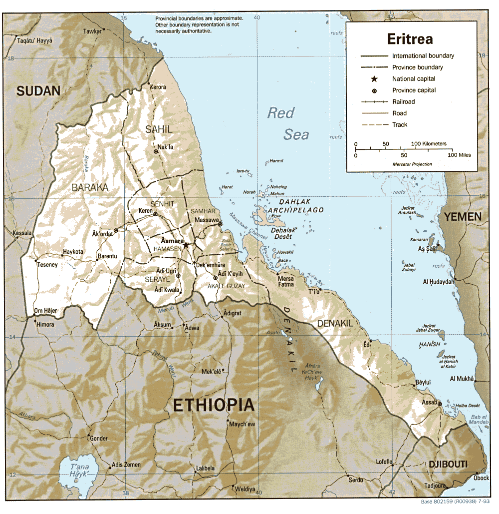
Another open question concerns the especially in the past highly disputed border between Yemen and Eritrea: Apart from the fact that I do not even know exactly how and if this dispute is definitely resolved, are there any islands closer to a continent they do not belong to politically (for example: If these islands belong to Yemen (which I believe), is there any of these islands that is closer to Africa than to the Asia/Arabian Peninsula? If yes, at least Yemen would not only be a country with non-contiguous territory on several countries because of its (undisputed and) big island Socotra, but also because of (some of) its islands in the Red Sea.
Tectonic consideration: Two major tectonic plates, the African Plate and the Arabian Plate have a common boundary in this area, maybe this would help to decide the border between the continents.
A good map for an overwiev (at least in regard to Socotra) can be found here: http://upload.wikimedia.org/wikipedia/en/4/4b/World-map-2004-cia-factbook-large-2m.jpg. Another map in regard to the island between Yemen and Eritrea could be found here: http://www.lib.utexas.edu/maps/middle_east_and_asia/yemen_pol_2002.jpg and here: http://www.lib.utexas.edu/maps/africa/eritrea.gif. Unfortunately, I could not find other maps that display the area in question larger.
-- Citylover 18:02, 8 September 2005 (UTC)
See the section on countries in both Africa and Asia, where I added a clarification on the boundary in the
The geographical border between Russia and the United States
A similar "problem" like the border between Yemen and Eritrea is the border between
Actually, I added an entry for the boundary between Asia and North America. Although the Near Islands at the west end of the Aleutian Islands are associated with Asia and make the United States a transcontinental country without having to look to Hawaii or overseas possessions, I doubt that only having 47 residents of Alaska in Asia according to the 2000 census would justify the trouble of adding a table, yet alone the heat that it would draw. For anyone who's curious, that would be approximately 1.19*10-2% of the area and 1.67*10-5% of the population of the 50 states in Asia. Taking Hawaii into account, 0.30% of the area and 0.43% of the population of the 50 states are in Oceania. Heff01 01:56, 4 January 2007 (UTC)
The Near Islands being associated with Asia and making it possible to credit the United States with a presence in Asia today is the same reason that the Japanese Empire cannot be credited with a North American presence, since these are the only islands currently belonging to any of the 50 states that it ever occupied. Heff01 01:33, 26 January 2007 (UTC)
St. Lawrence Island in the northern Bering Sea is part of Alaska, but it could be counted as Asian or North American. It actually is closer to the Russian mainland than the remainder of Alaska, and if it is counted as Asian, 1,792 km2 of US land and 1,292 Americans shift from North America to Asia. Heff01 20:06, 7 March 2007 (UTC)
Palau
As far as
A good map for an overwiev can be found here: http://upload.wikimedia.org/wikipedia/en/4/4b/World-map-2004-cia-factbook-large-2m.jpg.
-- Citylover
Australia
As far as
A good map for an overwiev can be found here: http://upload.wikimedia.org/wikipedia/en/4/4b/World-map-2004-cia-factbook-large-2m.jpg.
-- Citylover
New Zealand
In the case of New Zealand, if the Ross Dependency, the area on Antarctica and the island belonging to the part of Antarctica claimed by New Zealand like for example Ross Island, the Balleny Islands (with their three main islands Young Island, Buckle Island and Sturge Island and several smaller islands like Row Island, Borradaile Islands, Sabrina Islet, The Monolith), Scott Island, and Roosevelt Island is considered being part of New Zealand, New Zealand is also a country with non-contiguous territory on several continents (Oceania and Antarctica). However, if the area on Antarctica and the islands belonging to the part of Antarctica claimed by New Zealand (the Ross Dependency) is not considered being a part of New Zealand, then it becomes unclear if New Zealand is a country with non-contiguous territory on several continents or not. In the latter case, like in the case of South Africa, one would have to decide if some of the islands of New Zealand are (by distance or by tectonic borders) close enough to Antarctica to be considered as Antarctican what would mean that New Zealand would be a country with non-contigous territory on several continents. Especially Campbell Island or the southernmost rock of the rocks that surround Campbell Island, Jacquemart Island could be considered as the decisive landmark to measure the distances (to Antarctica and New Zealand/Oceania) from. Another question might arise here if New Zealand can be considered as the "mainland" of Australia/Oceania or if only Australia is the mainland of Australia/Oceania (see also the article Oceania about the definition of Oceania).
Tectonic consideration: In the area south of New Zealand, there are three tectonic plates, the Antarctic Plate having a common boundary with the Australian Plate in the West and with the Pacific Plate in the East, maybe this would help to decide (but in my opinion, tectonic plates should not be much less important than distances)).
A good map for an overwiev can be found here: http://upload.wikimedia.org/wikipedia/en/4/4b/World-map-2004-cia-factbook-large-2m.jpg.
-- Citylover 18:02, 8 September 2005 (UTC)
- From a New Zealand viewpoint, the Campbell, Auckland and Antipodes Islands are always considered to be an outlying part of Antarctica and are referred to as such. It is for that reason that I have added them to the list on this article. In the case of Campbell Island, at 52°35'S, it is at virtually the same latitude as Heard Island (53°06' S) and a comparable latitude to Bird Island, South Georgia (54°S), and considerably further south than any of the French Southern territories (other than those in abeyance due to the Antarctic Treaty), the southernmost island of which is at some 49°S. The Antipodes Islands and Auckland Islands (at 49°45'S and 50*45'S respectively) are also further south than this. Grutness...wha? 12:48, 23 December 2006 (UTC)
I find it hard to buy the Campbell, Auckland and Antipodes Islands being considered Antarctic islands. Although the Antarctic Treaty System uses 60°S latitude as the defining line south of which all land claims are held in abeyance, latitude alone is not sufficient to classify New Zealand's outlying islands correctly as belonging to Oceania or Antarctica. Although the island groups in question are slighly farther south than the French Southern territories, the latter are closer to Antarctica than Africa, the closest populated continent (1,520 miles to the NW versus 1,320 miles to Antarctica.) The measurements that I obtained for Campbell Island are 415 miles to South Island and 1,190 miles to Mawson Peninsula, the closest land on the Antarctic mainland.
That sounds to me like New Zealand's island groups north of 60° clearly belong to Oceania. New Zealanders considering them Antarctic may be somewhat of a cultural bias, since very few have been to their southern islands, the majority live on North Island, and their tendency may be to distance such islands without permanent habitation away from "metropolitan" New Zealand and with the unhabitated continent to the south. I do not consider New Zealand a transcontinental country, but this matter remains open for debate. Heff01 10:16, 27 December 2006 (UTC)
The measurements for South Georgia are 910 miles from the Antarctic Peninsula and 1,115 miles from Argentine land on Tierra del Fuego. Although I consider the Falkland Islands South American, that is not intended to buttress Argentina's claims to British-owned islands to its east. Heff01 16:55, 27 December 2006 (UTC)
Whether New Zealand's southern outlying islands are viewed as Oceanian or Antarctic can depend on what reference point is used for Oceania. Using South Island places them clearly in Oceania, but using Tasmania results in a tie and using the Australian mainland places them in Antarctica. I feel that they should remain on the page as disputed, along with the South African Prince Edward Islands. Heff01 20:21, 22 January 2007 (UTC)
- They are definitely regarded in New Zealand as Antarctic and always referred to as "New Zealand's subantarctic islands". Distances to different places is largely irrelevant - by the same guideline you could say that Frobisher Bay is no more Arctic than Stockholm, or that Sardinia is part of Africa and not Europe. The more important differences are in landform, vegetation, and climate. In the case of the South Island, the climate is largely modulated by northwesterly and southwesterly winds coming off the relatively warm waters of the Tasman Sea. For the small island groups mentioned, this does not happen, the climate being modulated entirely by Antarctic currents. In terms of landform and vegetation, this means that whereas the South Island is (or at least was) dominated by southern beech temperate rainforest, islands like the Auckland Islands -though they have some beech forest - mainly low-lying scrub and megaherb ground cover. Grutness...wha? 03:16, 23 February 2007 (UTC)
Turkey, Russia, Egypt and Panama
First of all, Turkey, Russia, Egypt and Panama are considered "ordinary" bicontinental countries because most of their the territory is comprised of one single mainland on two continents (in the case of both Turkey and Russia, the majority of the mainland is Asian, the minority European).
Turkey and Russia:
Because of the fact that Turkey and Russia have maritime boundaries on two different continents, it is also very likely that they have (at least very small) islands along these seashores. Indeed, not only Russia (where it is clear anyway, for a better overview about Russia, see also http://upload.wikimedia.org/wikipedia/en/4/4b/World-map-2004-cia-factbook-large-2m.jpg.) but also Turkey have at least one bigger island on their European part (for a map of Turkey, see http://upload.wikimedia.org/wikipedia/en/6/61/Turkiyemap.gif. There, you can see a quite big Turkish island West of Cannakale (southwest of Istanbul)). Therefore, Turkey and Russia are not only bicontinental countries in a classical sense like landlocked countries like [[1]], but Turkey and Russia are also countries with non-contiguous territory on several continents.
Egypt and Panama:
The same applies to Egypt and Panama: Because of the fact that both countries have a mainland on two different continents and both parts are not landlocked, both parts must also have islands. Therefore, both countries should be considered countries with non-contiguous territory on several continents. In the case of Panama, there is the further complication that there are different versions of the border between the Americas (see below). -- Citylover 09:21, 9 September 2005 (UTC)
Caribbean (Venezuela, Colombia, Bahamas, Panama)
Several countries in or near the
I have added the Wikipedia map for
Georgia (country) and Azerbaijan
A similar case, similar to the case of Turkey and Russia mentioned just above, is Georgia (country) and Azerbaijan but with the complication that it depends on the definition of Europe and Asia. With line B taken as the definition between Asia an Europe (see map, http://en.wikipedia.org/wiki/Transcontinental_nation#Europe_and_Asia), Georgia (country) and Azerbaijan are completely Asian, so there would be no difficulties. With line C taken as the definition between Asia and Europe, the case would already become more complicated: Georgia (country) would be a bicontinental country with a mainland on two different continents and non-contiguous territory on one of those two continents, Asia (because of the Asian islands Georgia might have in the Black Sea). Azerbaijan would also become a bicontinental country with two different mainlands (Asia and Europe) but since both mainlands would not be landlocked and have a maritime boundary (and very likely some islands), Azerbaijan would become a bicontinental country with non-contiguous territory on several continents and islands on two different continents very close to the mainland (similar to Russia). With the defining lane generally chosen by this article, the situation for Azerbaijan would remain the same (except the line being further in the South), but Georgia would only now become a bicontinental country with non-contiguous territory on several continents, due to the fact that it has a mainland on two different continents and a seashore on both mainlands. (in the case of Armenia, these considerations are unnecessary because Armenia is completely landlocked anyway). -- Citylover 09:21, 9 September 2005 (UTC)
Indonesia
Indonesia, lies not only on the Asian continent, but also on the Oceanian continent, regardless of the line that defines the border between Asia and Oceania (the Wallace line or the Melanesian definition, see http://en.wikipedia.org/wiki/Transcontinental_nation#Asia_and_Oceania). If the definition of the Wallace line applies to Indonesia, according to this arcticle, 60.84 percent of the Indonesian area is Asian (while 39.16 percent of the Indonesian area is Oceanian) and 87.3 percent of the Indonesian population lives in Asia while 12.7 percent of the Indonesian population lives in Oceania. If the definition of the Melanesian line applies, even a bigger percentage of the area and population is Asian and an even smaller percentage of the area and population is Oceanian. Nevertheless, even if the Melanesian line applies, Indonesia is still a country (at least by area) that has no clear mainland nor a very small percentage of population and especially area on just one single continent. So, Indonesia is actually a special case, a bicontinental country with a mainland (or - in the case of Indonesia, one could also argue that it has no mainland or several mainlands) on two continents.
Tectonic consideration: As already mentioned in the discussion here, the
- I speak from the Wallace line hardly matters here, it seems, and few actually know about its existance.--Huaiwei11:57, 12 October 2006 (UTC)
Russia and Europe
Seeing that Russia is given as an example of a transcontinental nation, a note should be put somewhere that in Russia 'Europe' is not considered as a continent at all, so the Russians don't consider their own country to be transcontinental, but entirely contained on the Eurasian continent. Seabhcán 12:45, 22 November 2005 (UTC)
Georgia (country) and Azerbaijan inaccuracies and inconsistencies
In the article it is claimed in one section ("Europe and Asia") that "The majority of Georgia's and Azerbaijan's populations live in Europe, and two-thirds of the Georgian territory and a little less than half of Azerbaijan's territory are in Europe. However, they are often excluded today from lists of European states (unlike Russia and Turkey, with proportionally less European territory and population)." However in another section ("Countries in both Asia and Europe") it is then stated that "Azerbaijan - according to most definitions which consider the Caucasus as the Europe-Asia boundary, this country has a relatively small portion in Eastern Europe but lies mostly in SouthWestern Asia." and "Georgia is geographically almost completely (except for a small section at its northern border that lies north of the Caucasus watershed) in Asia according to virtually all major geographic authorities such as the National Geographic Society and the CIA World Factbook. However, for the purpose of this study, it is considered to be divided between both." and the Statistics section has 70% of Georgia and 45% of Azerbaijan being in Europe (even though directly above that section the article states that most of Georgia is in Asia)! Now how can the majority of Georgia's and Azerbaijan's populations live in Europe if most of Georgia and Azerbaijan are geographically in Asia? The line drawn on the map for both countries is incorrect (and the possible source of this inconsistency) since the Caucasus watershed boundary (which is the boundary used in the article) and the peaks of Caucasus are pretty much one and the same. The Caucasus mountains do not run south of Baku and most maps have the line for the watershed following the high points of the mountain range and just managing to go into or south of Baku. If this were reflected in the article then the Europe-Asia boundary would closely follow the Georgia-Russia border and only be slightly south of the political border (basically following the line of the mountains within Georgia). Unless most of Georgia's population is located in this mountainous area directly along the border, then the first statement in the article in incorrect. These inaccuracies (both in the text and the map) need to be cleaned up. As for the Statistics section, it needs to be recalculated, but I would roughly estimate (using the line along the mountains that is drawn by most geographical societies and maps) that around 10% or less of Georgia is in Europe and around 20% or less of Azerbaijan is in Europe.
— Preceding unsigned comment added by 72.27.10.54 (talk) 18:52, 18 December 2005 (UTC)
Transcontinental empires in history
For the colonial era empires: 1)why are the various claims in Antarctica not included? and 2) which territory in South America did the United States ever possess? Shouldn't the United States possessions be listed as spanning 3 continents (North America, Asia and Oceania)? — Preceding unsigned comment added by 72.27.10.54 (talk) 18:59, 18 December 2005 (UTC)
Portugal did have territories in North America: Terra Nova and Lavrador. They have been clamed: see Cantino and Walldseemuller maps for example. This is not cited in the transcontinentalty of empires. —Preceding unsigned comment added by Câmara (talk • contribs) 19:56, 23 May 2006 (UTC)
I have since added North America to the Portuguese Empire's credit, included Antarctic island possessions north of 60°S and thus recognized by the Antarctic Treaty System, and listed the US as spanning North America, Asia and Oceania. The only technically South American territory that the US ever possessed was the east side of the Panama Canal Zone. Heff01 20:00, 7 March 2007 (UTC)
Recent edits by DLinth, User:24.161.41.93, User:4.155.87.40, User:61.59.83.208, User:169.253.4.21 and User:4.155.250.113
I have to say that I find the edits on articles relating to
- Yes; these WP:POV edits are irksome. E Pluribus Anthony23:23, 6 January 2006 (UTC)
- Yes; also I have seen the same repeated in Geography of Europe. So maybe it is happening at Geography of Asia too. Alinor 13:16, 7 January 2006 (UTC)
- They are really annoying, yes. —Nightstallion (?) 20:06, 7 January 2006 (UTC)
- Great – I'm glad I'm not alone: I was starting to wonder if I was being 'petty'. And what if he persists? E Pluribus Anthony 20:35, 7 January 2006 (UTC)
American Empire
I've changed the alias used for the link to the article "American Empire" since by historical definition, there is an American Empire and to call them "American Possessions" would be incorrect in two ways. Firstly, they would be "United States Possessions" or "Possessions of the United States of America" or b) The same type of empire that Great Britain, Germany, France or any other nation in the world with such "possessions". On top of that, the article of which it links to is called American Empire. Why would one call them possessions?
I wouldn't consider it politically incorrect, especially in historical context, to call it such. Andem 10:16, 23 January 2006 (UTC)
Accuracy of border between Asia and Europe in Russia
I wonder - how could it be happen, when accuracy was setted as high, when administrative border of in huge parts of Svedlovsk and Chelyabinsk provinces located in over 200km to west of line of watershed. And almost 130km in Yamalo-Nenets AD. Those borders located on plain in Europe. It measn population of European part population lost several millions and over 45 thous sq km of area. Elk Salmon 13:16, 12 February 2006 (UTC)
- this taken into account in the numbers. That is why the accuracy (relative) is set to high.
- explain please. i see it should be medium - high.Elk Salmon 01:08, 6 March 2006 (UTC)
Total Objection
In reading some of the examples given, it is incredibly odd to define such countries as Colombia (a South American country), Italy (definitely European), Portugal (European), Spain (European), Venezuela (South American), Yemen (Asian), and Iceland (European) as being bicontinental countries.
Greece may be considered, since it has islands that are located close to the defined continent of Asia, however, France? No way. Colonization may have brought in overseas departments, but along those lines, you could define the United States also as an Asian country (with dependencies in the South Pacific), as well as a European country (with sovereign property in many of the European countries).
Where does it end? Rarelibra 22:53, 28 March 2006 (UTC)
- Spain has enclaves in Morocco, and the Canaries are on the African continental shelf. Anorak2 10:50, 4 April 2006 (UTC)
- PS: The USA has no sovereign territory anywhere in Europe. Anorak2 11:09, 4 April 2006 (UTC)
- Italy presumably is called African on account of Lampedusa, Portugal for the Azores; Yemen for Socotra; there are similar islands off of Central America for Columbia and Venezuela. All these islands are integral, as are Ceuta and Melilla for Spain. Denying the existence of these would be like not calling Hawaii part of the United States. Septentrionalis 22:31, 4 April 2006 (UTC)
Transcontinental nation or country
If this article is about countries belonging to more than one continent, as the definition says, shouldn't it be titled "transcontinental country". A nation (and therefore a transcontinental nation) is something different. Nurg 07:29, 22 July 2006 (UTC)
Agreed. Let's take a poll but make it complicated and have three choices... - AjaxSmack 01:50, 17 August 2006 (UTC)
- The following discussion is an archived debate of the proposal. Please do not modify it. Subsequent comments should be made in a new section on the talk page. No further edits should be made to this section.
The result of the debate was move to
Requested move
Transcontinental nation → Transcontinental state or Transcontinental country – Article deals with states/countries, not nations .
Survey
Option 1: Keep page at Transcontinental nation (i.e., Oppose Move)
Add "* Support" followed by an optional one-sentence explanation, then sign your opinion with ~~~~
- Support. See no reason to change. Septentrionalis 17:03, 21 August 2006 (UTC)
Option 3: Move page to Transcontinental state
Add "* Support" followed by an optional one-sentence explanation, then sign your opinion with ~~~~
- Support as nominee. - AjaxSmack 01:50, 17 August 2006 (UTC)
Option 3: Move page to Transcontinental country
Add "* Support" followed by an optional one-sentence explanation, then sign your opinion with ~~~~
- Support as nominee. - AjaxSmack 01:50, 17 August 2006 (UTC)
- Support. Of the redirect pages this has most links. Alinor 08:48, 21 August 2006 (UTC)
- Support. There is a difference between nation and country acc to Wikipedia, and this deals with the latter. Nurg 09:29, 21 August 2006 (UTC)
- Per Nurg. —Nightstallion (?) 08:18, 22 August 2006 (UTC)
Discussion
Add any additional comments
- The above discussion is preserved as an archive of the debate. Please do not modify it. Subsequent comments should be made in a new section on this talk page. No further edits should be made to this section.
Fatimid Caliphate
I greatly expanded the list of transcontinental empires and subsequently determined that the Fatimid Caliphate covered three continents, since it controlled Sicily, associated with Europe over the past millennium, although in past ages it was also associated with northern Africa, particularly during Carthaginian and Islamic rule. Heff01 01:44, 9 October 2006 (UTC)
The Fatimids also controlled Sardinia at their peak. Heff01 01:31, 22 December 2006 (UTC)
Transcontinental confederations
Two of the pre-colonial examples of transcontinental empires were actually better considered transcontinental confederations. The
I have added
There was a Navarrese Empire with outposts and coastal exploration of
Yemen and Socotra
I added
It is also noteworthy that as the
The previous figures for Yemen's African portion only included the island of Socotra proper and not the other islands in the archipelago known as "The Brothers." I corrected this in the tables when I discovered the area for Abd al Kuri in its Wikipedia article, as well as its area and the Samha figures here [3]. Heff01 01:49, 30 June 2007 (UTC)
Crusader kingdoms and occupations
The Angevin Empire largely led some Crusades, particularly the Fifth Crusade, and placed Norman princes in control of the Principality of Antioch, Kingdom of Jerusalem, Kingdom of Cyprus, Kingdom of Sicily (including the southern Italian mainland,) and Malta. It was at its peak early in the reign of Richard I of England, controlling England, the majority of France, most of Ireland, neighboring parts of Scotland and Wales, and the aforementioned overseas dependencies.
The Wikipedia map of Norman possessions [4] reflects early Norman involvement in the
![[4]](https://en.wikipedia.org/wiki/Image:Normans_possessions_12century-fr.png)
After most of the French vassals of
See also Siege of Damietta
Actually, the
Peter of Courtenay had been crowned Latin Emperor in Rome and attempted to claim the vacant throne in 1217, but was taken prisoner by
The Angevin Empire was the successor to the Norman Empire from 1135 to 1214 as a result of
The
02:34, 23 February 2007 (UTC)The Angevin Empire was already disbanded by the time of the Crusader occupation of the Nile Delta, but despite its lack of African mainland presence, it had African island possessions in Malta, Pantelleria, and the Pelagie Islands. The forces in the Fifth Crusade invasion of Egypt were mainly German and Netherlandic and no particular empire could claim their occupations. 65.54.154.144 06:23, 28 October 2007 (UTC)
Srivijaya and Madagascar
The Empire of
If the powers-that-be can accept ancient ocean crossings and permanent settlements from the Malay Archipelago to Madagascar, why can't they accept the possibility of the same to the New World from across its oceans? Apparently in the case of Madagascar, they were forced by the overwhelming linguistic evidence to acquiesce, but the resistance is strong for transatlantic and transpacific contacts with the New World. Much knowledge and records of the matter was destroyed by the Inquisitions.---Heff01 20:02, 11 November 2006 (UTC)
Question
Is there a difference between a transcontinental country and a transcontinental state? Atabata 01:03, 16 November 2006 (UTC)
No. It's only a matter of semantics. Heff01 01:17, 20 November 2006 (UTC)
Actually, Wikipedia defines the terms differently and transcontinental states are a subset of transcontinental countries. A transcontinental state, as used in the article, has to have either contiguous land on a continent neighboring the one on which the country is based or nearby islands associated with a neighboring continent. Heff01 17:58, 11 May 2007 (UTC)
This article sustain that timor est belongs to oceania, while the eas timor articl substain it belongs to Asia; Mac9
— Preceding unsigned comment added by 205.223.229.203 (talk) 13:35, 17 November 2006 (UTC)
Long, dubious, nonsenses
Whay this article cannot be short, saying this and that country clearly spans over two continents? Why does it need to include every single dubious (admitting it) calculations? Why does it need to rehash articles on geography and continents? What is "Norse Empire"? Who the heck had invented "Courlander Empire"? How did teeny-tiny, private, unprofitable and shortlived Swedish colony in Delaware turn the chronically poor Baltic country into multi-continental power? 90% of the article could be safely omitted as redundant, invented here or garbage. Pavel Vozenilek 05:18, 19 November 2006 (UTC)
This criticism is nonsense. This article is about a subject of which there are many examples. I added the Norse Empire to reflect the
Swedish and Seljuq Empires
I have credited the
Actually, although Sweden overran the Duchy of Courland at home, their Dutch allies took Tobago, so I removed South America from the Swedish Empire's list. Heff01 16:25, 11 June 2007 (UTC)
Norwegian Empire
I noticed that my initial entry of "Norse Empire" was replaced by "Danish-Norwegian Kingdom." Actually,
That was the medieval Norwegian Empire and the modern Norwegian Empire came into existence with the annexation of the Svalbard archipelago in 1920 and became transcontinental when it annexed Bouvet Island in 1927. This island is remote and much closer to Antarctica than Africa. I want to see how this entry goes over before I consider counting Antarctica for other nations. The Earth below 60°S latitude is terra nulius with all land claims held in abeyance according to the Antarctic Treaty System, so only island claims above this line should count for the sake of this article. Heff01 22:43, 29 November 2006 (UTC)
See also:
Unfortunately, the only map that I could find of Norway's medieval possessions in North America was a map including all Viking possessions and not demarcating Norway from Danish and Norman territories. If someone finds a map demarcating Norway, please replace the link.---Heff01 00:59, 10 February 2007 (UTC)
I found such a map link of the Norwegian Empire by itself, including Greenland, and kept the previous map link, since it includes the lands in present-day Canada, while the new one does not. Heff01 02:17, 19 April 2007 (UTC)
Subantarctic island territories
The following are sub-Antarctic island territories north of 60°S latitude and associated with Antarctica:
Norway: Bouvet Island
British Empire: South Georgia and the South Sandwich Islands (Falkland Islands are associated with South America)
French Empire:
Australia: Heard Island and McDonald Islands, Macquarie Island ---Heff01 02:10, 12 December 2006 (UTC)
- Also:
- New Zealand: The Campbell Island group.
- See my comment at 12:56, 23 December 2006 (UTC)
Strongly suggest revision of the boundary of Europe to common definition
For some reason, we are using a definition of the eastern boundary of Europe that was, as far as I can tell, invented by a Wikipedia user. The edit was made on July 6, 2005 by a user at 62.204.151.1
I see DLinth, from early December of last year through late January of this year, tried to edit this properly, but he appears he lost an editing war to more (wiki-)experienced and persistent folks. Check out his edits for some solid comments.
I'll split my discussion into two parts. One, how we get from the Arctic to the Caspian Sea, and second, how we get from the Caspian Sea to the Black Sea.
The standard geographic definition of the first part is:
1) The watershed borders that follow the crest of the Ural mountain chain, from the Arctic Ocean on south to the edge of the Ural river watershed.
2) From that point (the border of the Ob, Volga, and Ural river watersheds) to the headwaters of the Ural.
3) Along the length of the Ural river to the Caspian Sea
The only one of those lines that is not completely geographically defined is line #2. In reality it is a short distance since the headwaters of the Volga are very near the border of the watershed. (See http://earthtrends.wri.org/images/maps/p2_63_lg.gif)
The only solution that completely removes this ambiguity would be to never leave watershed boundaries; that is, to follow either the eastern or western edge of a watershed all the down to the Caspian. If I were in charge of defining continental borders, that is how I would define it (probably by following the eastern edge of the Volga watershed). But the fact of the matter is that it is not the place of an encyclopedia to suggest such a new definition. The standard definition, using the Ural river, has very little ambiguity and is entirely geographically (i.e. non-politically) based.
The definition we are using, by contrast, is
1) "the eastern side of the Ural mountains".
2) From "the eastern side" to the headwaters of the Ural
3) Along the Ural river "until the Mugodzhar Hills"
4) From that point on the Ural to (the headwaters of the?) Emba.
5) Along the Emba to the Caspian Sea.
Part (1) is extremely ill-defined; where does a mountain start? Watershed boundaries are, by contrast, precise. Our current definition requires a preceise delineation of the eastern border of the entire length of the Urals. This is not a straight line, and it must be invented for this purpose. This alone is enough of a reason to reject the current definition, but in the interest of completeness I will continue.
Part (2) suffers from the same problems as part (2) of the standard definition, but by comparison to the other problems this approach has, this is not a big deal.
Part (3) is again, very poorly defined. When do we stop following the Urals? Where do the hills begin?
Part (4) - Again, this is ambiguous. Are we using a straight line? The headwaters of the Emba are not adjacent to the Ural.
All in all, this definition constitutes uncited, original work, and should be scrapped in favor of the standard geographic definition.
The second part of the path is from the Caspian Sea to the Black Sea. The standard definition is:
1) The watershed borders that follow the crest of the Greater Caucuses mountain chain
You really can't get much more simple than that. There's a reason this is the standard definition. By contrast, the definition in the article is:
1) Along the Kura River
2) From the Kura River to the Surami passage
3) Along the Surami passage
4) From the Surami passage to the headwaters of the Qvirila river
5) Along the Qvirila river to the Black sea
Basically, all the problems I mention above for the jump from the Ural river to the Emba river apply just as well to the jump from the Kura River to the Qvirila river. We don't know when to stop following the Kura (which flows all the way to Turkey), how to get the Surami passage, how to move along the Surami passage (which is perpendicular to watershed boundaries), and how to get from there to the Qvirila river headwaters. Again, it's a mess.
The only drawback to gettig rid of the current definition is that we need to draw a new map. Any volunteers? Atarr 18:53, 14 December 2006 (UTC)
- OK, I did a little research and I found, in the archives, both an accurate map:
http://upload.wikimedia.org/wikipedia/en/archive/a/a6/20050206084016%21TransAsia.PNG
... and an accurate table of area:
http://en.wikipedia.org/w/index.php?title=Bicontinental_country&oldid=8808046
So... unless there are objections, I will go forward with the edit to match the common definition within a few days. —The preceding ) 21:09, 14 December 2006 (UTC).
- OK, I did a little research and I found, in the archives, both an accurate map:
- Thanks to Zé Carioca for a nice summary of alternate definitions (including the one that I replaced). I think the section, overall, is a lot stronger than it was before. - Atarr 17:31, 16 December 2006 (UTC)
American Empire and Panama
This article uses the Panama Canal as part of the boundary between North and South America, and the American Empire controlled the Panama Canal Zone from 1903 to 1979, ergo it had a foothold in South America. Heff01 06:30, 18 December 2006 (UTC)
- Fair enough. It's highly debateable whether (a) this is the generally accepted definition of the border, and (b) it is significant enough to merit the USA being considered transcontinental when, say, Hawaii is not enough by our standards. But it's arguable, due to the strategic significance of the canal. Does anyone else have an opinion on this? -- Atarr 16:57, 18 December 2006 (UTC)
Actually, the USA is properly listed as being a colonial-era nation with non-contiguous overseas possessions, of which the Panama Canal Zone was one and Hawaii remains one, as well as the 50th state of the Union. The United States continues to control American Samoa, Guam, the Northern Mariana Islands, and the United States Minor Outlying Islands to this day in Oceania. Heff01 00:35, 9 January 2007 (UTC)
The Northern Mariana Islands are now in a commonwealth with the USA. Heff01 03:51, 26 February 2007 (UTC)
Australian external territories
Australia's external territories include not only the uninhabited Heard Island and McDonald Islands, but also the inhabited Norfolk Island in the Pacific and the Cocos (Keeling) Islands and Christmas Island in the Indian Ocean, both of which are associated with Asia. Heff01 16:06, 18 December 2006 (UTC)
- Firstly, consider this statement at the top of the article: "Non-contiguous parts of countries are not considered (i.e. distant integral parts, extraterritorial possessions, dependencies and the like – examples include French Guiana, Hawaii, and Ceuta and Melilla)." These distant islands constitute an incredibly tiny fraction of overall Australian territory/population/wealth, and as such do not in and of themselves merit consideration of Australia as a transcontinental state.
- Moreover, none of these territories qualify as imperial posessions. Please take a look at the definition of an empire. These islands have no native populations that desire self-government. They were all unpopulated until they were colonized by westerners (and African/Polynesians that came along with them). Australia has never been considered a colonial empire. If you want the article to reflect the opposite opinion, please provide a scholarly reference that cites Australia in this way.
- That said, Australia's pre-treaty claims on Antarctica were significant in scope, so I will leave that part in. -- Atarr 16:53, 18 December 2006 (UTC)
I revised the article using the official name of the "Commonwealth of Australia" and describing what it consists of. The couchsurfing.com and answers.com websites both list the locations of the Cocos (Keeling) Islands and Christmas Island as "Southeastern Asia." The population of Christmas Island is circa 1,493 and of the Cocos Islands is circa 628 for a total of circa 2,121 Australian residents on Asian islands. Heff01 22:27, 20 December 2006 (UTC)
The Commonwealth of Australia is a modern nation, but not an empire, with non-contiguous overseas possessions and is now where it belongs in the list. Heff01 22:30, 20 December 2006 (UTC)
Abbasid Caliphate
When the
Two large suggestions:
1) Eliminate all the texts with discussions of how the estimates were derived. They can be stored here on the talk page or on a sub-page, but they seem irrelevant for the purposes of a main encyclopedia article.
2) Alphabetize the empire list at the end. Atarr 17:35, 28 December 2006 (UTC)
I am strongly in favor of maintaining the empire list in chronological order, which is the manner the
- OK, sounds good. What about the other suggestion? Atarr 23:08, 3 January 2007 (UTC)
I believe that knowing how the estimates are derived is a key part of the article text if their credibility is to be maintained. A thorough job has been done in order to document these. I would prefer the status quo, but would wonder how a sub-page would work. Heff01 04:12, 5 January 2007 (UTC)
Is today's Japan transcontinental?
In addition, there are the
Spain and Portugal in a new table
Apparently Spain and Portugal have been added to the table of nations in both Europe and Africa. I had shied away from adding this out of uncertainty over whether the total area and population figures of these two nations include the Canary Islands and Madeira Islands, respectively. Now I need to know whether Wikipedia's national totals include these. Heff01 00:32, 25 January 2007 (UTC)
Yes, I did that. I am a registered Italian Wikipedia user, I found data for
Armenia, East Timor, Aruba, and Trinidad and Tobago are also included for clarification purposes, although each of them is also entirely associated with one continent. Although they are not transcontinental countries by the Wikipedia definition, their inclusion in the charts reinforces where the boundaries are. Heff01 15:25, 25 January 2007 (UTC)
Rashidun Empire
The map link that I included for the
Chinese concession zones
Would the Chinese
Apparently Austria doesn't need the Tianjin concessions to have had a presence in Asia. From 1719 to 1732, the
Proper entry for Chile
I removed the new entry for Chile in the list of countries that "could all be considered transcontinental, solely by virtue of the fact that an integral part of their national territory consists of islands that are situated within the continental shelf of another continent or are otherwise geographically closer to another continent than the mainland." Although it controls Oceanian islands, these are not associated with an actual continent. This is the reason that you won't find Chile properly on the aforementioned list, along with Japan and Indonesia, but you will find these three nations on the list of countries that "might be considered transcontinental, as occupying land in both Oceanian islands and a continent." Also, Chilean Antarctic territories should not count, since they are held in abeyance according to the Antarctic Treaty System. Heff01 20:14, 7 March 2007 (UTC)
Getting the Turkey figures right
Having
The following are Asian districts of Istanbul:
20:24, 7 March 2007 (UTC)It has been 1 1/2 months since I e-mailed the Istanbul mayor's office requesting area and population figures for the city's Asian districts. I've received no response, which may be due to the fact that Turkish people tend to be suspicious of the intentions of outsiders doing documentaries on their nation. Heff01 18:37, 23 April 2007 (UTC)
Finally I've had some real luck with the population numbers! I found a link to a Turkish-language Excel page in Wikipedia's Imbros island article. [5] Since Turkish uses the Western numeral system, it is obvious which numbers in the table, which is broken down by provinces and districts, should be used as the 2000 totals without being at all fluent in Turkish. It is also obvious by context that "toplam" means "total" in English. The Çanakkale numbers are 65,030 European and 399,945 Asian residents. The Istanbul numbers are 3,532,777 Asian and 6,485,958 European residents. I will modify the chart numbers for Turkey in this article and see what I can do for the area numbers. Heff01 22:36, 18 June 2007 (UTC)
- Thanks for the info Heff, sounds about right. And no, those governing offices will not give any info, not even to Turkish citizens. They are overworked and underpayed (even though theres a right to access of information now...) 81.215.13.145 07:53, 18 July 2007 (UTC)
When I e-mailed the Turkish Research Institute for the area numbers for the Çanakkale and Istanbul districts, my correspondence immediately bounced back due to a "junk filter." The real reason for this probably wasn't that it was recognized as junk, but as being in the English language. As for an alleged "right to access of information" existing, a lot of rights exist in Turkey, but only on paper, since the authorities routinely snub their noses at them. Even though Turkish people vote, their nation is still a police state. Heff01 00:41, 28 July 2007 (UTC)
- In the future, I suggest you go directly to the website of Turkish Statistical Institute, where all such data are accessible in both Turkish and English. You are also always welcome to ask for help from Turkish speaking Wikipedians listed in National Statistical Service of Greece; for Turkey, you go to Turkish Statistical Institute. I think you got the idea. Atilim Gunes Baydin12:52, 28 July 2007 (UTC)
I didn't intend to insult your country of origin. I checked the TRI website thoroughly and it has the Excel document with the 2000 populations of all Turkish districts sorted by province, but no area figures for the same. Sometimes it can be hard enough trying to find online statistical information from an English-speaking country, let alone some other countries. Patience is a virtue in this line of online research, it has been paying off for me, and hopefully will continue to do so. Heff01 12:23, 31 July 2007 (UTC)
- I've found a table with district population, surface area, and population density figures from the Turkstat website I mentioned. It can be accessed by selecting Population, housing & demography from the main menu, then Population statistics -> The Characteristics Of The Population By Provinces, 2000 Population Census -> Population Size, Age And Sex Structure -> City and Village Population, Annual Growth Rate of Population, Surface Area and Population Density By Districts. The district maps Image:Çanakkale districts.png and Image:Istanbul districts.png could also be of help for distinguishing the Asian and European sides. I wish I could help with editing the article but I'm very busy with school work right now. Atilim Gunes Baydin 12:53, 31 July 2007 (UTC)
- The url for the table is [6]. Atilim Gunes Baydin 12:55, 31 July 2007 (UTC)
- Another note which might be helpful: In the districts list in that table, the "merkez" entry (which means "center") refers to a central district of a province that has the same name with the province. E.g. there is a Canakkale "merkez" district within the Canakkale province (see Image:Çanakkale districts.png). This doesn't apply to Istanbul. Atilim Gunes Baydin 13:04, 31 July 2007 (UTC)
Thanks a lot! Mission accomplished for Turkey! Now maybe we'll have more luck with Panama, Georgia, and Kazahstan soon. Heff01 01:38, 1 August 2007 (UTC)
Çanakkale Province has 1,572 km² in Europe and 8,361 km² in Asia. Istanbul has 3,395 km² in Europe and 1,801 km² in Asia. Heff01 01:54, 1 August 2007 (UTC)
The Turkish Research Institute area numbers only include land area. I found it odd that even though the area in Europe decreased slightly, the percentage of Turkish area in Europe should increase from 3.05% to 3.07%. Then I noticed that the area in Asia was considerably smaller according to the TRI than according to Wikipedia. This is accounted for by the inductive reasoning that Turkey has thousands of square kilometres of inland lakes in Anatolia, with the giant one being Lake Van. I reflected this fact by editing the methodology for Turkey's calculations. Heff01 20:05, 2 August 2007 (UTC)