
User:Orest2000/Palestinian maqams

Galilee and Golan Heights
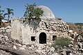
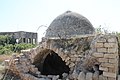
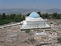
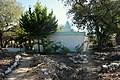
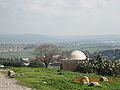
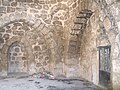
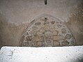
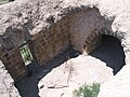
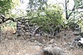
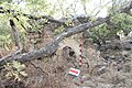
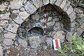
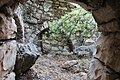
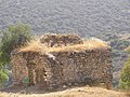
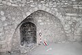
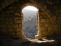
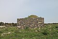
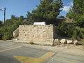
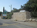
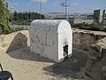
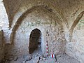
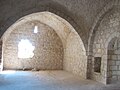
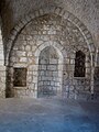
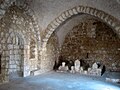
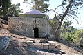
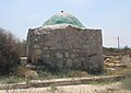
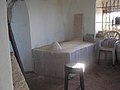
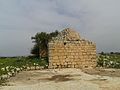
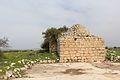
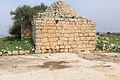
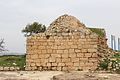
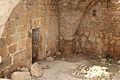
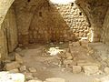
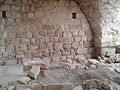
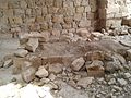
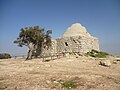
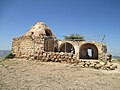
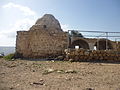
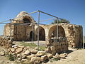
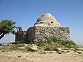
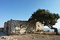
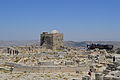
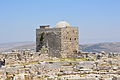
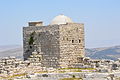
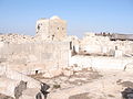
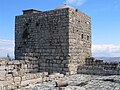
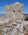
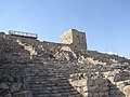
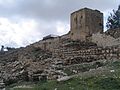
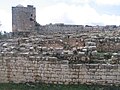
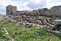
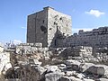
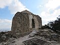
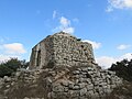
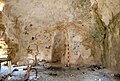
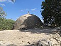
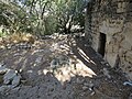
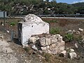
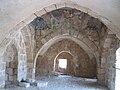
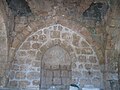
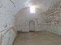
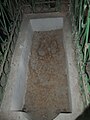
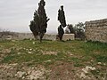
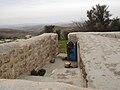
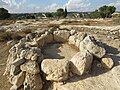
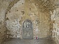
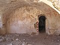
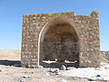
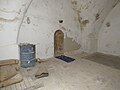
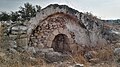
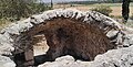
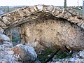
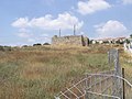
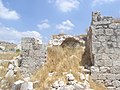
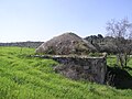
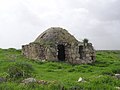
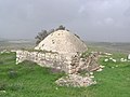
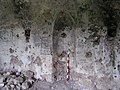
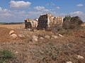
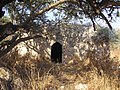
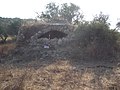
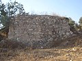
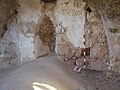
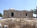
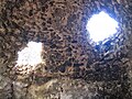
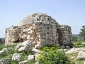
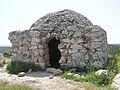
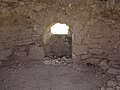
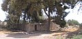
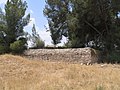
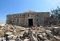
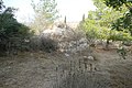
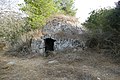
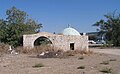
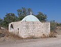
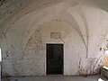
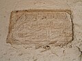
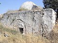
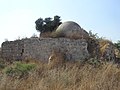
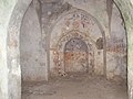
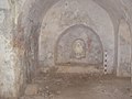
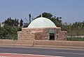
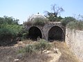
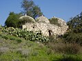
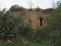
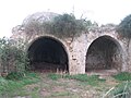
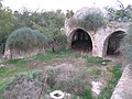
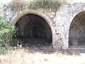
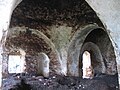
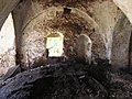
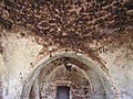
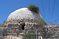
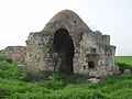
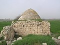
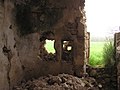
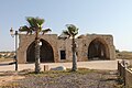
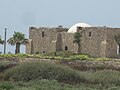
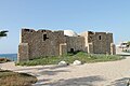
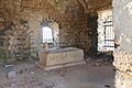
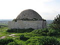
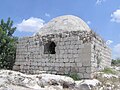
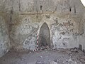
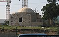
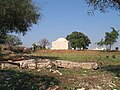
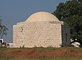
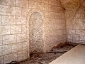
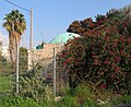
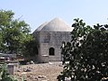
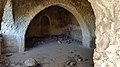
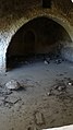
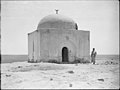
Maqam al-Khidr
33°04′41″N 35°08′36″E / 33.07806°N 35.14333°E — Al-Bassa — Shlomi, Israel
-
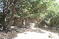
 View from the west.
 -
 View from the west.
 -
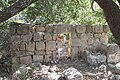
 View from the south.
 -
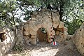
 View from the east.
 -
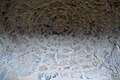
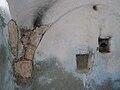
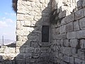
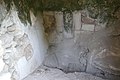
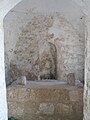
 The mihrab.


References: Khalidi 1992, 9; Petersen 2001, 111; Maqams. Galilee and the Golan Heights.
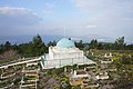
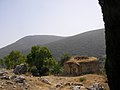
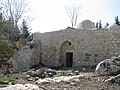
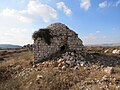
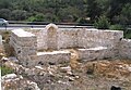
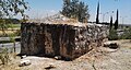
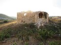
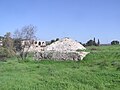
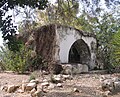
Maqam nabi Dahi
32°37′03″N 35°20′56″E / 32.61750°N 35.34889°E — Ed-Dahi
-
 View from the south.
 -
 View from the south.
 -
 View from the west.
 -
 View from the west.


References: Guérin, Galilée I, 115; Wilson 1881, II 41; Ariel 1996, 103; Petersen 2001, 226.
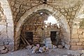
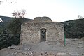
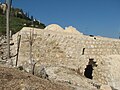
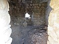
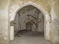
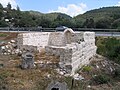
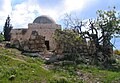
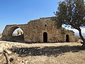
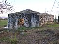
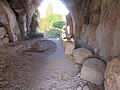
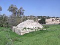
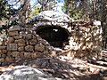
Maqam nabi Husha
32°47′29″N 35°08′34″E / 32.79139°N 35.14278°E — Hawsha
-
 View from the north-west.
 -
 View from the north.
 -
 The mihrab.
 -


.jpg)


References: Guérin, Galilée I, 415–416; SWP I, 311; Petersen 2001, 151.
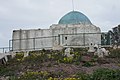
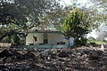
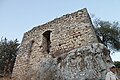
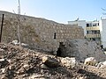
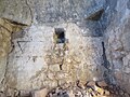
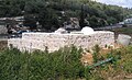
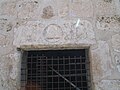
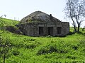
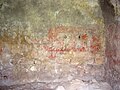
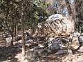
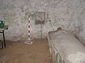
Maqam sheikh Abu Atabi
32°56′15″N 35°05′30″E / 32.93750°N 35.09167°E — Al-Manshiyya, Acre — Acre, Israel
-
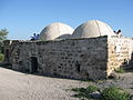
 View from the south-east.
 -
 View from the south.
 -

-
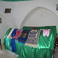
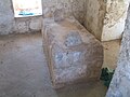
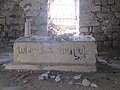
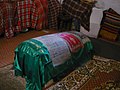 The cenotaph.
 -
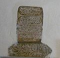 Two inscriptions of 18th century.
.jpg)
.jpg)
.jpg)


References: Pococke 1745, II 54; Mariti 1792, 332; Palmer 1881, 39; Khalidi 1992, 23–24; Sharon, CIAP I, 34–36; Petersen 2001, 65; Archaeological Survey of Israel; Maqams. Galilee and the Golan Heights.
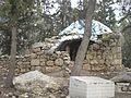
Maqam sheikh Abu al-Hija
32°50′11″N 35°15′10″E / 32.83639°N 35.25278°E — Kaukab Abu al-Hija
-
 View from the south-west.
 -
 The mihrab.
 -

-
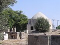
 The cenotaph.


References: Palmer 1881, 110; Petersen 2001, 196–197.
Maqam sheikh Abu Shusha
32°51′13″N 35°30′26″E / 32.85361°N 35.50722°E — Ghuwayr Abu Shusha — Migdal, Israel
-
 View from the north.
 -
 View from the south.
 -
 View from the south-east.
 -
 View from the north-west.
 -
 The cenotaph.


References: Robinson 1841, III 285; Sepp 1863, II 171; Guérin, Galilee I, 209–210; De Vaux 1883, 362; Meistermann 1907, 418; Khalidi 1992, 517; Maqams. Galilee and the Golan Heights.
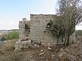
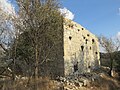
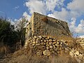
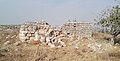
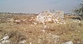
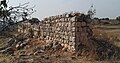
Maqam sheikh Bureik (Abreik)
32°42′03″N 35°07′43″E / 32.70083°N 35.12861°E —
-
 View from the north-west.
 -
 View from the north.
 -
 View from the west.
 -
 View from the west.
 -
 View from the west.
 -

-

-

-
-
-
-
 The mihrab.
 -
 The cenotaph.
 -

-
-


.jpg)

.jpg)
.jpg)
.jpg)
.jpg)


.jpg)
References: Sepp 1863, II 450; Quarterly statement V 47; Conder 1879, I 163; Conder, 1887, 254; SWP 1881, 131; SWP I, 273; Palmer 1881, 116; Stewardson 1888, 139; Meistermann 1907, 363; Mülinen, DPV 1908, 194; Canaan 1927, 68, 111; Ariel 1996, 105; Sharon, CIAP III, XXXVII–XLV; The Archaeological Survey of Israel; Maqams. Galilee and the Golan Heights.
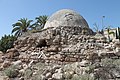
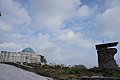
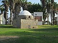
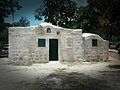
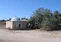
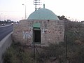
Maqam sheikh Ghanim
32°55′10″N 35°04′05″E / 32.91944°N 35.06806°E — Acre, Israel
.jpg)
Maqam sheikh Hussein
33°00′45″N 35°11′42″E / 33.01250°N 35.19500°E — Khirbat Ja'tun — Ga'aton
-
 View from the west.
 -
 View from the north.
 -
 View from the east.
 -
 The mihrab.
 -
 The interior.


References: Palmer 1881, 54; Stewardson 1888, 139; Petersen 2001, 180–181; The Archaeological Survey of Israel; Maqams. Galilee and the Golan Heights.
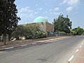
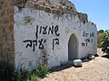
Maqam sheikh Izz ad-Din
32°56′15″N 35°04′23″E / 32.93750°N 35.07306°E — Acre, Israel
-
 View from the south-east.
 -
 View from the south-west.
 -
 View from the south.
 -
 View from the south.
 -
 View from the west.
.I.jpg)
.II.jpg)
.IV.jpg)
.XVIII.jpg)
.XXVI.jpg)
References: Palmer 1881, 41; Gautier 1898, 292; Petersen 2001, 84–85; The Archaeological Survey of Israel; Rebuilt Maqams and Modern replicas of Maqams.
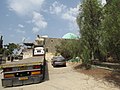
Maqam sheikh Kuweiyis
32°57′05″N 35°28′43″E / 32.95139°N 35.47861°E — Al-Zahiriyya al-Tahta — Nahal Amud
-
 View from the east.
 -
 View from the north-east.
 -
 View from the north-east.
 -
 View from the east.
 -
 View from the south-east.
 -
 View from the west.
 -
 View from the east.
 -
 The mihrab.
 -
 The interior.
 -
 The interior.


References: Palmer 1881, 93; Stewardson 1888, 139; Maqams. Galilee and the Golan Heights.
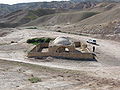
Maqam sheikh Marzuk
33°03′01″N 35°42′01″E / 33.05028°N 35.70028°E — Ulleika, Jaulan — Golan Heights
-
 View from the north.
 -
 View from the south.
 -
 View from the west.
 -
 The mihrab.
 -
 The room.


References: Schumacher 1888, 99; Palästina-Vereins IX 246; 312; Maqams. Galilee and the Golan Heights.
Maqam sheikh Muhammad al-Qureishi
32°58′13″N 35°08′52″E / 32.97028°N 35.14778°E — Kuwaykat — Beit HaEmek
-
 View from the south.
 -
 View from the south-east.
 -
 View from the south-east.
 -
 The cenotaph.

.JPG)
.JPG)
.JPG)
References: Khalidi 1992, 22; The Archaeological Survey of Israel; Rebuilt Maqams and Modern replicas of Maqams.
Maqam sheikh Muhammad ar-Raslan
32°49′24″N 35°30′59″E / 32.82333°N 35.51639°E —
-
 View from the south. 1900s.
 -
 View from the south. 1900s.
 -
 1903.
1903. -
 1910s.
 -
 View from the north-west.
 -
 View from the north-east.
 -
 The cenotaph.


References: Guérin, Galilee I, 249; Palmer 1881, 134; Wilson 1884, II 70; Stewardson 1888, 139; McCown 1922, 78; Khalidi 1992, 530; Petersen 2001, 210; Maqams. Galilee and the Golan Heights.
Tomb of nabi Shuwamin
32°46′44″N 35°25′40″E / 32.77889°N 35.42778°E — Lubya — Giv'at Avni
-

-
 View from the south.
 -
 View from the east.
 -
 View from the west.
 -
 The mihrab.


References: Palmer 1881, 132; Stewardson 1888, 131; Maqams. Galilee and the Golan Heights
Mount Carmel and Sharon plain
Maqam sheikh Abdallah as-Sahili
32°46′18″N 35°02′33″E / 32.77167°N 35.04250°E — Balad al-Sheikh — Nesher
-
 View from the north-west.
 -
 View from the north.
 -
 View from the north.
 -
 View from the north.
 -
 View from the north-east.
 -
 View from the east.
 -
 View from the east.
 -
View from the east.
-
 Entrance to the maqam.
 -
 Eastern side.
 -
 The mihrab.
 -
 The cenotaphs.
 -
 The cenotaphs.
 -
 The cenotaphs.
 -
 The dome.


References: Mülinen 1908, 176; Mülinen, DPV 1907, 189; Mülinen, DPV 1908, 85; Khalidi 1992, 151–152; Petersen 2001, 108–109; The Archaeological Survey of Israel; Maqams. Sharon Plain and Carmel.
Maqam sheikh Abd ar-Rahman al-Mudjarmi
32°36′33″N 34°55′02″E / 32.60917°N 34.91722°E — Tantura — Dor, Israel
-
 View from the south-west.
 -
 View from the north.


References: Mülinen, DPV 1907, 189; Mülinen, 1908, 310; Khalidi 1992, 195; Petersen 2001, 293; Benvenisti 2000, 198; Rebuilt Maqams and Modern replicas of Maqams.
Maqam sheikh Amir
32°39′17″N 34°57′46″E / 32.65472°N 34.96278°E —
-
 View from the north. 2011.
 -
 View from the east.
 -
 View from the north.
 -
 The mihrab.


References: Palmer 1881, 152; Stewardson 1888, 138; Mülinen 1908, 283; The Archaeological Survey of Israel; Maqams. Sharon Plain and Carmel.
Maqam sheikh Bureik
32°40′26″N 34°56′20″E / 32.67389°N 34.93889°E — Sheikh Bureik, Haifa
-
 View from the north.
 -
 View from the north-west.
 -
 View from the north-west.
 -
 View from the west.
 -
 The dome.
 -

-
-

-

-
-

-

-

-
-
-
 The mihrab.
 -
 View from the Highway 2.


References: Palmer 1881, 116; Mülinen, 1908, 274–275; Petersen 2001, 215; Rebuilt Maqams and Modern replicas of Maqams.
Maqam sheikh Musharraf
32°14′29″N 35°00′30″E / 32.24139°N 35.00833°E — Tzur Natan
-
 View from the north-east.
 -
 View from the north.
 -
 View from the south.
 -
 View from the east.
 -

-
 The cenotaph.
 -
 East wall.
 -


References: Palmer 1881, 191; Stewardson 1888, 139; Magen 2002, 429–430; Maqams. Sharon Plain and Carmel
Maqam sheikh Shahada
32°37′54″N 34°58′04″E / 32.63167°N 34.96778°E — Ayn Ghazal
-
 View from the south.
 -
 View from the south-east.
 -
 View from the south-west.
 -
 The cenotaph.


References: Khalidi 1992, 148; Maqams. Sharon Plain and Carmel.
Samaria
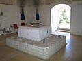
Maqam imam Ali (Budrus)
31°57′59″N 34°59′21″E / 31.96639°N 34.98917°E — Budrus


Maqam imam Ali (Qusin)
32°14′35″N 35°10′08″E / 32.24306°N 35.16889°E — Qusin — Kedumim
-
 View from the north.
 -
 View from the south.
 -
 The interior.
 -
 The interior.
_01.jpg)
_04.jpg)
_07.jpg)
_09.jpg)
References: Palmer 1881, 182; Stewardson 1888, 96; Maqams. Samaria
Maqam sheikh Abdallah
31°56′57″N 35°13′55″E / 31.94917°N 35.23194°E — Dura al-Qar' — Beit El
-
 View from the east.
 -
 View from the south.
 -
 View from the south.
 -
 View from the south.
 -
 View from the south.
 -
 View from the south.
 -

-
 The prayer room.
 -
 The prayer room.
 -
 The prayer room.
 -
 The prayer room.
 -
 The prayer room.
 -
 The prayer room.
 -
 Entrance to the burial chamber.
 -
 The mihrab.
 -


.jpg)
.jpg)


.jpg)
.jpg)
.jpg)
.jpg)
.jpg)

References: Palmer 1881, 242; Stewardson 1888, 137; Canaan 1927, 105; Maqams. Samaria.
Maqam sheikh Ahmad at-Taban
32°13′45″N 35°06′02″E / 32.22917°N 35.10056°E — Kur, Tulkarm

References: Palmer 1881, 192.
Maqam sheikh Ali ad-Dajani

Maqam sheikh Bilal
32°14′32″N 35°19′40″E / 32.24222°N 35.32778°E — Azmut — Elon Moreh
-
 View from the south-west.
 -
 View from the south-west.
 -
 View from the east.
 -
 View from the east.
 -
 View from the north-east.
 -
 View from the north-east.
 -
 View from the south.
 -
 View from the south.
 -
 View from the west.
 -

-
 Mount Kabir.
 -
 Israeli settlement Elon Moreh.

.jpg)


.jpg)


.jpg)
.jpg)


References: Robinson 1856, 298, 301; Guérin, Samarie I, 370, 458; SWP II, 249; Palmer 1881, 205; Stewardson 1888, 131 ("Neby Belan"); Maqams. Samaria.
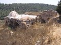
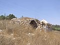
Maqam sheikh Ghanim
32°12′05″N 35°16′26″E / 32.20139°N 35.27389°E — Kafr Qallil — Mount Gerizim
-
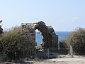
 Picture of Harry Fenn, 1884.
 -
 1900
1900 -
 Вetween 1898 and 1914.
 -
 Вetween 1898 and 1914.
 -
 1913
1913 -
 View from the south-west.
 -
 View from the south-west.
 -
 View from the south-west.
 -
 View from the south-west.
 -
 View from the south-west.
 -
 View from the south.
 -
 View from the south-west.
 -
 View from the south-west.
 -
 View from the south.
 -
 View from the south-west.
 -
 View from the north-east.
 -
 View from the north.
 -
 View from the north-west.
 -
 View from the north-west.
 -
 View from the west.


References: Duncan 1824, 253; Saulcy 1853, II 406, 409; Robinson 1856, 298; Guérin, Samarie I, 444 ("oualy du cheikh Abou-Rhanem"); Olesnitsky 1878, II 359–370 ("sheikh Abu Rhanem"); Baedeker 1882, 353; Clermont-Ganneau, ARP II, 325, 326; Tomb of sheikh Ghanim
Maqam sheikh Isa
31°56′39″N 35°08′36″E / 31.94417°N 35.14333°E — Al-Mazra'a al-Qibliya — Harasha
-
 View from the north.
 -
 View from the north-west.
 -
 Mihrab in the south wall


References: SWP II 305 ("Sheikh ‘Aisa"); Palmer 1881, 327; Stewardson 1888, 138; Maqams. Samaria.
Maqam sheikh Mas'ud

Maqam sheikh al-Qatrawani
31°59′36″N 35°11′52″E / 31.99333°N 35.19778°E — 'Atara
-
 View from the north-west.

Maqam sheikh Salman the Persian
32°10′07″N 35°13′58″E / 32.16861°N 35.23278°E — Asira al-Qibliya — Yitzhar
-
 View from the north-east.
 -
 View from the north-west.
 -
 The mihrab.


References: Robinson 1856, 296; Palmer 1881, 191; Stewardson 1888, 140; Maqams. Samaria
Maqam sheikh Sha'li
32°16′00″N 35°12′36″E / 32.26667°N 35.21000°E — An-Naqura


Tomb of nabi Ismail (sheikh Abu Ismain)
32°10′37″N 35°16′06″E / 32.17694°N 35.26833°E — Burin, Nablus
-
 View from the south
 -
 View from the west
 -
 The dome
 -
 A small yard in front of the entrance to the tomb
 -
 View from the north
 -
 Inside the tomb
_01.jpg)
_04.jpg)
_05.jpg)
_06.jpg)
_07.jpg)
_08.jpg)
References: Palmer 1881, 190; Stewardson 1888, 137; Burin Village Profile; Maqams. Samaria
Tomb of nabi Uzeir (Now is a tomb of Eleazar and Ithamar)
32°09′36″N 35°16′52″E / 32.16000°N 35.28111°E — Awarta — Hill of Phinehas
-
 Wilson, vol. I, 1881.
 -
 Photo of 1930s.
 -
.jpg)

.JPG)
Judaean Mountains
Maqam imam Ali
31°48′13″N 35°02′59″E / 31.80361°N 35.04972°E — Sha'ar HaGai
-
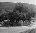 Photo of 1930s.
 -
 Photo of 1930s.
 -

-
 View from the east.
 -
 View from the north.
 -
 View from the north.
 -
 View from the south-west.
 -
 The sabil.


References: Olesnitsky 1878, 257; Conder 1879, I 18; Palmer 1881, 323; Baedeker 1882, 146; Thomson 1883, 132; Stewardson 1888, 130; Guide 1888, 109; Meistermann 1907, 51; Canaan 1927, 18, 39; Ariel 1996, 97; Petersen 2001, 154–155; Maqams. Judaean Mountains.
Maqam Hasan ar-Ra'i
31°46′51″N 35°25′29″E / 31.78083°N 35.42472°E — Nabi Musa
-
 View from the east.
 -

-

-

-
 The cenotaph.


.jpg)


References: Muravyov 1840, II 27; Saulcy 1853, II 172 ("oualy Qobr-er-Raay"); Guérin, Samarie I 20 ("Kabr er-Ra’ai"); SWP III 231; Clermont-Ganneau, ARP II 48 ("Kubbet er ra‘y"); Canaan 1927, 14, 17–19, 20, 104, 110, 199 ("Qabr er-Ra‘i"); The Archaeological Survey of Israel; Maqams. Judean Desert and Negev.
Maqam Muadh ibn Jabal (Sheikh Mu'alla)
31°50′08″N 34°59′30″E / 31.83556°N 34.99167°E — Imwas — Canada Park
-

-
 View from the north.
 -
 View from the north-west.
 -
-
-
 The mihrab.
 -


References: Palmer, 1881, 328; Stewardson 1888, 139; Clermont-Ganneau, ARP II, 483; Sharon, CIAP I, 83–84; Rebuilt Maqams and Modern replicas of Maqams.
Maqam nabi Samit
31°46′26″N 34°59′07″E / 31.77389°N 34.98528°E — Sar'a — Non-existent shrine
-
 Wilson, vol. III, 1883.
 -
 Picture 1880s.
 -
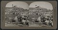 Photo 1910s.
 -
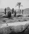 Photo 1930s.
 -
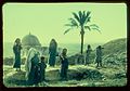 Photo 1930s.
 -
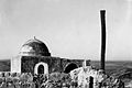 Photo 1930s.
 -
 The mihrab. Photo 1920s.
 -
 Photo 1930s.
,_on_the_summit_of_the_hill._Below_is_shown_the_upper_part_of_the_W%C3%A2dy_es_Su%27ar_(Vally_of_Sorek),_which_falls_into_the_river_called_Nahr_Rub%C3%AEn_(NYPL_b10607452-80662).jpg)


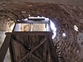
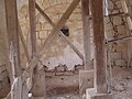
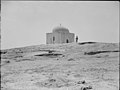
Maqam nabi Yaqin
31°29′55″N 35°09′28″E / 31.49861°N 35.15778°E — Bani Na'im
-
 View from the north.
 -
 View from the east.
 -
 View from the north-east.
 -
 The inscription.
 -
 The mihrab.
 -
 The shrine: imprints of feet of Abraham in a rock.
 -
 The cave.
 -
 The cave.
 -
 The cave.
 -
 The shrine: imprints of feet of Lot in a rock.


References: Guérin, Judée, III 158 ; Finn 1877, 291; Palmer 1881, 405; Stewardson 1888, 132; Canaan 1927, 78; Sharon, CIAP II 15, 18
Maqam sheikh Abu az-Zeitun
31°53′15″N 35°08′04″E / 31.88750°N 35.13444°E — Beitunia — Beit Horon
-
 View from the west.
 -
 Burial chamber. View from the north.
 -
 Burial chamber.
 -
 View from the north.
 -
 Prayer room.


References: Guérin, Samarie II 46; Palmer, 1881, 327; Stewardson 1888, 137; Wavell 1938, 171; iNature; Maqams. Judaean Mountains.
Maqam sheikh Ahmad ad-Dajani
31°46′38″N 35°13′02″E / 31.77722°N 35.21722°E — Jerusalem, Mamilla Cemetery
-
 View from the east.

References: Arab and Islamic Studies: In Honor of Marsden Jones. Cairo, 1997. P. 97; Rebuilt Maqams and Modern replicas of Maqams.
Maqam sheikh Ahmad al-Hubani
31°43′31″N 35°04′49″E / 31.72528°N 35.08028°E — Allar, Jerusalem — Bar Giora
-
 View from the east.
 -
 View from the north-east.
 -
 View from the south-west.
 -
 The prayer room.


References: Guérin, Judee II, 383; Palmer 1881, 327; Stewardson 1888, 138; Petersen 2001, 195; Hadashot Arkheologiyot; Maqams. Judaean Mountains.
Maqam sheikh Badr ad-Din al-Jimali
31°44′56″N 35°04′02″E / 31.74889°N 35.06722°E — Dayr al-Shaykh — Bar Giora
-
-
 View from the north-east.
 -
 View from the north-east.
 -

-
 View from the north.
 -


References: Palästina-Vereins II, 160; SWP III, 24; Palmer 1881, 293; Baedeker 1882, 148; Stewardson 1888, 140; Quarterly statement XXVI, 35; Canaan 1927, 285, 305–308; Petersen 1996, 99–103; Khalidi 1992, 288; Ariel 1996, 120; Petersen 2001, 136–138; Ephrat 2008, 158; Maqams. Judaean Mountains.
Maqam sitna Aisha
31°47′09″N 35°26′02″E / 31.78583°N 35.43389°E — Nabi Musa
-

-

-
 View from the north-west.
 -
 View from the north.


References: Canaan 1927, 18, 61, 104, 194; The Archaeological Survey of Israel; Maqams. Judean Desert and Negev.
Maqam sitt Badriya
31°44′34″N 35°11′26″E / 31.74278°N 35.19056°E — Sharafat, East Jerusalem


References: Canaan 1927, 23, 43, 49, 237, 306, 307; Ariel 1996, 113; Maqams. Judaean Mountains.
Maqam sitt Humeidiya
31°40′10″N 35°08′52″E / 31.66944°N 35.14778°E — al-Khader — Neve Daniel
-
 View from the north.
 -
 View from the north-east.
 -
 View from the south-east.
 -
 The mihrab.


Maqam sitt Huria
31°54′24″N 35°02′25″E / 31.90667°N 35.04028°E — Al-Burj, Ramle — Kfar Ruth
-
 View from the south.
 -
 View from the south-west.
 -
 View from the south-east.
 -
 View from the north.
 -
 The mihrab.


References: Robinson 1841, III, 57; Clermont-Ganneau, ARP II, 78; SWP III, 103; Palmer 1881, 295; Maqams. Judaean Mountains.
Maqam sitt Mana
31°53′30″N 35°01′26″E / 31.89167°N 35.02389°E — Bir Ma'in — Modi'in-Maccabim-Re'ut — Maqam sitt Mana
-
 View from the east.
 -
 View from the north-west.
 -
 View from the north-west.
 -
 View from the north-west.
 -
 View from the west.
 -
 The dome.
 -
 The dome.
 -
 The mihrab.


References: Robinson 1841, III, 57; Clermont-Ganneau, ARP II, 78; SWP III, 103; Palmer 1881, 295; Maqams. Judaean Mountains.
Shfela
Maqam nabi Bulus
31°42′51″N 34°58′51″E / 31.71417°N 34.98083°E — Khirbat an-Nabi Bulus — Beit Shemesh
-
 View from the south.
 -
 View from the north.
 -
 View from the west.
 -
 View from the east.
 -
 The entrance.
 -
 Burial chamber.


References: Robinson 1841, II, 343; Robinson 1841, III, 17; Tobler 1859, 120; Guérin, Judee II, 374; Quarterly statement, III 94; SWP III, 24, 123; Palmer 1881, 309; Petersen 2001, 226; Hadashot Arkheologiyot, 117, 2005; Hadashot Arkheologiyot, 119, 2007; Hadashot Arkheologiyot, 122, 2010; Tombs of the Prophets.
Maqam nabi Jibrin (Prophet Gabriel)
31°36′25″N 34°53′40″E / 31.60694°N 34.89444°E —
-
 View from the north-east.
 -
 View from the east.
 -
 View from the west.
 -
 View from the south-west.
 -
 The interior.


References: Quarterly statement IX 98; Clermont-Ganneau, ARP II, 440 ; Conder 1879 II, 150, 219; SWP III, 271, 294; Palmer 1881, 377; Canaan 1927, 285; Petersen 2001, 122; Tombs of the Prophets.
Maqam sheikh ‘Abdallah
31°33′13″N 34°48′49″E / 31.55361°N 34.81361°E — Khirbat al-Habur — Lakhish, Israel, Samah caves
-
 View from the north-east.
 -
 View from the west.
 -
 View from the south-east.
 -
 The mihrab.


References: SWP III, 281; Maqams. Shfela.
Maqam sheikh Abu Amran
31°40′21″N 34°51′09″E / 31.67250°N 34.85250°E — Zikrin — Beit Nir
-
 View from the south-east.
 -
 View from the south.
 -
 View from the north.
 -
 The entrance.
 -
 Interior.
 -
 Interior.
 -


References: Palmer 1881, 273; Stewardson 1888, 137; Khalidi 1992, 228; Maqams. Shfela.
Maqam sheikh Ahmad al-Misyad
31°41′12″N 34°54′43″E / 31.68667°N 34.91194°E — 'Ajjur — Agur, Israel
-
 View from the westt.
 -
 View from the east.
 -
 View from the north.
 -
 View from the south.
 -
 The mihrab.


References: Guérin, Judee II 104; Maqams. Shfela.
Maqam sheikh Ali ad-Dawayimi
31°32′09″N 34°53′13″E / 31.53583°N 34.88694°E — Al-Dawayima — Amatzia, Israel
-
 View from the east.
 -
 View from the south.
 -
 View from the north.
 -
 The entrance.
 -
 The mihrab.


References: SWP III, 258; Palmer 1881, 378; Stewardson 1888, 138; Khalidi 1992, 213; Petersen 2001, 280–281; Maqams. Shfela.
Maqam sheikh al-Gharbawi (Now is a tomb of Mattathias)
31°56′01″N 34°59′41″E / 31.93361°N 34.99472°E — al-Midya — Modi‘im
-
 View from the west.
 -
 View from the south.
 -
 View from the west.
 -
 View from the west.
 -
 View from the west.
 -
 View from the north-west.
 -
 View from the north.
 -
 The dome.
 -
 Smeared the mihrab in the south wall.


References: Guérin, Samarie II, 54; Quarterly statement V, 94; Olesnitsky 1878 II, 235; SWP II, 349; Palmer 1881, 243; Stewardson 1888, 138; Clermont-Ganneau, ARP II, 359; Maqams that were Judaized.
Maqam sheikh Muhammad al-Jezari
31°51′36″N 34°55′11″E / 31.86000°N 34.91972°E — Abu Shusha — Gezer


References: SWP II, 432; Palmer 1881, 273; Baedeker 1882, 145; Thomson 1883, 115; Stewardson 1888, 139; Geikie 1888, I 66; Quarterly statement IV, 40; Quarterly statement VII, 74; Macalister 1925, 273; Maqams. Shfela.
Maqam sheikh as-Salihi
31°40′58″N 34°57′59″E / 31.68278°N 34.96639°E — Bayt Nattif — Givat HaTurmusim, Sokho
-
 View from the north-west.
 -
 View from the north-east.
 -
 View from the north.
 -
 View from the south.
 -
 The mihrab.


References: Finn 1868, 153; Palmer 1881, 328; Wilson 1884, III 157; Stewardson 1888, 140; Maqams. Shfela.
Maqam sheikh Tamim
31°36′47″N 34°53′16″E / 31.61306°N 34.88778°E —
-
 View from the north-west.
 -
 View from the south-east.
 -
 View from the east.
 -
 View from the east.
 -


References: Guérin, Judee II 316; Conder 1879, I 228; Palmer 1881, 379; Stewardson 1888, 140; Clermont-Ganneau, ARP II, 46; Khalidi 1992, 210; Sharon, CIAP II 142; Petersen 2001, 122; Tamim al-Dari; Bayt Jibrin; Rebuilt Maqams and Modern replicas of Maqams.
Maqam sheikh Usheish
31°36′39″N 34°56′00″E / 31.61083°N 34.93333°E — Dayr Nakhkhas — Maresha Forest
-
 View from the east.
 -
 View from the north-east.
 -
 View from the north.
 -
 View from the south-west.
 -
 The interior.


.jpg)


References: SWP III, 287; Palmer 1881, 375, 378; Stewardson 1888, 137; Maqams. Shfela.
Maqam al-hajj Salim
31°36′19″N 34°53′29″E / 31.60528°N 34.89139°E —
-
 View from the south-west.
 -
 View from the south-west.
 -
 View from the west.
 -
 View from the north.
 -
 The mihrab.
 -
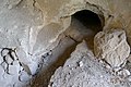 A small tunnel leading to an ancient burial chamber.
 -
 A small tunnel leading to an ancient burial chamber.


References: Palmer 1881, 367; Khalidi 1992, 211; Maqams. Shfela.
Israeli coastal plain
Maqam Abd an-Nabi
32°05′15″N 34°46′11″E / 32.08750°N 34.76972°E — Al-Mas'udiyya — Independence Park (Tel Aviv))
-
 View from the north.
 -
 View from the north-east.
 -
 The cenotaph.
 -
 The mihrab.
 -
 View from the north.
 -
 View from the south.


References: Palmer 1881, 218; Stewardson 1888, 137; Meistermann 1907, 499; Petersen 2001, 298–299; Maqams. Coastal Plain.
Maqam imam Ali (Ramla)
31°55′54″N 34°52′42″E / 31.93167°N 34.87833°E — Ramla
-
 View from the south-east.
 -
 View from the west.
 -
 View from the south.
 -
 Entrance from the north.
 -
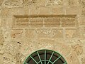
 Inscription.
 -

-
 The mihrab.
 -
 The cenotaph.
 -

-


References: Palmer 1881, 214; Stewardson 1888, 130; Rebuilt Maqams and Modern replicas of Maqams.
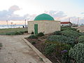
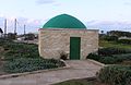
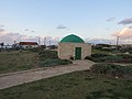
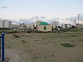
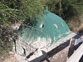
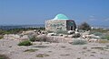
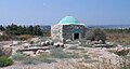
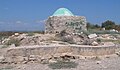
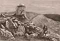
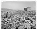
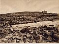
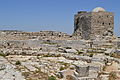
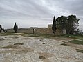
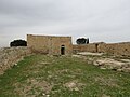
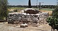
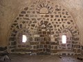
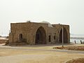
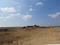
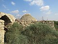
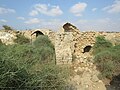
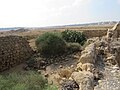
Maqam al-Khidr (Green Mosque)
31°39′48″N 34°32′40″E / 31.66333°N 34.54444°E — Al-Jura — Ashkelon National Park
-
 Wilson, vol. III, 1883.
 -
-

-

._The_beach_is_strewn_with_masses_of_ancient_masonry._On_the_cliff_above_there_is_a_Mohammadan_shrine,_called_El_Khudrah,_with_a_few_palm_trees_near_it.jpg)
.jpg)


References: Sepp 1863, II 514; Olesnitsky 1878, II 202; SWP III, 240; Palmer 1881, 360; Pringle 1993, I 64; Petersen 2001, 97; Maqams. Coastal Plain.
Maqam nabi Barq
31°46′40″N 34°41′45″E / 31.77778°N 34.69583°E — Barqa, Gaza — Non-existent shrine
-
 Photo 1898.
.jpg)
References: Clermont-Ganneau, ARP II, 192; II, 378; Gautier 1898, 95; Lost shrines. South.
Maqam nabi Kifl
32°00′25″N 34°55′35″E / 32.00694°N 34.92639°E — Al-Tira, Ramle — Tirat Yehuda
-
 View from the east.
 -
 View from the north.
 -
 View from the south.
 -
 The mihrab.
 -
 The interior.


References: SWP II, 269; Palmer 1881, 216; Stewardson 1888, 131; Canaan 1927, 215; Petersen 2001, 227–229; Tombs of the Prophets.
Maqam nabi Sawarka
32°10′45″N 34°56′41″E / 32.17917°N 34.94472°E — Kafr Saba — Kfar Saba
-
 View from the south.
 -
 View from the north-east.
 -
 View from the east.
 -
 The interior.


References: Conder 1879 I, 231; Palmer 1881, 188; Stewardson 1888, 132; Clermont-Ganneau, ARP II, 339–340; Petersen 2001, 235; Hadashot Arkheologiyot 122, 2010; Tombs of the Prophets.
Maqam nabi Shitt
31°49′28″N 34°44′54″E / 31.82444°N 34.74833°E — Bashshit — Aseret
-
 View from the east.
 -
 View from the east.
 -
 View from the south.
 -
 View from the south.
 -
 View from the east.
 -
 View from the east.
 -
 View from the east.
 -
 The interior.
 -
 The interior.
 -
 The interior.
 -
 The interior.
 -
 The interior.


References: Guérin, Judee II, 66; Olesnitsky 1878, II 184; SWP II, 409; Palästina-Vereins II, 144; Palmer 1881, 272; Stewardson 1888, 132; Clermont-Ganneau, ARP II, 184; Gautier 1898, 94–95; Khalidi 1992, 363; Petersen 2001, 110; Tombs of the Prophets.
Maqam nabi Sheman (Now is a tomb of Simeon (son of Jacob))
32°12′08″N 34°57′35″E / 32.20222°N 34.95972°E — Qalqilya — Junction Eyal
-
 View from the north.
 -
 View from the north-east.
 -
 View from the south-east.
 -
 View from the south.
 -
 View from the north.
 -
-

-
-


References: Guérin, Samaria II, 356; Palmer 1881, 188; Stewardson 1888, 132; Canaan 1927, 295; Benvenisti 2000, 276, 362; Maqams that were Judaized.
Maqam sheikh Abu Ghazala
31°34′04″N 34°46′47″E / 31.56778°N 34.77972°E — Khirbat as-Sukriyya — No'am
-
 View from the north.
 -
 View from the south.
 -
 View from the east.
 -
 The cenotaph.
 -
 The interior.


References: Guérin, Judee II, 304; Petersen 2001, 288–289; Maqams. Coastal Plain.
Maqam sheikh Arslan
31°55′22″N 34°52′16″E / 31.92278°N 34.87111°E — Ramla


Maqam sheikh Awad
31°41′15″N 34°33′47″E / 31.68750°N 34.56306°E — Hamama — Ashkelon
-
 View from the north-east.
 -
 View from the north-east.
 -
 View from the north.
 -
 View from the south.
 -
 View from the south.
 -
 The cenotaph.
 -
 The cenotaph.
 -


.jpg)
.jpg)
References: Jacotin map (1799); Guérin, Judee II, 151–152; SWP 1881, 141; Palmer 1881, 273; Baedeker 1882, 336; Stewardson 1888, 138; Khalidi 1992, 99; Petersen 2001, 98; The Archaeological Survey of Israel; Maqams. Coastal Plain.
Maqam sheikh Baraz ad-Din (sheikh as-Sadiq)
32°05′01″N 34°57′28″E / 32.08361°N 34.95778°E — Majdal Yaba — Migdal Afek
-
 Photo 1990s.
 -
 View from the south.
 -
 View from the south.
 -
 View from the east.
 -
 View from the north.
 -
 View from the south-west.
 -
 The mihrab.


References: Robinson 1856, 139; Clermont-Ganneau, ARP II, 158; SWP II, 361; Palmer 1881, 243; Stewardson 1888, 138; Khalidi 1992, 396–397; Petersen 2001, 215; The Archaeological Survey of Israel; Maqams. Coastal Plain.
Maqam sheikh Ibrahim as-Suwayq
31°56′59″N 34°53′45″E / 31.94972°N 34.89583°E — Lod
-
 View from the east.
 -
 View from the south.


References: Petersen 2001, 209; Muslim shrines in Lod.
Maqam sheikh al-Katanani
32°01′16″N 34°48′17″E / 32.02111°N 34.80472°E — Yazur — Holon
-
 View from the east.
 -
 View from the south.
 -
 View from the south.
 -
 View from the north-west.
 -
 The mihrab.


References: SWP II, 258; Palmer 1881, 218; Stewardson 1888, 139; Khalidi 1992, 262; Benvenisti 2000, 292; Petersen 2001, 312; Maqams. Coastal Plain.
Maqam sheikh al-Kheiri
31°55′19″N 34°52′12″E / 31.92194°N 34.87000°E — Ramla
-
 View from the south-west.
 -
 View from the west.
 -
 View from the north.


Maqam (Qubbat) sheikh Murad
32°02′53″N 34°46′47″E / 32.04806°N 34.77972°E — Tel Aviv, Sheikh Murad Cemetery
-
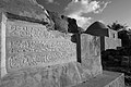 Photo of 2009
 -
 Photo of 2009
 -
 View from the west.
 -
 View from the south-west.
 -
 View from the north.
 -
 View from the north.
 -
 View from the west.
 -
 View from the south-west.
 -
 View from the north-east.
 -
 The Interior.
 -
 The Interior.


References: Palästina-Vereins II, 161; Clermont-Ganneau, ARP II, 152–154; Quarterly statement VI, 270; Quarterly statement XXX, 246; Petersen 2001, 169; Rebuilt Maqams and Modern replicas of Maqams.
Maqam sheikh Nabhan
31°25′32″N 34°25′28″E / 31.42556°N 34.42444°E — Gaza City
-
 View from the east.
 -
 View from the north.
 -
 The Interior.
 -
 The Interior.
 -
 The Interior.


Negev
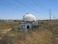
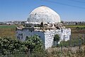
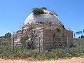
Maqam sheikh Nuran
31°18′01″N 34°25′24″E / 31.30028°N 34.42333°E — Magen, Israel
-
 Between 1934 and 1939.
 -
 Photo of 1948.
 -
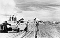 Photo of 1948.
 -
 Photo of 1948.
 -
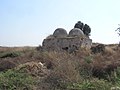
 View from the north.
 -
 View from the south.
 -
 The interior.
 -
 The interior.


References: Canaan 1927, 11; Operation Assaf; Maqams. Judean Desert and Negev.
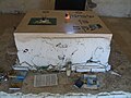
Maqam sheikh Saleh al-Akby (Abu Huraira)
31°22′55″N 34°36′23″E / 31.38194°N 34.60639°E — Tell Abu Hureira — Tel Haror (Non-existent shrine)
-
 Вetween 1920 and 1933.
 -
 Вetween 1920 and 1933.
 -
 Вetween 1920 and 1933.

._About_Horaira._Tomb,_shrine_of_Sheik_Saleh_el_Akby_LOC_matpc.15533.jpg)

References: Lost shrines. South.
External links
| Styles | ||||||||||||||||||||
|---|---|---|---|---|---|---|---|---|---|---|---|---|---|---|---|---|---|---|---|---|
| Elements |
| |||||||||||||||||||
| Types |
| |||||||||||||||||||
| Resources | ||||||||||||||||||||
| Influences |
| |||||||||||||||||||
| Category pages | ||||||||||||||||||||
