
Aucanquilcha
| Aucanquilcha | |
|---|---|
Quechua: Auqa/aukka; "cruel"/"enemy", kichka/khiska; "spine"; "cruel spine"[4] | |
| Pronunciation | OW-kahn-KEEL-chuh |
| Geography | |
 Aucanquilcha | |
Central Volcanic Zone | |
| Last eruption | 240,000 ± 50,000 years ago (Pleistocene)[5] |
Aucanquilcha is a massive
.The cluster has generated lava ranging in composition from andesite to dacite, with the main volcano being exclusively of dacitic composition. Systematic variations in temperature, crystal and biotite content have been recorded during the evolution of the cluster.
At Aucanquilcha volcano there is some
In 1986, four men were reported to be living at an altitude of 5,900 metres (19,400 ft), making them the highest permanent residents on Earth.
Geography and geology
Regional setting
Aucanquilcha is part of the
The Aucanquilcha complex lies northwest of the
The long-term magma output of Aucanquilcha is comparable to the magma output of other long-term active volcanoes in the central Andes such as
Local setting

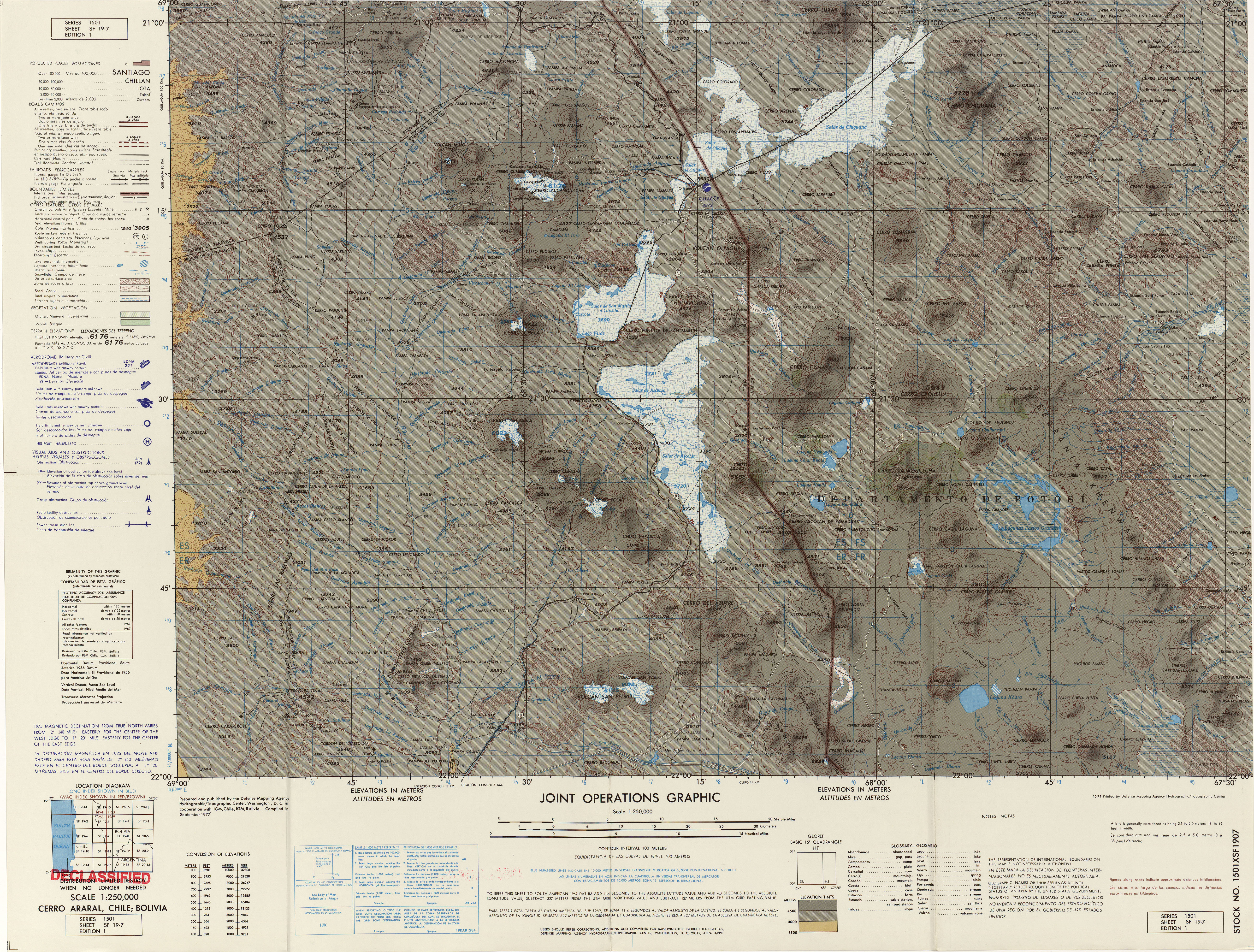
Aucanquilcha is part of a cluster of volcanoes located between the
The volcanic cluster of which Aucanquilcha is a part contains about 19–20 volcanoes and has generated about 340 cubic kilometres (82 cu mi) of andesite and
Aucanquilcha underwent a northwestward flank collapse, generating a debris avalanche deposit. The debris avalanche descended 2,100 metres (6,900 ft) and ran for 17 kilometres (11 mi) with an
Petrographically, the composition of the cluster ranges from andesite to dacite with
Rocks have a porphyritic texture.[5] Basaltic andesites typically contain less than 10% crystals while dacites generally have more than 20% crystals. The Alconcha group lavas of the first one million years are crystal-poor and lack biotite; later lavas contain biotite and more crystals. Based on geothermometric data, the highest temperatures occurred during phases of high activity and lower temperatures are associated with low output periods.[10] It is likely that crustal feedback and increased deep crustal influx of mantle-derived basalts drive increased magmatic flux. During the time of the Polan eruption on the west flank, magma output was spatially segregated with the peripheral Miño Volcano generating andesite lavas and the more central volcanos generating dacites.[7]
Various parts of the main volcano have been subjected to
Eruptive history
Eruption rates increased 6 million years ago, coinciding with magmas becoming more uniform in composition and the onset of strong hydrothermal alteration. It is possible that solidification of magmas below the volcano insulated the feeding channels from heat loss and caused the temperatures in the system to increase. Activity waned again 2 million years ago, with magma and included crystals being drawn from depths of 3 to 23 kilometres (1.9 to 14.3 mi) and forming the Aucanquilcha volcano proper.[6][10] The 10-million-year duration of activity of the Altiplano–Puna volcanic complex systems is comparable to the duration of Aucanquilcha activity.[11] The age of the lava flows ranges from heavily glaciated andesite flows overlying less-eroded ones to possibly postglacial lava flows that may be tens of thousands of years old.[3]
Aucanquilcha cluster

The Aucanquilcha cluster formed in four stages, each corresponding to a group. The Alconcha group, with seven volcanoes, is constructed from pyroxene, andesite and dacite and formed 11–8 mya. It is constructed from two northern
The Gordo group, which erupted 6–4 mya following a probable 2-million-year hiatus, is located in the southern and western parts of the cluster. Cerro Gordo itself (5.49
The 3.6–2.3 mya Polan group, with ten dispersed volcanoes including Miño Volcano, is the largest group in the cluster and includes Tres Monos, La Luna, Cerro Polan, Chaihuiri, Miño Volcano and the lavas of the Aucanquilcha platform. Cerro Polan's (3.5–3 mya) eastern side is deeply dissected, and the exposed materials are heavily altered in the deeper sections. Lava fields to Polan's west and southwest (2.6 mya on one western field) are associated with it. La Luna (2.97–2.57) lies just east of Polan; these two volcanoes were probably one volcano in the past. La Luna has a lava dome surrounded by a glaciated but unaltered lava table. Cerro Tres Monos (3.4–2.78 mya) forms a northbound 14-kilometre (8.7 mi) long ridge with at least six vents. Hydrothermal alteration has affected some lavas and pyroclastics from Tres Monos, and the western side has lateral and terminal moraines. The Aucanquilcha platform (3.6–2.7 mya) sits underneath the main Aucanquilcha volcano, and its lava mostly flowed north. Its southern side is a 4,500-metre (14,800 ft) table with one hill, Cerro Campana, dated to 3.3 mya. The platform presumably forms one third of the total volume of the Aucanquilcha cluster and may have originated from a part of the ridge of the La Luna-Polan trend, now buried beneath Aucanquilcha. Chaihuiri (2.39 mya) is a lava dome with moraines and two short lava flows; it is the youngest Polan group volcano. The total volume of this group is 154 cubic kilometres (37 cu mi), indicating a flux rate of 0.077 cubic kilometres per millennium (0.018 cubic miles per millennium).[7]
After the four main phases, some
Aucanquilcha proper

The main Aucanquilcha volcano formed in four stages. Between 1.04–0.92
The second stage, named Rodado, lasted from 0.95 to 0.85 mya. It formed on the eastern slopes of the Azufrera volcano, with one vent at the 6,073 metres (19,925 ft) summit. Rodado stage lavas are blocky and platy and usually thicker than Azufrera stage lavas. Some of the summit vent lavas are among the most
The third stage is the Cumbre Negra stage, named after the westernmost summit and principal vent of this stage, Cerro Cumbre Negra (5,670 metres (18,600 ft)). The time course of its activity is less defined than the previous two stages; it may have occurred between 1–0.47 mya, but most likely 0.6–0.5 mya based on
The youngest stage, known as Angulo, lasted from 0.66 to 0.24 mya. It was centered between the Azufrera and Rodado stage edifices 0.35–0.23 mya. Most lava flows from this stage originate on a 1-kilometre (0.62 mi) long ridge that includes Aucanquilcha's highest summit. One crater on the northeast side of the ridge fed lavas to the north. Other than that, most flows extend southwards 4 to 9 kilometres (2.5 to 5.6 mi) from the vent, and with the exception of a due south flow 50 metres (160 ft) thick they are thin, with thicknesses of 15–20 metres (49–66 ft). One of the oldest flows has been compared in length to the 50% longer Chao Dacite flow but is much thinner. The flows from this stage are weakly weathered and partially overlie glacial deposits. The total volume is 5.8 cubic kilometres (1.4 cu mi), indicating a flux rate of 0.015 cubic kilometres per millennium (0.0036 cubic miles per millennium).[5]
There is no evidence of Holocene activity[12] but the volcano has active fumaroles though the low-temperature fumaroles are not visible through short wavelength infrared data from satellites.[13] Fumarole activity was observed in 1962[14] and is most conspicuous in the trenches dug during sulfur mining operations. Lava flow emissions and minor explosive activity, confined to the edifice of the volcano, are the most important risks from renewed activity.[15]
Glaciation and hydrology
The volcano is currently not glaciated despite its height, due to the
The volcanic cluster was modestly glaciated during the
Human activity and mining


A famous
The cableway, of which ruins are still standing,
Altitude and habitation
The sulfur mine is notable for being the highest mine in the world at 5,950 metres (19,520 ft)[28] and the highest permanently inhabited area.[8] An expedition in 1935, part of the International High Altitude Expedition, found that miners lived at an altitude of 5,300 metres (17,500 ft) in the town of Quilcha and reached the higher mine on foot. The expedition found that an even higher abandoned village at 5,639 metres (18,501 ft) existed, but miners refused to live there. The conclusion taken from the expedition was that 5,334 metres (17,500 ft) was the highest habitable altitude.[28]
West in 1986 reported that a few miners permanently lived in the mine area.[31] A small group of men, caretakers of the mine, has lived at an altitude of 5,900 metres (19,500 ft) in a galvanized iron hut. One of them reportedly had spent two years there.[32] These are considered to be the highest human inhabitants on Earth.[33] Research performed on Aymara miners of the Aucanquilcha mine indicates that they are fully acclimatized to the altitude, with less hyperventilation and higher hemoglobin than acclimatized people from lower areas.[34] Their families are born and raised at lower altitudes, however.[33]
See also
References
- ^ ISSN 0022-1430.
- ^ "Aucanquilcha". Andes Specialists. Retrieved 2020-04-12.
- ^ ISBN 978-3-642-77355-6.
- ^ (in Spanish) Cerro Aucanquilcha
- ^ S2CID 140668081.
- ^ ISSN 0091-7613.
- ^ S2CID 129122958.
- ^ S2CID 128824938.
- S2CID 128974452.
- ^ S2CID 129808417.
- ISSN 0016-7606.
- ISBN 978-0-12-818082-2.
- ISSN 0148-0227.
- S2CID 128979648.
- ISSN 0717-7305. Archived from the original(PDF) on June 29, 2021. Retrieved 20 August 2021.
- ISSN 0717-7356.
- PMID 34690508.
- ^ Salar de Ascotan. Archived from the original (jpg) on 11 November 2010. Retrieved 6 September 2015. Alt URL
- ^ ISBN 3906151034.
- ^ S2CID 213428375.
- PMID 11809089.
- ISBN 978-1-4381-0963-3.
- ^ González, José Antonio (2010). "The mining industry in Antofagasta and the Bolivian immigration during the nitrate cycle. Study notes". Revista Si Somos Americanos (in Spanish). 10 (2).
- ^ S2CID 216492401 – via ResearchGate.
- ISBN 978-0-19-973107-7.
- ISBN 978-956-00-0010-1.
- ^ .
- ^ PMID 12631426.
- ISBN 978-3-642-88284-5.
- ISBN 978-3-642-36833-2.
- ISBN 978-1-4684-5481-9.
- PMID 3305469.
- ^ ISBN 978-1-139-48535-7.
- PMID 2506621.
Further reading
- "Aucanquilcha". Global Volcanism Program. Smithsonian Institution.
- Biggar, John (2020). The Andes: A Guide for Climbers and Skiers (5th ed.). Andes Publishing (Scotland). pp. 198 pp. ISBN 978-0-9536087-6-8.
- González-Ferrán, Oscar (1995). Volcanes de Chile. Santiago, Chile: Instituto Geográfico Militar. pp. 640 pp. ISBN 956-202-054-1. (in Spanish; also includes volcanoes of Argentina, Bolivia, and Peru)
- De Silva, Shanaka L.; Francis, Peter (1991). Volcanoes of the Central Andes. Springer-Verlag. pp. 216 pp. ISBN 3-540-53706-6.
- McIntyre, Loren (April 1987). "The High Andes". National Geographic. 171 (4). National Geographic Society: 422–460. (includes description and photos of Aucanquilcha summit road and mine)