
Lascar (volcano)
| Lascar | |
|---|---|
 The Lascar volcano, seen from the Chaxas lagoon on the Gran Salar. To the left, in the background, the Aguas Calientes volcano. | |
| Highest point | |
| Elevation | 5,592 m (18,346 ft)[1] |
| Coordinates | 23°22′S 67°44′W / 23.367°S 67.733°W[1] |
| Geography | |
 Lascar Chile | |
| Location | Northern Chile |
| Parent range | Andes |
| Geology | |
| Mountain type | Stratovolcano |
| Last eruption | December 10, 2022[2] |
Lascar is a
Lascar has been active since at least 56,000 years ago, though some argue for activity beginning 220,000 years ago. The first known activity occurred at the eastern cone and was characterized by lava flows, before shifting to the western cone where lava domes were emplaced. An eruption event known as Piedras Grandes was followed by the large Soncor eruption. A new western edifice was constructed on top of the Soncor vent, during the
.The volcano experienced at least three major eruptions throughout its history: One is the Soncor eruption about 26,450 ± 500 years ago, another in 7,250
Etymology
The name originates from the Atacameño word láskar or lassi (English: tongue), thought to refer to the shape of the volcano.[3] Other names for the volcano are Hlàscar,[4] Hlascar, Ilascar, Kar Las, Laskar, Toconado and Toconao.[5]
Human use
The new town of Talabre is 17 kilometres (11 mi) west of Lascar. As of 2012[update], it had a population of 50 inhabitants.
Lascar, like El Tatio, is a destination for volcano tourism.[10] Unlike the neighbouring volcanoes Acamarachi, Licancabur and Quimal, there is no evidence of archeological sites on Lascar,[11] possibly because of the volcanic activity.[12] However, the inhabitants of the town of Camar consider Lascar a protective mountain spirit[13] and in Susques (Argentina) it is believed that snow will fall if Lascar is steaming strongly.[14] The inhabitants of Talabre give the volcano gifts, viewing it as their source of water.[15]

Geography and geological context
Regional setting
Volcanoes in the Andes occur in
Of these volcanic zones, the Central Volcanic Zone of which Lascar is a member of
About 122 volcanoes with
Local setting


The volcanism of Lascar relates to the subduction of the
Lascar is located in the Antofagasta Region of Chile,[32] and is 5,641 metres (18,507 ft),[34][3][35] 5,592 metres (18,346 ft),[32][22][16][1] or 5,450 metres (17,880 ft) high, according to different sources.[36] With a surface area of 54 square kilometres (21 sq mi), the volcano has a volume of 15 cubic kilometres (3.6 cu mi).[37] Geographically, the area of Lascar is located between the Altiplano and the Salar de Atacama[22] 30 kilometres (19 mi) farther west;[38] the terrain at Lascar dips in the direction of the Salar.[39]
Lascar is located in the main
Cerro Opla, 20 kilometres (12 mi) west of Lascar, is a hill formed by
The 9-kilometre-long (5.6 mi) Quebrada de Chaile, the 17-kilometre-long (11 mi) Quebrada de Soncor and the 17-kilometre-long (11 mi) Quebrada de Talabre canyons run towards Salar de Atacama; they are 30–80 metres (98–262 ft) deep and 80–500 metres (260–1,640 ft) wide.[48] These valleys were probably formed by erosion during glacial periods.[37] The valleys drain the western, northern and southwestern slopes of Lascar. The southeastern slopes drain into Laguna Lejía[9] which is close to the volcano,[49] and the northwestern slope drains through the Quebrada de Morro Blanco.[9]
Lascar is located atop of a

Geology
Lascar is a steep volcano[7] formed by two irregularly shaped truncated cones that extend east–west,[53][54] on a trend that includes Aguas Calientes.[55] Six craters are located on the volcano,[30] but sometimes only five craters are counted, in which case the central crater is considered to be the active one.[56] The extinct western cone (also known as Apagado) is composed of layers of lava and pyroclastics. Its large crater is filled by another cone,[55] which forms the highest summit of the Lascar volcano.[3] Immediately east of it lies the eastern cone, which is contiguous with the western cone. The eastern cone (also known as Activo)[55] is capped off with three distinct craters[54] which are delimited by arcuate fractures.[57] Measurements made from 1961 to 1997 determined that the eastern crater is 1 kilometre (0.62 mi) wide and 150–200 metres (490–660 ft) deep[58] and thus the largest,[54] the central crater is 600 metres (2,000 ft) wide and 100–200 metres (330–660 ft) deep, and the western crater is 800 metres (2,600 ft) wide and 200–300 metres (660–980 ft) deep,[58] increasing to 400 metres (1,300 ft) depth in 2005–2006.[59] The craters show evidence that activity has migrated westward.[35] The westernmost of these three eastern craters is the currently active one, surrounded by rims that reach heights of 150 metres (490 ft). In 1985, a 150-by-150-metre (490 ft × 490 ft) hot spot in this crater was observed in satellite images.[35] In the centre of the westernmost crater lies a smaller crater, with dimensions of 310 by 340 metres (1,020 ft × 1,120 ft)[60] and a depth of 250 metres (820 ft).[61] There are furrows formed by erosion, large blocks, deposits of sulfur[60] and many fumaroles along the rim of the inner crater.[61] The exact configuration is variable owing to ongoing volcanic activity.[62]
The rims of the craters are partially buried by pyroclastic flows or cut by rockslides.[63] Layers of lava and pyroclastics are discernible in the craters.[64] These craters are not collapsed calderas,[58] and there is no evidence of the deposits a large explosion would produce.[65] Remnants of a previous edifice are visible in the craters; this older edifice constitutes the bulk of the eastern cone. There are traces of a collapse of the volcano towards the northeast, with an associated horseshoe-shaped scar.[55]

Large lava flows are noticeable on the flanks of the volcano,[35] with a total of eight lava flows recognized.[66] They extend from the summit craters, although none of them appear to be associated with the currently active crater.[36] Flows from the first stage of Lascar's activity are exposed at its western foot,[55] while lava flows are buried beneath pyroclastic material on the eastern flank.[67] A 6-kilometre-long (3.7 mi) lava flow on the northern flank reaches almost to the village of Talabre.[35] This lava flow is known as the Tumbres–Talabre lava flow; its margins are 10–40 metres (33–131 ft) high, and it features a central channel. The flow advanced just north of the head of Quebrada Talabre before passing over cliffs and entering it.[68] Another lava flow on the southwest flank is known as the Capricorn Lava.[52] This dacitic lava was erupted on Lascar at high altitude and has a blocky surface. It features well developed levees and a 10-metre-thick (33 ft) flow front. Its rocks have a pale gray-blue colour, and their composition resembles the Soncor flow, despite more mafic lavas and pyroclastics being erupted in the time period between the emplacement of the Soncor flow and the Capricorn Lava.[69]
An early pyroclastic flow, the Saltar Flow, is exposed on the eastern flank. It was emplaced after the collapse of the oldest edifice, covering Aguas Calientes' western slopes. The flow deposit was later modified by
The Quebrada Talabre cuts into the upper flanks of Lascar[68] and eventually joins the Quebrada Soncor.[9] Lahar deposits are found in adjacent valleys, suggesting that wetter periods had occurred during Lascar's activity.[68] The Quebrada Talabre was scoured by pyroclastic flows during the 1993 eruption, exposing bedrock and Tertiary ignimbrites.[72] Traces of glacial action are found on the older parts of Lascar at altitudes above 4,600 metres (15,100 ft) and include meltwater gorges, striated rock surfaces, and U-shaped valleys.[73] Moraines are found at Tumisa down to an altitude of 4,850 metres (15,910 ft).[37]
The volcano sits above a major local geological trend, the north–south Miscanti Line. Other volcanic centres are also located on this line,
Composition
Lascar rocks consist of andesite and dacite. These rocks have a composition mainly characterized as "two-pyroxene",
The rocks of Lascar belong to the
2 concentrations range from 55.5 to 67.8% by weight, and the rocks have medium to large concentrations of potassium.[83] The magmas are contaminated by the local crust, but not to the extent found in the Galan or Purico complex eruption products.[84] The magma interacts with former salar deposits before ascending.[80] The chemistry of Lascar's rocks is fairly similar to those of neighbouring Tumisa volcano.[85]
Magma erupted by Lascar appears to form from the mixing of mafic and more evolved magmas; the 1993 eruption deposits contain bands of different rocks.
The magma chamber of Lascar appears to lie at depths of 10–17 kilometres (6.2–10.6 mi),[91] although the lack of deformation of the edifice during the 1993 eruption indicates that it may be deeper, over 25–30 kilometres (16–19 mi) or even over 40 kilometres (25 mi) deep.[92] Magma petrology implies that there is another reservoir at 6 kilometres (3.7 mi) depth.[93] A large regional-scale structure, the Altiplano-Puna Magma Body, underlies Lascar.[94] There appear to be two distinct chamber systems, an andesitic one that is responsible for the frequent andesite lava and pyroclastic flow activity, and a dacitic one that was involved in the Piedras Grandes and Soncor activities.[95]
Temperatures of the magma chamber range from 890–970 °C (1,630–1,780 °F); the mafic magmas that are injected in the chamber are about 150–200 °C (270–360 °F) hotter than the extant andesite and dacite. The chamber may be surrounded by
A number of
Gas emissions
Lascar emits
There are high-temperature fumaroles (temperatures equal to or exceeding 150 °C (302 °F)) and low-temperature fumaroles (temperatures of less than 82 °C (180 °F)), with noticeable chemical differences between the two; the latter tend to emit far more water than carbon dioxide. The fumaroles also release carbon monoxide, hydrogen, hydrogen chloride, hydrogen sulfide, and smaller amounts of helium. Hydrocarbons and other organic compounds are also found in the low-temperature fumaroles.[107] Trace elements include arsenic, boron and titanium, with smaller amounts of barium, chromium, copper, lead, strontium and zinc.[108] The fumarole gases react with surrounding rocks, forming precipitates and altered rocks.[109]
Release rates of
Hydrogen chloride and hydrogen fluoride are also released in large amounts, with estimates made in 2003–2004 indicating a mass flux of 340,000,000 kilograms per year (11 kg/s) and 150,000,000 kilograms per year (4.8 kg/s) respectively.[120] They correspond to about 2 and 5%, respectively, of the global volcanic flux of these compounds.[121] Finally, Lascar is vigorous producer of sulfate dust particles,[120] which are released at a rate of about 100,000 trillion particles per second.[111]
| Minor emissions[122] | |
|---|---|
| Element | Output |
| Antimony | 0.0029 kilograms per day (0.0064 lb/d) |
| Arsenic | 0.324 kilograms per day (0.71 lb/d) |
| Barium | 0.054 kilograms per day (0.12 lb/d) |
| Bismuth | 0.0036 kilograms per day (0.0079 lb/d) |
| Boron | 0.141 kilograms per day (0.31 lb/d) |
| Cadmium | 0.00043 kilograms per day (0.00095 lb/d) |
Cesium |
0.0012 kilograms per day (0.0026 lb/d) |
| Chromium | 0.046 kilograms per day (0.10 lb/d) |
| Copper | 0.051 kilograms per day (0.11 lb/d) |
| Indium | 0.00012 kilograms per day (0.00026 lb/d) |
| Lead | 0.019 kilograms per day (0.042 lb/d) |
| Lithium | 0.0038 kilograms per day (0.0084 lb/d) |
| Molybdenum | 0.004 kilograms per day (0.0088 lb/d) |
| Rubidium | 0.0075 kilograms per day (0.017 lb/d) |
| Selenium | 0.0042 kilograms per day (0.0093 lb/d) |
| Tellurium | 0.0032 kilograms per day (0.0071 lb/d) |
| Thallium | 0.0048 kilograms per day (0.011 lb/d) |
| Tin | 0.014 kilograms per day (0.031 lb/d) |
| Tungsten | 0.00084 kilograms per day (0.0019 lb/d) |
| Zinc | 0.088 kilograms per day (0.19 lb/d) |
Gases are partly supplied from shallow magma; the volume of magma erupted is too small to contain all the exhalations.[123] The release of gas by the magma is favoured by strong temperature contrasts between incoming magma and the magma chamber,[99] and processes occurring during the mixing may explain the high emission of sulfur dioxide by Lascar.[124] The presence of argon and nitrogen in low-temperature fumaroles indicates that air is involved in their formation,[107] although a portion of each of these two gases is non-atmospheric.[125]
The heat output of Lascar is about 75–765 megawatts (71,000–725,000 BTU/s) during regular activity,
Basement
Lascar rests atop the Atana ignimbrite, a rhyodacitic sheet which was erupted by La Pacana caldera 4.5–3.7 million years ago.
Eruptive history
Lascar is one of the three most active volcanoes in the Andean Central Volcanic Zone (the other two are the Peruvian volcanoes
Early activity
The oldest volcanic activity at Lascar occurred between 220,000[6] and less than 50,000 years ago.[54] Activity has alternated between the eastern and western part of the volcano during its history. The eastern edifice formed first (stage I), erupting andesite containing pyroxene, and eventually forming the Chaile and Saltar pyroclastic flows.[54] The oldest mafic andesites are less than 43,000 years old, while the Chaile and Saltar pyroclastic flows erupted over 26,500 years ago.[40] An alternative dating scheme considers Chaile to be 47,000 ± 16,000 years old and Saltar 167,000 ± 9,000 years old.[140]
Lava flows less than 50 metres (160 ft) thick issued from the stage I cone and reached lengths of 16 kilometres (9.9 mi). They occur beneath altitudes of 4,100 metres (13,500 ft), their vents buried by later activity.[37] The lavas from stage I are mostly exposed north and west of Lascar. The Chaile flows are actually formed by two separate units and are found on the southwest flanks of the volcano, up to a distance of 6 kilometres (3.7 mi).[40] They reach thicknesses of 5 metres (16 ft) in the upper unit[141] and 30 metres (98 ft) in the lower one. The Saltar flow reached widths of 0.7–1.3 kilometres (0.43–0.81 mi) and thicknesses of 5–20 metres (16–66 ft), increasing to 35 metres (115 ft) where the flow entered valleys. At least nine units form the Saltar deposit, with the northern flows displaying flow welding.[142] These deposits have volumes of 0.1 cubic kilometres (0.024 cu mi) and probably formed when an explosive eruption took place in a lava lake.[90] After the end of stage I, a period of glacial erosion occurred prior to new activity,[76] which created furrows in the Saltar flow. Imprecise argon–argon dating on younger andesites has yielded dates of 14,000 ± 18,000 and 17,000 ± 22,000 years.[142]
Later volcanic activity buried this edifice beneath thin pyroclastic flows. The western edifice generated a complex of lava domes (stage II),[54] which was probably surrounded by a horseshoe-shaped crater open to the west.[143] Possibly, the magma chamber of stage I had almost solidified when the injection of basaltic magma at depths of over 5 kilometres (3.1 mi) triggered a remelting.[144] Andesite-rhyodacite intrusions occurred beneath the volcano,[145] some of which were still hot when the Soncor eruption tore them out of the ground.[146] An ice cap formed over Lascar at that time, feeding two glaciers that extended northeast and southeast away from the volcano.[71]
Piedras Grandes unit
The stage II activity was accompanied by the eruption of
The lava domes interacted with
Soncor eruption
A major Plinian eruption occurred 26,450 ± 500 years ago,
The Soncor ignimbrite extended as much as 27 kilometres (17 mi) west from the volcano,[48] 10 kilometres (6.2 mi) north and 15 kilometres (9.3 mi) south.[142] It is white, heterogeneous[95] and mostly featureless with only weak sorting,[152] but features a noticeable compositional zonation.[153] The ignimbrite features three facies, one rich in breccia, another rich in pumice, and a normal ignimbrite.[150]
Ignimbrite was channeled to the Salar de Atacama by the Quebrada de Chaile, Quebrada de Soncor and Quebrada de Talabre canyons and some smaller valleys, northeastwards by the Quebrada de Morro Blanco and as far as 11 kilometres (6.8 mi) southeastwards over the Pampa Leija area.
The magma erupted was generated in a magma chamber starting from andesite, which underwent complex petrogenetic processes.[157] This magma chamber was located at a floor depth of 5–6 kilometres (3.1–3.7 mi) (older estimate 12–22 kilometres (7.5–13.7 mi)[158]) and probably had a complex shape, given certain chemical properties of the Soncor rocks. At the time preceding the eruption, the magma chamber had a thermal stratification;[159] injections of mafic magmas had heated the magma chamber and induced convection.[148]
A volatile phase containing chlorine formed inside the magma chamber and quickly removed most sulfur from the magma. This sulfur extraction was facilitated by the high oxygen content of the magma, which allowed the formation of sulfur dioxide.[159] Water is a principal volatile involved in the processes of Plinian eruptions; the water content of the Soncor and Piedras Grandes magmas was about 4–5%.[148] The Soncor magmas were associated with a volatile phase that underwent extensive interaction with the future eruption products.[160]
The previous volcanic edifice was destroyed by this eruption,
The Soncor deposit was subsequently affected by
Post-Soncor activity
Later, a new
The Tumbres eruption occurred around 7250
Activity subsequently shifted to the eastern edifice.[54] Around 5150 ± 1250 BCE, as obtained by surface exposure dating,[165] the Tumbres-Talabre lava flow was erupted from the eastern crater.[165][54] This flow extends 8 kilometres (5.0 mi) northwest and is 20–30 metres (66–98 ft) thick.[48][166] The Tumbres-Talabre flow was originally considered to be of late-19th-century age.[35] It probably formed when one of the craters filled with andesitic lava to the point of overflow.[64] This eruption was the last effusive eruption of Lascar, when later lava domes are excluded.[167] The three eastern summit craters formed at the time when the Tumbres-Talabre flow erupted in the remains of the stage I cone.[145] This edifice is the currently active one, with the deepest of its three summit craters being active.[54]
Historical activity
Lascar has erupted about thirty times since the 19th century.
In 1984, Lascar awakened to new activity;
A 200-metre-wide (660 ft) and 50-metre-high (160 ft) lava dome formed in early 1989. This dome began to shrink in October 1989, and in December 1989, white clouds rose 2 kilometres (1.2 mi) above Lascar's crater. On 20 February 1990, an eruption column rose 8–14 kilometres (5.0–8.7 mi) above the crater,
An alternating cycle of fumarolic activity, an accumulation of fumarolic gases in the conduit and lava dome, and explosive activity followed by renewed fumarolic activity have characterized Lascar's activity since 1984. Explosive activity presumably occurs when gases can no longer escape.[82] This occurs because as the magma loses its gas content, the number of pores in it, and thus its permeability to gas, decreases. Further, fractures permitting gas passage are obstructed when the magma contracts.[175] Most of the time, numerous fumaroles within the crater form a plume that reaches an altitude of 1,000 metres (3,300 ft). During minor explosive eruptions, eruption columns reach heights of up to 5,000 metres (16,000 ft).[176] The temperatures of the lava dome can reach 148–367 °C (298–693 °F).[177] This cycle ended after 1993, probably because the April 1993 eruption modified the conditions in the volcanic system.[123] Alternatively, the cycle may have continued, to reach another lava dome collapse stage in early 2003.[178] While eruptions before 1993 had always been preceded by a reduction in heat radiated from the volcano, such a reduction in 1999–2000 did not lead to an eruption, and when an eruption took place in July 2000, it was preceded by only a brief drop in heat radiation.[179]
1993 eruption
The eruption columns underwent several collapses, creating pyroclastic flows at least seven to nine times.[186] The first pyroclastic flow was observed around 10:12 on 19 April.[180] Other flows occurred at 12:05, after 13:37, 17:25, 21:35–21:48, 23:40–23:50 and on 20 April at 9:20.[187] After being discharged through gaps in the crater rim,[183] pyroclastic flows on the northwestern and the eastern sides reached lengths of 8.5 kilometres (5.3 mi),[188] and 4 kilometres (2.5 mi) on the southern side.[189] These flows reached a thickness of about 5–10 metres (16–33 ft) and advanced through the Quebrada de Talabre, which had intercepted the flows on the northern flank. On the southeastern flank, the pyroclastic flows formed a fan extending several hundred metres into Pampa Leija. Pyroclastic flows reached a speed of 55 metres per second (180 ft/s),[186] and themselves generated ash surges that partly rose above the flows.[190] Hot pyroclastic flows on the southeastern flank covered a surface area of 13–18.5 kilometres (8.1–11.5 mi).[191] The southern flank flows at first proceeded along a gully before spreading out.[192] The total area covered by the flows is about 14.2 square kilometres (5.5 sq mi) on the northern slopes (Tumbres fan)[193] and 4.3 square kilometres (1.7 sq mi) on the southern slopes (Lejia fan).[193][194] The flows left lobate structures that form a stacked deposit, which shows such structures as levees and finger-like toes.[195] The speed of these flows has been estimated at 100–700 kilometres per hour (62–435 mph).[36]
About 30% of these flows were formed by ash and 70% by blocks,[182] with larger fragments accumulating on the margins of each flow deposit.[196] The pyroclastic flow deposits contain lithics from several sources, as well as pumice.[197] Pumice mostly accumulated on the surface of the flows, and individual stones are up to 30 centimetres (12 in) wide.[183] Lithic blocks are up to 3 metres (9.8 ft) thick.[68] The total volume of these pyroclastic flows is about 0.06 cubic kilometres (0.014 cu mi).[198]
There is a pronounced morphology characterized by a channel upslope and snout-like toes downslope.[199] Flow surfaces display pronounced fractures with a V profile,[200] which developed a year after the eruption.[201] The pyroclastic flow surfaces subsided after the eruption, with pulses of faster subsidence coinciding with the 1995 Antofagasta earthquake and the 2007 Tocopilla earthquake.[202]
The flows were strongly erosive, extracting rocks and material from the bedrock, even far away from the vent.[46] Noticeable erosion occurred in the areas over which pyroclastic flows had passed, forming abrasion surfaces and removing loose detritus from the ground.[203]
These flows took a long time to cool down; in the Quebrada Tumbres, they had not cooled down completely by December 1993.[204] Additional surfaces were covered by ash cloud surges, reaching thicknesses of no more than 5 centimetres (2.0 in) on the sides of the pyroclastic flows.[68] In some parts of the edifice, ejecta formed layers thick enough to undergo landsliding.[205] The deposits and small structures, such as levees and lobes, were conserved by the dry climate in the region.[193]
The ash from the volcano was carried by western wind towards Argentina and the
This eruption was the most significant eruption of Lascar in the last 9,000 years, with a volcanic explosivity index of 4[36][137] and a duration of 32 hours,[8] and one of the most significant volcanic eruptions in the recent history of Chile.[213] It caused noticeable changes in the morphology of the volcano, including the formation of a new fracture along the summit craters;[214] however, the summit craters themselves were not heavily altered[215] apart from the formation of a trench across the three craters that runs in west–east direction. The whole volcano did not deform during the eruption sequence.[57] The eruption released about 400,000 tonnes (390,000 long tons; 440,000 short tons) of sulfur dioxide, about half the quantity released by the 1980 eruption of Mount St. Helens,[216] and was sufficient to cause a noticeable increase in atmospheric opacity.[217] The Quebrada Tumbre was blocked, and its water chemistry noticeably altered, by the eruption.[218] About 900,000 tonnes (890,000 long tons; 990,000 short tons) of gypsum was deposited in the drainages around the volcano, forming a significant supply of sulfur in the region.[219]
The people of Talabre were evacuated during the eruption to Toconao, although some ignored evacuation orders. There were no injuries[220] or fatalities,[8] however the eruption did lead to water pollution in the region, including increases in cadmium, copper and lead concentrations in local rivers.[221] An increase of mercury from the eruption was detected as far as Laguna del Plata, Argentina.[222] The 1993 eruption was followed by a significant increase in the fluorine content of plants covered by the ash. Regulatory limits on concentrations of other elements in water were also exceeded, although only temporarily.[218]
Post-1993 activity
The eruption record at Lascar becomes more irregular after the 1993 eruption.[223] During April 1993, a new lava dome formed in the crater.[188] It was larger than preceding lava domes,[224] reaching a diameter of 380 metres (1,250 ft). It started to shrink again by May. On 17 December 1993, another explosion created an eruption column 8–10 kilometres (5.0–6.2 mi) high. By 28 December, the dome had subsided completely in the centre, leaving only its margins. Subsequently, a number of fumaroles were active around the crater.[188] Explosive eruptions, accompanied by the formation of eruption columns reaching heights of several kilometres, sometimes leading to ash fall in Jujuy, Argentina, occurred on 27 February 1994; in July 1994, November 1994, and March 1995; and on 10 May, 20 July and 18 October 1996.[176] During the July 1995 eruption, subsidence was noted on satellite images of the inside of the central crater.[225] The collapse structures during this activity were larger than those noted in previous activity, possibly because the April 1993 eruption had emptied part of the system.[123] Otherwise, activity between 1993 and 2000 was not accompanied by deformation of the edifice.[226][227]
An eruption in July 2000 was seen from Chuquicamata, and the noise was audible as far as San Antonio de los Cobres, 160 kilometres (99 mi) away. The eruption lasted for two hours and formed a 10–11-kilometre-high (6.2–6.8 mi) eruption column.[228] An ash plume was carried 660 kilometres (410 mi) east.[61] Three eruptions in October 2002 formed ash columns that rose 500–2,500 metres (1,600–8,200 ft), while an explosion in December 2003 created a column 400–500 metres (1,300–1,600 ft) high.[229] No lava domes were recorded in the crater during that period.[230]

Further activity occurred in May 2005, with a 8–10-kilometre-high (5.0–6.2 mi) ash cloud, and in April 2006.
Weak eruptions, characterized by earthquakes and the release of plumes, occurred in February–March 2012 and March–April 2013.[237] Between April and June 2013, glow was observed at the summit, accompanied by the occasional release of gray clouds. Glowing was also reported in October and November 2013.[238] The last eruption, on 30 October 2015, created a 2,500-metre-high (8,200 ft) column of ash that prompted a raise in the local volcano alert level.[239] This eruption may have been triggered by a precipitation event which added water to the volcan's hydrothermal system.[240] Thermal anomalies from this eruption persisted into 2017 but with a tendency to decrease in number, accompanied by persistent degassing.[241] In December 2022, an explosion generated a 6 kilometres (3.7 mi) high plume.[2] A new lava dome formed inside the active crater in January 2023.[106]
Seismic activity
Monitoring and threats
Because of the volcano's remote location, much information on its activity comes from remote sensing.[189] Lascar's activity has been monitored by Thematic Mapper, which has been used to monitor volcanic activity since 1985, when hot spots were observed on Lascar.[245] The eruptions of April 1993 and September 1986 were both preceded by a reduction of thermal radiation observed by Thematic Mapper.[137]
A monitoring network has been built around the volcano beginning from 2010. These include gas monitoring,
The
Heavy metal exposure is a problem for the region. High quantities of arsenic have been observed in local crops.[255] Thallium from the volcano is a pollution hazard in the Talabre area.[256] High nickel concentrations in crops from Talabre appear to be caused by volcanic activity as well.[257]
Climate and biota

The area around Lascar is one of the driest and highest volcanic settings in the world.[237] Precipitation at Lascar is about 50–100 millimetres per year (2.0–3.9 in/year) and consists mostly of snow.[76] Persistent snow cover exists on the western and southern slopes of the volcano; it contributes partly to the fumarole water.[107] Steam explosions caused by rainfall have been reported.[258] In 1993, yearly precipitation at several towns around Lascar ranged from 2.5 to 20.1 millimetres (0.098 to 0.791 in). Lascar is located close to the Atacama Desert, one of the world's driest deserts.[259]
During the
Temperatures in the surrounding region range between −25 and 40 °C (−13 and 104 °F).
Due to the dry climate, there is little vegetation at Lascar.
Volcanic activity at Lascar affects neighbouring ecosystems such as the Aguas Calientes crater lake and Laguna Lejia; flamingos disappeared from the latter after the 1993 eruption and did not return until 2007.[263] Other reports claim that flamingos remained; other animals like donkeys and llamas were seen around the volcano one day after its eruption.[218]
See also
Notes
- orthopyroxene.[79]
References
- ^ a b c d "Láscar". Global Volcanism Program. Smithsonian Institution. Retrieved 8 December 2016.
- ^ a b Reporte Especial de Actividad Volcánica Región de Antofagasta, 10 de diciembre de 2022, 17:30 (horario local) (PDF). SERNAGEOMIN (Report) (in Spanish). Retrieved 11 December 2022.
- ^ a b c Casertano & Barozzi 2015, p. 309.
- ^ a b Casertano & Barozzi 2015, p. 312.
- ^ "Láscar". Global Volcanism Program. Smithsonian Institution. Retrieved 25 October 2017., Synonyms & Subfeatures
- ^ a b c d e Menard et al. 2014, p. 53.
- ^ a b c d Gaete et al. 2020, p. 378.
- ^ a b c d e Bertin 2017, p. 1136.
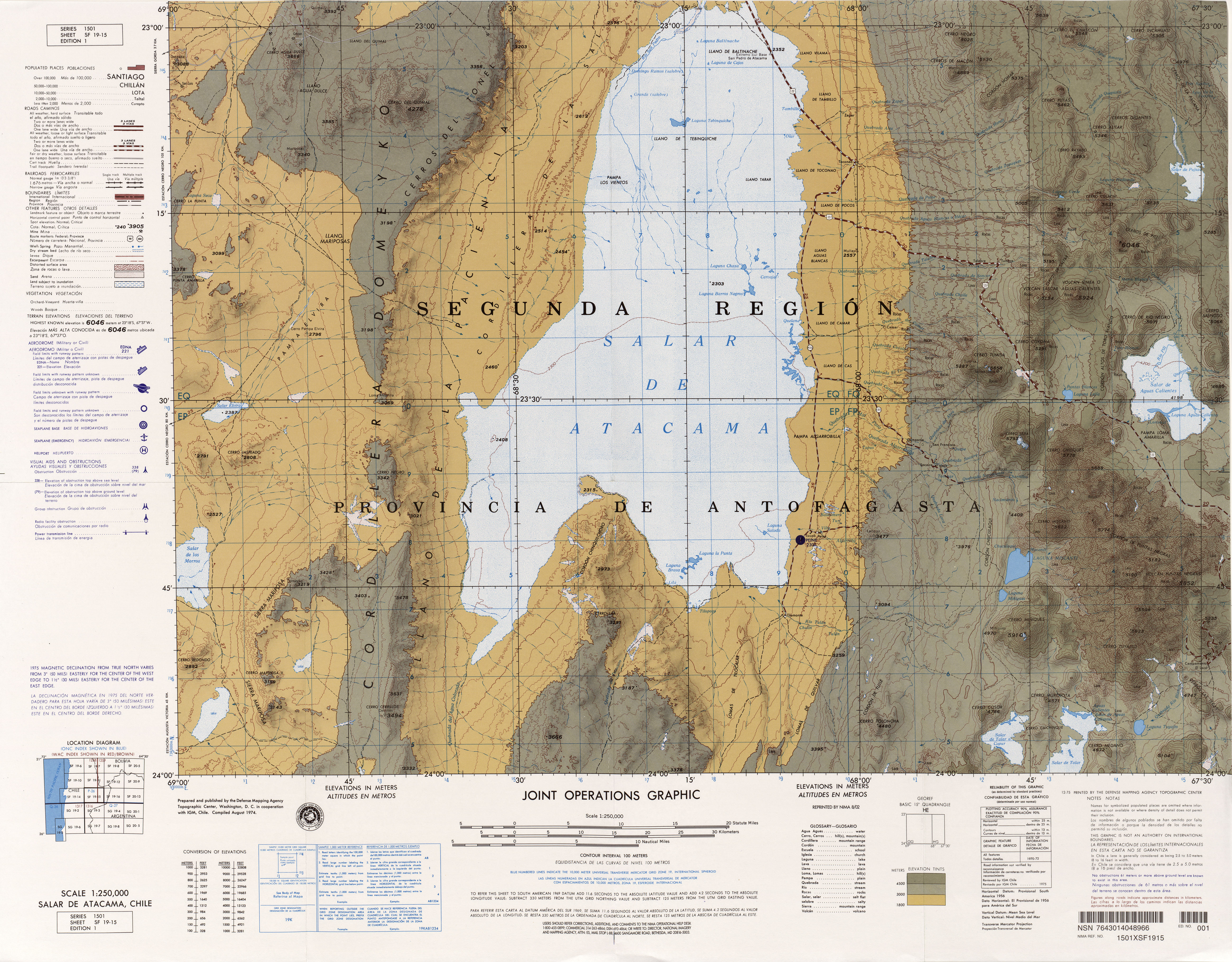
- ^ National Imagery and Mapping Agency. "Salar de Atacama, Chile" (Map). Latin America, Joint Operations Graphic(jpg) (1 ed.). 1:250,000. 1501.
- ISBN 978-3-642-16191-9.
- .
- S2CID 129002495.
- ISSN 0718-1043.
- ^ Morales et al. 2018, p. 257.
- ^ S2CID 257092455.
- ^ a b c Matthews, Jones & Gardeweg 1994, p. 401.
- ^ a b Tilling 2009, p. 126.
- ^ Tilling 2009, p. 127.
- ^ Nur & Ben-Avraham 1981, p. 730.
- ^ Nur & Ben-Avraham 1981, p. 731.
- ^ Nur & Ben-Avraham 1981, p. 738.
- ^ a b c d e f Calder, Sparks & Gardeweg 2000, p. 202.
- ^ Díaz, Brasse & Ticona 2012, p. 21.
- ^ Díaz, Brasse & Ticona 2012, p. 22.
- ^ Tilling 2009, p. 128.
- ^ Mather et al. 2004, p. 1.
- ^ a b c Matthews et al. 1996, p. 510.
- ^ a b Francis & Rothery 1987, p. 614.
- ^ Matthews, Jones & Gardeweg 1994, p. 401,403.
- ^ a b c d Glaze et al. 1989, p. 151.
- ^ Francis & Rothery 1987, p. 616.
- ^ a b c d Tassi et al. 2008, p. 172.
- ^ Pritchard & Simons 2004, p. 2.
- ^ a b Glaze et al. 1989, p. 149.
- ^ a b c d e f g h Francis & Rothery 1987, p. 615.
- ^ a b c d e f Denniss et al. 1998, p. 802.
- ^ a b c d e f g h i j Gardeweg, Sparks & Matthews 1998, p. 92.
- ^ a b Gardeweg, Sparks & Matthews 1998, p. 90.
- ^ Déruelle et al. 1996, p. 191.
- ^ a b c d e f Calder, Sparks & Gardeweg 2000, p. 204.
- .
- ^ Gardeweg, Sparks & Matthews 1998, p. 91.
- ^ Cabrol et al. 2009, p. 3.
- ^ a b c d Calder, Sparks & Gardeweg 2000, p. 203.
- ^ a b c d e Donoso, Aguilera & Medina 2005, p. 231.
- ^ a b Calder, Sparks & Gardeweg 2000, p. 223.
- ^ Díaz, Brasse & Ticona 2012, p. 27.
- ^ a b c d e f g h i Calder, Sparks & Gardeweg 2000, p. 205.
- S2CID 5088303.
- ^ a b Donoso, Aguilera & Medina 2005, p. 230.
- ^ Donoso, Aguilera & Medina 2005, p. 233.
- ^ a b Matthews, Jones & Gardeweg 1994, p. 402.
- ^ a b Fernández, Álvarez & Salinas 2011, p. 748.
- ^ a b c d e f g h i j k l Matthews, Gardeweg & Sparks 1997, p. 73.
- ^ a b c d e f g h i Matthews, Jones & Gardeweg 1994, p. 403.
- ^ Gardeweg, Sparks & Matthews 1998, p. 89.
- ^ a b Richter et al. 2018, p. 3.
- ^ a b c d e f g h i Matthews, Gardeweg & Sparks 1997, p. 74.
- ^ de Zeeuw-van Dalfsen et al. 2017, p. 9.
- ^ a b c Ai et al. 2023, p. 5.
- ^ a b c d e f Tassi et al. 2008, p. 173.
- ^ Ai et al. 2023, p. 7.
- ^ Ai et al. 2023, p. 3.
- ^ a b c d e f Gardeweg, Sparks & Matthews 1998, p. 100.
- ^ de Zeeuw-van Dalfsen et al. 2017, p. 2.
- ^ Casertano & Barozzi 2015, p. 311.
- ^ a b c Zellmer et al. 2014, p. 189.
- ^ a b c d e Sparks et al. 1997, p. 559.
- ^ Matthews, Jones & Gardeweg 1994, pp. 409–411.
- ^ Matthews, Jones & Gardeweg 1994, p. 404.
- ^ a b c d e f Matthews, Jones & Gardeweg 1994, p. 405.
- ^ Sparks et al. 1997, p. 560.
- ^ Sparks et al. 1997, p. 562.
- ISBN 9782709911542.
- ^ a b de Zeeuw-van Dalfsen et al. 2017, p. 3.
- ^ a b c d e Matthews, Jones & Gardeweg 1994, p. 428.
- ^ de Zeeuw-van Dalfsen et al. 2017, p. 8.
- ^ Casertano & Barozzi 2015, p. 308.
- S2CID 56007738.
- ^ a b Sainlot et al. 2020, p. 2.
- ^ Matthews, Jones & Gardeweg 1994, pp. 406–407.
- ^ a b Matthews, Gardeweg & Sparks 1997, p. 72.
- ^ Matthews, Jones & Gardeweg 1994, p. 414.
- ^ Matthews, Jones & Gardeweg 1994, p. 421.
- ^ Matthews, Jones & Gardeweg 1994, p. 422.
- ^ Matthews, Sparks & Gardeweg 1999, pp. 1892–1893.
- ^ a b c Matthews, Jones & Gardeweg 1994, p. 411.
- ^ Matthews, Jones & Gardeweg 1994, p. 406.
- ^ Sainlot et al. 2020, p. 12.
- ^ a b c Gardeweg, Sparks & Matthews 1998, p. 102.
- ^ a b González et al. 2015, p. 288.
- ^ a b Pritchard & Simons 2004, p. 26.
- ^ a b Sainlot et al. 2020, p. 66.
- ^ Jenkins et al. 2023, p. 4.
- ^ a b c d e Matthews, Sparks & Gardeweg 1999, p. 1893.
- ^ a b Matthews, Jones & Gardeweg 1994, p. 412.
- ^ Matthews et al. 1996, p. 516.
- ISBN 978-3-642-12404-4.
- ^ a b Matthews, Jones & Gardeweg 1994, p. 413.
- ^ a b Matthews et al. 1996, p. 528.
- ^ Matthews et al. 1996, p. 513.
- ^ Richter et al. 2018, p. 8.
- ^ Tassi et al. 2008, p. 173,175.
- ^ Sheldrake et al. 2016, p. 250.
- ^ Ai et al. 2023, p. 9.
- ^ a b Ai et al. 2023, p. 11.
- ^ a b c Tassi et al. 2008, p. 175.
- ^ Menard et al. 2014, p. 55.
- ^ Sainlot et al. 2020, p. 78.
- ^ Mather et al. 2004, p. 7.
- ^ a b Mather et al. 2004, p. 18.
- ^ a b Menard et al. 2014, p. 52.
- ^ a b Menard et al. 2014, p. 58.
- S2CID 53487329.
- S2CID 14447296.
- ISBN 978-0-08-044847-3.
- .
- ^ Menard et al. 2014, p. 63.
- ^ Sheldrake et al. 2016, p. 249.
- ^ a b Mather et al. 2004, p. 8.
- ^ Menard et al. 2014, p. 59.
- S2CID 219479662.
- ^ a b c Matthews, Gardeweg & Sparks 1997, p. 81.
- ^ Matthews, Jones & Gardeweg 1994, p. 426.
- ^ Tassi et al. 2008, p. 176,178.
- ^ Matthews, Jones & Gardeweg 1994, pp. 428–429.
- ^ Risacher & Alonso 2001, p. 327.
- ^ Tassi et al. 2008, p. 176.
- Bibcode:2014AGUFM.V41C4833I.
- S2CID 132265558.
- ^ Díaz, Brasse & Ticona 2012, p. 28.
- ^ Jenkins et al. 2023, p. 3.
- ^ Tassi, F.; Aguilera, F.; Medina, E.; Vaselli, O.; Tedesco, D.; Poreda, R. J. (January 2007). "First geochemical survey of fumarolic gases from Lascar volcano (Central Andes, Chile)" (PDF). Geophysical Research Abstracts. 9. Archived from the original (PDF) on 7 November 2017. Retrieved 11 December 2016.
- S2CID 226323216.
- ^ Sheldrake et al. 2016, p. 244.
- ^ a b c Richter et al. 2018, p. 2.
- ^ a b c d e f g Wooster & Rothery 1997, p. 567.
- ^ Richter et al. 2018, p. 10.
- .
- ^ a b c González et al. 2015, p. 278.
- ^ Gardeweg, Sparks & Matthews 1998, p. 95.
- ^ a b c Gardeweg, Sparks & Matthews 1998, p. 94.
- ^ a b c Gardeweg, Sparks & Matthews 1998, p. 96.
- ^ Matthews, Sparks & Gardeweg 1999, p. 1913.
- ^ a b c d e Matthews, Sparks & Gardeweg 1999, p. 1892.
- ^ Matthews, Sparks & Gardeweg 1999, p. 1897.
- ^ a b Matthews, Sparks & Gardeweg 1999, p. 1900.
- ^ a b c Matthews, Sparks & Gardeweg 1999, p. 1917.
- ^ Matthews, Sparks & Gardeweg 1999, p. 1895.
- ^ a b c Gardeweg, Sparks & Matthews 1998, p. 97.
- ^ Matthews, Sparks & Gardeweg 1999, p. 1901.
- ^ a b c Calder, Sparks & Gardeweg 2000, p. 207.
- ^ Matthews, Sparks & Gardeweg 1999, p. 1903.
- ^ Calder, Sparks & Gardeweg 2000, p. 211.
- ^ Gardeweg, Sparks & Matthews 1998, p. 98.
- ^ Calder, Sparks & Gardeweg 2000, p. 210.
- ^ Matthews, Sparks & Gardeweg 1999, p. 1914.
- ^ Pritchard & Simons 2004, p. 28.
- ^ a b Matthews, Sparks & Gardeweg 1999, p. 1915.
- ^ a b Matthews, Jones & Gardeweg 1994, p. 409.
- ^ a b Gardeweg, Sparks & Matthews 1998, p. 99.
- ^ Gardeweg, Sparks & Matthews 1998, p. 94,97.
- ^ Gardeweg, Sparks & Matthews 1998, p. 99,100.
- ^ a b c Gardeweg, Sparks & Matthews 1998, p. 103.
- ^ a b c d e f "Lascar, Eruptive History". Global Volcanism Program. Smithsonian Institution. Retrieved 11 December 2016.
- ^ Gardeweg, Sparks & Matthews 1998, p. 101.
- ISSN 0717-7305. Archived from the original(PDF) on 29 June 2021. Retrieved 20 August 2021.
- ^ a b Hellweg 1999, p. 452.
- ^ Casertano & Barozzi 2015, p. 313.
- JSTOR 211839.
- ^ a b Francis & Rothery 1987, p. 617.
- ^ a b Glaze et al. 1989, p. 152.
- ^ Glaze et al. 1989, p. 153.
- ^ a b Matthews, Gardeweg & Sparks 1997, p. 75.
- ^ Wooster & Rothery 1997, p. 568.
- ^ a b Matthews, Gardeweg & Sparks 1997, p. 77.
- doi:10.1130/G19645.1.
- ^ Mather et al. 2004, p. 2.
- ^ Wooster 2001, p. 848.
- ^ a b Gardeweg & Medina 1994, p. 299.
- ^ Gardeweg & Medina 1994, p. 300.
- ^ a b c d Déruelle et al. 1996, p. 192.
- ^ a b c Sparks et al. 1997, p. 558.
- ^ Déruelle et al. 1996, p. 194.
- ^ Bertin 2017, p. 1137.
- ^ a b Calder, Sparks & Gardeweg 2000, p. 217.
- ^ Gardeweg & Medina 1994, pp. 299–300.
- ^ a b c d Matthews, Gardeweg & Sparks 1997, p. 76.
- ^ a b Harris et al. 1997, p. 55.
- ^ Calder, Sparks & Gardeweg 2000, p. 219.
- ^ Harris et al. 1997, p. 56.
- ^ Jessop et al. 2012, p. 82.
- ^ a b c Whelley, Calder & Wooller 2017, p. 81.
- ^ Denniss et al. 1998, p. 808.
- ^ Whelley, Calder & Wooller 2017, p. 83.
- ^ Whelley, Calder & Wooller 2017, p. 87.
- ^ Calder, Sparks & Gardeweg 2000, p. 221.
- ^ Calder, Sparks & Gardeweg 2000, p. 228.
- ^ Jessop et al. 2012, p. 94.
- ^ Whelley et al. 2011, p. 514.
- ^ Whelley et al. 2011, p. 515.
- ^ Whelley et al. 2011, p. 521,522.
- ^ Sparks et al. 1997, p. 557.
- ^ Wooster 2001, p. 849.
- ^ Gardeweg & Medina 1994, p. 302.
- ^ Gardeweg & Medina 1994, p. 301.
- ^ Comité Científico Asesor - Centro Nacional de Prevención de Desastres (1995). "Sistema Nacional de Proteccion Civil Centro Nacional de Prevencion de Desastres Universidad Nacional Autonoma de Mexico Volcan Popocatepetl Estudios Realizados Durante La Crisis de 1994-1995 Comite Cientifico Asesor Cenapred-Unam" (PDF). Protección Civil Mexico (in Spanish). p. 298. Retrieved 2 November 2018.
- ^ Cirer & Bertea 2023, p. 12.
- hdl:11336/54533.
- )
- ^ Fernández, Álvarez & Salinas 2011, p. 749.
- ^ Collini, E.A.; Mingari, L.; Reckziegel, F.; Bustos, E.; Baez, W.; Andrioli, M.; Folch, A.; Alexander, P.; Viramonte, J.G. (2015). "Satellite images uncertainty: eruption or resuspension? The importance of the multidisciplinary approach. The case of June 13th, 2015 Ojos del Salado false volcanic eruption" (PDF). World Meteorological Organization. p. 5. Retrieved 19 February 2019.
- ^ Hayes et al. 2019, p. 8.
- ^ Pavez et al. 2006, p. 308.
- ^ de Zeeuw-van Dalfsen et al. 2017, p. 10.
- .
- .
- ^ a b c Gardeweg & Medina 1994, p. 303.
- ^ Risacher & Alonso 2001, p. 333.
- ^ Hayes et al. 2019, p. 96.
- PMID 10898397.
- ISSN 1026-8774.
- ^ González et al. 2015, p. 277.
- ^ Ai et al. 2023, p. 2.
- ^ Pavez et al. 2006, p. 315.
- ^ Pavez et al. 2006, p. 313.
- ^ Pritchard & Simons 2004, p. 10.
- ^ González et al. 2015, p. 278,279.
- ^ a b González et al. 2015, p. 279.
- ^ González et al. 2015, p. 285.
- ^ Clavero, Naranjo & Cayupi 2006, p. 435.
- ^ a b Clavero, Naranjo & Cayupi 2006, p. 436.
- ^ Aguilera et al. 2006, p. 394.
- ^ Clavero, Naranjo & Cayupi 2006, pp. 436–437.
- ^ Aguilera et al. 2006, p. 395.
- ^ Clavero, Naranjo & Cayupi 2006, p. 437.
- ^ a b c d e f Global Volcanism Program, 2013. Report on Lascar (Chile). In: Venzke, E (ed.), Bulletin of the Global Volcanism Network, 38:7. Smithsonian Institution.
- ^ Global Volcanism Program, 2015. Report on Lascar (Chile). In: Venzke, E (ed.), Bulletin of the Global Volcanism Network, 40:6. Smithsonian Institution.
- ^ a b Global Volcanism Program, 2016. Report on Lascar (Chile). In: Venzke, E (ed.), Bulletin of the Global Volcanism Network, 41:7. Smithsonian Institution.
- ^ Gaete et al. 2020, p. 393.
- ^ Global Volcanism Program, 2017. Report on Lascar (Chile). In: Venzke, E (ed.), Bulletin of the Global Volcanism Network, 42:7. Smithsonian Institution.
- ^ Asch et al. 1996, p. 282.
- ^ Sheldrake et al. 2016, p. 251.
- ^ Hellweg 1999, p. 463.
- ^ Harris et al. 1997, p. 49.
- ^ Gaete et al. 2020, p. 379.
- ^ Jorzik et al. 2020, p. 195.
- ^ "SERNAGEOMIN da a conocer nuevo ranking de volcanes" (in Spanish). Sernageomin. 20 February 2020. Retrieved 5 December 2021.
- ^ Cirer & Bertea 2023, p. 9.
- ^ a b "Red Nacional de Vigilancia Volcánica de Chile". sernageomin.cl (in Spanish). National Geology and Mining Service. Archived from the original on 15 December 2017.
- ^ Aguilera et al. 2006, p. 396.
- ISBN 9780444531179.
- Ministry of Federal Planning, Public Investment and Services. 2010. p. 251. Retrieved 2 November 2018.
- ^ a b Morales et al. 2018, p. 251.
- PMID 10898396.
- ISSN 0717-9707.
- .
- ^ Jorzik et al. 2020, p. 95.
- ^ a b Risacher & Alonso 2001, p. 321.
- S2CID 25538335.
- ^ Gardeweg, Sparks & Matthews 1998, pp. 101–102.
- ISBN 978-81-7024-472-1.
- ^ Cabrol et al. 2009, p. 3,4.
Sources
- Aguilera, F.; Viramonte, J.; Medina, E.; Guzmán, K.; Becchio, R.; Delgado, H.; Arnosio, M. (August 2006). "Recent eruptive activity from Lascar volcano (2006)" (PDF). SERNAGEOMIN. Antofagasta: 11th Chilean Geological Congress. Retrieved 5 December 2016.
- Ai, Lun; Walter, Thomas R.; Aguilera, Felipe; Layana, Susana; Mania, René; Kujawa, Christian; Zimmer, Martin; Inostroza, Manuel (July 2023). "Crater morphology, nested ring structures, and temperature anomalies studied by unoccupied aircraft system data at Lascar volcano, northern Chile". Journal of Volcanology and Geothermal Research. 439: 107840. .
- Asch, G.; Wylegalla, K.; Hellweg, M.; Seidl, D.; Rademacher, H. (March 1996). "Observations of rapid-fire event tremor at Lascar volcano, Chile". Annals of Geophysics. 39 (2): 273–282. doi:10.4401/ag-3972.
- Bertin, Daniel (1 February 2017). "3-D ballistic transport of ellipsoidal volcanic projectiles considering horizontal wind field and variable shape-dependent drag coefficients". Journal of Geophysical Research: Solid Earth. 122 (2): 1126–1151. S2CID 132171799.
- Cabrol, Nathalie A.; Grin, Edmond A.; .
- Calder, E. S.; Sparks, R. S. J.; Gardeweg, M. C. (December 2000). "Erosion, transport and segregation of pumice and lithic clasts in pyroclastic flows inferred from ignimbrite at Lascar Volcano, Chile". Journal of Volcanology and Geothermal Research. 104 (1–4): 201–235. .
- Casertano, L.; Barozzi, R. (2015). "Informe sobre el sistema volcánico de Lascar" (PDF). Anales de la Facultad de Ciencias Físicas y Matemáticas (in Spanish). 18 (18): 303–315. Retrieved 7 December 2016.
- Cirer, Mercedes; Bertea, Esteban (30 June 2023). "Una ventana al pasado del volcán Láscar, ejemplo de la colaboración científica entre Argentina y Chile en la gestión del riesgo". Temas de Biología y Geología del NOA (in Spanish). 13 (1): 5–15. ISSN 1853-6700.
- Clavero, Jorge; Naranjo, José A; Cayupi, Juan (August 2006). "El ciclo eruptivo del 18 al 25 de Abril de 2006 del volcan Lascar, Andes Centrales" (PDF). biblioserver.sernageomin.cl (in Spanish). Antofagasta: 9th Chilean Geological Congress. pp. 435–438. Archived from the original (PDF) on 20 December 2016. Retrieved 11 December 2016.
- de Zeeuw-van Dalfsen, Elske; Richter, Nicole; González, Gabriel; Walter, Thomas R. (2017). "Geomorphology and structural development of the nested summit crater of Láscar Volcano studied with Terrestrial Laser Scanner data and analogue modelling". Journal of Volcanology and Geothermal Research. 329: 1–12. .
- Denniss, A. M.; Harris, A. J. L.; Rothery, D. A.; Francis, P. W.; Carlton, R. W. (January 1998). "Satellite observations of the April 1993 eruption of Lascar volcano". International Journal of Remote Sensing. 19 (5): 801–821. .
- Déruelle, Bernard; Figueroa, A. Oscar; Medina, T. Eduardo; Viramonte, G. Jose; Maragaño, C. Mario (March 1996). "Petrology of pumices of April 1993 eruption of Lascar (Atacama, Chile)". Terra Nova. 8 (2): 191–199. .
- Díaz, Daniel; Brasse, Heinrich; Ticona, Faustino (March 2012). "Conductivity distribution beneath Lascar volcano (Northern Chile) and the Puna, inferred from magnetotelluric data". Journal of Volcanology and Geothermal Research. 217–218: 21–29. .
- Donoso, C. L.; Aguilera, F. A.; Medina, Eduardo T. (1 January 2005). Geology and petrology of the Corona and Cerros de Saltar domes near the Lascar volcano system, northern Chile. IRD Editions. pp. 230–233. ISBN 9782709915755.
- Fernández, Luis; Álvarez, Gabriel; Salinas, Renato (25 November 2011). "Impact area determination of pyroclastic deposits in Lascar volcano, eruptive process in the year 1993" (PDF). Natural Hazards. 60 (2): 747–760. S2CID 128912355.
- Francis, P. W.; Rothery, D. A. (1987). "Using the Landsat Thematic Mapper to detect and monitor active volcanoes: An example from Lascar volcano, northern Chile". Geology. 15 (7): 614–617. .
- Gaete, Ayleen; Walter, Thomas R.; Bredemeyer, Stefan; Zimmer, Martin; Kujawa, Christian; Franco Marin, Luis; San Martin, Juan; Bucarey Parra, Claudia (4 February 2020). "Processes culminating in the 2015 phreatic explosion at Lascar volcano, Chile, evidenced by multiparametric data". Natural Hazards and Earth System Sciences. 20 (2): 377–397. S2CID 211131500.
- Gardeweg, P. Moyra; Medina, Eduardo (1994). "La erupcion subpliniana del 19-20 de Abril de 1993 del volcan Lascar, N de Chile" (PDF). 7th Chilean Geological Congress (in Spanish). Archived from the original (PDF) on 20 December 2016. Retrieved 11 December 2016.
- Gardeweg, M. C.; Sparks, R. S. J.; Matthews, S. J. (1 February 1998). "Evolution of Lascar Volcano, Northern Chile". Journal of the Geological Society. 155 (1): 89–104. S2CID 128916568.
- Glaze, L. S.; Francis, P. W.; Self, S.; Rothery, D. A. (May 1989). "The 16 September 1986 eruption of Lascar volcano, north Chile: Satellite investigations". Bulletin of Volcanology. 51 (3): 149–160. S2CID 128887339.
- González, C.; Inostroza, M.; Aguilera, F.; González, R.; Viramonte, J.; Menzies, A. (August 2015). "Heat and mass flux measurements using Landsat images from the 2000–2004 period, Lascar volcano, northern Chile". Journal of Volcanology and Geothermal Research. 301: 277–292. hdl:11336/2613.
- Harris, Andrew J. L.; Butterworth, Anna L.; Carlton, Richard W.; Downey, Ian; Miller, Peter; Navarro, Pedro; Rothery, David A. (23 September 1997). "Low-cost volcano surveillance from space: case studies from Etna, Krafla, Cerro Negro, Fogo, Lascar and Erebus". Bulletin of Volcanology. 59 (1): 49–64. S2CID 129595866.
- Hayes, J.L.; Deligne, N.I.; Bertin, L.; Calderon, R.; Wardman, J.B.; Wilson, T.M.; Leonard, G.S.; Stewart, C.; Wallace, K.L.; Baxter, P.J. (April 2019). Impacts of the 2015 eruption of Calbuco volcano on Chilean infrastructure, utilities, agriculture, and health (Report). GNS Science report. doi:10.21420/02YC-VX66 – via ResearchGate.
- Hellweg, Margaret (June 1999). "Listening carefully: unique observations of harmonic tremor at Lascar volcano, Chile". Annals of Geophysics. 42 (3): 451–464. doi:10.4401/ag-3729.
- Jenkins, A.P.; Rust, A.C.; Blundy, J.; Biggs, J. (August 2023). "Magnetotelluric investigations at Andean volcanoes: Partial melt or saline magmatic fluids?". Journal of Volcanology and Geothermal Research. 440: 107852. .
- Jessop, D. E.; Kelfoun, K.; Labazuy, P.; Mangeney, A.; Roche, O.; Tillier, J.-L.; Trouillet, M.; Thibault, G. (November 2012). "LiDAR derived morphology of the 1993 Lascar pyroclastic flow deposits, and implication for flow dynamics and rheology". Journal of Volcanology and Geothermal Research. 245–246: 81–97. .
- Jorzik, O.; Kandarr, J.; Klinghammer, P.; Spreen, D. (September 2020). ESKP-Themenspezial Vulkanismus und Gesellschaft. Zwischen Risiko, Vorsorge und Faszination. Helmholtz-Zentrum Potsdam – Deutsches GeoForschungsZentrum. ISBN 978-3-9816597-3-3.
- .
- Matthews, Stephen J.; Gardeweg, Moyra C.; Sparks, R. Stephen J. (23 September 1997). "The 1984 to 1996 cyclic activity of Lascar Volcano, northern Chile: cycles of dome growth, dome subsidence, degassing and explosive eruptions". Bulletin of Volcanology. 59 (1): 72–82. S2CID 140637221.
- Matthews, S. J.; Jones, A. P.; Gardeweg, M. C. (1 April 1994). "Lascar Volcano, Northern Chile; Evidence for Steady-State Disequilibrium". Journal of Petrology. 35 (2): 401–432. .
- Matthews, S. J.; Marquillas, R. A.; Kemp, A. J.; Grange, F. K.; Gardeweg, M. C. (July 1996). "Active skarn formation beneath Lascar Volcano, northern Chile: a petrographic and geochemical study of xenoliths in eruption products". Journal of Metamorphic Geology. 14 (4): 509–530. .
- Matthews, S. J.; Sparks, R. S. J.; Gardeweg, M. C. (1 December 1999). "The Piedras Grandes-Soncor Eruptions, Lascar Volcano, Chile; Evolution of a Zoned Magma Chamber in the Central Andean Upper Crust". Journal of Petrology. 40 (12): 1891–1919. .
- Menard, G.; Moune, S.; Vlastélic, I.; Aguilera, F.; Valade, S.; Bontemps, M.; González, R. (October 2014). "Gas and aerosol emissions from Lascar volcano (Northern Chile): Insights into the origin of gases and their links with the volcanic activity". Journal of Volcanology and Geothermal Research. 287: 51–67. .
- Morales, Héctor; González, Luis; Dibona, Gisella; Vilches, Juan Carlos; Azócar, Rodrigo (11 June 2018). "Viajes e intercambios entre las comunidades argentinas y chilenas en la puna atacameña (segunda mitad del siglo XX)". Revista Chilena de Antropología (in European Spanish) (37): 249–266. ISSN 0719-1472.
- Nur, Amos; Ben-Avraham, Zvi (1981). "Volcanic gaps and the consumption of aseismic ridges in South America". GSA Memoirs. Geological Society of America Memoirs. 154: 729–740. ISBN 978-0-8137-1154-6.
- Pavez, A.; Remy, D.; Bonvalot, S.; Diament, M.; Gabalda, G.; Froger, J-L.; Julien, P.; Legrand, D.; Moisset, D. (February 2006). "Insight into ground deformations at Lascar volcano (Chile) from SAR interferometry, photogrammetry and GPS data: Implications on volcano dynamics and future space monitoring" (PDF). Remote Sensing of Environment. 100 (3): 307–320. S2CID 128775883.
- Pritchard, M. E.; Simons, M. (February 2004). "An InSAR-based survey of volcanic deformation in the central Andes" (PDF). Geochemistry, Geophysics, Geosystems. 5 (2): Q02002. S2CID 18453316.
- Richter, Nicole; Salzer, Jacqueline Tema; de Zeeuw-van Dalfsen, Elske; Perissin, Daniele; Walter, Thomas R. (10 February 2018). "Constraints on the geomorphological evolution of the nested summit craters of Láscar volcano from high spatio-temporal resolution TerraSAR-X interferometry". Bulletin of Volcanology. 80 (3): 21. S2CID 134142712.
- Risacher, François; Alonso, Hugo (September 2001). "Geochemistry of ash leachates from the 1993 Lascar eruption, northern Chile. Implication for recycling of ancient evaporites". Journal of Volcanology and Geothermal Research. 109 (4): 319–337. .
- Sainlot, N.; Vlastélic, I.; Moune, S.; Rose-Koga, E. F.; Schiavi, F.; Valade, S.; Aguilera, F. (15 April 2020). "Uptake of gaseous thallium, tellurium, vanadium and molybdenum into anhydrous alum, Lascar volcano fumaroles, Chile". Geochimica et Cosmochimica Acta. 275: 64–82. S2CID 212909746.
- Sainlot, N.; Vlastélic, I.; Nauret, F.; Moune, S.; Aguilera, F. (1 August 2020). "Sr–Pb isotopes signature of Lascar volcano (Chile): Insight into contamination of arc magmas ascending through a thick continental crust". Journal of South American Earth Sciences. 101: 102599. S2CID 218777423.
- Sheldrake, T. E.; Sparks, R. S. J.; Cashman, K. V.; Wadge, G.; Aspinall, W. P. (1 September 2016). "Similarities and differences in the historical records of lava dome-building volcanoes: Implications for understanding magmatic processes and eruption forecasting" (PDF). Earth-Science Reviews. 160 (Supplement C): 240–263. .
- Sparks, R. S. J.; Gardeweg, M. C.; Calder, E. S.; Matthews, S. J. (7 May 1997). "Erosion by pyroclastic flows on Lascar Volcano, Chile". Bulletin of Volcanology. 58 (7): 557–565. S2CID 140641850.
- Tassi, F.; Aguilera, F.; Vaselli, O.; Medina, E.; Tedesco, D.; Delgado Huertas, A.; Poreda, R.; Kojima, S. (3 June 2008). "The magmatic- and hydrothermal-dominated fumarolic system at the Active Crater of Lascar volcano, northern Chile". Bulletin of Volcanology. 71 (2): 171–183. S2CID 130795166.
- Tilling, R. I. (14 December 2009). "Volcanism and associated hazards: the Andean perspective". Advances in Geosciences. 22: 125–137. .
- Whelley, Patrick L.; Calder, Eliza S.; Wooller, Luke (2017). "The emplacement dynamics of pumice lobes ascertained from morphology and granulometry: Examples from the 1993 deposits at Lascar Volcano, Chile" (PDF). Journal of Volcanology and Geothermal Research. 342: 79–90. S2CID 134099980.
- Whelley, Patrick L.; Jay, J.; Calder, E. S.; Pritchard, M. E.; Cassidy, N. J.; Alcaraz, S.; Pavez, A. (27 September 2011). "Post-depositional fracturing and subsidence of pumice flow deposits: Lascar Volcano, Chile". Bulletin of Volcanology. 74 (2): 511–531. PMID 26069384.
- Wooster, Martin J. (1 March 2001). "Long-term infrared surveillance of Lascar Volcano: Contrasting activity cycles and cooling pyroclastics". Geophysical Research Letters. 28 (5): 847–850. S2CID 129763252.
- Wooster, M. J.; Rothery, D. A. (7 May 1997). "Thermal monitoring of Lascar Volcano, Chile, using infrared data from the along-track scanning radiometer: a 1992–1995 time series". Bulletin of Volcanology. 58 (7): 566–579. S2CID 140180427.
- Zellmer, Georg F.; Freymuth, Heye; Cembrano, José M.; Clavero, Jorge E.; Veloso, Eugenio A. E.; Sielfeld, Gerd G. (2014). "Altered mineral uptake into fresh arc magmas: insights from U–Th isotopes of samples from Andean volcanoes under differential crustal stress regimes". Geological Society, London, Special Publications. 385 (1): 185–208. S2CID 128528082.
Further reading
- González-Ferrán, Oscar (1995). Volcanes de Chile (in Spanish). Santiago, Chile: Instituto Geográfico Militar. ISBN 978-956-202-054-1.
External links
- Lascar at sernageomin.cl
- Ascención al Volcán Lascar(5590msnm.) at the Wayback Machine (archived 13 July 2011)
- Atacama Photo Gallery – panoramic view into the crater of Lascar
- SI Google Earth Placemarks – Smithsonian Institution Global Volcanism Program: download placemarks with SI Holocene volcano-data.