
Harare
This article needs additional citations for verification. (July 2024) |
Harare | ||
|---|---|---|
Capital city and province | ||
Harare skyline Jacaranda trees lining Josiah Chinamano Avenue | ||
|
Council Harare City Council | | |
| Area | ||
• Capital city and province | 982.3 km2 (379.3 sq mi) | |
| Elevation | 1,490 m (4,890 ft) | |
| Population (2022 census)[1] | ||
• Capital city and province | 1,491,740 | |
| • Density | 1,500/km2 (3,900/sq mi) | |
| • Urban | 1,558,823 | |
| • Metro | 1,603,201 | |
| Demonym | Hararean | |
| Time zone | UTC+02:00 (CAT) | |
| Area code | 242 | |
| HDI (2018) | 0.645[4] Medium | |
| Dialling code 242 (or 0242 from within Zimbabwe) | ||


Harare (
The city was founded in 1890 by the
Being the commercial capital of Zimbabwe, it remains an important center of commerce and government, as well as finance, real estate, manufacturing, healthcare, education, art, culture, tourism, agriculture, mining and regional affairs.[9] Harare has the second-highest number of embassies in Southern Africa and serves as the location of the African headquarters of the World Health Organization, which it shares with Brazzaville.[10]
Harare has hosted multiple international
History
Early colonial history


The

At the time of the city's founding, its site and surroundings were poorly drained. The earliest development was on sloping ground along the left bank of a stream, in an area where the Julius Nyerere Way industrial road runs today. The first area to be fully drained was near the head of the stream and was named Causeway. Causeway is now the site of many important government buildings, including the Senate House and the Office of the Prime Minister. After the position was abolished in January 1988, the office was renamed for the use of the President.[15]

Salisbury was the seat of the British South Africa Company administrator and became the capital of the self-governing British colony of Southern Rhodesia in 1923.[16]
Post-war period
In the immediate aftermath of the
The optimism and prosperity of this period proved to be short-lived, as the Federation collapsed, which hindered the city's prosperity.[17][additional citation(s) needed]
1960s and 1970s
This section needs expansion. You can help by adding to it. (July 2024) |
The Federation of Rhodesia and Nyasaland was dissolved in 1963. Ian Smith's Rhodesian Front government declared Rhodesia independent from the United Kingdom on 11 November 1965, with Salisbury retained as the capital. Smith's Rhodesia later became the short-lived state of Zimbabwe Rhodesia; it was not until 18 April 1980 that the country was internationally recognized as independent as the Republic of Zimbabwe.[18]
Post-independence years

The city initially boomed under a wave of optimism and investment that followed the country's independence in 1980. The name of the city was changed to Harare on 18 April 1982, the second anniversary of Zimbabwean independence, taking its name from the village near Harare Kopje of the Shona chief Neharawa, whose nickname was "he who does not sleep".[19] Before independence, "Harare" was the name of the black residential area now known as Mbare.[citation needed]
Significant investment in education and healthcare produced a confident and growing middle class, evidenced by the rise of firms such as Econet Global and innovative design and architecture, exemplified by the Eastgate Centre. A notable symbol of this era in Harare's history is the New Reserve Bank Tower, one of the city's major landmarks.[citation needed]
Harare was the location of several international summits during this period, such as the 8th Summit of the Non-Aligned Movement in September 1986 and the 1991 Commonwealth Heads of Government Meeting.[20] The latter produced the Harare Declaration, dictating the membership criteria of the Commonwealth. In 1998, Harare was the host city of the 8th Assembly of the World Council of Churches.[21]
However, by 1992, Harare began to experience an economic downturn and the government responded by enacting
Economic difficulties and hyperinflation (1999–2008)
In the early 21st century, Harare was adversely affected by the political and economic crises that plagued Zimbabwe, particularly following the contested 2002 presidential election and 2005 parliamentary elections. The elected council was replaced by a government-appointed commission due to alleged inefficiency.[
Operation Murambatsvina
In May 2005, the Zimbabwean government demolished shanties, illegal vending sites, and backyard cottages in Harare, Epworth and other cities in
Economic uncertainty
In late March 2010, Harare's Joina City Tower was finally opened after fourteen years of delayed construction, marketed as 'Harare's New Pride'.[26] Initially, uptake of space in the tower was low, with office occupancy at only 3% in October 2011.[27] By May 2013, office occupancy had risen to around half, with all the retail space occupied.[28][relevant?]
The Economist Intelligence Unit rated Harare as the world's least livable city (out of 140 surveyed) in February 2011,[29] rising to 137th out of 140 in August 2012.[30]
In March 2015, Harare City Council planned a two-year project to install 4,000 solar street lights, starting in the central business district, at a cost of $15,000,000.[31]
In November 2017, the biggest demonstration in the history of the Republic of Zimbabwe was held in Harare, which led to the forced resignation of the long-serving 93-year-old President of Zimbabwe, Robert Mugabe, an event which was part of the first successful coup in Zimbabwe.[32][33]
Contemporary Harare
Since 2000, Harare has experienced periods of spectacular decline, particularly in the 2000s, but since the
Beginning in 2006, the city's growth extended into its northern and western fringes, beyond the city's
In 2020, Harare was classified as a Gamma city by the Globalization and World Cities Research Network.[38]
Demographics
| Year | Pop. | ±% |
|---|---|---|
| 1982 | 656,011 | — |
| 1992 | 1,189,103 | +81.3% |
| 2002 | 1,435,784 | +20.7% |
| 2012 | 1,485,231 | +3.4% |
| 2022 | 1,491,754 | +0.4% |
| Source:[39] | ||
As of 2012, Harare has a population of 2,123,132.[1] Over 90% of people in Harare are Shona-speaking people of African descent. Harare is also home to many Ndebele and Kalanga people as well. Roughly 25,000 white Zimbabweans also live in the Harare metro area.[40]
Geography
Topography
The city sits on one of the higher parts of the Highveld plateau of Zimbabwe at an elevation of 1,483 metres (4,865 feet). The original landscape could be described as a "parkland"[41] or wild place. The soils of Harare are varied: the northern and central areas largely have reddish brown, granular clay; some of the southern parts have gray-brown sand over pale, loamy sand or sandy loam.[42]
Suburbs
The City of Harare is divided into suburbs, outside of which are independent municipalities such as Epworth, Mount Hampden, Norton, Ruwa, and Chitungwiza, which are still located within the greater metropolitan province.[43]
The
The northern and north-eastern suburbs of Harare are generally home to its more affluent residents, including former president
To the east of Harare's city center, notable suburbs include
The southern portions of Harare have historically been more industrial areas, often home to most of its African population as well as some lower-class European-descended populations.
Climate

Under the
The average annual temperature is 17.95 °C (64.3 °F), rather low for the tropics. This is due to its high altitude position and the prevalence of cool south-easterly airflow.[52]
There are three main seasons: a warm, wet summer from November to March/April; a cool, dry winter from May to August (corresponding to winter in the Southern Hemisphere); and a warm to hot, dry season in September/October. Daily temperature ranges are about 7–22 °C (45–72 °F) in July (the coldest month), about 15–29 °C (59–84 °F) in October (the hottest month) and about 16–26 °C (61–79 °F) in January (midsummer). The hottest year on record was October 26, 2011 with 37 °C (98.6 °F) and the coldest year was 1965 with 17.13 °C (62.8 °F).
The average annual rainfall is about 825 mm (32.5 in) in the southwest, rising to 855 mm (33.7 in) on the higher land of the northeast (from around Borrowdale to Glen Lorne). Very little rain typically falls during the period of May to September, although sporadic showers occur most years. Rainfall varies a great deal from year to year and follows cycles of wet and dry periods from 7 to 10 years long. Records begin in October 1890 but all three Harare stations stopped reporting in early 2004.[53]
The climate supports the natural vegetation of open woodland. The most common tree of the local region is the msasa or
| Climate data for Harare (1961–1990, extremes 1897–present) | |||||||||||||
|---|---|---|---|---|---|---|---|---|---|---|---|---|---|
| Month | Jan | Feb | Mar | Apr | May | Jun | Jul | Aug | Sep | Oct | Nov | Dec | Year |
| Record high °C (°F) | 33.9 (93.0) |
35.0 (95.0) |
32.3 (90.1) |
32.0 (89.6) |
30.0 (86.0) |
27.7 (81.9) |
28.8 (83.8) |
31.0 (87.8) |
35.0 (95.0) |
36.7 (98.1) |
35.3 (95.5) |
33.5 (92.3) |
36.7 (98.1) |
| Mean daily maximum °C (°F) | 26.2 (79.2) |
26.0 (78.8) |
26.2 (79.2) |
25.6 (78.1) |
23.8 (74.8) |
21.8 (71.2) |
21.6 (70.9) |
24.1 (75.4) |
28.4 (83.1) |
28.8 (83.8) |
27.6 (81.7) |
26.3 (79.3) |
25.5 (77.9) |
| Daily mean °C (°F) | 21.0 (69.8) |
20.7 (69.3) |
20.3 (68.5) |
18.8 (65.8) |
16.1 (61.0) |
13.7 (56.7) |
13.4 (56.1) |
15.5 (59.9) |
18.6 (65.5) |
20.8 (69.4) |
21.2 (70.2) |
20.9 (69.6) |
18.4 (65.1) |
| Mean daily minimum °C (°F) | 15.8 (60.4) |
15.7 (60.3) |
14.5 (58.1) |
12.5 (54.5) |
9.3 (48.7) |
6.8 (44.2) |
6.5 (43.7) |
8.5 (47.3) |
11.7 (53.1) |
14.5 (58.1) |
15.5 (59.9) |
15.8 (60.4) |
12.3 (54.1) |
| Record low °C (°F) | 9.6 (49.3) |
8.0 (46.4) |
7.5 (45.5) |
4.7 (40.5) |
2.8 (37.0) |
0.1 (32.2) |
0.1 (32.2) |
1.1 (34.0) |
4.1 (39.4) |
5.1 (41.2) |
6.1 (43.0) |
10.0 (50.0) |
0.1 (32.2) |
| Average precipitation mm (inches) | 190.8 (7.51) |
176.3 (6.94) |
99.1 (3.90) |
37.2 (1.46) |
7.4 (0.29) |
1.8 (0.07) |
2.3 (0.09) |
2.9 (0.11) |
6.5 (0.26) |
40.4 (1.59) |
93.2 (3.67) |
182.7 (7.19) |
840.6 (33.09) |
| Average precipitation days | 17 | 14 | 10 | 5 | 2 | 1 | 0 | 1 | 1 | 5 | 10 | 16 | 82 |
| Average relative humidity (%)
|
76 | 77 | 72 | 67 | 62 | 60 | 55 | 50 | 45 | 48 | 63 | 73 | 62 |
| Mean monthly sunshine hours | 217.0 | 190.4 | 232.5 | 249.0 | 269.7 | 264.0 | 279.0 | 300.7 | 294.0 | 285.2 | 231.0 | 198.4 | 3,010.9 |
| Mean daily sunshine hours | 7.0 | 6.8 | 7.5 | 8.3 | 8.7 | 8.8 | 9.0 | 9.7 | 9.8 | 9.2 | 7.7 | 6.4 | 8.2 |
| Source 1: World Meteorological Organization,[55] NOAA (sun and mean temperature, 1961–1990),[56] | |||||||||||||
| Source 2: Deutscher Wetterdienst (humidity, 1954–1975),[57] Meteo Climat (record highs and lows)[58] | |||||||||||||
Economy
This section may be unbalanced towards certain viewpoints. . (July 2024) |
Harare is Zimbabwe's leading financial, commercial, and communications centre, as well as an international trade centre for
Harare experienced a real estate boom in the 2000s and early 2010s, particularly in the wealthy northern suburbs, with prices rising dramatically over the last decade despite challenges in other sectors of the economy.[60] This boom was largely fueled by members of the Zimbabwean diaspora and by speculation, with investors hedging against the local currency.[60][34] However, the once-growing market began to cool off due to a 2019 hike in interest rates and the economic fallout from the COVID-19 pandemic, leaving a number of projects unfinished.[61]
Another challenge to Harare's economy is the persistent emigration of highly educated and skilled residents to the United Kingdom, Australia, Canada, Ireland, South Africa and New Zealand, largely due to the economic downturn and political unrest.
Shopping and retail
Locally produced art, handicrafts and souvenirs can be purchased at locations including Doon Estate, Uwminsdale, Avondale Market and Mbare Musika. Msasa Park and Umwinsdale in particular host a number of galleries that produce high-quality Shona soapstone sculptures and textiles, such as Patrick Mavros Studios, which has another gallery in Knightsbridge, London.[66] International brands are generally less common in Harare than in European cities. However, conventional and luxury shopping can be found on Fife Avenue, Sam Nujoma (Union) Avenue, Arundel Village, Avondale, Borrowdale, Eastgate, Westgate and Sam Levy's Village.[67] Virtually all luxury shopping is concentrated in the wealthier northern suburbs, particularly Borrowdale.
Transportation

Harare is a relatively young city, mostly growing during the country's post-
The city's public transport system includes public and private sector operations. The former consists of

As of May 2023, Harare is not served by any
Long-distance bus services link Harare to most parts of Zimbabwe.[citation needed]
The city is crossed by Transafrican Highway 9 (TAH 9), which connects it to the cities of Lusaka and Beira.
The largest airport in Zimbabwe, the Robert Gabriel Mugabe International Airport, serves Harare.
Education
The University of Zimbabwe is located in Harare. Founded in 1952, the university is the country's oldest and largest, offering a wide range of undergraduate and postgraduate programs. The student population stands at 20,399, with 17,718 undergraduate students and 2,681 postgraduate students.[74]
Sports
_2.jpg)
Harare has long been regarded as Zimbabwe's sporting capital due to its role in developing Zimbabwean sport, the range and quality of its sporting events and venues, and its high rates of spectatorship and participation.
In 1995, Harare hosted most of the sixth
Harare is home to
Popular teams
This section needs additional citations for verification. (July 2024) |
The following table shows the major sports teams in the Harare area.
| Club | Sport | League | Founded | Venue | Capacity |
|---|---|---|---|---|---|
| Dynamos F.C. | Association football | ZPSL | 1963[a] | Rufaro Stadium (Mbare, Harare) |
40,00 |
| CAPS United F.C. | Association football | ZPSL | 1973[a] | National Sports Stadium (Harare) |
60,000 |
| Old Georgians | Rugby Union |
SSRL | 1926[a] | Harare Sports Club | 10,000 |
| Old Hararians | Rugby Union |
SSRL | 1898[a] | Harare Sports Club | 10,000 |
| Black Rhinos F.C. | Association football | ZPSL | 1983 | Figaro Stadium | 17,544 |
| Mashonaland Eagles | Cricket | Logan Cup | 2009[a] | Harare Sports club | 10,000 |
| Old Miltonians | Rugby Union |
SSRL | 1910[a] | Harare Sports Club | 10,000 |
Football and cricket
The main football stadiums in Harare are the National Sports Stadium and Rufaro Stadium.
Virtually all first-class and international
Rugby
Harare is also the heartland of
High school teams are generally of a high standard, with Prince Edward School, St. George's College, and St. John's College all ranking among the country's leading teams and frequently sending their first XV sides to compete against well-known South African high schools during Craven Week.[82] After high school, the city's best players unfortunately tend to move on to South Africa or the United Kingdom due to a lack of professionalism and greater educational and earning opportunities abroad, thus depleting the strength of the rugby union in Zimbabwe.[84] Notable internationals hailing from Harare include Tendai Mtawarira, Don Armand, and Brian Mujati, among numerous others.[85]
Media
Harare is host to some of Zimbabwe's leading media outlets. Despite accusations of government censorship and intimidation, the city maintains a robust press, much of which is defiantly critical of the current government.[86][additional citation(s) needed] In print media, the most internationally-famous paper is the Herald, the city's oldest newspaper, founded in 1893 and former paper of record prior to its purchase by the government. The paper is best noted for its heavy censorship during the Rhodesian Front government from 1962 to 1979, with many of its articles appearing as redacted — with black boxes marking the words removed by government censors — before its forced purchase.[87] Today it is largely seen as little more than a government mouthpiece by residents and overwhelmingly supports the government line.[88][additional citation(s) needed]
In contrast, private newspapers continue to adopt a more independent line and enjoy a diverse and vibrant readership.[
Online media outlets include ZimOnline, ZimDaily, the Zimbabwe Guardian and NewZimbabwe.com amongst others.[89][90][87]
Television and radio
The state-owned ZBC TV maintains a monopoly on free-to-air TV channels in the city, with private broadcasters (such as the now-defunct Joy TV) coming and going based on the whims of the government.[91] As such, many households that can afford the cost subscribe to the satellite television distributor DStv for entertainment, news, and sport from Africa and abroad.
In November 2021, it was announced that six new free-to-air private television stations would go live in Zimbabwe and join ZBC TV after the Broadcasting Authority of Zimbabwe issued licences, ending the 64-year monopoly enjoyed by the state-owned broadcaster. Zimpapers Television Network, a subsidiary of diversified media group Zimbabwe Newspapers Ltd, was one of the channels awarded a free-to-air television licence. The other five were NRTV, 3K TV, Kumba TV, Ke Yona TV, and Channel Dzimbahwe.[92][93]
Harare is also well served by radio, with a number of the country's leading radio stations maintaining a presence in the city. There are currently four state-controlled Zimbabwe Broadcasting Corporation channels (SFM, Radio Zimbabwe, Power FM and National FM), as well as private national commercial free-to-air stations such as Star FM, Capital 100.4 FM, and ZiFM. In addition, Channel Zim (an alternative satellite channel) and VOA Zimbabwe both broadcast via inexpensive free-to-air decoders.[94] Eight newly licensed local commercial stations have been commissioned, but were not yet on air as of 2020.[94]
Commercial stations tend to show similar trends in programming, with high percentages of music, talk radio or phone-in programs, and sports, with only infrequent news bulletins. Despite the country's 16 official languages, virtually all broadcasts occur in English, Shona, and Ndebele.[94]
Notable institutions
- 44 Harvest House
- Eastgate Centre
- Econet Wireless
- Gwanzura
- Joina City
- Mbare Musika
- Parirenyatwa Hospital
- Reserve Bank of Zimbabwe
- St. George's College, Harare
- Sam Nujoma Street
- Zimbabwe Stock Exchange
Culture

Harare has a strong cultural and artistic scene that often responds to ongoing economic and political crises, offering opportunities for satire, experimentation, and reinvention. While authors and musicians such as
The city is also the site of the Harare International Festival of the Arts (HIFA), which has featured such acclaimed artists as Cape Verdean singer Sara Tavares.[97] HIFA was cancelled in 2019, and it is unclear whether it has been held in subsequent years.[98]
Harare is home to several notable museums and monuments. The National Gallery of Zimbabwe exhibits Shona art and stone sculpture. The Zimbabwe Museum of Human Sciences near Rotten Row documents the archaeology of Southern Africa through the Stone Age and into the Iron Age. Artifacts, newspapers, and other items from milestones in Zimbabwe's history can be found at the National Archives. The Heroes' Acre is a burial ground and national monument, whose purpose is to commemorate both pro-independence fighters killed during the Rhodesian Bush War and contemporary Zimbabweans who have served their country and are buried at the site.[citation needed]
Private cultural institutions include Chapungu Sculpture Park in the Msasa Park neighborhood, which displays the work of Zimbabwean stone sculptors. It was founded in 1970 by Roy Guthrie, who was instrumental in promoting the work of its sculptors worldwide.[citation needed] One notable example of architecture in Harare is the Eastgate Centre, a shopping mall with an innovative design, located equidistant from Unity Square and Borrowdale.
Green spaces
Harare has been nicknamed Zimbabwe's "Sunshine City" for its abundant parks and outdoor amenities.[43] There is an abundance of parks and gardens across town, many close to the CBD, with a variety of common and rare plant species amid landscaped vistas, pedestrian pathways, and tree-lined avenues.[43][failed verification] Harare's parks are often considered the best public parks in all of Zimbabwe's major cities.[citation needed] There are also many parks in the surrounding suburbs, particularly in the affluent suburbs of Borrowdale, Mount Pleasant, and Glen Lorne, located northeast of the central business district.[citation needed]
Within the city, prominent green spaces include:[citation needed]
- The .
- The Royal Harare Golf Course, an 18-hole championship course set in msasa woodland that hosts the Zimbabwe Open each year as part of the Sunshine Tour.
- Cleveland Dam Recreational Park, which overlooks its namesake dam and is located in msasa woodland along the highway to Mutare.
- msasa and miombo woodland and is home to zebras, giraffes, eland, wildebeest, ostriches, impalas, and birdlife and indigenous flora.[99]
Other sites near the City of Harare include Lake Chivero Dam and Recreational Park, Epworth's balancing rocks, Ewanrigg Botanical Gardens, Domboshava National Monument, Lion and Cheetah Park, and Vaughn Animal Sanctuary.[citation needed]
Places of worship
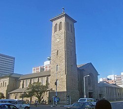
Most
Sister cities
Harare has co-operation agreements, partnerships, or sister city agreements with the following towns:[101]
 Cincinnati, United States[102]
 Guangzhou, China[103]
 Kazan, Russia
 Lago, Italy
 Maputo, Mozambique[104]
 Munich, Germany
 Nakhon Ratchasima, Thailand
 Nottingham, United Kingdom
- Prato, Italy
 Windhoek, Namibia
Gallery
-
 Sam Nujoma Street, looking south
 -
-
 Downtown Harare, facing the Reserve Bank
 -
 First Street
 -
 Side view of the Parliament Buildings
 -
 Eastgate Centre
 -
 Relief at National Heroes' Acre
 -
 National Heroes' Acre


.jpg)
.jpg)
See also
- Districts of Zimbabwe
- Place names in Zimbabwe
- Provinces of Zimbabwe
References
- ^ a b Zimstat. "2012 Population Census National Report" (PDF). Retrieved 20 September 2020.
- ^ Zimstat. "2012 Population Report: Harare" (PDF). Retrieved 20 September 2020.
- ^ Zimstat. "2019 Labour Force Report" (PDF). Retrieved 20 September 2020.
- ^ "Sub-national HDI – Area Database – Global Data Lab". hdi.globaldatalab.org. Retrieved 20 September 2020.
- ^ "Harare". Retrieved 25 May 2015.
- ^ a b "2022 national census shows Zim rapidly urbanising". The Herald. Retrieved 27 August 2023.
- ^ Harare Provincial Profile (PDF) (Report). Parliament Research Department. 2011. Archived from the original (PDF) on 3 July 2013. Retrieved 22 November 2013.
- ^ "Zimbabwe Celebrates Finish of New Parliament, Built by China". Voice of America. Retrieved 26 September 2023.
- ^ Abu Hassan Abu Bakar, Arman Abd Razak, Shardy Abdullah and Aidah Awang. "Project Management Success Factors for Sustainable Housing: A Framework" (PDF). School of Housing, Building and Planning, Universiti Sains Malaysia, Pulau Pinang, Malaysia. Retrieved 3 March 2022 – via eprints.usm.my.
{{cite web}}: CS1 maint: multiple names: authors list (link) - ^ "Who we are". www.who.int. Retrieved 21 June 2021.
- ISBN 0-86918-013-4.
- ^ Roman Adrian Cybriwsky, Capital Cities around the World: An Encyclopedia of Geography, History, and Culture, ABC-CLIO, USA, 2013, p. 120
- ^ Horace A. Laffaye, Polo in Britain: A History, Jefferson, North Carolina: McFarland & Company, 2012, p. 76
- ^ Britannica, Harare, britannica.com, USA, accessed on 7 July 2019
- ^ Journal of Frederick Courtney Selous, Rhodesiana Reprint Library, Salisbury, 1969
- ^ Lee, M. Elaine (31 December 1975). "The origins of the Rhodesian Responsible Government Movement". The Journal of Central Africa Historical Association (Rhodesian History). 6. Department of History, University of Rhodesia: 33–53.
- ^ ISSN 1474-6743.
- ^ "Zimbabwe - Rhodesia, UDI, Independence | Britannica". www.britannica.com. 12 December 2024. Retrieved 13 December 2024.
- ISBN 9780786418145.
- ^ "List of previous CHOGMS". Archived from the original on 31 October 2008.
- ^ "8th assembly & 50th anniversary". Retrieved 25 May 2015.
- ^ kdc. "The Zimbabwe Situation". zimbabwesituation.com.
- ^ Sinoski, Kelly. "Vancouver world's most livable city, Harare the worst: Poll". Calgary Herald. The Vancouver Sun. Archived from the original on 11 June 2009. Retrieved 8 June 2009.
- ^ "Least livable cities". Reuters. 21 February 2011. Retrieved 19 August 2016.
- ^ "Zimbabwe – Rhodesia and the UDI". Encyclopedia Britannica. 3 January 2024.
- ^ "Joina City- Harare's New Pride – Inside Joina City- Facts & Figures". Urbika.com. 31 March 2010. Archived from the original on 20 June 2013. Retrieved 17 June 2013.
- ^ "Joina City Occupancy 3pc". ForBuilder. 16 October 2011. Archived from the original on 9 September 2013.
- ^ Moyo, Jason (31 May 2013). "Zimbabwe's Changing Spaces". Mail and Guardian. Retrieved 17 June 2013.
- ^ Koranyi, Balazs (21 February 2011). "Vancouver still world's most livable city: survey". Reuters. Retrieved 28 September 2012.
- The Economist Intelligence Unit (August 2012). Liveabililty Ranking and Overview August 2012(Report). Retrieved 17 June 2013.
- ^ Madalitso Mwando (27 March 2015). "Zimbabwe Capital Turns to Solar Streetlights to Cut Costs, Crime". allAfrica.com – Thomson Reuters Foundation. Retrieved 28 March 2015.
- ^ "Zimbabwe crowds rejoice as they demand end to Mugabe rule". BBC News.
- ^ "Zimbabwe leader Mugabe under house arrest as army tightens grip on capital". Market Watch.
- ^ .
- ^ Staff Writer. "A look at Zimbabwe's property market".
- ^ "Zimbabwe property market characterised by a high demand and low supply". www.iol.co.za.
- ^ a b "Why property is more pricey in Zim than SA". The Standard.
- ^ "The World According to GaWC 2020". GaWC – Research Network. Globalization and World Cities. Archived from the original on 24 August 2020. Retrieved 31 August 2020.
- ^ "2022 Population and Housing Census Preliminary Results". UNFPA - Zimbabwe. Retrieved 13 January 2024.
- ^ Current Africanist Research: International Bulletin. La Recherche Africaniste en Cours; Bulletin International - International African Institute. Research Information Liaison Unit - pg. 367
- ^ TV Bulpin: Discovering South Africa pp 838
- ^ "Provisional Soil Map of Zimbabwe Rhodesia". European Soil Data Centre.
- ^ S2CID 225530172.
- ISBN 9780749440657.
- ^ "Zimbabwe displays 'Biblical Ark'". 18 February 2010. Retrieved 25 November 2020.
- ^ a b Herald, The. "Inside Rotten Row Court 6". The Herald. Retrieved 25 November 2020.
- ^ "History and Architecture". The Royal Parks. Archived from the original on 27 November 2020. Retrieved 25 November 2020.
- ^ Kola, F. T. (19 November 2016). "Rotten Row by Petina Gappah review – buzzing with Zimbabwe life". The Guardian. Retrieved 25 November 2020.
- ^ "Mugabe's Borrowdale Brooke neighbour speaks out". 22 June 2014.
- ^ a b c d "Of suburb names and colonial hangover". The Patriot. Archived from the original on 28 April 2021. Retrieved 16 November 2020.
- JSTOR 41230768.
- ^ Average for years 1965–1995, Goddard Institute of Space Studies World Climate database
- ^ Global Historic Climate Network database NGDC
- ^ "Ornamental Trees". goldenstairsnursery.co.zw. 27 September 2021. Archived from the original on 27 September 2021.
- ^ "World Weather Information Service – Harare". World Meteorological Organization. Archived from the original on 29 August 2019. Retrieved 10 June 2016.
- ^ "Harare Kutsaga Climate Normals 1961–1990". National Oceanic and Atmospheric Administration. Retrieved 10 June 2016.
- ^ "Klimatafel von Harare-Kutsaga (Salisbury) / Simbabwe" (PDF). Baseline climate means (1961–1990) from stations all over the world (in German). Deutscher Wetterdienst. Retrieved 10 June 2016.
- ^ "Station Harare" (in French). Meteo Climat. Retrieved 10 June 2016.
- ^ a b "Zimbabwe". United States Department of State. Retrieved 21 January 2021.
- ^ a b Dzirutwe, MacDonald (15 May 2006). "Zimbabweans ask, who can afford houses? (Published 2006)". The New York Times.
- ^ "'Policy flip-flopping crippling real estate' - the Zimbabwe Independent". Archived from the original on 27 November 2020. Retrieved 19 November 2020.
- ^ a b c "The Engagement of the Zimbabwean Medical Diaspora" (PDF). samponline.org. Retrieved 21 January 2021.
- ^ "Unfriendly Neighbours" (PDF). samponline.org. Retrieved 21 January 2021.
- ^ "Zimbabwe's exodus to australia" (PDF). samponline.org. 2015. Retrieved 21 January 2021.
- ^ "Zimbabwe: Migration and Brain Drain". ResearchGate.
- S2CID 145351878.
- ^ "Harare, capital of Zimbabwe | Zimbabwe Field Guide". zimfieldguide.com.
- ^ a b "Getting Around With Kids, When Even the Grocery Store Is an Onerous Journey". Bloomberg.com. 7 January 2019. Retrieved 25 November 2020.
- ^ "Transportation in Harare, Zimbabwe". Lonely Planet. Retrieved 25 November 2020.
- ^ "A look At Public Transportation In Zimbabwe". 16 February 2020. Archived from the original on 27 November 2020. Retrieved 19 November 2020.
- ISBN 0415234794.
- ^ Chronicle, The (20 January 2023). "NRZ speaks on return of intercity passenger trains". The Chronicle. Retrieved 12 May 2023.
- ^ "University of Zimbabwe Profile". www.uz.ac.zw. Archived from the original on 19 March 2022. Retrieved 3 November 2021.
- ^ "Sport in Zimbabwe". www.topendsports.com. Retrieved 21 June 2021.
- ^ "ICC World Cup Qualifiers 2018 – Super Sixes Match 8 – Zimbabwe v United Arab Emirates – Preview". Cricket World.
- ^ "'Harare among world's worst cities to live in'". DailyNews Live. Archived from the original on 2 August 2018. Retrieved 2 August 2018.
- ^ "Importance of counties' Zimbabwe tours 'cannot be overstated' – Hamilton Masakadza". ESPNcricinfo.
- ^ Moyo, Brandon (29 May 2023). "Eagles crowned Logan Cup champions". Chronicle. Retrieved 7 July 2024.
- ^ "World Rugby". www.world.rugby.
- ^ "Zim rugby league suspended". 25 April 2019.
- ^ a b Herald, The. "Rugby's forgetable year". The Herald.
- ^ "Wild times in Zimbabwe and Namibia". Welsh Rugby Union | Wales & Regions.
- ^ "Long Read | Rugby in post-colonial Zimbabwe". New Frame. 11 March 2020. Archived from the original on 16 November 2020. Retrieved 17 November 2020.
- ^ "'If you lived in bitterness you wouldn't enjoy anything': Exeter's Zimbabwean rugby exiles". The Guardian. 1 December 2017.
- ^ "Critics Decry Zimbabwe's Press Freedom Failures". Voice of America. 26 November 2020.
- ^ a b "Zimbabwe: Online News & the Internet | Columbia University Libraries". library.columbia.edu.
- ^ a b "More newspapers hit the streets of Harare as Zimbabwe media industry opens up". The National. 1 July 2010.
- ^ "Muckraker: The hunt for democracy in the land of despotism - the Zimbabwe Independent". Archived from the original on 2 April 2020. Retrieved 28 November 2020.
- ^ "Zimbabwe news". Stanford Libraries.
- ^ 'MuckRaker: ZBC has taken over the RBC's mantle', Zimbabwe Independent, 16 February 2012
- ^ "Major milestone as six new TV stations get licences". The Herald. Retrieved 4 May 2023.
- ^ "Zimbabwe awards new TV licences, but only to regime-linked players". The Africa Report.com. 30 November 2020. Retrieved 4 May 2023.
- ^ a b c "Radio Stations in Zimbabwe". My Guide Zimbabwe. 24 July 2019.
- ^ "Rest in Power: Oliver Mtukudzi, music legend and pan-African trailblazer". 25 January 2019.
- ^ "Modern Sculptures from Zimbabwe". Archived from the original on 23 November 2016. Retrieved 29 November 2020.
- ^ "What's Next..." reflecting a sense of positive progress". hifa.co.zw. Archived from the original on 26 June 2013. Retrieved 6 June 2013.
- ^ Machaya, Prince (15 February 2019). "HIFA cancelled, organisers say Zimbabwe has other 'important issues'". Zimbabwe News Now. Retrieved 8 July 2024.
- ^ "Discover The Rich Zimbabwean Culture In Its Capital | Harare, Zimbabwe Activities". Lonely Planet.[permanent dead link]
- ^ Britannica, Zimbabwe – Places. britannica.com. Retrieved 7 July 2019.
- ^ Dhedheya, Itai. "City of Harare – Twinning Arrangements". City of Harare. Archived from the original on 15 April 2019. Retrieved 10 June 2017.
- ^ Pennick, Faith; Calhoun, Jim (5 August 1990). "Harare newest link: Cincinnati adds sister city in Africa". The Cincinnati Enquirer. Retrieved 21 May 2018.
- ^ "Harare twins Guangzhou". The Herald. 22 September 2015. Retrieved 23 May 2018.
- ISBN 9781781484647.
Bibliography
External links
 Media related to Harare at Wikimedia Commons
African Games host cities | |
|---|---|
| International | |
|---|---|
| National | |
| Geographic | |
| Other | |