Al-Wayziyya
Al-Wayziyya
الويزية Weiziya[1] | ||
|---|---|---|
Village | ||
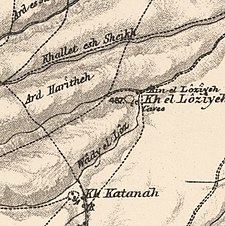
A series of historical maps of the area around Al-Wayziyya (click the buttons) | ||
Geopolitical entity Mandatory Palestine | | |
| Subdistrict | Safad | |
| Date of depopulation | May 1948[1] | |
| Population (1945) | ||
| • Total | 100[2][3] | |
Al-Wayziyya (
In 1945, the village had a population of 100. A shrine for a local sage known as al-Shaykh al-Wayzi was located in the village.
History
The majority of the villagers were Bedouin farmers.[4] A shrine for Shaykh al-Wayzi and a quarry were located nearby.[4]
British Mandate era
In the 1922 census of Palestine conducted by the British Mandate authorities, Wazia had a population of 30, all Muslim.[5]
In the 1945 statistics the population was 100 Muslims,[2] with a total of 6,361 dunams of land, according to an official land and population survey.[3] Of this, Arabs used 795 dunums for plantations or irrigable land, 1,623 for cereals;[6] while a total of 2,114 dunams was classified as uncultivable.[7]
1948, aftermath
During the 1948 war, nearby Mughr al-Khayt was struck by mortars on 2 May, while villages to the north were evacuated earlier because of the threat of the oncoming war.[4]
Today there are no
References
- ^ a b Morris, 2004, p. xvi, village #49. Gives cause of depopulation as "?"
- ^ a b Department of Statistics, 1945, p. 10
- ^ a b Government of Palestine, Department of Statistics. Village Statistics, April, 1945. Quoted in Hadawi, 1970, p. 70 Archived 2015-09-24 at the Wayback Machine
- ^ a b c d e Khalidi, 1992, p. 503
- ^ Barron, 1923, Table XI, Sub-district of Safad, p. 42
- ^ Government of Palestine, Department of Statistics. Village Statistics, April, 1945. Quoted in Hadawi, 1970, p. 120
- ^ Government of Palestine, Department of Statistics. Village Statistics, April, 1945. Quoted in Hadawi, 1970, p. 170
Bibliography
- Barron, J. B., ed. (1923). Palestine: Report and General Abstracts of the Census of 1922. Government of Palestine.
- Department of Statistics (1945). Village Statistics, April, 1945. Government of Palestine.
- Hadawi, S. (1970). Village Statistics of 1945: A Classification of Land and Area ownership in Palestine. Palestine Liberation Organization Research Center. Archived from the original on 2018-12-08. Retrieved 2009-08-18.
- ISBN 0-88728-224-5.
- ISBN 978-0-521-00967-6.
External links
- Welcome to al-Wayziyya
- al-Wayziyya, at Zochrot
- Survey of Western Palestine, map 4: IAA, Wikimedia commons
- al-Wayziyya, at Khalil Sakakini Cultural Center
- Al-Wayziyya, Dr. Khalil Rizk.


