
Qaqun
Qaqun
قاقون Quaquo, Caco, Chaco, Kâkôn, Kakoun | |
|---|---|
![In the Crusader period, a castle called Caco or Cacho stood here, of which an 8.5m tower survives.[1]](/File:Qaqun-fortress-18.jpg) | |
| Etymology: from personal name[2] | |
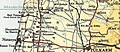
.jpg) 1870s map 1870s map .jpg) 1940s map 1940s map.jpg) modern map modern map .jpg) 1940s with modern overlay map 1940s with modern overlay mapA series of historical maps of the area around Qaqun (click the buttons) | |
Qaqun (
Evidence of organized settlement in Qaqun dates back to the period of
Etymology
While the site is an ancient one, the current name, Qāqūn is an Aramaic one, meaning “little pelican”. In the Crusader period it was variously transcribed as Caco, Caccho among other forms. Some 17th century Ottoman documents have another variant, Qāqūm (قاقوم).[9]
History
Ancient and classical
In the 1st century AD, Antipas, like others close to the Herodians who ruled over parts of the region at the time, was granted dominion over large areas of land. One of the gifts (doreai) he received was a parcel of land located in the Plain of Sharon which included Qaqun, among other villages.[12]
Crusader period
In the
In 1271, Lord
Mamluk period
Qaqun was captured by the
In December 1271, as Baybars was battling the Mongols in Aleppo, the Crusader forces of King Edward raided Qaqun, but were quickly fought back by the forces of the Mamluk emirs.[20] However the near contemporary Egyptian historian Ibn al-Furat wrote that Edward’s raid may have been a little more troublesome, he wrote:
“At the end of the month of Rabi' II, the month already mentioned (4 December 1271), the Sultan learnt that the Franks had attacked Qaqun (Caco); the emir Husam al-Din, the ustadh-dar, had been killed and the emir Rukn al-Din al-Jaliq wounded; while the governor of the place had had to leave.”[21]
At the end of the 13th century, the
Ottoman period
During early
During
In the 1830s, the inhabitants of Qanqun participated in the
In the late 19th century, Qaqun was described as a large village built around the central tower of the Crusader/Mamluk fort. Its houses, built of stone and mud, were dispersed over the surface of a hill. There was arable land in the surrounding area.
British Mandate
In the 1922 census of Palestine there were 1,629 villagers, 29 Christian males, and the rest Muslim,[32] decreasing in the 1931 census to a population of 1367 Muslims, in a total of 260 houses.[33]
In the
Just prior to the 1948 war, in addition to the mosque and fortress, Qaqun also housed an elementary school for boys and hundreds of homes for its more than 2,000 inhabitants.[37] The village families were made up of the Abu-Hantash, Zidan, al-Shaykh Ghanem, Matrouk, and al-Hafi clans.[37]
-
 Qaqun 1930 1:20,000
 -
 Qaqun 1939 1:20,000
 -
 Qaqun 1945 1:250,000


1948 War
| Battle of Qaqun | |||||||
|---|---|---|---|---|---|---|---|
| Part of 1948 Arab-Israeli War | |||||||
.jpg) War Memorial of Alexandroni Brigade in Qaqun with Bible citation from Zephaniah 3:19 | |||||||
| |||||||
| Belligerents | |||||||
|
|
| ||||||
| Commanders and leaders | |||||||
|
| |||||||
| Strength | |||||||
| Reinforced battalion | Iraqi regulars, 200 irregulars[38] | ||||||
| Casualties and losses | |||||||
| 16[38] | |||||||
Qaqun was the victim of a "hit-and-run" raid carried out by the
On 9 May 1948 the Alexandroni Arab affairs experts decided on a meeting in
After the establishment of the State of Israel and the outbreak of the
Qaqun was chosen as the target of an Israeli offensive, and on 5 June at 04:00, the 33rd Battalion of the Alexandroni Brigade attacked the village. A frontal assault was conducted on the Iraqi headquarters to the north of the village, after the nearby mill was cleared. The Israel Defense Forces were only able to clear the village during the day, and used reinforcements from the 32nd Battalion at Ein HaHoresh, which flanked the Arab forces from the south. Iraqi counter-attacks from Kalansawe and Tulkarem lasted until nightfall, with both sides bombing each other's positions from the air. Israeli forces were able to hold on to the village and put an end to Iraqi advances on the coastal plain.[42] Alexandroni suffered 16 casualties and by their estimate the entire Iraqi battalion was wiped out. According to the Alexandroni memorial website, the Iraqi defeat in the battle is considered its biggest of the war.[43]
However, according to Benny Morris, the attack was preceded by an artillery barrage that precipitated the evacuation of most of Qaqun's inhabitants to nearby groves.[44] And only a few local militiamen and several dozen Iraqi Army soldiers remained to fight and they were rapidly overwhelmed by the Alexandroni infantry.[45]
Two days later, on 7 June,
After 1948
Walid Khalidi described the remaining structures of the village in 1992:
The fortress on top of the hill, a well that belonged to the family of Abu Hantash, and the school building are all that remain of the village. The fortress is surrounded by stone rubble and the remains of houses, and the school building is still used as a school by Israelis. Cactuses and an old mulberry tree grow south of the hill. The surrounding lands are covered by orchards. In addition, cotton, pistachios, and vegetables are grown on the lands. There is an Israeli fodder-processing factory northeast of the village site.[37][6]
The estimated number of Palestinian refugees from Qaqun, as of 1998, was 14,034. This figure includes descendants of the original refugees.[37]
The Nature and Parks Authority and the Hefer Valley Economic Development Corporation recently ordered that the former site of Qaqun, its fortress and other ruins be declared a national park.[48] The plan is to rehabilitate the site and turn it into a "focal point that will draw tourism."[48]
See also
- Depopulated Palestinian locations in Israel
- List of villages depopulated during the Arab-Israeli conflict
References
- ^ a b Pringle, 1997, pp. 83-84
- ^ Palmer, 1881, p. 183
- ^ a b Government of Palestine, Department of Statistics, 1945, p. 21
- ^ a b Government of Palestine, Department of Statistics. Village Statistics, April, 1945. Quoted in Hadawi, 1970, p. 76
- ^ Morris, 2004, p. xviii, village #187. Also gives cause of depopulation
- ^ a b c d e f g h Khalidi, 1992, p. 560
- ISBN 0-940670-11-9.
- ^ a b c Benvenisti, 2000, p. 302
- ^ Marom, Roy; Zadok, Ran (2023). "Early-Ottoman Palestinian Toponymy: A Linguistic Analysis of the (Micro-)Toponyms in Haseki Sultan's Endowment Deed (1552)". Zeitschrift des Deutschen Palästina-Vereins. 139 (2).
- S2CID 165504283.
- ^ Keel etal., 1998, p. 284.
- ^ Sartre et al., 2005, pp. 106-107.
- ^ Conder and Kitchener, 1882, SWP II, p. 195
- ^ a b Conder, 2002, p. 213.
- ^ Röhricht, 1893, RRH, p. 319, No 1210; cited Pringle, 1997, p. 83
- ^ Marshall 1994, p. 206.
- ^ Amitai-Preiss 2005, p. 70.
- ^ ISBN 0-8126-9518-6.
- ^ Al-Maqrizi (d.1441), cited in Khalidi, 1992, p. 559
- ISBN 0-521-46226-6.
- ^ Ibn al-Furat, 1971. Ayyubids, Mamlukes and Crusaders, vol 2: Translation, ed. Jonathan Riley-Smith, Malcolm Cameron Lyons, Ursula Lyons. Cambridge. W. Heffer and Sons Ltd. 157.
- ^ a b Sharon, 1999, pp. 228, 229.
- ^ Atallah 1986: 111-12. Cited in Khalidi, 1992, p.559
- ^ Al-Nujum, cited in D3/2:336. Quoted in Khalidi, 1992, p. 559
- ^ Singer, 2002, p. 50
- ^ Hütteroth and Abdulfattah, 1977, p. 138. Quoted in Khalidi, 1992, p. 559
- ^ Khalidi, 1992, p. 559
- ^ Karmon, 1960, p. 170 Archived 22 December 2019 at the Wayback Machine
- ^ D 3/2:337-39. Quoted in Khalidi, 1992, p. 559
- ^ Robinson and Smith, 1841, vol 3, 2nd Appendix, p. 129
- ^ Conder and Kitchener, 1882, SWP II, p. 152. Quoted in Khalidi, 1992, p. 559
- ^ Barron, 1923, Table IX, Sub-district of Tulkarem, p. 27
- ^ Mills, 1932, p. 56
- ^ Khalidi, 1992, p.559
- ^ Government of Palestine, Department of Statistics. Village Statistics, April, 1945. Quoted in Hadawi, 1970, p. 127
- ^ Government of Palestine, Department of Statistics. Village Statistics, April, 1945. Quoted in Hadawi, 1970, p. 177
- ^ a b c d "Welcome to Qaqun". Palestine Remembered. Retrieved 12 December 2001.
- ^ a b "Capture of Qaqun" (in Hebrew). Alexandroni Brigade. Retrieved 13 September 2008.
- ^ Filastin 09.03.1948, cited in Khalidi, 1992, p.559
- ^ "Summary of the Meeting of the Arab Affairs Advisers in Netanya, 9.5.48", IDFA 6127\49\\109. Cited in Morris, 2004, p. 246
- ^ Alexandroni, "Operational order for Operation Kipa", 3 June 1948, IDFA 922\75\\949. Previously, HGS\Operations had ordered Alexandroni "to conquer and destroy" Qaqun (along with al Tira and Qalansuwa) but this had not been carried out (see HGS\Operations to Alexandroni, 12 May 1948, IDFA 922\75\\949). Cited in Morris, 2004, p. 248
- ^ Carta. p. 15.
- ^ Conquering Qaqun, in Hebrew
- ^ Abd al Rahim ´Abd al Madur, "The Village of Qaqun", p.94-95. Cited in Morris, 2004, p. 248
- ^ Unsigned, "The course of Operation Kipa", IDFA 922\75\\949; and "Report on Operation Kipa (from Combat HQ)", undated, IDFA 922\75\\949, Cited in Morris, 2004, p. 248
- ^ Morris, 2004, p. 248
- ^ Morris, 2004, p. 533
- ^ Israeli Antiquities Authority. Retrieved 12 December 2007.
Bibliography
- Amitai-Preiss, Reuven (2005). Mongols and Mamluks. Cambridge University Press.
- Barron, J.B., ed. (1923). Palestine: Report and General Abstracts of the Census of 1922. Government of Palestine.
- ISBN 978-0-520-23422-2.
- Conder, C.R.; Kitchener, H.H. (1882). The Survey of Western Palestine: Memoirs of the Topography, Orography, Hydrography, and Archaeology. Vol. 2. London: Committee of the Palestine Exploration Fund.
- ISBN 978-1-4021-8987-6.
- Government of Palestine, Department of Statistics (1945). Village Statistics, April, 1945.
- Guérin, V. (1875). Description Géographique Historique et Archéologique de la Palestine (in French). Vol. 2: Samarie, pt. 2. Paris: L'Imprimerie Nationale.
- Keel, Othmar; Uehlinger, Christoph; Trapp, Thomas H. (1998). Gods, Goddesses, and Images of God in Ancient Israel (Illustrated ed.). Continuum International Publishing Group. ISBN 978-0-567-08591-7.
- ISBN 0-88728-224-5.
- Hadawi, S. (1970). Village Statistics of 1945: A Classification of Land and Area ownership in Palestine. Palestine Liberation Organization Research Center.
- Hütteroth, Wolf-Dieter; Abdulfattah, Kamal (1977). Historical Geography of Palestine, Transjordan and Southern Syria in the Late 16th Century. Erlanger geographische Arbeiten. Vol. Sonderband 5. Erlangen, Germany: Vorstand der Fränkischen Geographischen Gesellschaft. ISBN 3-920405-41-2.
- Karmon, Y. (1960). "An Analysis of Jacotin's Map of Palestine" (PDF). Israel Exploration Journal. 10 (3, 4): 155–173, 244–253. Archived from the original (PDF) on 22 December 2019. Retrieved 16 April 2015.
- ISBN 0-88728-224-5.
- Marshall, Christopher (1994). Warfare in the Latin East, 1192-1291. Cambridge University Press.
- Mills, E., ed. (1932). Census of Palestine 1931. Population of Villages, Towns and Administrative Areas. Jerusalem: Government of Palestine.
- ISBN 978-0-521-00967-6.
- Palmer, E.H. (1881). The Survey of Western Palestine: Arabic and English Name Lists Collected During the Survey by Lieutenants Conder and Kitchener, R. E. Transliterated and Explained by E.H. Palmer. Committee of the Palestine Exploration Fund.
- Petersen, Andrew (2001). A Gazetteer of Buildings in Muslim Palestine (British Academy Monographs in Archaeology). Vol. I. ISBN 978-0-19-727011-0.
- ISBN 0521-46010-7.
- ISBN 0-521-39037-0.
- Robinson, E.; Smith, E. (1841). Biblical Researches in Palestine, Mount Sinai and Arabia Petraea: A Journal of Travels in the year 1838. Vol. 3. Boston: Crocker & Brewster.
- Röhricht, R. (1893). (RRH) Regesta regni Hierosolymitani (MXCVII-MCCXCI) (in Latin). Berlin: Libraria Academica Wageriana.
- ISBN 978-0-674-01683-5.
- ISBN 90-04-11083-6.
- ISBN 0-7914-5352-9.
External links
- Qaqun Site موقع قرية قاقون
- Welcome To Qaqun
- Qaqun, Zochrot
- Survey of Western Palestine, Map 11: IAA, Wikimedia commons
- Qaqun from the Khalil Sakakini Cultural Center
- Qaqun Archived 22 July 2003 at the Wayback Machine by Rami Nashashibi (1996), Center for Research and Documentation of Palestinian Society.
- Tell Qaqun - illustrated article about the site's history and national park at BibleWalks.com
- Cachon - French-language illustrated article about the castle at "Forteresses d'Orient"

_1963.jpg) | ||
| |||||||||||||||||||
| |||||||||||||||||||
| International | |
|---|---|
| National | |