Khiyam al-Walid
Khiyam al-Walid
خيام الوليد | ||
|---|---|---|
Village | ||
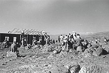
 Khiyam al-Walid was located on the eastern edge of the Hula Valley | ||
| Etymology: "the tents of al-Walid" | ||
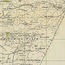
A series of historical maps of the area around Khiyam al-Walid (click the buttons) | ||
Geopolitical entity Mandatory Palestine | | |
| Subdistrict | Safad | |
| Date of depopulation | May 1, 1948[3] | |
| Area | ||
| • Total | 4,215 dunams (4.215 km2 or 1.627 sq mi) | |
| Population (1945) | ||
| • Total | 280[1][2] | |
| Cause(s) of depopulation | Fear of being caught up in the fighting | |
| Current Localities | Lehavot HaBashan[4] | |
Khiyam al-Walid (
History
The name of the village in
British Mandate era
In the 1931 census of Palestine the population of Khiyam al-Walid was 181, all Muslims, in a total of 42 houses.[5]
Khiyam al Walid was classified as a hamlet by the Palestine Index Gazeteer. During the
Types of land use in dunams in the village in the 1945 statistics:[6][7]
| Land Usage | Arab | Jewish |
|---|---|---|
| Irrigated and plantation | 153 | 2,599 |
| Cereal | 0 | 502 |
| Cultivable | 153 | 3,101 |
| Urban | ||
| Non-cultivable | 8 | 800 |
The land ownership of the village before occupation in dunams:[2]
| Owner | Dunams |
|---|---|
| Arab | 161 |
| Jewish | 3,901 |
| Public | 153 |
| Total | 4,215 |


1948, aftermath
According to an Israeli military report in June 1948, the residents fled on May 1 in anticipation of an attack by Israeli forces. It was occupied by the end of may in Operation Yiftach.[8]
Palestinian historian Walid Khalidi wrote of the remains of the village in 1992, saying "The site is deserted and overgrown with grass and thorns. There are a few carob trees, piles of stones, and crumbled terraces."[4]
References
- ^ Department of Statistics, 1945, p. 10
- ^ a b Government of Palestine, Department of Statistics. Village Statistics, April, 1945. Quoted in Hadawi, Village Statistics, 1945. PLO Research Center, 1970, p.70
- ^ Morris, 2004, p. xvi, village #22. Also gives cause of depopulation.
- ^ a b c d e f Khalidi, 1992, p.466.
- ^ Mills, 1932, p. 107
- ^ Government of Palestine, Department of Statistics. Village Statistics, April, 1945. Quoted in Hadawi, 1970, p. 119
- ^ Government of Palestine, Department of Statistics. Village Statistics, April, 1945. Quoted in Hadawi, 1970, p. 169
- ^ Morris, 2004, pp. 132 note #542 on 160; 249 note #686 on 302
Bibliography
- Department of Statistics (1945). Village Statistics, April, 1945. Government of Palestine.
- Hadawi, S. (1970). Village Statistics of 1945: A Classification of Land and Area ownership in Palestine. Palestine Liberation Organization Research Center.
- ISBN 0-88728-224-5.
- Mills, E., ed. (1932). Census of Palestine 1931. Population of Villages, Towns and Administrative Areas. Jerusalem: Government of Palestine.
- ISBN 978-0-521-00967-6.


