Jusayr
Jusayr
جسير | |
|---|---|
| Etymology: "the little bridge"[1] | |
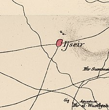
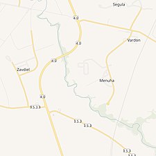
A series of historical maps of the area around Jusayr (click the buttons) | |
Wardon[5] |
Jusayr was a
History
Ceramics from the Byzantine era have been found here.[6]
Jusayr's residents came from Egypt and the Hejaz.[7]
Ottoman era
In 1517, Jusayr was incorporated into the
In 1838, Edward Robinson noted el Juseir as a Muslim village, located in the Gaza district.[10][11]
In 1863 Victor Guérin visited the village, which he found to have 500 inhabitants,[12] while an Ottoman village list from about 1870 found that the village had a population of 296, in a total of 119 houses, though the population count included men, only.[13][14]
In 1883 the PEF's Survey of Western Palestine (SWP) described it as being an adobe village on flat ground.[15]
British Mandate era
In the

By the 1945 statistics, Jusayr had a population of 1180 Muslims,[2] with a total of 12,361 dunams of land, according to an official land and population survey.[3] Of this, 11,852 dunams were used for cereals,[18] while 54 dunams were built-up land.[19]

Jusayr had an elementary school for boys which was founded in 1937, and by 1945, it had 74 students.[9]

Post 1948
In 1992 the village site was described: "One concrete, flat-roofed house still stands in the middle of a peach orchard. Its front facade has two rectangular windows and a rectangular entrance in the middle. The debris of houses among tall grasses and weeds is visible. A garbage dump is now located on the site, as well as buildings that belong to an Israeli settlement. The surrounding lands are cultivated."[5]
References
- ^ Palmer, 1881, p. 368
- ^ a b Department of Statistics, 1945, p. 31
- ^ a b c Government of Palestine, Department of Statistics. Village Statistics, April, 1945. Quoted in Hadawi, 1970, p. 46
- ^ Morris, 2004, p. xix, village #300. Also gives cause for depopulation
- ^ a b c Khalidi, 1992, p. 118
- ^ Dauphin, 1992, p. 873
- ^ Grossman, D. (1986). "Oscillations in the Rural Settlement of Samaria and Judaea in the Ottoman Period". in Shomron studies. Dar, S., Safrai, S., (eds). Tel Aviv: Hakibbutz Hameuchad Publishing House. p. 381
- ^ a b c Hütteroth and Abdulfattah, 1977, p. 147
- ^ a b Khalidi, 1992, p. 117
- ^ Robinson and Smith, 1841, vol 2, p. 369
- ^ Robinson and Smith, 1841, vol 3, Appendix 2, p. 118
- ^ Guérin, 1869, p. 122
- ^ Socin, 1879, p. 153
- ^ Hartmann, 1883, p. 133, also noted 119 houses
- ^ Conder and Kitchener, 1883, SWP III, p. 260, Cited in Khalidi, 1992, p. 117
- ^ Barron, 1923, Table V, Sub-district of Gaza, p. 9
- ^ Mills, 1932, p. 4
- ^ Government of Palestine, Department of Statistics. Village Statistics, April, 1945. Quoted in Hadawi, 1970, p. 87
- ^ Government of Palestine, Department of Statistics. Village Statistics, April, 1945. Quoted in Hadawi, 1970, p. 137
Bibliography
- Barron, J. B., ed. (1923). Palestine: Report and General Abstracts of the Census of 1922. Government of Palestine.
- Conder, C.R.; Kitchener, H.H. (1883). The Survey of Western Palestine: Memoirs of the Topography, Orography, Hydrography, and Archaeology. Vol. 3. London: Committee of the Palestine Exploration Fund.
- ISBN 0-860549-05-4.
- Department of Statistics (1945). Village Statistics, April, 1945. Government of Palestine.
- Guérin, V. (1869). Description Géographique Historique et Archéologique de la Palestine (in French). Vol. 1: Judee, pt. 2. Paris: L'Imprimerie Nationale.
- Hadawi, S. (1970). Village Statistics of 1945: A Classification of Land and Area ownership in Palestine. Palestine Liberation Organization Research Center.
- Hartmann, M. (1883). "Die Ortschaftenliste des Liwa Jerusalem in dem türkischen Staatskalender für Syrien auf das Jahr 1288 der Flucht (1871)". Zeitschrift des Deutschen Palästina-Vereins. 6: 102–149.
- Hütteroth, Wolf-Dieter; Abdulfattah, Kamal (1977). Historical Geography of Palestine, Transjordan and Southern Syria in the Late 16th Century. Erlanger Geographische Arbeiten, Sonderband 5. Erlangen, Germany: Vorstand der Fränkischen Geographischen Gesellschaft. ISBN 3-920405-41-2.
- ISBN 0-88728-224-5.
- Mills, E., ed. (1932). Census of Palestine 1931. Population of Villages, Towns and Administrative Areas. Jerusalem: Government of Palestine.
- )
- Nasser, G.A (1955/1973): "Memoirs" in Journal of Palestine Studies
- "Memoirs of the First Palestine War”" no. 2 (Win. 73): 3-32], pdf-file, downloadable
- Palmer, E.H. (1881). The Survey of Western Palestine: Arabic and English Name Lists Collected During the Survey by Lieutenants Conder and Kitchener, R. E. Transliterated and Explained by E.H. Palmer. Committee of the Palestine Exploration Fund.
- Robinson, E.; Smith, E. (1841). Biblical Researches in Palestine, Mount Sinai and Arabia Petraea: A Journal of Travels in the year 1838. Vol. 2. Boston: Crocker & Brewster.
- Robinson, E.; Smith, E. (1841). Biblical Researches in Palestine, Mount Sinai and Arabia Petraea: A Journal of Travels in the year 1838. Vol. 3. Boston: Crocker & Brewster.
- Socin, A. (1879). "Alphabetisches Verzeichniss von Ortschaften des Paschalik Jerusalem". Zeitschrift des Deutschen Palästina-Vereins. 2: 135–163.
External links
- Welcome To Jusayr
- Jusayr, Zochrot
- Survey of Western Palestine, Map 20: IAA, Wikimedia commons
- Jusayr, from the Khalil Sakakini Cultural Center


