
Bayt Shanna
Bayt Shanna
بيت شنّة | ||
|---|---|---|
| Etymology: The house of Shenna[1] | ||
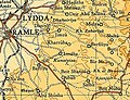
.jpg) 1870s map 1870s map .jpg) 1940s map 1940s map.jpg) modern map modern map .jpg) 1940s with modern overlay map 1940s with modern overlay mapA series of historical maps of the area around Bayt Shanna (click the buttons) | ||
Geopolitical entity Mandatory Palestine | | |
| Subdistrict | Ramle | |
| Date of depopulation | July 15-16, 1948[4] | |
| Population (1945) | ||
| • Total | 210[2][3] | |
| Cause(s) of depopulation | Military assault by Yishuv forces | |
Bayt Shanna was a
Etymology
Bayt šannā /Bēt šanna/ is an Aramaic place-name, which means "House of the Rock" (šn’).[5] A rarely documented variant in 16th century endowment deeds reads Bayt al-šunnāra /Bēt iš-šunnāra/ [53] , “the place of the cat (or ‘of the partridge’)”.[5]
History
Ceramics from the Byzantine era have been found here.[6]
Ottoman era
Bayt Shanna was incorporated into the Ottoman Empire in 1517 with all of Palestine.
In 1552, Bayt Shanna was an inhabited village.
In 1596, it appeared in the
In 1838, it was noted as Beit Shinna, a place "in ruins or deserted," in the Ibn Humar area in the District of
In 1883, the PEF's Survey of Western Palestine noted at Beit Shenna: "Traces of ruins and squared stones."[11]
British Mandate era
In the 1922 census of Palestine, conducted by the British Mandate authorities, Bait Shanna had a population of 8 Muslims,[12] increasing in the 1931 census, when it was counted together with Salbit, to 406, still all Muslims, in a total of 71 houses.[13]
In the 1945 statistics, the village had a population of 210 Muslims[2] with 3,617 dunams of land.[3] Of this, 44 dunams were used for plantations and irrigable land, 865 for cereals,[14] while 2,708 dunams were non-cultivable areas.[15]
-
 Bayt Shanna 1942 1:20,000
 -
 Bayt Shanna 1945 Scale 1:250,000

1948, and aftermath
Bayt Shanna became depopulated after a military assault on July 15–16, 1948.[4]
As of 1992, there were no Israeli settlement on village land. Sha'alvim, on the land of the depopulated Palestinian village of Salbit is the closest.[9]
In 1992, the village site was described: "The stone rubble of the former houses covers the village site. Large mulberry, olive, and almond trees grow amid the rubble, most of which is covered by wild vegetation. The whole site is fenced in and appears to be used as a grazing area. On the hillside east of the village, a room made of masonry still stands. Fruit trees grow around it."[9]
References
- ^ Palmer, 1881, p. 287
- ^ a b Department of Statistics, 1945, p. 29
- ^ a b Government of Palestine, Department of Statistics. Village Statistics, April, 1945. Quoted in Hadawi, 1970, p. 66
- ^ a b Morris, 2004, p. xix, village #238. Also gives cause of depopulation, with a "?".
- ^ a b Marom, Roy; Zadok, Ran (2023). "Early-Ottoman Palestinian Toponymy: A Linguistic Analysis of the (Micro-)Toponyms in Haseki Sultan's Endowment Deed (1552)". Zeitschrift des Deutschen Palästina-Vereins. 139 (2).
- ^ Dauphin, 1998, p. 841
- ^ Marom, Roy (2022-11-01). "Jindās: A History of Lydda's Rural Hinterland in the 15th to the 20th Centuries CE". Lod, Lydda, Diospolis. 1: 8.
- ^ a b Hütteroth and Abdulfattah, 1977, p. 155
- ^ a b c Khalidi, 1992, p. 367
- ^ Robinson and Smith, 1841, vol 3, Appendix 2, p. 120
- ^ Conder and Kitchener, 1883, SWP III, p. 86
- ^ Barron, 1923, Table VII, Sub-district of Jerusalem, p. 15
- ^ Mills, 1932, p. 43
- ^ Government of Palestine, Department of Statistics. Village Statistics, April, 1945. Quoted in Hadawi, 1970, p. 114
- ^ Government of Palestine, Department of Statistics. Village Statistics, April, 1945. Quoted in Hadawi, 1970, p. 164
Bibliography
- Barron, J.B., ed. (1923). Palestine: Report and General Abstracts of the Census of 1922. Government of Palestine.
- Conder, C.R.; Kitchener, H.H. (1883). The Survey of Western Palestine: Memoirs of the Topography, Orography, Hydrography, and Archaeology. Vol. 3. London: Committee of the Palestine Exploration Fund.
- ISBN 0-860549-05-4.
- Department of Statistics (1945). Village Statistics, April, 1945. Government of Palestine.
- Hadawi, S. (1970). Village Statistics of 1945: A Classification of Land and Area ownership in Palestine. Palestine Liberation Organization Research Center.
- Hütteroth, Wolf-Dieter; Abdulfattah, Kamal (1977). Historical Geography of Palestine, Transjordan and Southern Syria in the Late 16th Century. Erlanger Geographische Arbeiten, Sonderband 5. Erlangen, Germany: Vorstand der Fränkischen Geographischen Gesellschaft. ISBN 3-920405-41-2.
- ISBN 0-88728-224-5.
- Mills, E., ed. (1932). Census of Palestine 1931. Population of Villages, Towns and Administrative Areas. Jerusalem: Government of Palestine.
- ISBN 978-0-521-00967-6.
- Palmer, E.H. (1881). The Survey of Western Palestine: Arabic and English Name Lists Collected During the Survey by Lieutenants Conder and Kitchener, R. E. Transliterated and Explained by E.H. Palmer. Committee of the Palestine Exploration Fund.
- Robinson, E.; Smith, E. (1841). Biblical Researches in Palestine, Mount Sinai and Arabia Petraea: A Journal of Travels in the year 1838. Vol. 3. Boston: Crocker & Brewster.
External links
- Welcome To Bayt Shanna
- Bayt Shanna, Zochrot
- Survey of Western Palestine, Map 17: IAA, Wikimedia commons
