
Tokyo
Tokyo
東京都 | |
|---|---|
| Tokyo Metropolis | |
|
US$1.027 trillion (2020) | |
| • Metro | JP¥222.129 trillion US$2.084 trillion (2020) |
| Time zone | UTC+09:00 (Japan Standard Time) |
| ISO 3166-2 | JP-13 |
| Flower | Yoshino cherry |
| Tree | Ginkgo |
| Bird | Black-headed gull |
| Website | tokyotokyo.jp www.metro.tokyo.lg.jp |

.jpg)


Tokyo (/ˈtoʊkioʊ/;[8] Japanese: 東京, Tōkyō, [toːkʲoː] ⓘ), officially the Tokyo Metropolis (東京都, Tōkyō-to), is the capital of Japan and one of the most populous cities in the world with a population of over 14 million residents as of 2023.[9] The Tokyo metropolitan area, which includes Tokyo and nearby prefectures, is the world's most-populous metropolitan area, with 40.8 million residents as of 2023[update],[10] and is the second-largest metropolitan economy in the world after New York, with a 2022 gross metropolitan product estimated at US$2.08 trillion (US$51,124 per capita).[11]
Located at the head of Tokyo Bay, Tokyo is part of the Kantō region on the central coast of Honshu, Japan's largest island. Tokyo serves as Japan's economic center and the seat of both the Japanese government and the Emperor of Japan. The Tokyo Metropolitan Government administers Tokyo's central 23 special wards (which formerly made up Tokyo City), various commuter towns and suburbs in its western area, and two outlying island chains known as the Tokyo Islands. Despite most of the world knowing Tokyo as a city, since 1943 its governing structure has been more akin to a prefecture, with an accompanying Governor and Assembly taking precedence over the smaller municipal governments which make up the metropolis.
Prior to the 17th century, Tokyo was predominantly a fishing village and was named Edo. In 1603, however, the city ascended to political prominence after being named the seat of the Tokugawa shogunate. By the mid-18th century, Edo emerged as one of the world's most-populous cities with a population of over one million people. Following the Meiji Restoration in 1868, the imperial capital in Kyoto was moved to Edo, and the city was renamed Tokyo (lit. 'Eastern Capital'). In 1923, Tokyo was damaged substantially by the Great Kantō earthquake, and the city was later badly damaged by allied bombing raids during World War II in retaliation for Japan's attack on Pearl Harbor. Beginning in the mid-20th century, Tokyo underwent rapid reconstruction and expansion that contributed to the era's so-called Japanese economic miracle in which Japan's economy propelled to the second-largest in the world behind that of the United States.[12] Tokyo is also part of an industrial region that spans from Yokohama and Kawasaki to Chiba. As of 2023[update], the city is home to 29 of the world's largest 500 companies listed in the annual Fortune Global 500.[13]
Tokyo is categorized as an Alpha+ city by the Globalization and World Cities Research Network. While Tokyo has dropped out as one of the top three financial centers in the world in the 1980s, the city continues to be considered a large financial hub and remains Japan's financial capital.[14] The city is home to the world's tallest tower, Tokyo Skytree,[15] and the world's largest underground floodwater diversion facility, the Metropolitan Area Outer Underground Discharge Channel in Kasukabe, Saitama, a Tokyo suburb.[16] The Tokyo Metro Ginza Line, which opened in 1927, is the oldest underground metro line in East Asia.[17] Tokyo is recognized as one of the world's most livable cities; it was ranked fourth in the world in Global Livability Ranking, published in 2021.[18]
In the 20th and 21st centuries, Tokyo has hosted several major international events, including the 1964 Summer Olympics and Paralympics, the 2020 Summer Olympics and Paralympics, and three G7 summits in 1979, 1986, and 1993. Tokyo is an international research and development hub and an academic center with several major universities, including the University of Tokyo, the top-ranking university in the country.[19][20] Tokyo Station is the central hub for the Shinkansen, Japan's high-speed railway network, and Shinjuku Station in Tokyo is the world's busiest train station. Notable special wards in Tokyo include Chiyoda, the site of the National Diet Building and the Tokyo Imperial Palace, Shinjuku, the city's administrative center, and Shibuya, a commercial, cultural, and business hub in the city.
Etymology
| Tokyo | |||||||
|---|---|---|---|---|---|---|---|
Tōkyō in kanji | |||||||
| Japanese name | |||||||
| Hiragana | とうきょう | ||||||
| Katakana | トウキョウ | ||||||
| Kyūjitai | 東亰 | ||||||
| Shinjitai | 東京 | ||||||
| |||||||
Tokyo was originally known as
History
Pre-1869 (Edo period)
Tokyo was originally a village called Edo, in what was formerly part of the old
Edo was still the home of the
This prolonged period of seclusion however came to an end with the arrival of American Commodore
- Gallery
-
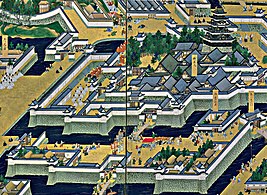 Edo Castle, 17th century
 -
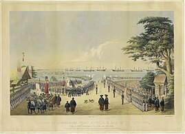 Commodore Matthew Perryexpedition and his first arrival in Japan in 1853
 -
 Famous Edo Places. Yamanote (above), Nihonbashi (center) and Shitamachi (below), c. 1858.
 -
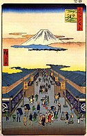 Suruga street with Mount Fuji by Hiroshige (1856)


1869–1943
Edo was renamed Tokyo (Eastern Capital) on September 3, 1868, as the new government was consolidating its power after the fall of the Edo shogunate. The young Emperor Meiji visited once at the end of that year and eventually moved in in 1869. Tokyo was already the nation's political center,[31] and the emperor's residence made it a de facto imperial capital as well, with the former Edo Castle becoming the Imperial Palace. The city of Tokyo was officially established on May 1, 1889.
The
Tokyo went on to suffer two major catastrophes in the 20th century: the 1923 Great Kantō earthquake, which left 140,000 dead or missing; and World War II.[32]
- Gallery
-
-
 Great Kanto Earthquake, 1 September 1923
 -
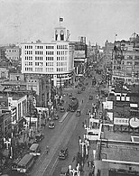 The Ginza area in 1933
 -
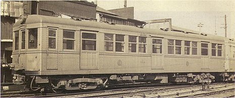 "The first underground railway in the Orient", Tokyo Underground, opened on 30 December 1927


1943–1945
In 1943, the city of Tokyo merged with the prefecture of Tokyo to form the "Metropolitan Prefecture" of Tokyo. Since then, the
The deadliest night of the war came on March 9–10, 1945, the night of the American "
- Gallery
-
 The bombing of Tokyo in 1945
 -
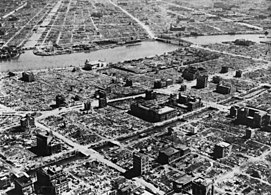 The aftermath of the bombing of Tokyo, March 1945
 -
 Nihonbashi in 1946


1945–present
After the war, Tokyo became the base from which the United States under Douglas MacArthur administered Japan for six years. Tokyo struggled to rebuild as occupation authorities stepped in and drastically cut back on Japanese government rebuilding programs, focusing instead on simply improving roads and transportation. Tokyo did not experience fast economic growth until the 1950s.[38]
After the occupation of Japan ended in 1952, Tokyo was completely rebuilt and was showcased to the world during the 1964 Summer Olympics. Present in Tokyo then were the Yoyogi National Gymnasium and the 0 Series Shinkansen, the first bullet train of its class in the world. The 1970s and the 1980s brought new high-rise developments. In 1978, Sunshine 60 – the tallest skyscraper in Asia until 1985, and in Japan until 1991[39] – and Narita International Airport were constructed, and the population increased to about 11 million in the metropolitan area.[40] The Edo-Tokyo Open Air Architectural Museum has historic Japanese buildings that existed in the urban landscape of pre-war Tokyo.
Tokyo still sees new urban developments on large lots of less profitable land. Recent projects include
Land reclamation projects in Tokyo have also been going on for centuries. The most prominent is the Odaiba area, now a major shopping and entertainment center. Various plans have been proposed[44] for transferring national government functions from Tokyo to secondary capitals in other regions of Japan, to slow down rapid development in Tokyo and revitalize economically lagging areas of the country. These plans have been controversial[45] within Japan and have yet to be realized.
The
On September 7, 2013, the
- Gallery
-
 Tokyo Tower, built in 1958
 -
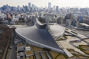 Yoyogi National Gymnasium, built for the 1964 Summer Olympics
 -
 Sunshine 60, at 239.7 m (786 ft), the tallest building in Asia until 1985, and in Japan until 1991
 -
 Landscape of Tokyo seen from top floors of Sumitomo Fudosan Roppongi Grand Tower
 -
 Minato City at night


.jpg)
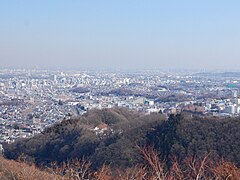
Geography and government


The mainland portion of Tokyo lies northwest of Tokyo Bay and measures about 90 km (56 mi) east to west and 25 km (16 mi) north to south. The average elevation in Tokyo is 40 m (131 ft).[53] Chiba Prefecture borders it to the east, Yamanashi to the west, Kanagawa to the south, and Saitama to the north. Mainland Tokyo is further subdivided into the special wards (occupying the eastern half) and the Tama area (多摩地域) stretching westwards. Tokyo has a latitude of 35.65 (near the 36th parallel north), which makes it more southern than Rome (41.90), Madrid (40.41), New York City (40.71) and Beijing (39.91).[54]
Within the administrative boundaries of Tokyo Metropolis are two island chains in the Pacific Ocean directly south: the
Under Japanese law, the prefecture of Tokyo is designated as a to (都), translated as metropolis.[56] Tokyo Prefecture is the most populous prefecture and the densest, with 6,100 inhabitants per square kilometer (16,000/sq mi); by geographic area it is the third-smallest, above only Osaka and Kagawa. Its administrative structure is similar to that of Japan's other prefectures. The 23 special wards (特別区, tokubetsu-ku), which until 1943 constituted the city of Tokyo, are self-governing municipalities, each having a mayor, a council, and the status of a city.
In addition to these 23 special wards, Tokyo also includes 26 more cities (

Municipalities


Since 2001, Tokyo consists of 62
- The special wards (特別区, tokubetsu-ku) of Tokyo comprise the area formerly incorporated as Tokyo City. The special wards use the word "city" in their official English name (e.g. Chiyoda City). The wards differ from other cities in having a unique administrative relationship with the prefectural government. Certain municipal functions, such as waterworks, sewerage, and fire-fighting, are handled by the Tokyo Metropolitan Government. To pay for the added administrative costs, the prefecture collects municipal taxes, which would usually be levied by the city.[57] The "three central wards" of Tokyo – Chiyoda, Chūō and Minato – are the business core of the city, with a daytime population more than seven times higher than their nighttime population.[58] Chiyoda Ward is unique in that it is in the very heart of the former Tokyo City, yet is one of the least populated wards. It is occupied by many major Japanese companies and is also the seat of the national government, and the Japanese emperor. It is often called the "political center" of the country.[59] Akihabara, known for being an otaku cultural center and a shopping district for computer goods, is also in Chiyoda.
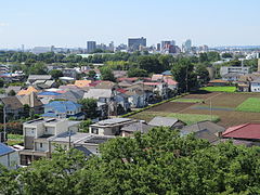
- To the west of the special wards, Tokyo Metropolis consists of cities, towns, and villages that enjoy the same legal status as those elsewhere in Japan. While serving as "Hinohara). The Tokyo Metropolitan Government has designated Hachiōji, Tachikawa, Machida, Ōme and Tama New Town as regional centers of the Tama area,[60]as part of its plans to relocate urban functions away from central Tokyo.
- Tokyo has numerous outlying islands, which extend as far as 1,850 km (1,150 mi) from central Tokyo. Because of the islands' distance from the administrative headquarters of the Tokyo Metropolitan Government in Shinjuku, local subprefectural branch offices administer them. The Minami Torishima, the easternmost point in Japan and at 1,850 km (1,150 mi) the most distant island from central Tokyo, and Okinotorishima, the southernmost point in Japan.[61] Japan's claim on an exclusive economic zone (EEZ) surrounding Okinotorishima is contested by China and South Korea as they regard Okinotorishima as uninhabitable rocks which have no EEZ.[62] The Iwo chain and the outlying islands have no permanent population, but hosts Japan Self-Defense Forces personnel. Local populations are only found on Chichi-Jima and Haha-Jima. The islands form both Ogasawara Subprefecture and the village of Ogasawara, Tokyo.
| Flag, name w/o suffix | Full name | District or Subprefecture |
Population | LPE code(w/o checksum) | ||
|---|---|---|---|---|---|---|
| Japanese | Transcription | Translation | ||||
| 足立区 | Adachi-ku | Adachi Ward | — | 674,067 | 13121 | |
| 荒川区 | Arakawa-ku | Arakawa Ward | 213,648 | 13118 | ||
| 文京区 | Bunkyō-ku | Bunkyō Ward | 223,389 | 13105 | ||
| 千代田区 | Chiyoda-ku | Chiyoda Ward | 59,441 | 13101 | ||
| 中央区 | Chūō-ku | Chūō Ward (Central Ward) |
147,620 | 13102 | ||
| 江戸川区 | Edogawa-ku | Edogawa Ward (Edo River Ward) |
685,899 | 13123 | ||
| 板橋区 | Itabashi-ku | Itabashi Ward | 569,225 | 13119 | ||
| 葛飾区 | Katsushika-ku | Katsushika Ward (after Katsushika District) |
447,140 | 13122 | ||
| 北区 | Kita-ku | Kita Ward (North Ward) |
345,063 | 13117 | ||
| 江東区 | Kōtō-ku | Kōtō Ward | 502,579 | 13108 | ||
| 目黒区 | Meguro-ku | Meguro Ward | 280,283 | 13110 | ||
| 港区 | Minato-ku | Minato Ward (Harbor/Port District) |
248,071 | 13103 | ||
| 中野区 | Nakano-ku | Nakano Ward | 332,902 | 13114 | ||
| 練馬区 | Nerima-ku | Nerima Ward | 726,748 | 13120 | ||
| 大田区 | Ōta-ku | Ōta Ward | 722,608 | 13111 | ||
| 世田谷区 | Setagaya-ku | Setagaya Ward | 910,868 | 13112 | ||
| 渋谷区 | Shibuya-ku | Shibuya Ward | 227,850 | 13113 | ||
| 品川区 | Shinagawa-ku | Shinagawa Ward | 392,492 | 13109 | ||
| 新宿区 | Shinjuku-ku | Shinjuku Ward | 339,211 | 13104 | ||
| 杉並区 | Suginami-ku | Suginami Ward | 570,483 | 13115 | ||
| 墨田区 | Sumida-ku | Sumida Ward | 260,358 | 13107 | ||
| 台東区 | Taitō-ku | Taitō Ward | 200,486 | 13106 | ||
| 豊島区 | Toshima-ku | Toshima Ward (after Toshima District) |
294,673 | 13116 | ||
| あきる野市 | Akiruno-shi | Akiruno City | 80,464 | 13228 | ||
| 昭島市 | Akishima-shi | Akishima City | 111,449 | 13207 | ||
Chōfu
|
調布市 | Chōfu-shi | Chōfu City | 240,668 | 13208 | |
| 府中市 | Fuchū-shi | Fuchū City (provincial capital city) |
260,891 | 13206 | ||
| 福生市 | Fussa-shi | Fussa City | 58,393 | 13218 | ||
Hachiōji
|
八王子市 | Hachiōji-shi | Hachiōji City | 579,330 | 13201 | |
| 羽村市 | Hamura-shi | Hamura City | 55,596 | 13227 | ||
| 東久留米市 | Higashi-Kurume-shi | Higashi-Kurume City East Kurume City (as opposed to Kurume City, Western Japan )
|
116,869 | 13222 | ||
| 東村山市 | Higashi-Murayama-shi | Higashi-Murayama City East Murayama City (after Murayama Region) |
150,984 | 13213 | ||
| 東大和市 | Higashi-Yamato-shi | Higashi-Yamato City (here: Tokyo's Yamato City)[63] (as opposed to Kanagawa's Yamato City) |
85,229 | 13220 | ||
| 日野市 | Hino-shi | Hino City | 185,133 | 13212 | ||
Inagi
|
稲城市 | Inagi-shi | Inagi City | 87,927 | 13225 | |
| 清瀬市 | Kiyose-shi | Kiyose City | 74,495 | 13221 | ||
| 小平市 | Kodaira-shi | Kodaira City | 194,757 | 13211 | ||
| 小金井市 | Koganei-shi | Koganei City | 121,516 | 13210 | ||
| 国分寺市 | Kokubunji-shi | Kokubunji City (provincial temple city) |
122,787 | 13214 | ||
| 狛江市 | Komae-shi | Komae City | 81,671 | 13219 | ||
| 国立市 | Kunitachi-shi | Kunitachi City | 75,867 | 13215 | ||
| 町田市 | Machida-shi | Machida City | 429,040 | 13209 | ||
| 三鷹市 | Mitaka-shi | Mitaka City | 189,168 | 13204 | ||
| 武蔵村山市 | Musashi-Murayama-shi | Musashi-Murayama City (as opposed to Murayama City, Dewa Province) |
70,649 | 13223 | ||
| 武蔵野市 | Musashino-shi | Musashino City (after Musashino Region) |
143,686 | 13203 | ||
| 西東京市 | Nishi-Tōkyō-shi | Nishi-Tokyo City (Western Tokyo City) |
200,102 | 13229 | ||
| 青梅市 | Ōme-shi | Ōme City | 136,071 | 13205 | ||
| 立川市 | Tachikawa-shi | Tachikawa City | 184,183 | 13202 | ||
| 多摩市 | Tama-shi | Tama City (after Tama district/area/river) |
147,953 | 13224 | ||
| 日の出町 | Hinode-machi | Hinode Town | Nishi-Tama (Western Tama) |
17,141 | 13305 | |
| 檜原村 | Hinohara-mura | Hinohara Village | 2,194 | 13307 | ||
| 瑞穂町 | Mizuho-machi | Mizuho Town | 33,117 | 13303 | ||
| 奥多摩町 | Okutama-machi | Okutama Town (Rear/Outer Tama Town) |
5,177 | 13308 | ||
| 八丈町 | Hachijō-machi | Hachijō Town (on Hachijō Island) |
Hachijō | 7,516 | 13401 | |
| 青ヶ島村 | Aogashima-mura | Aogashima Village (on Aogashima) |
169 | 13402 | ||
| 三宅村 | Miyake-mura | Miyake Village (on Miyake Island) |
Miyake | 2,451 | 13381 | |
| 御蔵島村 | Mikurajima-mura | Mikurajima Village (Mikura Island Village) |
328 | 13382 | ||
| 大島町 | Ōshima-machi | Ōshima Town ( [Izu] Grand Island Town) |
Ōshima | 7,762 | 13361 | |
| 利島村 | Toshima-mura | To-shima Village (on homonymous island) |
309 | 13362 | ||
| 新島村 | Niijima-mura | Niijima Village (on homonymous island )
|
2,697 | 13363 | ||
| 神津島村 | Kōzushima-mura | Kōzushima Village (on homonymous island )
|
1,856 | 13364 | ||
| 小笠原村 | Ogasawara-mura | Ogasawara Village (on homonymous islands ) |
Ogasawara | 3,029 | 13421 | |
| 東京都 | Tōkyō-to | Tokyo "Metropolis" functionally: ~ Prefecture literally/etymologically: ~ Capital |
– | 13,960,236 | 13000 ISO: JP-13 | |
-
 Tama
Tama -
 Hachioji
 -


Municipal mergers
When Tokyo reached its current extent except for smaller border changes in 1893, it consisted of over 170 municipalities, 1 (by definition: district-independent) city, nine districts with their towns and villages, plus the island communities that had never part of ritsuryō[clarification needed] districts. By 1953, the number of municipalities had dropped to 97. The current total of 62 was reached in 2001.
National parks

As of March 31, 2008, 36% of the total land area of the prefecture was designated as
A number of museums are located in Ueno Park: Tokyo National Museum, National Museum of Nature and Science, Shitamachi Museum and National Museum for Western Art, among others. There are also artworks and statues at several places in the park. There is also a zoo in the park, and the park is a popular destination to view cherry blossoms.
Earthquakes
Minor quakes

Tokyo is near the boundary of three plates, making it an extremely active region for smaller quakes and slippage which frequently affect the urban area with swaying as if in a boat, although epicenters within mainland Tokyo (excluding Tokyo's 2,000 km (1,243 mi)–long island jurisdiction) are quite rare. It is not uncommon in the metro area to have hundreds of these minor quakes (magnitudes 4–6) that can be felt in a single year, something local residents merely brush off but can be a source of anxiety not only for foreign visitors but for Japanese from elsewhere as well. They rarely cause much damage (sometimes a few injuries) as they are either too small or far away as quakes tend to dance around the region. Particularly active are offshore regions and to a lesser extent Chiba and Ibaraki.[65]
Infrequent powerful quakes
Tokyo has been hit by powerful
Volcanic eruptions
Water management

Tokyo is located on the Kantō Plain with five river systems and dozens of rivers that expand during each season.[71] Important rivers are Edogawa, Nakagawa, Arakawa, Kandagawa, Megurogawa and Tamagawa.[72] In 1947, Typhoon Kathleen struck Tokyo, destroying 31,000 homes and killing 1,100 people.[71] In 1958, Typhoon Ida dropped 400 mm (16 in) of rain in a single week, causing streets to flood.[71] In the 1950s and 1960s, the government invested 6–7% of the national budget on disaster and risk reduction.[71] A huge system of dams, levees and tunnels was constructed.[71] The purpose is to manage heavy rain, typhonic rain, and river floods.[71]
Tokyo has currently the world's largest underground floodwater diversion facility called the
Climate
The former city of Tokyo and the majority of Tokyo prefecture lie in the humid subtropical climate zone (Köppen climate classification: Cfa),[73] with hot, humid summers and mild to cool winters with occasional cold spells. The region, like much of Japan, experiences a one-month seasonal lag. The warmest month is August, which averages 26.9 °C (80.4 °F). The coolest month is January, averaging 5.4 °C (41.7 °F). The record low temperature was −9.2 °C (15.4 °F) on January 13, 1876. The record high was 39.5 °C (103.1 °F) on July 20, 2004. The record highest low temperature is 30.3 °C (86.5 °F), on August 12, 2013, making Tokyo one of only seven observation sites in Japan that have recorded a low temperature over 30 °C (86.0 °F).[74]
Annual rainfall averages nearly 1,600 millimeters (63.0 in), with a wetter summer and a drier winter. The growing season in Tokyo lasts for about 322 days from around mid-February to early January.[75] Snowfall is sporadic, and occurs almost annually.[76] Tokyo often sees typhoons every year, though few are strong. The wettest month since records began in 1876 was October 2004, with 780 millimeters (30 in) of rain,[77] including 270.5 mm (10.65 in) on the ninth of that month.[78] The most recent of four months on record to observe no precipitation is December 1995.[74] Annual precipitation has ranged from 879.5 mm (34.63 in) in 1984 to 2,229.6 mm (87.78 in) in 1938.[74]
| Climate data for Kitanomaru Park, Chiyoda, Tokyo (1991–2020 normals, extremes 1875–present)[79][80] | |||||||||||||
|---|---|---|---|---|---|---|---|---|---|---|---|---|---|
| Month | Jan | Feb | Mar | Apr | May | Jun | Jul | Aug | Sep | Oct | Nov | Dec | Year |
| Record high °C (°F) | 22.6 (72.7) |
24.9 (76.8) |
28.1 (82.6) |
29.2 (84.6) |
32.6 (90.7) |
36.4 (97.5) |
39.5 (103.1) |
39.1 (102.4) |
38.1 (100.6) |
32.6 (90.7) |
27.5 (81.5) |
24.8 (76.6) |
39.5 (103.1) |
| Mean daily maximum °C (°F) | 9.8 (49.6) |
10.9 (51.6) |
14.2 (57.6) |
19.4 (66.9) |
23.6 (74.5) |
26.1 (79.0) |
29.9 (85.8) |
31.3 (88.3) |
27.5 (81.5) |
22.0 (71.6) |
16.7 (62.1) |
12.0 (53.6) |
20.3 (68.5) |
| Daily mean °C (°F) | 5.4 (41.7) |
6.1 (43.0) |
9.4 (48.9) |
14.3 (57.7) |
18.8 (65.8) |
21.9 (71.4) |
25.7 (78.3) |
26.9 (80.4) |
23.3 (73.9) |
18.0 (64.4) |
12.5 (54.5) |
7.7 (45.9) |
15.8 (60.4) |
| Mean daily minimum °C (°F) | 1.2 (34.2) |
2.1 (35.8) |
5.0 (41.0) |
9.8 (49.6) |
14.6 (58.3) |
18.5 (65.3) |
22.4 (72.3) |
23.5 (74.3) |
20.3 (68.5) |
14.8 (58.6) |
8.8 (47.8) |
3.8 (38.8) |
12.1 (53.8) |
| Record low °C (°F) | −9.2 (15.4) |
−7.9 (17.8) |
−5.6 (21.9) |
−3.1 (26.4) |
2.2 (36.0) |
8.5 (47.3) |
13.0 (55.4) |
15.4 (59.7) |
10.5 (50.9) |
−0.5 (31.1) |
−3.1 (26.4) |
−6.8 (19.8) |
−9.2 (15.4) |
| Average precipitation mm (inches) | 59.7 (2.35) |
56.5 (2.22) |
116.0 (4.57) |
133.7 (5.26) |
139.7 (5.50) |
167.8 (6.61) |
156.2 (6.15) |
154.7 (6.09) |
224.9 (8.85) |
234.8 (9.24) |
96.3 (3.79) |
57.9 (2.28) |
1,598.2 (62.92) |
| Average snowfall cm (inches) | 4 (1.6) |
4 (1.6) |
0 (0) |
0 (0) |
0 (0) |
0 (0) |
0 (0) |
0 (0) |
0 (0) |
0 (0) |
0 (0) |
0 (0) |
8 (3.1) |
| Average precipitation days (≥ 0.5 mm) | 5.3 | 6.1 | 10.3 | 10.9 | 11.1 | 12.8 | 12.0 | 9.4 | 12.3 | 11.8 | 8.2 | 5.8 | 116.0 |
| Average relative humidity (%)
|
51 | 52 | 57 | 62 | 68 | 75 | 76 | 74 | 75 | 71 | 64 | 56 | 65 |
| Average dew point °C (°F) | −5 (23) |
−4 (25) |
1 (34) |
8 (46) |
13 (55) |
18 (64) |
22 (72) |
23 (73) |
19 (66) |
12 (54) |
6 (43) |
−1 (30) |
9 (49) |
| Mean monthly sunshine hours | 192.6 | 170.4 | 175.3 | 178.8 | 179.6 | 124.2 | 151.4 | 174.2 | 126.7 | 129.4 | 149.8 | 174.4 | 1,926.7 |
| Percent possible sunshine | 61 | 56 | 47 | 45 | 41 | 30 | 34 | 42 | 34 | 37 | 48 | 57 | 44 |
| Average ultraviolet index | 2 | 3 | 5 | 7 | 9 | 10 | 10 | 9 | 7 | 5 | 3 | 2 | 6 |
| Source 1: Japan Meteorological Agency[81][82][74] | |||||||||||||
| Source 2: Weather Atlas (UV),[83] Time and Date (dewpoints, 1985–2015)[84] | |||||||||||||
Graphs are unavailable due to technical issues. There is more info on Phabricator and on MediaWiki.org. |
See or edit raw graph data.
Tokyo's climate has warmed significantly since temperature records began in 1876.
| Climate data for Tokyo, 1876–1905 normals | |||||||||||||
|---|---|---|---|---|---|---|---|---|---|---|---|---|---|
| Month | Jan | Feb | Mar | Apr | May | Jun | Jul | Aug | Sep | Oct | Nov | Dec | Year |
| Mean daily maximum °C (°F) | 8.3 (46.9) |
8.7 (47.7) |
11.9 (53.4) |
17.2 (63.0) |
21.1 (70.0) |
24.5 (76.1) |
28.1 (82.6) |
29.8 (85.6) |
26.1 (79.0) |
20.5 (68.9) |
15.5 (59.9) |
11.0 (51.8) |
18.6 (65.5) |
| Daily mean °C (°F) | 2.9 (37.2) |
3.6 (38.5) |
6.9 (44.4) |
12.4 (54.3) |
16.6 (61.9) |
20.5 (68.9) |
24.1 (75.4) |
25.5 (77.9) |
22.1 (71.8) |
15.9 (60.6) |
10.2 (50.4) |
5.3 (41.5) |
13.8 (56.8) |
| Mean daily minimum °C (°F) | −1.7 (28.9) |
−0.9 (30.4) |
2.0 (35.6) |
7.6 (45.7) |
12.0 (53.6) |
16.8 (62.2) |
20.8 (69.4) |
21.9 (71.4) |
18.6 (65.5) |
11.9 (53.4) |
5.4 (41.7) |
0.4 (32.7) |
9.6 (49.3) |
| Average precipitation mm (inches) | 55.2 (2.17) |
72.4 (2.85) |
111.0 (4.37) |
129.1 (5.08) |
151.9 (5.98) |
166.3 (6.55) |
139.7 (5.50) |
114.7 (4.52) |
203.3 (8.00) |
184.1 (7.25) |
104.7 (4.12) |
58.7 (2.31) |
1,491.1 (58.7) |
| Mean monthly sunshine hours | 186.7 | 178.5 | 174.1 | 183.1 | 204.8 | 158.5 | 183.9 | 207.0 | 142.8 | 144.0 | 167.4 | 190.8 | 2,121.6 |
| Source: Japan Meteorological Agency[85] | |||||||||||||
The western mountainous area of mainland Tokyo,
| Climate data for Ogouchi, Okutama, Tokyo, 1991–2020 normals, extremes 1875–present | |||||||||||||
|---|---|---|---|---|---|---|---|---|---|---|---|---|---|
| Month | Jan | Feb | Mar | Apr | May | Jun | Jul | Aug | Sep | Oct | Nov | Dec | Year |
| Record high °C (°F) | 17.8 (64.0) |
20.9 (69.6) |
22.9 (73.2) |
30.6 (87.1) |
33.0 (91.4) |
34.3 (93.7) |
36.3 (97.3) |
36.4 (97.5) |
35.0 (95.0) |
30.2 (86.4) |
23.8 (74.8) |
22.8 (73.0) |
36.4 (97.5) |
| Mean daily maximum °C (°F) | 6.8 (44.2) |
7.6 (45.7) |
10.9 (51.6) |
16.5 (61.7) |
21.1 (70.0) |
23.4 (74.1) |
27.4 (81.3) |
28.5 (83.3) |
24.3 (75.7) |
18.8 (65.8) |
14.0 (57.2) |
9.3 (48.7) |
17.4 (63.3) |
| Daily mean °C (°F) | 1.5 (34.7) |
2.2 (36.0) |
5.5 (41.9) |
10.8 (51.4) |
15.6 (60.1) |
18.9 (66.0) |
22.6 (72.7) |
23.5 (74.3) |
19.8 (67.6) |
14.3 (57.7) |
8.8 (47.8) |
3.9 (39.0) |
12.3 (54.1) |
| Mean daily minimum °C (°F) | −2.4 (27.7) |
−1.9 (28.6) |
1.0 (33.8) |
5.8 (42.4) |
10.9 (51.6) |
15.3 (59.5) |
19.3 (66.7) |
20.1 (68.2) |
16.6 (61.9) |
10.9 (51.6) |
5.0 (41.0) |
0.1 (32.2) |
8.4 (47.1) |
| Record low °C (°F) | −9.3 (15.3) |
−11.6 (11.1) |
−8.1 (17.4) |
−3.8 (25.2) |
0.7 (33.3) |
7.5 (45.5) |
12.4 (54.3) |
13.2 (55.8) |
6.2 (43.2) |
1.0 (33.8) |
−2.1 (28.2) |
−6.9 (19.6) |
−11.6 (11.1) |
| Average precipitation mm (inches) | 49.5 (1.95) |
45.9 (1.81) |
88.5 (3.48) |
106.3 (4.19) |
118.7 (4.67) |
163.2 (6.43) |
205.6 (8.09) |
217.4 (8.56) |
270.2 (10.64) |
215.4 (8.48) |
68.9 (2.71) |
43.7 (1.72) |
1,608 (63.31) |
| Mean monthly sunshine hours | 206.5 | 187.7 | 173.0 | 178.4 | 172.2 | 104.2 | 124.8 | 144.6 | 104.5 | 128.7 | 164.5 | 186.5 | 1,874.6 |
| Source: Japan Meteorological Agency[86][87] | |||||||||||||
The climates of Tokyo's offshore territories vary significantly from those of the city. The climate of Chichijima in Ogasawara village is on the boundary between the tropical savanna climate (Köppen classification: Aw) and the tropical rainforest climate (Köppen classification: Af). It is approximately 1,000 km (621 mi) south of the Greater Tokyo Area, resulting in much different climatic conditions.
| Climate data for Chichijima, Ogasawara, Tokyo, 1991–2020 normals, extremes 1896–present | |||||||||||||
|---|---|---|---|---|---|---|---|---|---|---|---|---|---|
| Month | Jan | Feb | Mar | Apr | May | Jun | Jul | Aug | Sep | Oct | Nov | Dec | Year |
| Record high °C (°F) | 26.1 (79.0) |
25.4 (77.7) |
26.7 (80.1) |
28.4 (83.1) |
30.1 (86.2) |
33.0 (91.4) |
34.1 (93.4) |
33.7 (92.7) |
33.1 (91.6) |
32.1 (89.8) |
30.2 (86.4) |
27.5 (81.5) |
34.1 (93.4) |
| Mean daily maximum °C (°F) | 20.7 (69.3) |
20.5 (68.9) |
21.7 (71.1) |
23.4 (74.1) |
25.6 (78.1) |
28.5 (83.3) |
30.4 (86.7) |
30.3 (86.5) |
29.9 (85.8) |
28.6 (83.5) |
25.9 (78.6) |
22.7 (72.9) |
25.7 (78.3) |
| Daily mean °C (°F) | 18.5 (65.3) |
18.1 (64.6) |
19.3 (66.7) |
21.1 (70.0) |
23.4 (74.1) |
26.2 (79.2) |
27.7 (81.9) |
28.0 (82.4) |
27.7 (81.9) |
26.4 (79.5) |
23.8 (74.8) |
20.6 (69.1) |
23.4 (74.1) |
| Mean daily minimum °C (°F) | 15.8 (60.4) |
15.4 (59.7) |
16.8 (62.2) |
18.8 (65.8) |
21.4 (70.5) |
24.4 (75.9) |
25.6 (78.1) |
26.1 (79.0) |
25.7 (78.3) |
24.4 (75.9) |
21.6 (70.9) |
18.2 (64.8) |
21.2 (70.2) |
| Record low °C (°F) | 8.9 (48.0) |
7.8 (46.0) |
9.2 (48.6) |
10.7 (51.3) |
13.9 (57.0) |
17.7 (63.9) |
20.8 (69.4) |
22.2 (72.0) |
19.6 (67.3) |
17.2 (63.0) |
13.2 (55.8) |
10.8 (51.4) |
7.8 (46.0) |
| Average rainfall mm (inches) | 63.6 (2.50) |
51.6 (2.03) |
75.8 (2.98) |
113.3 (4.46) |
151.9 (5.98) |
111.8 (4.40) |
79.5 (3.13) |
123.3 (4.85) |
144.2 (5.68) |
141.7 (5.58) |
136.1 (5.36) |
103.3 (4.07) |
1,296.1 (51.02) |
| Average rainy days (≥ 0.5 mm) | 11.0 | 8.5 | 9.8 | 10.0 | 11.8 | 8.8 | 8.6 | 11.3 | 13.4 | 13.7 | 12.0 | 11.2 | 130.1 |
| Average relative humidity (%)
|
66 | 68 | 72 | 79 | 84 | 86 | 82 | 82 | 82 | 81 | 76 | 70 | 77 |
| Mean monthly sunshine hours | 131.3 | 138.3 | 159.2 | 148.3 | 151.8 | 205.6 | 246.8 | 213.7 | 197.7 | 173.2 | 139.1 | 125.3 | 2,030.3 |
| Source: Japan Meteorological Agency[88][89] | |||||||||||||
Tokyo's easternmost territory, the island of Minamitorishima in Ogasawara village, is in the tropical savanna climate zone (Köppen classification: Aw). Tokyo's Izu and Ogasawara islands are affected by an average of 5.4 typhoons a year, compared to 3.1 in mainland Kantō.[90]
Cityscape
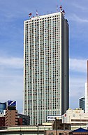
Architecture in Tokyo has largely been shaped by Tokyo's history. Twice in recent history has the metropolis been left in ruins: first in the 1923 Great Kantō earthquake and later after extensive firebombing in World War II.[91] Because of this, Tokyo's urban landscape consists mainly of modern and contemporary architecture, and older buildings are scarce.[91] Tokyo features many internationally famous forms of modern architecture including Tokyo International Forum, Asahi Beer Hall, Mode Gakuen Cocoon Tower, NTT Docomo Yoyogi Building and Rainbow Bridge. Tokyo features two distinctive towers: Tokyo Tower and Tokyo Skytree, the latter of which is the tallest tower in both Japan and the world, and the second tallest structure in the world after the Burj Khalifa in Dubai.[15] Mori Building Co started work on Tokyo's new tallest building which was set to be finished in March 2023. The project will cost 580 billion yen ($5.5 billion).[92]
Tokyo contains
.JPG)
Environment
Tokyo has enacted a measure to cut greenhouse gases. Governor
In 2006, Tokyo enacted the "10 Year Project for Green Tokyo" to be realized by 2016. It set a goal of increasing roadside trees in Tokyo to 1 million (from 480,000), and adding 1,000 ha (2,500 acres) of green space, 88 ha (220 acres) of which will be a new park named "Umi no Mori" (Sea Forest) which will be on a reclaimed island in Tokyo Bay which used to be a landfill.[97] From 2007 to 2010, 436 ha (1,080 acres) of the planned 1,000 ha of green space was created and 220,000 trees were planted, bringing the total to 700,000. As of 2014[update], roadside trees in Tokyo have increased to 950,000, and a further 300 ha (740 acres) of green space has been added.[98]
Demographics

| Year | Pop. | ±% |
|---|---|---|
| 1870 | 590,268 | — |
| 1880 | 712,259 | +20.7% |
| 1890 | 1,389,684 | +95.1% |
| 1900 | 1,580,124 | +13.7% |
| 1910 | 2,202,079 | +39.4% |
| 1920 | 3,699,428 | +68.0% |
| 1925 | 4,485,144 | +21.2% |
| 1930 | 5,408,678 | +20.6% |
| 1935 | 6,369,919 | +17.8% |
| 1940 | 7,354,971 | +15.5% |
| 1945 | 3,488,284 | −52.6% |
| 1950 | 6,277,500 | +80.0% |
| 1955 | 8,037,084 | +28.0% |
| 1960 | 9,683,802 | +20.5% |
| 1965 | 10,869,244 | +12.2% |
| 1970 | 11,408,071 | +5.0% |
| 1975 | 11,673,554 | +2.3% |
| 1980 | 11,618,281 | −0.5% |
| 1985 | 11,829,363 | +1.8% |
| 1990 | 11,855,563 | +0.2% |
| 1995 | 11,773,605 | −0.7% |
| 2000 | 12,064,101 | +2.5% |
| 2005 | 12,576,601 | +4.2% |
| 2010 | 13,159,388 | +4.6% |
| 2015 | 13,515,271 | +2.7% |
| 2020 | 13,982,112 | +3.5% |
As of October 2012, the official intercensal estimate showed 13.506 million people in Tokyo, with 9.214 million living within Tokyo's 23 wards.[99] During the daytime, the population swells by over 2.5 million as workers and students commute from adjacent areas. This effect is even more pronounced in the three central wards of Chiyoda, Chūō, and Minato, whose collective population as of the 2005 National Census was 326,000 at night, but 2.4 million during the day.[100]
In 1889, the Home Ministry recorded 1,375,937 people in Tokyo City and a total of 1,694,292 people in Tokyo-fu.[101] In the same year, a total of 779 foreign nationals were recorded as residing in Tokyo. The most common nationality was English (209 residents), followed by American (182) and Chinese nationals (137).[102]
 |
| ||||||||||||||||||||||||
 Increase 10.0% and over 7.5–9.9% 5.0–7.4% 2.5–4.9% 0.0–2.4% Decrease 0.0–2.4% 2.5–4.9% 5.0–7.4% 7.5–9.9% 10.0% and over |
| ||||||||||||||||||||||||
Economy


.jpg)
Tokyo has the second-largest metropolitan economy in the world, after New York City, with a gross metropolitan product estimated at US$2 trillion.
Tokyo is a major international finance center;
Tokyo was rated by the Economist Intelligence Unit as the most expensive (highest cost-of-living) city in the world for 14 years in a row ending in 2006, when it was replaced by Oslo, and later Paris.[106][107]
Tokyo emerged as a leading international financial center (IFC) in the 1960s and has been described as one of the three "command centers" for the world economy, along with New York City and London.[108] In the 2020 Global Financial Centers Index, Tokyo was ranked as having the fourth most competitive financial center in the world (alongside cities such as New York City, London, Shanghai, Hong Kong, Singapore, Beijing, San Francisco, Shenzhen and Zürich in the top 10), and second most competitive in Asia (after Shanghai).[109] The Japanese financial market opened up slowly in 1984 and accelerated its internationalization with the "Japanese Big Bang" in 1998.[110] Despite the emergence of Singapore and Hong Kong as competing financial centers, the Tokyo IFC manages to keep a prominent position in Asia. The Tokyo Stock Exchange is Japan's largest stock exchange, and third largest in the world by market capitalization and fourth largest by share turnover. In 1990 at the end of the Japanese asset price bubble, it accounted for more than 60% of the world stock market value.[111] Tokyo had 8,460 hectares (20,900 acres) of agricultural land as of 2003,[112] according to the Ministry of Agriculture, Forestry and Fisheries, placing it last among the nation's prefectures. The farmland is concentrated in Western Tokyo. Perishables such as vegetables, fruits, and flowers can be conveniently shipped to the markets in the eastern part of the prefecture. Komatsuna and spinach are the most important vegetables; as of 2000, Tokyo supplied 32.5% of the komatsuna sold at its central produce market.[citation needed] Farms in Tokyo are more environmentally friendly than in other areas of Japan, due to a different culture and consumer expectations.[113]
With 36% of its area covered by forest, Tokyo has extensive growths of
The
Transportation


Tokyo, which is the center of the Greater Tokyo Area, is Japan's largest domestic and international hub for rail and ground transportation. Public transportation within Tokyo is dominated by an extensive network of "clean and efficient"[117] trains and subways run by a variety of operators, with buses, monorails and trams playing a secondary feeder role. There are up to 62 electric train lines and more than 900 train stations in Tokyo.[118] Shibuya Crossing is the "world's busiest pedestrian crossing", with around 3,000 people crossing at a time.[119][120][121]
Narita International Airport in Chiba Prefecture is the major gateway for international travelers to Japan. Japan's flag carrier Japan Airlines, as well as All Nippon Airways, have a hub at this airport. Haneda Airport on the reclaimed land at Ōta, offers domestic and international flights.
Various islands governed by Tokyo have their own airports.
) have services to Tokyo International and other airports.Rail is the primary mode of transportation in Tokyo,
Two different organizations operate the subway network: the private Tokyo Metro and the governmental Tokyo Metropolitan Bureau of Transportation. The Metropolitan Government and private carriers operate bus routes and one tram route. Local, regional, and national services are available, with major terminals at the giant railroad stations, including Tokyo, Shinagawa, and Shinjuku.
Expressways link the capital to other points in the Greater Tokyo Area, the Kantō region, and the islands of Kyushu and Shikoku. To build them quickly before the 1964 Summer Olympics, most were constructed above existing roads.[123] Other transportation includes taxis operating in the special wards and the cities and towns. Also, long-distance ferries serve the islands of Tokyo and carry passengers and cargo to domestic and foreign ports.
Education

Tokyo is the educational, academic and cultural hub of the country. From primary to tertiary levels, a number of educational institutions that cater to the needs of various pupils operate in the city.
Most notably, Tokyo is the heartland of tertiary education in the country, home to 143 authorised universities in 2020.[124] This number includes the nation's most prestigious and selective universities, such as, University of Tokyo, Tokyo Institute of Technology, Hitotsubashi University, Waseda University, and Keio University. [125] Apart from those aforementioned top-ranking universities, other notable universities in Tokyo include:

The United Nations University, which is the academic arm of the United Nations, is headquartered in Shibuya, Tokyo.
At the secondary level, 429 senior high schools are located in Tokyo, six of which are national, 186 are public, and 237 are private.[126] Some senior high schools, often prestigious national or private ones, run jointly with their affiliated junior high schools, providing six-year educational programmes (Chūkō Ikkan Kyōiku). The Kaisei Academy,[127] Komaba Junior & Senior High School,[128] University of Tsukuba, Azabu High School, and Oin Junior and Senior High School,[129] the largest sources of successful applicants to the nation's top university, the University of Tokyo,[130] are some examples of such.

At the primary level, there are 1332 elementary schools in Tokyo. Six of them are national, 1261 are public, and 53 are private.[126]
Early-modern-established academies such as Gakushuin and Keio provide all-through educational programmes from primary schools to universities, originally to cater to the needs of traditionally affluent and powerful families.[131]
There are international and ethnic schools that abide by the national curricula of their respective countries or international curricula rather than the Japanese one as well, such as the British School in Tokyo, Tokyo Chinese School, the American School in Japan, and the Tokyo International School.
Culture

Tokyo has many museums. In
Tokyo has many theaters for performing arts. These include national and private theaters for traditional forms of Japanese drama. Noteworthy are the National Noh Theatre for noh and the Kabuki-za for Kabuki.[132] Symphony orchestras and other musical organizations perform modern and traditional music. The New National Theater Tokyo in Shibuya is the national center for the performing arts, including opera, ballet, contemporary dance and drama.[133] Tokyo also hosts modern Japanese and international pop, and rock music at venues ranging in size from intimate clubs to internationally known areas such as the Nippon Budokan.

Many different
In November 2007,
Sports


Tokyo, with a diverse array of sports, is home to two professional baseball clubs, the
).Basketball clubs include the
Tokyo hosted the
In popular culture

As the largest population center in Japan and the site of the country's largest broadcasters and studios, Tokyo is frequently the setting for many
Tokyo is also a popular foreign setting for non-Japanese media. Some Hollywood directors have turned to Tokyo as a backdrop for movies set in Japan. Postwar examples include
Japanese author
International relations
Tokyo is the founding member of the Asian Network of Major Cities 21 and is a member of the Council of Local Authorities for International Relations. Tokyo was also a founding member of the C40 Cities Climate Leadership Group.
Sister cities and states
As of 2022[update], Tokyo has
- New York City, United States (since February 1960)
- Beijing, China (since March 1979)
- Paris, France (since July 1982)[143]
- New South Wales, Australia (since May 1984)
- Seoul, South Korea (since September 1988)
- Jakarta, Indonesia (since October 1989)
- São Paulo State, Brazil (since June 1990)
- Cairo, Egypt (since October 1990)
- Moscow, Russia (since July 1991)
- Berlin, Germany (since May 1994)
- Rome, Italy (since July 1996)
- London, United Kingdom (since October 2015)
Friendship and cooperation agreements
This section needs additional citations for verification. (March 2022) |
- Tomsk Oblast, Russia (since May 2015)[144]
- Brussels, Belgium (since October 2016)
- Mumbai, India (since November 2016)
- Los Angeles County, United States (since August 2021)[145]
International academic and scientific research
See also
- List of cities proper by population
- List of cities with the most skyscrapers
- List of tallest structures in Tokyo
- List of development projects in Tokyo
- List of largest cities
- List of metropolitan areas in Asia
- List of most expensive cities for expatriate employees
- List of urban agglomerations in Asia
- List of urban areas by population
- Megacity
- Tokyo dialect
- Yamanote and Shitamachi
References
- ^ "Japan opens up to foreign direct investors". February 12, 2018.
- ^ 都庁は新宿区. Tokyo Metropolitan Government. Archived from the original on April 19, 2014. Retrieved April 12, 2014. Shinjuku is the location of the Tokyo Metropolitan Government Office. But Tokyo is not a "municipality". Therefore, for the sake of convenience, the notation of prefectural is "Tokyo".
- ^ "Reiwa 1 nationwide prefectures, cities and towns area statistics (October 1)" (in Japanese). Geospatial Information Authority of Japan. December 26, 2019. Archived from the original on April 15, 2020. Retrieved April 28, 2020.
- ^ "Mountains of Tokyo Metropolis" (in Japanese). Geospatial Information Authority of Japan. Retrieved April 28, 2020.
- ^ "東京都の人口(推計)とは" [Population of Tokyo(estimate)]. www.toukei.metro.tokyo.lg.jp (in Japanese). May 30, 2023. Archived from the original on June 9, 2023. Retrieved August 5, 2023.
- ^ "Major Agglomerations of the World". Population Statistics and Maps. February 28, 2023.
- ^ "県民経済計算(平成23年度 - 令和2年度)(2008SNA、平成27年基準計数)<47都道府県、4政令指定都市分>". esri.cao.go.jp.
- ^ "Tokyo". Dictionary.com Unabridged (Online). n.d. Retrieved January 7, 2022.
- ^ "Major Agglomerations of the World". Population Statistics and Maps. February 28, 2023.
- ^ Nations, United. "The World's Cities in 2018" (PDF). United Nations. Retrieved May 5, 2020.
- ^ "県民経済計算(平成23年度 - 令和2年度)(2008SNA、平成27年基準計数)<47都道府県、4政令指定都市分> : 経済社会総合研究所 - 内閣府". 内閣府ホームページ (in Japanese). Retrieved February 11, 2024.
- ^ "External Economic Relations: From Recovery to Prosperity to Making a Positive Contribution". www.mofa.go.jp. Retrieved July 15, 2023.
- ^ "Major European capital slips out of Fortune Global 500's top 5 cities for the first time in 5 years". Fortune. Retrieved August 8, 2023.
- ^ "The Global Financial Centres Index 35". Long Finance. March 21, 2024. Retrieved March 26, 2024.
- ^ a b "Tokyo – GoJapanGo". Tokyo Attractions – Japanese Lifestyle. Mi Marketing Pty Ltd. Archived from the original on April 26, 2012. Retrieved April 18, 2012.
- ^ a b "Metropolitan Area Outer Underground Discharge Channel". Archived from the original on September 14, 2018. Retrieved January 10, 2015.
- ^ Japan Times. Archived from the originalon December 9, 2020. Retrieved December 29, 2017.
- ^ "The Global Liveability Index 2021" (PDF). The Economist. Retrieved February 5, 2023.
- ^ "QS World University Rankings 2024". Top Universities. Retrieved February 11, 2024.
- ^ "World University Rankings". Times Higher Education (THE). September 25, 2023. Retrieved February 11, 2024.
- ^ ISBN 0-7864-1814-1.
- ^ US Department of State. (1906). A digest of international law as in diplomatic discussions, treaties and other international agreements (John Bassett Moore, ed.), Volume 5, p. 759 Archived January 1, 2016, at the Wayback Machine; excerpt, "The Mikado, on assuming the exercise of power at Yedo, changed the name of the city to Tokio".
- ^ Fiévé, Nicolas & Paul Waley (2003). Japanese Capitals in Historical Perspective: Place, Power and Memory in Kyoto, Edo and Tokyo. p. 253.
- ^ 明治東京異聞~トウケイかトウキョウか~東京の読み方 (in Japanese). Tokyo Metropolitan Archives. 2004. Archived from the original on October 6, 2008. Retrieved September 13, 2008.
- ^ McClain, James, James; et al. (1994). Edo and Paris: Urban Life and the State in the Early Modern Era. p. 13.
- ^ Sorensen, Andre (2004). The Making of Urban Japan: Cities and Planning from Edo to the Twenty-First Century. p. 16.
- ^ Naitō, Akira (2003). Edo, the City That Became Tokyo: An Illustrated History. pp. 33, 55.
- ^ Naitō, Akira (2003). Edo, the City That Became Tokyo: An Illustrated History. pp. 182–183.
- ^ Naitō, Akira (2003). Edo, the City That Became Tokyo: An Illustrated History. p. 186.
- ^ Naitō, Akira (2003). Edo, the City That Became Tokyo: An Illustrated History. p. 188.
- ^ "History of Tokyo". Tokyo Metropolitan Government. Archived from the original on October 12, 2007. Retrieved October 17, 2007.
- ^ "Tokyo-Yokohama earthquake of 1923". Encyclopædia Britannica. Archived from the original on June 26, 2015. Retrieved October 10, 2014.
- ISBN 978-0-585-45322-4.
- ^ "9 March 1945: Burning the Heart Out of the Enemy". Wired. March 9, 2011. Archived from the original on March 15, 2014. Retrieved August 8, 2011.
- ^ "1945 Tokyo Firebombing Left Legacy of Terror, Pain". Common Dreams. Archived from the original on January 3, 2015. Retrieved January 2, 2015.
- ^ Cybriwsky, Roman (1997). Historical Dictionary of Tokyo. Lanham, MD: Scarecrow. p. 22.
- S2CID 140541502.
- ISBN 0-415-35422-6.
- ^ "Sunshine 60". Skyscraperpage.com. Retrieved September 25, 2008.
- ^ "Tokyo Narita International Airport (NRT) Airport Information (Tokyo, Japan)". Archived from the original on October 17, 2014. Retrieved October 10, 2014.
- ^ "Rail Transport in The World's Major Cities" (PDF). Japan Railway and Transport Review. Archived from the original (PDF) on October 25, 2007. Retrieved October 17, 2007.
- ISBN 978-1-4051-1917-7.
- ^ Worrall, Julian. "The view from the Hills: Minoru Mori defends the Omotesando Hills development and reveals big plans for Tokyo". Metropolis. Archived from the original on November 19, 2006.
- ^ "Shift of Capital from Tokyo Committee". Japan Productivity Center for Socio-Economic Development. Archived from the original on August 25, 2007. Retrieved October 14, 2007.
- ^ "Policy Speech by Governor of Tokyo, Shintaro Ishihara at the First Regular Session of the Metropolitan Assembly, 2003". Tokyo Metropolitan Government. Archived from the original on November 3, 2007. Retrieved October 17, 2007.
- ^ "Despite Major Earthquake Zero Tokyo Buildings Collapsed Thanks to Stringent Building Codes". March 11, 2011. Archived from the original on September 12, 2011. Retrieved October 11, 2011.
- ^ Williams, Carol J. (March 11, 2011). "Japan earthquake disrupts Tokyo, leaves capital only lightly damaged". Los Angeles Times. Archived from the original on December 13, 2011. Retrieved October 11, 2011.
- ^ "Tokyo Radiation Levels". Metropolis Magazine. Archived from the original on May 20, 2012. Retrieved April 25, 2012.
- ^ "Tokyo radiation levels – daily updates – April". Archived from the original on August 19, 2011. Retrieved October 11, 2011.
- ^ "IOC selects Tokyo as host of 2020 Summer Olympic Games". Archived from the original on October 10, 2014. Retrieved October 10, 2014.
- ISBN 978-9811566868.
- ^ "Hot Market: Tokyo Residential Real Estate sees Strong Demand in a Tight Market, Prices Surge! – Housing Japan". April 13, 2022. Retrieved September 6, 2022.
- ^ "Population of Tokyo, Japan". Mongabay. Archived from the original on January 21, 2012. Retrieved February 10, 2012.
- ^ "Tokyo, Japan Geographic Information". Latlong.net. September 2020. Archived from the original on September 14, 2017. Retrieved September 16, 2020.
- ^ "Population of Tokyo – Tokyo Metropolitan Government". www.metro.tokyo.lg.jp. October 2015. Retrieved September 7, 2020.
- ^ "Local Government in Japan" (PDF). Council of Local Authorities for International Relations. p. 8. Archived from the original (PDF) on September 23, 2008. Retrieved September 14, 2008.
- ^ The Structure of the Tokyo Metropolitan Government Archived December 8, 2014, at the Wayback Machine (Tokyo government webpage)
- ^ The Population of Tokyo – Tokyo Metropolitan Government Archived December 23, 2008, at the Wayback Machine (Retrieved on July 4, 2009)
- ^ "Pray For Tokyo: Chiyoda". Karis Japan. Archived from the original on July 20, 2014. Retrieved April 20, 2015.
- ^ "Development of the Metropolitan Center, Subcenters and New Base". Bureau of Urban Development, Tokyo Metropolitan Government. Archived from the original on October 23, 2007. Retrieved October 14, 2007.
- ^ "Ogasawara Islands: World Natural Heritage". Ogasawara Village Industry and Tourist Board. Archived from the original (Adobe Flash) on March 31, 2017. Retrieved June 29, 2018.
- ^ Yoshikawa, Yukie (2005). "Okinotorishima: Just the Tip of the Iceberg". Harvard Asian Quarterly. 9 (4). Archived from the original on November 4, 2013.
- ^ Literally, 東/Higashi- means East; but when Yamato Town was renamed to Higashi-Yamato City in 1970, 東 was meant to represent the 東/Tō- in Tokyo, see Higashi-Yamato City: 市の名称 「東大和」の名称について Archived July 9, 2021, at the Wayback Machine (Japanese: On the city name "Higashi-Yamato"), retrieved July 6, 2021.
- ^ "General overview of area figures for Natural Parks by prefecture" (PDF). Ministry of the Environment. Archived (PDF) from the original on April 21, 2012. Retrieved February 8, 2012.
- – via BioMed Central.
- .
- ^ "A new probabilistic seismic hazard assessment for greater Tokyo" (PDF). U.S. Geological Survey. Archived (PDF) from the original on October 25, 2007. Retrieved October 14, 2007.
- ^ Masato Oyama (March 2007). 宝永四年(1707)噴火 (1707 Eruption). 富士山歴史噴火総解説 (Database of eruptions and other activities of Fuji Volcano, Japan, based on historical records since AD 781) (in Japanese). Shizuoka University. Archived from the original on August 12, 2017. Retrieved September 25, 2008.
- ^ a b https://commons.wikimedia.org/wiki/File:Volcanic-ash-downfall_map_of_Mt.Fuji_Hoei-eruption01.jpg Ashfall distribution map for examining disaster prevention measures (Mt. Fuji Hoei eruption)
- ^ a b c d "Mt Fuji eruption could cripple Tokyo". Nippon TV News 24 Japan. Archived from the original on November 8, 2020 – via YouTube.
- ^ a b c d e f g h "The underground cathedral protecting Tokyo from floods". BBC. November 29, 2018. Archived from the original on November 8, 2020.
- ^ a b c "Floods in Tokyo and Safety Tips and Preparation". Plaza Homes. February 28, 2020. Archived from the original on August 14, 2020.
- ^ Peel, M.C., Finlayson, B.L., and McMahon, T.A.: Updated world map of the Köppen-Geiger climate classification Archived February 10, 2017, at the Wayback Machine, Hydrol. Earth Syst. Sci., 11, 1633–1644, 2007.
- ^ a b c d 観測史上1~10位の値( 年間を通じての値) (in Japanese). Japan Meteorological Agency. Archived from the original on October 1, 2018. Retrieved May 19, 2021.
- ^ "Average Weather in Tokyo, Japan, Year Round - Weather Spark".
- ^ "Tokyo observes latest ever 1st snowfall". Archived from the original on March 19, 2007. Retrieved June 9, 2017.
- ^ 観測史上1~10位の値(年間を通じての値). Japan Meteorological Agency. Retrieved December 4, 2011.
- ^ 観測史上1~10位の値(10月としての値). Japan Meteorological Agency. Retrieved December 4, 2011.
- ^ The JMA Tokyo, Tokyo (東京都 東京) station is at 35°41.4′N 139°45.6′E, JMA: 気象統計情報 過去の気象データ検索>都道府県の選択>地点の選択. Japan Meteorological Agency. Archived from the original on October 1, 2018. Retrieved November 15, 2018.
- ^ "47662: Tokyo (Japan)". ogimet.com. OGIMET. November 7, 2023. Retrieved November 7, 2023.
- ^ 気象庁 / 平年値(年・月ごとの値) (in Japanese). Japan Meteorological Agency. Archived from the original on May 18, 2016. Retrieved May 19, 2021.
- ^ 気象庁 / 平年値(年・月ごとの値) (in Japanese). Japan Meteorological Agency. Archived from the original on November 2, 2014. Retrieved December 16, 2014.
- ^ "Tokyo, Japan - Detailed climate information and monthly weather forecast". Weather Atlas. Yu Media Group. Retrieved July 9, 2019.
- ^ "Climate & Weather Averages in Tokyo". Time and Date. Retrieved August 7, 2022.
- ^ "Station Name: TOKYO WMO Station ID: 47662". Japan Meteorological Agency. Retrieved July 7, 2020.
- ^ 気象庁 / 気象統計情報 / 過去の気象データ検索 / 平年値(年・月ごとの値). Japan Meteorological Agency. Retrieved September 7, 2021.
- ^ 観測史上1~10位の値-小河内(東京都). Japan Meteorological Agency. Retrieved September 7, 2021.
- ^ 平年値(年・月ごとの値) (in Japanese). Japan Meteorological Agency.
- ^ 観測史上1~10位の値-父島(東京都). Japan Meteorological Agency. Retrieved September 7, 2021.
- ^ 気象統計情報 / 天気予報・台風 / 過去の台風資料 / 台風の統計資料 / 台風の平年値. Japan Meteorological Agency. Archived from the original on June 7, 2012. Retrieved August 8, 2012.
- ^ ISBN 0-520-07135-2.
- ^ "Tokyo skyline reaches for new heights with $5.5 billion Mori project". Reuters. August 2, 2019. Archived from the original on August 22, 2019. Retrieved August 22, 2019.
- ^ "World Business Council for Sustainable Development (WBCSD)". Wbcsd.org. Archived from the original on January 4, 2009. Retrieved October 18, 2008.
- ^ ISBN 0-415-27170-3.
- ^ Toshiaki Ichinose, Kazuhiro Shimodozono, and Keisuke Hanaki. Impact of anthropogenic heat on urban climate in Tokyo. Atmospheric Environment 33 (1999): 3897–3909.
- ^ "Heat Island Control Measures". kankyo.metro.tokyo.jp. January 6, 2007. Archived from the original on May 24, 2008. Retrieved October 29, 2010.
- ^ "Cool ocean breezes flowing through Tokyo" (PDF). Archived from the original (PDF) on January 16, 2013. Retrieved July 11, 2012.
- ^ "2012 Action Program for Tokyo Vision 2020 – Tokyo Metropolitan Government". Metro.tokyo.jp. Archived from the original on December 9, 2012. Retrieved December 23, 2012.
- ^ 東京都の人口(推計). Tokyo Metropolitan Government. Archived from the original on October 2, 2018. Retrieved January 17, 2015.
- ^ a b "Population of Tokyo". Tokyo Metropolitan Government. Archived from the original on December 23, 2008. Retrieved January 1, 2009.
- ^ 東京府 編 (1890). 東京府統計書. 明治22年 [Tōkyō-Fu Statistics Book (1889)] (in Japanese). Vol. 1. 東京府. pp. 40–41. (National Diet Library Digital Archive) Archived September 6, 2014, at the Wayback Machine (digital page number 32)
- ^ 東京府 編 (1890). 東京府統計書. 明治22年 [Tōkyō-Fu Statistics Book (1889)] (in Japanese). Vol. 1. 東京府. pp. 66–67. (National Diet Library Digital Archive) Archived September 6, 2014, at the Wayback Machine (digital page number 46)
- ^ a b "Tokyo Statistical Yearbook 2024" (Excel 97). Bureau of General Affairs, Tokyo Metropolitan Government. Retrieved February 21, 2024.
- ^ "Life in Tokyo:Your Guide". Tokyo Metropolitan Government Bureau of Life, Culture, and Sports. Retrieved February 22, 2024.
- ^ "Financial Centres, All shapes and sizes". The Economist. September 13, 2007. Archived from the original on October 31, 2007. Retrieved October 14, 2007.
- ^ "Top 3 Things to See & Do in Shibuya – Tokyo's Busiest District". April 13, 2017. Archived from the original on February 5, 2019. Retrieved June 9, 2017.
- ^ "The expenses of Japan". The Economist. July 7, 2011. Retrieved July 11, 2020.
- ISBN 978-0-691-07063-6.
- ^ "The Global Financial Centres Index 28" (PDF). Long Finance. September 2020. Retrieved October 4, 2020.
- ^ Ito, Takatoshi; Melvin, Michael. "Nber Working Paper Series – Japan's Big Bang and the Transformation of Financial Markets" (PDF). www.nber.org. Archived (PDF) from the original on June 2, 2018. Retrieved February 11, 2019.
- ^ "Tokyo Stock Exchange". Stock-market.in. February 25, 2007. Archived from the original on November 27, 2021. Retrieved October 29, 2010.
- ^ Horticulture Statistics Team, Production Statistics Division, Statistics and Information Department, Ministry of Agriculture, Forestry and Fisheries (July 15, 2003). "Statistics on Cultivated Land Area" (PDF). Archived from the original (PDF) on June 24, 2008. Retrieved October 18, 2008.
- ^ Annelise Giseburt (April 10, 2024). "In highly urbanized Japan, city farmers are key to achieving organic goal". Mongabay. Retrieved April 15, 2024.
- ^ "Tokyo Economy - Tokyo Travel Guide". www.tokyo-travelguide.com. Retrieved April 23, 2022.
- ^ Kato, Issei (September 29, 2018). "As Tokyo's historic Tsukiji market closes, fishmongers mourn". Reuters. Archived from the original on October 3, 2018. Retrieved October 4, 2018.
- S2CID 143762239.
- ^ "A Country Study: Japan". The Library of Congress. Chapter 2, Neighborhood. Archived from the original on May 26, 2012. Retrieved October 24, 2007.
- ^ "Orientation – Tokyo Travel Guide | Planetyze". Planetyze. Archived from the original on September 10, 2017. Retrieved July 18, 2017.
- 朝日新聞. p. 29.
- ^ 渋谷スクランブル交差点——世界で最もワイルドな交差点にようこそ. CNN.co.jp. August 25, 2019. Archived from the original on September 23, 2020. Retrieved September 26, 2019.
- ^ "The World's Busiest Pedestrian Crossing". WorldAtlas. March 5, 2018. Archived from the original on August 12, 2020. Retrieved April 13, 2020.
- ISBN 978-1-317-00732-6.
- ^ "Revamping Tokyo's expressways could give capital a boost". Yomiuri Shimbun. Archived from the original on November 2, 2012. Retrieved October 8, 2012.
- ^ "学校基本調査 令和2年度 高等教育機関《報告書掲載集計》 学校調査 大学・大学院 7 都道府県別 学校数及び学生数 | ファイル | 統計データを探す". 政府統計の総合窓口 (in Japanese). Retrieved February 11, 2024.
- ^ "QS World University Rankings 2024: Top global universities". June 27, 2023. Retrieved February 11, 2024.
- ^ a b "令和5年度学校基本統計(学校基本調査報告)". www.toukei.metro.tokyo.lg.jp. Retrieved February 11, 2024.
- ^ "The Kaisei Academy Official English Homepage | 開成中学校・高等学校公式サイト" (in Japanese). Retrieved February 11, 2024.
- ^ "Junior High School at Komaba / Senior High School at Komaba - University of Tsukuba". www.tsukuba.ac.jp. Retrieved February 11, 2024.
- ^ "English | 桜蔭学園【公式】". www.oin.ed.jp (in Japanese). Retrieved February 11, 2024.
- ^ "東京大学 | 大学合格者 高校別ランキング". 大学通信オンライン (in Japanese). July 31, 2023. Retrieved February 11, 2024.
- ^ 濱田, 英毅 (2013). "上流学校」 の大衆化と教養主義 東京女学館館長・澤田源一の学校経営" (PDF). Diss. Gakushuin University.
- ISBN 978-1-74220-581-6
- ^ Ozaki, Motoki (June 22, 2019). "About us. The Heart Of Performing Arts In Japan". New National Theatre, Tokyo. Archived from the original on June 22, 2019. Retrieved December 7, 2019.
- ^ Perry, Chris (April 25, 2007). Rebels on the Bridge: Subversion, Style, and the New Subculture (Flash) (Report). Self-published (Scribd). Archived from the original on October 14, 2007. Retrieved December 4, 2007.
- ^ "Tokyo 'top city for good eating'". BBC News. November 20, 2007. Archived from the original on December 17, 2008. Retrieved October 18, 2008.
- ^ "Tokyo Keeps Gymnastics Worlds, Bolsters Olympics Ambitions". Aroundtherings.com. May 23, 2011. Archived from the original on June 1, 2012. Retrieved December 23, 2012.
- ^ "BBC World Service: World Update. 'Carl Randall – Painting the faces in Japan's crowded cities'.", BBC World Service, 2016, archived from the original on December 27, 2016, retrieved December 21, 2016
- ^ "'Painting the faces in Japan's crowded cities'.", BBC News – Arts & Entertainment, 2016, archived from the original on February 22, 2017, retrieved July 21, 2018
- ^ 'Tokyo Portraits by Carl Randall'., The Daiwa Anglo Japanese Foundation, London, 2014, archived from the original on December 21, 2016, retrieved December 21, 2016
- ^ 'The BP Portrait Awards 2013'., The National Portrait Gallery, London, 2012, archived from the original on February 6, 2017, retrieved December 21, 2016
- ^ 'Japan Portraits'., Carl Randall – artist website, 2016, archived from the original on December 21, 2016, retrieved December 21, 2016
- ^ "Sister Cities (States) of Tokyo – Tokyo Metropolitan Government". Archived from the original on June 11, 2016. Retrieved May 30, 2016.
- ^ "Friendship and cooperation agreements". Paris: Marie de Paris. Archived from the original on July 1, 2016. Retrieved September 10, 2016.
- ^ "Governor of Tomsk Region, Russia, visits Governor Masuzoe". Tokyo Metropolitan Government Official Website. June 15, 2015. Retrieved September 6, 2022.
- ^ Houston, Michael (August 27, 2021). "Tokyo Metropolitan Government signs MoU with 2028 Olympic host City of Los Angeles". Inside the Game. Retrieved September 6, 2022.
- ISBN 978-92-64-80595-8. Retrieved December 24, 2019.
- ^ "Six colleges dominate in research stature". Washington Post. March 27, 2012. Archived from the original on December 25, 2019. Retrieved December 24, 2019.
- ^ "Radiation-free stem cell transplants, gene therapy may be within reach". News Center. May 29, 2019. Archived from the original on December 11, 2019. Retrieved December 24, 2019.
- ^ "UTokyo-Berkeley". UTokyo-Berkeley. December 23, 2017. Archived from the original on December 24, 2019. Retrieved December 24, 2019.
- S2CID 92979929.
- ^ "Rikkyo University". UNM: Global Education Office. Archived from the original on December 24, 2019. Retrieved December 24, 2019.
- ^ United States. Department of Energy (1999). Sandia National Laboratories/New Mexico: Environmental Impact Statement. p. 166–PA54. Retrieved December 24, 2019.
- ^ "University of Oxford Japan Office" オックスフォード大学日本事務所. November 30, 2019.
- ^ "The University of Tokyo – National University of Singapore – 1st Joint Symposium – The University of Tokyo". The University of Tokyo. Archived from the original on December 24, 2019. Retrieved December 24, 2019.
- ^ "Exchange: University of Tokyo – University of Toronto". University of Toronto – Learning Abroad. May 5, 2018. Archived from the original on December 24, 2019. Retrieved December 24, 2019.
- ^ "Tsinghua University News". Tsinghua University. July 27, 2018. Archived from the original on December 24, 2019. Retrieved December 24, 2019.
Bibliography
- Fiévé, Nicolas and Paul Waley. (2003). Japanese Capitals in Historical Perspective: Place, Power and Memory in Kyoto, Edo and Tokyo. London: RoutledgeCurzon. OCLC 51527561
- McClain, James, John M Merriman and Kaoru Ugawa. (1994). Edo and Paris: Urban Life and the State in the Early Modern Era. Ithaca: Cornell University Press. OCLC 30157716
- Nussbaum, Louis-Frédéric and Käthe Roth. (2005). Japan encyclopedia. Cambridge: OCLC 58053128
- Sorensen, Andre. (2002). The Making of Urban Japan: Cities and Planning from Edo to the Twenty First Century. London: RoutledgeCurzon. OCLC 48517502
Further reading
Guides
- Bender, Andrew, and Timothy N. Hornyak. Tokyo (City Travel Guide) (2010)
- Mansfield, Stephen. Dk Eyewitness Top 10 Travel Guide: Tokyo (2013)
- Waley, Paul. Tokyo Now and Then: An Explorer's Guide. (1984). 592 pp
- Yanagihara, Wendy. Lonely Planet Tokyo Encounter
Contemporary
- Allinson, Gary D. Suburban Tokyo: A Comparative Study in Politics and Social Change. (1979). 258 pp.
- Bestor, Theodore. Neighborhood Tokyo (1989). online edition
- Bestor, Theodore. Tsukiji: The Fish Market at the Centre of the World. (2004) online edition[permanent dead link]
- Fowler, Edward. San'ya Blues: Labouring Life in Contemporary Tokyo. (1996) ISBN 0-8014-8570-3.
- Friedman, Mildred, ed. Tokyo, Form and Spirit. (1986). 256 pp.
- Jinnai, Hidenobu. Tokyo: A Spatial Anthropology. (1995). 236 pp.
- Jones, Sumie et al. eds. A Tokyo Anthology: Literature from Japan's Modern Metropolis, 1850–1920 (2017); primary sources excerpt
- Perez, Louis G. Tokyo: Geography, History, and Culture (ABC-CLIO, 2019).
- Reynolds, Jonathan M. "Japan's Imperial Diet Building: Debate over Construction of a National Identity". Art Journal. 55#3 (1996) pp. 38+.
- Sassen, Saskia. The Global City: New York, London, Tokyo. (1991). 397 pp.
- Sorensen, A. Land Readjustment and Metropolitan Growth: An Examination of Suburban Land Development and Urban Sprawl in the Tokyo Metropolitan Area (2000)
- Taira, J. [re]TOKYO. (2018). San Francisco: ORO Editions. ISBN 978-1-940743-66-0
- Waley, Paul. "Tokyo-as-world-city: Reassessing the Role of Capital and the State in Urban Restructuring". Urban Studies 2007 44(8): 1465–1490. Ebsco
External links
 Definitions from Wiktionary
 Media from Commons
 News from Wikinews
 Textbooks from Wikibooks
 Travel information from Wikivoyage
- Official website (in Japanese)
- Official website (in English)
- Go Tokyo travel guide
- Tokyo Convention & Visitors Bureau
| |
[c1] Cancelled due to World War I; [c2] Cancelled due to World War II; [c3] Postponed to 2021 due to the COVID-19 pandemic |
Host cities of Asian Games | ||
|---|---|---|
| Summer |
| |
| Winter | ||
| 2,000,000 and more | |
|---|---|
| 1,000,000–1,999,999 | |
| 500,000–999,999 | |
| 200,000–499,999 |
|
| Africa (4) | |
|---|---|
| Asia (33) | |
| Europe (4) | |
| North America (3) | |
| South America (5) | |